Category:Weston, Nottinghamshire
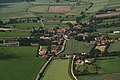
English: Weston is a village in Nottinghamshire, England. It is located 10 miles south of Retford. According to the 2001 census it had a population of 312.
village and civil parish in Nottinghamshire, UK | |||||
| Upload media | |||||
| Instance of | |||||
|---|---|---|---|---|---|
| Location | Newark and Sherwood, Nottinghamshire, East Midlands, England | ||||
 | |||||
Subcategories
This category has only the following subcategory.
Media in category "Weston, Nottinghamshire"
The following 159 files are in this category, out of 159 total.
-
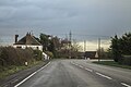
 180111 , Weston.jpg 3,946 × 2,700; 2.59 MB
-
 87022 Weston on Trent.jpg 1,200 × 839; 249 KB
-
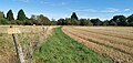
 A field of stubble - geograph.org.uk - 6268576.jpg 640 × 480; 78 KB
-
 A1 - road liable to flooding - geograph.org.uk - 2642869.jpg 640 × 428; 104 KB
-

-
 A1 footbridge near Weston - geograph.org.uk - 4960452.jpg 2,256 × 1,496; 888 KB
-
 A1 layby - geograph.org.uk - 2642925.jpg 640 × 428; 87 KB
-
 A1 layby - geograph.org.uk - 2642940.jpg 640 × 428; 77 KB
-
 A1 looking towards Lady Wood - geograph.org.uk - 6268077.jpg 3,121 × 1,729; 1.07 MB
-
 A1 near Egmanton - geograph.org.uk - 4105671.jpg 1,280 × 960; 214 KB
-
 A1 north - geograph.org.uk - 2277892.jpg 640 × 427; 78 KB
-
 A1 southbound - geograph.org.uk - 2692123.jpg 640 × 480; 62 KB
-
 A1 towards Tuxford - geograph.org.uk - 4960462.jpg 2,068 × 1,300; 1.35 MB
-
 B1164 bend near Goosemoore Hall - geograph.org.uk - 4745089.jpg 1,600 × 1,104; 573 KB
-
 B1164 towards Weston - geograph.org.uk - 2692093.jpg 640 × 480; 95 KB
-
 Bell Lane bridge - geograph.org.uk - 2349738.jpg 640 × 427; 127 KB
-
 Bell Lane, Scarthingmoor - geograph.org.uk - 4105609.jpg 1,280 × 960; 333 KB
-
-
 Blue Bell Farm - geograph.org.uk - 2347818.jpg 640 × 427; 74 KB
-
 Bridge carrying Wadnall Lane across A1 - geograph.org.uk - 6268072.jpg 3,462 × 1,655; 1.63 MB
-
 Bridge over A1 - geograph.org.uk - 4396584.jpg 640 × 428; 101 KB
-
 Bridge over A1 - geograph.org.uk - 4396599.jpg 640 × 428; 100 KB
-
 Bridge over A1 - geograph.org.uk - 4396606.jpg 640 × 428; 113 KB
-
 Bridge over A1 - geograph.org.uk - 4396621.jpg 640 × 428; 88 KB
-

-

-
 Bridge over the A1 - geograph.org.uk - 6268579.jpg 640 × 480; 81 KB
-
 Bridge over the A1 near to Moorhouse - geograph.org.uk - 4925659.jpg 640 × 480; 333 KB
-
 By the road to Tuxford - geograph.org.uk - 2071623.jpg 900 × 663; 331 KB
-
 Chinese restaurant, Weston - geograph.org.uk - 2692099.jpg 640 × 480; 63 KB
-
 Church of All Saints - geograph.org.uk - 6265806.jpg 480 × 640; 72 KB
-
 Church of All Saints, Weston - geograph.org.uk - 6268042.jpg 1,655 × 3,463; 1.44 MB
-
 Church path - geograph.org.uk - 3632468.jpg 427 × 640; 105 KB
-
 Converted windmill - geograph.org.uk - 679804.jpg 640 × 480; 74 KB
-
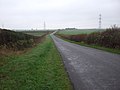
 Country road - geograph.org.uk - 1455144.jpg 640 × 427; 70 KB
-

-
 Dovecote House, Weston - geograph.org.uk - 4105583.jpg 1,280 × 916; 231 KB
-
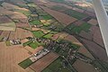
 Egmanton, aerial 2016 - geograph.org.uk - 5009814.jpg 800 × 533; 111 KB
-
 Electricity pylon and straw bales - geograph.org.uk - 3156388.jpg 1,024 × 768; 118 KB
-
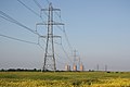
 Electricity Pylons from the Power Station - geograph.org.uk - 3455052.jpg 1,600 × 1,060; 191 KB
-
 Electricity transmission lines - geograph.org.uk - 3990412.jpg 1,562 × 1,078; 155 KB
-
 Farm buildings near Weston - geograph.org.uk - 2073846.jpg 900 × 668; 340 KB
-
 Farm machinery and a giant haystack - geograph.org.uk - 2073840.jpg 900 × 521; 302 KB
-
 Farm track near Weston - geograph.org.uk - 2692082.jpg 640 × 480; 80 KB
-
 Farm track off Hawbush Road, Weston - geograph.org.uk - 3156422.jpg 1,024 × 768; 194 KB
-
 Farm track off Moorhouse Road - geograph.org.uk - 2692152.jpg 640 × 480; 68 KB
-
 Farmland east of Weston - geograph.org.uk - 2659277.jpg 1,600 × 1,200; 224 KB
-
 Farmland near Grassthorpe Lane - geograph.org.uk - 4237509.jpg 640 × 430; 38 KB
-
 Farmland near Scarthingmoor Farm - geograph.org.uk - 2692113.jpg 640 × 480; 56 KB
-
 Farmland near The Ruddings Farm - geograph.org.uk - 2659257.jpg 1,600 × 1,014; 170 KB
-
 Farmland near Weston - geograph.org.uk - 2659265.jpg 1,600 × 878; 131 KB
-
 Farmland near Weston - geograph.org.uk - 4237513.jpg 640 × 430; 40 KB
-
 Farmland north of Weston - geograph.org.uk - 2405675.jpg 640 × 430; 34 KB
-
 Farmland off Moorhouse Road - geograph.org.uk - 2692150.jpg 640 × 480; 65 KB
-
 Field boundary near Bluebell Farm - geograph.org.uk - 3156570.jpg 1,024 × 768; 200 KB
-
 Field by the East Coast Main Line - geograph.org.uk - 2352805.jpg 640 × 430; 26 KB
-
 Field by the railway - geograph.org.uk - 2071581.jpg 900 × 675; 347 KB
-
 Field edge and Lady Wood - geograph.org.uk - 5206096.jpg 1,024 × 768; 192 KB
-
 Fields and countryside west of Weston - geograph.org.uk - 2073830.jpg 900 × 635; 308 KB
-
 Fields and hedges near Weston, from the railway - geograph.org.uk - 4579517.jpg 1,600 × 691; 230 KB
-
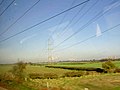
 Fields and pylons north of the railway at Weston - geograph.org.uk - 4712741.jpg 1,600 × 840; 164 KB
-
 Fields and pylons north of the railway at Weston - geograph.org.uk - 4712762.jpg 1,600 × 1,064; 254 KB
-
 Fields near Mount Pleasant Farm - geograph.org.uk - 2071594.jpg 900 × 499; 240 KB
-
 Fields outside Weston, from the railway - geograph.org.uk - 4580294.jpg 1,600 × 899; 270 KB
-
 Flat farmland - geograph.org.uk - 4237519.jpg 640 × 356; 23 KB
-
 Footpath by the A1 - geograph.org.uk - 1924027.jpg 640 × 465; 86 KB
-
 Footpath from Ladywood Lane - geograph.org.uk - 2347875.jpg 640 × 427; 118 KB
-
 Footpath not quite aligned with Weston church - geograph.org.uk - 5118549.jpg 1,024 × 768; 167 KB
-
 Footpath to Weston - geograph.org.uk - 5205862.jpg 1,024 × 768; 324 KB
-
 Former Methodist Chapel, Weston - geograph.org.uk - 4105592.jpg 1,280 × 967; 266 KB
-

-
 Grassthorpe Lane Level Crossing - geograph.org.uk - 2692074.jpg 640 × 480; 60 KB
-
 Grassthorpe Lane level crossing - geograph.org.uk - 4104558.jpg 1,280 × 938; 273 KB
-
 Grassthorpe Lane level crossing - geograph.org.uk - 4104560.jpg 1,280 × 906; 304 KB
-
 Grassthorpe Lane, near Weston - geograph.org.uk - 6268064.jpg 3,648 × 1,744; 1.82 MB
-
 Great North Road - geograph.org.uk - 2347823.jpg 640 × 427; 83 KB
-
 Great North Road at Weston - geograph.org.uk - 4745494.jpg 1,600 × 1,067; 242 KB
-
-
 Great North Road towards Tuxford - geograph.org.uk - 2692119.jpg 640 × 480; 54 KB
-
 Great Wall Chinese Take-away, Weston - geograph.org.uk - 6268058.jpg 3,648 × 1,744; 3.36 MB
-

-
 Harvest Cottage - geograph.org.uk - 2352792.jpg 640 × 430; 26 KB
-
 Isolated barn and electricity pylon - geograph.org.uk - 5118554.jpg 1,024 × 768; 230 KB
-
 Junction of Weston Road and B1164 - geograph.org.uk - 5259202.jpg 640 × 427; 38 KB
-
 Lady Wood overbridge, A1 - geograph.org.uk - 2514569.jpg 640 × 430; 42 KB
-
 Ladywood Lane Bridge over the A1 - geograph.org.uk - 4925653.jpg 640 × 480; 374 KB
-
 Large field near Weston - geograph.org.uk - 2073812.jpg 900 × 663; 397 KB
-
 Layby on Northbound A1 near to Weston - geograph.org.uk - 4929920.jpg 640 × 427; 312 KB
-
 Layby on Southbound A1 near to Weston, - geograph.org.uk - 4925649.jpg 640 × 427; 298 KB
-
 Layby on the A1 near to Weston - geograph.org.uk - 4929736.jpg 640 × 427; 367 KB
-
 Layby on the Northbound A1 - geograph.org.uk - 4929927.jpg 640 × 480; 392 KB
-
 Level crossing warning sign - geograph.org.uk - 6268591.jpg 640 × 480; 82 KB
-
 Minor road towards Stone Road End - geograph.org.uk - 2691775.jpg 640 × 480; 59 KB
-

-

-
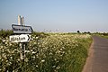 Normanton Road - geograph.org.uk - 1894966.jpg 640 × 426; 98 KB
-
 Old Great North Road at Bluebell Farm, Weston - geograph.org.uk - 6268035.jpg 3,255 × 1,606; 1.09 MB
-
 Old route now a green lane - geograph.org.uk - 167736.jpg 640 × 480; 98 KB
-
 Ordnance Survey Cut Mark - geograph.org.uk - 4982741.jpg 321 × 640; 88 KB
-
 Overbridge near Weston, A1 - geograph.org.uk - 2514577.jpg 640 × 430; 32 KB
-
 Overbridge north of Lady Wood, A1 - geograph.org.uk - 2514581.jpg 640 × 430; 53 KB
-
 Path towards Moor Farm, Weston - geograph.org.uk - 6268010.jpg 3,648 × 1,744; 2.36 MB
-
 Path towards Weston - geograph.org.uk - 6268021.jpg 3,233 × 1,733; 1.55 MB
-
 Power lines - geograph.org.uk - 1894974.jpg 640 × 426; 62 KB
-
-
 Power lines near Weston - geograph.org.uk - 3156470.jpg 1,024 × 768; 120 KB
-
 Private road to oil boreholes - geograph.org.uk - 5118569.jpg 1,024 × 768; 165 KB
-
 Pylon by the A1 near Lady Wood Farm - geograph.org.uk - 2514559.jpg 640 × 430; 41 KB
-
 Pylon by the East Coast Main Line - geograph.org.uk - 2352799.jpg 572 × 640; 32 KB
-
 Pylon by the East Coast Main Line - geograph.org.uk - 2352814.jpg 640 × 430; 54 KB
-
 Pylon by the East Coast Main Line - geograph.org.uk - 2352831.jpg 640 × 430; 23 KB
-
 Pylon by the East Coast Main Line - geograph.org.uk - 2352837.jpg 640 × 430; 27 KB
-
 Pylon by the ECML - geograph.org.uk - 2405682.jpg 640 × 418; 32 KB
-
 Pylon by the ECML - geograph.org.uk - 2405690.jpg 640 × 409; 37 KB
-
 Pylon by the ECML - geograph.org.uk - 4237512.jpg 640 × 430; 49 KB
-
 Pylon by the ECML - geograph.org.uk - 4237516.jpg 640 × 492; 42 KB
-
 Pylon near Grassthorpe Lane - geograph.org.uk - 4237507.jpg 640 × 430; 43 KB
-
 Railway access gate, Hawbush Road, Weston - geograph.org.uk - 3156439.jpg 1,024 × 768; 170 KB
-
 Railway bridge on Bell Lane - geograph.org.uk - 4920964.jpg 3,623 × 2,400; 4.59 MB
-
 Railway towards Retford - geograph.org.uk - 2692078.jpg 640 × 480; 60 KB
-
 Redroofs Farm, near Weston - geograph.org.uk - 6268301.jpg 4,941 × 2,363; 2.87 MB
-
 Scarthingmoor Mill Lane - geograph.org.uk - 2349724.jpg 640 × 427; 129 KB
-
 Scarthingmoor postbox ref NG23 83 - geograph.org.uk - 4105613.jpg 960 × 1,280; 441 KB
-
 Stubble field and Gipsy Lodge Farm - geograph.org.uk - 5206105.jpg 1,024 × 768; 146 KB
-
 Stubble field and Hall Farm, Weston - geograph.org.uk - 5207734.jpg 1,024 × 768; 148 KB
-

-
 The Great North Road - geograph.org.uk - 4105606.jpg 1,280 × 869; 219 KB
-
 The Great Wall Chinese Restaurant - geograph.org.uk - 4105597.jpg 1,280 × 967; 253 KB
-
 The Great Wall restaurant at Weston - geograph.org.uk - 2073857.jpg 900 × 585; 270 KB
-
 The old Great North Road leaving Weston - geograph.org.uk - 2073861.jpg 900 × 627; 315 KB
-
 The Old Post Office, Weston - geograph.org.uk - 3156492.jpg 1,024 × 768; 121 KB
-
 The Old Post Office, Weston - geograph.org.uk - 4105563.jpg 1,280 × 960; 261 KB
-
 The Vines, Weston - geograph.org.uk - 4105571.jpg 1,280 × 959; 303 KB
-
 Track to Mount Pleasant Farm - geograph.org.uk - 4920955.jpg 4,725 × 3,061; 5.14 MB
-

-
 View along the A1 from a bridge - geograph.org.uk - 2073845.jpg 900 × 535; 254 KB
-
 View from Hawbush Road - geograph.org.uk - 4105616.jpg 1,280 × 869; 359 KB
-
 View near Bluebell Farm, Weston - geograph.org.uk - 3156578.jpg 1,024 × 768; 160 KB
-
 View towards Cottam power station - geograph.org.uk - 3156451.jpg 1,024 × 768; 177 KB
-
 View towards The Ruddings Farm - geograph.org.uk - 3156428.jpg 1,024 × 768; 173 KB
-
 Village noticeboard and Village Hall, Weston - geograph.org.uk - 3156483.jpg 1,024 × 768; 145 KB
-

-
 Weathercow, Dovecote House - geograph.org.uk - 4105587.jpg 1,280 × 960; 216 KB
-
 Weston Cricket Club - geograph.org.uk - 4105601.jpg 1,280 × 960; 192 KB
-
 Weston Mill Farm - geograph.org.uk - 3052016.jpg 640 × 427; 134 KB
-
 Weston Mill Farm - geograph.org.uk - 4104563.jpg 1,280 × 914; 298 KB
-
 Weston Road heading west - geograph.org.uk - 2692127.jpg 640 × 480; 75 KB
-
 Weston Village - geograph.org.uk - 1455117.jpg 640 × 427; 79 KB
-
 Weston village - geograph.org.uk - 1455122.jpg 640 × 427; 76 KB
-
 Weston village hall - geograph.org.uk - 4105566.jpg 1,280 × 861; 275 KB
-
 Weston village sign - geograph.org.uk - 6268578.jpg 640 × 480; 118 KB
-

-
 Bridleway and A Road - geograph.org.uk - 382368.jpg 640 × 480; 82 KB
-
 Bridleway through Wadnal Plantation - geograph.org.uk - 463291.jpg 640 × 480; 193 KB
-

-
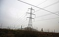
 Footpath and Power - geograph.org.uk - 322251.jpg 640 × 480; 103 KB
-
 Footpath in the fields - geograph.org.uk - 460811.jpg 640 × 480; 168 KB
-
 Footpath to Weston - geograph.org.uk - 237854.jpg 640 × 427; 74 KB
-


