Category:Weston Colville
village in United Kingdom  | |||||
| Upload media | |||||
| Instance of | |||||
|---|---|---|---|---|---|
| Location | South Cambridgeshire, Cambridgeshire, East of England, England | ||||
 | |||||
Subcategories
This category has the following 2 subcategories, out of 2 total.
M
W
- Weston Green, Cambridgeshire (3 F)
Media in category "Weston Colville"
The following 200 files are in this category, out of 214 total.
(previous page) (next page)-
 A bend in Clamp's Lane - geograph.org.uk - 3144468.jpg 1,024 × 768; 1.1 MB
-

-
 Across the valley at Lark Hall Corner - geograph.org.uk - 2250720.jpg 800 × 600; 546 KB
-
 Acute road junction - geograph.org.uk - 5641028.jpg 640 × 480; 92 KB
-
 Area of maize - geograph.org.uk - 1084548.jpg 640 × 480; 128 KB
-
 Bend In The Road - geograph.org.uk - 3265969.jpg 1,024 × 767; 285 KB
-
 Big fields and big skies, Cambridgeshire - geograph.org.uk - 2812092.jpg 1,024 × 768; 186 KB
-
 Bridleway to Willingham Green - geograph.org.uk - 2563345.jpg 1,600 × 1,200; 844 KB
-
 Brinkley Road - geograph.org.uk - 1637240.jpg 640 × 480; 140 KB
-

-
 Burger van at Weston Woods Farm - geograph.org.uk - 2950162.jpg 2,560 × 1,920; 1.06 MB
-
 Bus stop, Weston Green - geograph.org.uk - 1636633.jpg 640 × 571; 232 KB
-
 Byway - geograph.org.uk - 2711632.jpg 1,024 × 768; 292 KB
-
 Byway to Carlton and Willingham Green - geograph.org.uk - 1636794.jpg 640 × 480; 193 KB
-
 Byway to Carlton and Willingham Green - geograph.org.uk - 1636930.jpg 640 × 515; 283 KB
-
 Byway to Carlton and Willingham Green - geograph.org.uk - 3144471.jpg 1,024 × 768; 1.03 MB
-
 Byway to Green End Farm - geograph.org.uk - 2720808.jpg 1,600 × 1,200; 1,001 KB
-
 Byway to Lark Hall Corner - geograph.org.uk - 5500360.jpg 1,024 × 768; 968 KB
-
 Byway towards Old Cambridge Road Plantation - geograph.org.uk - 3108232.jpg 1,600 × 1,200; 797 KB
-
 Carlton Green - geograph.org.uk - 2158551.jpg 1,600 × 1,200; 931 KB
-
 Chappel Road to Weston Green - geograph.org.uk - 1636294.jpg 640 × 480; 182 KB
-
 Clamp's Lane in September - geograph.org.uk - 3144463.jpg 1,024 × 768; 1.26 MB
-
 Clamp's Lane, Carlton, Cambridgeshire (2) - geograph.org.uk - 2812108.jpg 1,024 × 768; 195 KB
-
 Clamp's Lane, Carlton, Cambridgeshire (3) - geograph.org.uk - 2812113.jpg 1,024 × 768; 250 KB
-
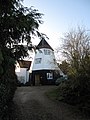 Converted windmill - geograph.org.uk - 1637717.jpg 480 × 640; 157 KB
-
 Country View - geograph.org.uk - 3265962.jpg 1,024 × 768; 349 KB
-
 Crest of the hill - geograph.org.uk - 2250620.jpg 800 × 600; 341 KB
-

-

-
 Crop field west of Weston Colville - geograph.org.uk - 5215937.jpg 640 × 480; 69 KB
-
 Crossing - geograph.org.uk - 3042876.jpg 1,024 × 768; 231 KB
-
 Ditch, hedge and parish boundary - geograph.org.uk - 5641068.jpg 640 × 480; 117 KB
-
 Down hill to Weston Green - geograph.org.uk - 3143101.jpg 1,024 × 752; 1.23 MB
-
 Edge of Weston Green - geograph.org.uk - 1636305.jpg 640 × 480; 178 KB
-
 Ex-RAF buildings at what was RAF Wratting - geograph.org.uk - 4389738.jpg 1,024 × 768; 261 KB
-
 Farm building, Wadlow Farm - geograph.org.uk - 5215922.jpg 640 × 480; 46 KB
-
 Farm machinery auction - geograph.org.uk - 2950136.jpg 2,560 × 1,920; 1.01 MB
-
 Farm machinery auction - geograph.org.uk - 2950150.jpg 1,024 × 768; 145 KB
-
 Farm track - geograph.org.uk - 1637317.jpg 640 × 480; 175 KB
-

-
 Farm track near Lark Hall - geograph.org.uk - 1009412.jpg 640 × 480; 90 KB
-
 Farming for game - geograph.org.uk - 4685149.jpg 640 × 480; 88 KB
-
 Farming for game - geograph.org.uk - 5641057.jpg 640 × 480; 122 KB
-
 Farmland by Lark Hall Heath Farm - geograph.org.uk - 3108305.jpg 1,600 × 1,200; 883 KB
-
 Fields near Spike Hall - geograph.org.uk - 3121346.jpg 1,024 × 768; 1.01 MB
-
 Fields, footpath and woods - geograph.org.uk - 3143099.jpg 1,024 × 768; 1.02 MB
-
 Fields, with view of Wind Farm - geograph.org.uk - 5580058.jpg 1,024 × 768; 188 KB
-
 Footbridge at the ford - geograph.org.uk - 1636790.jpg 640 × 480; 121 KB
-
 Footpath - geograph.org.uk - 2711719.jpg 768 × 1,024; 219 KB
-
 Footpath - geograph.org.uk - 3042630.jpg 1,024 × 768; 296 KB
-
 Footpath - geograph.org.uk - 3265955.jpg 1,024 × 768; 409 KB
-
 Footpath - geograph.org.uk - 3265957.jpg 1,024 × 768; 298 KB
-
 Footpath And Field Boundary - geograph.org.uk - 3265959.jpg 768 × 1,024; 299 KB
-
 Footpath around unnamed wood - geograph.org.uk - 2562225.jpg 1,600 × 1,200; 907 KB
-
 Footpath from Weston Woods Farm - geograph.org.uk - 2562153.jpg 1,600 × 1,200; 1.04 MB
-
 Footpath Junction - geograph.org.uk - 3265964.jpg 1,024 × 768; 301 KB
-
 Footpath to Lark Hall - geograph.org.uk - 5215933.jpg 640 × 480; 88 KB
-
 Footpath to Six Mile Bottom - geograph.org.uk - 5499572.jpg 1,024 × 768; 923 KB
-
 Footpath to Weston Green - geograph.org.uk - 2562168.jpg 1,600 × 1,200; 737 KB
-
 Footpath to Weston Green - geograph.org.uk - 2562218.jpg 1,600 × 1,200; 791 KB
-
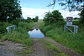
 Ford and byway at Weston Green - geograph.org.uk - 3144486.jpg 1,024 × 768; 1.14 MB
-
 Ford And Gate - geograph.org.uk - 2711683.jpg 1,024 × 768; 288 KB
-
 Ford at Weston Green - geograph.org.uk - 3029721.jpg 3,872 × 2,592; 2.36 MB
-
 Ford at Weston Green - geograph.org.uk - 3144480.jpg 1,024 × 754; 1.22 MB
-
 Ford On Byway - geograph.org.uk - 2711658.jpg 1,024 × 768; 304 KB
-
 Ford on the byway - geograph.org.uk - 1636773.jpg 640 × 480; 157 KB
-

-
 Former school, Weston Colville - geograph.org.uk - 5640989.jpg 640 × 480; 124 KB
-
 Game cover crop along Spring Plantation - geograph.org.uk - 1637688.jpg 640 × 480; 143 KB
-
 Game feeder at the end of the trees - geograph.org.uk - 1637396.jpg 640 × 480; 190 KB
-
 Game rearing area - geograph.org.uk - 1083562.jpg 640 × 480; 170 KB
-
 Grange Road - geograph.org.uk - 5641047.jpg 640 × 428; 92 KB
-
 Grange Road - geograph.org.uk - 5641063.jpg 640 × 480; 94 KB
-
 Grass field - geograph.org.uk - 1083591.jpg 640 × 480; 95 KB
-
 Grassy strip in field - geograph.org.uk - 1637337.jpg 640 × 480; 149 KB
-
 Green Path - geograph.org.uk - 3042838.jpg 768 × 1,024; 351 KB
-
 Hall Farm, Weston Colville - geograph.org.uk - 1636259.jpg 640 × 480; 173 KB
-
 Hardstanding by Grange Road - geograph.org.uk - 5641053.jpg 640 × 480; 99 KB
-
 Harvest time near Lark Hall Heath Farm - geograph.org.uk - 5500162.jpg 1,024 × 768; 987 KB
-
 Harvesting the barley - geograph.org.uk - 3108237.jpg 1,600 × 1,200; 644 KB
-
 Haystack hedgerow - geograph.org.uk - 1067173.jpg 640 × 427; 100 KB
-

-
 Hill Crofts - geograph.org.uk - 5641004.jpg 640 × 480; 123 KB
-
 Hill Crofts wood - geograph.org.uk - 1637726.jpg 480 × 640; 248 KB
-
 Houses on Brinkley Road, Weston Colville - geograph.org.uk - 5391116.jpg 2,014 × 1,490; 804 KB
-
 Icknield Way - geograph.org.uk - 3042899.jpg 768 × 1,024; 288 KB
-
 Icknield Way Path - geograph.org.uk - 1637246.jpg 640 × 480; 151 KB
-
 Infilled pit - geograph.org.uk - 1637376.jpg 640 × 480; 181 KB
-
 Information board at ex-RAF Wratting - geograph.org.uk - 4389714.jpg 3,456 × 2,592; 3.63 MB
-
 John Deere crop sprayer - geograph.org.uk - 2950201.jpg 2,560 × 1,920; 1.12 MB
-
 Junction near Weston Colville - geograph.org.uk - 3495905.jpg 4,320 × 3,240; 2.9 MB
-
 Lark Hall - geograph.org.uk - 5499598.jpg 1,024 × 768; 894 KB
-
 Lark Hall and Chilly Hill - geograph.org.uk - 2250707.jpg 800 × 539; 484 KB
-
 Lark Hall Corner - geograph.org.uk - 5215928.jpg 640 × 480; 62 KB
-
 Lark Rise (to let) - geograph.org.uk - 5580198.jpg 1,024 × 768; 261 KB
-
 Larkhall Cottages - geograph.org.uk - 5215923.jpg 640 × 480; 77 KB
-
 Machinery sale at Weston Woods Farm - geograph.org.uk - 2950108.jpg 2,560 × 1,920; 1.03 MB
-
 Machinery sale at Weston Woods Farm - geograph.org.uk - 2950121.jpg 2,560 × 1,920; 1 MB
-
 Machinery sale at Weston Woods Farm - geograph.org.uk - 2950188.jpg 2,560 × 1,920; 1.11 MB
-
 Maize cover crop - geograph.org.uk - 1636249.jpg 640 × 480; 189 KB
-
 Mill Cottage, Weston Colville - geograph.org.uk - 5580092.jpg 1,024 × 768; 189 KB
-
 Mines Farm - geograph.org.uk - 1636290.jpg 640 × 523; 138 KB
-
 Minor road junction - geograph.org.uk - 1637372.jpg 640 × 480; 179 KB
-

-
 Minor road towards Dullingham - geograph.org.uk - 5215942.jpg 640 × 480; 52 KB
-
 Minor road towards Dullingham - geograph.org.uk - 5215947.jpg 640 × 480; 65 KB
-
 Minor road towards Lark Hall - geograph.org.uk - 5215926.jpg 640 × 480; 46 KB
-
 Minor road towards Weston Colville - geograph.org.uk - 5215930.jpg 640 × 480; 52 KB
-
 Minor road towards Weston Colville - geograph.org.uk - 5215935.jpg 640 × 480; 56 KB
-
 Mixed farming near Weston Colville - geograph.org.uk - 1067169.jpg 640 × 427; 100 KB
-
 Nearing Lark Hall - geograph.org.uk - 5499605.jpg 1,024 × 768; 1.03 MB
-
 Nearing Weston Green - geograph.org.uk - 3143094.jpg 1,024 × 757; 851 KB
-
 New gates on the byway - geograph.org.uk - 1636991.jpg 640 × 480; 167 KB
-
 New silos - geograph.org.uk - 2562135.jpg 1,600 × 1,200; 803 KB
-

-
 Nissen Hut at RAF Wratting site - geograph.org.uk - 4050431.jpg 4,320 × 3,240; 4.91 MB
-
 Oil seed rape being harvested - geograph.org.uk - 2158576.jpg 1,600 × 1,200; 1,014 KB
-
 Old airfield track - geograph.org.uk - 2156071.jpg 1,600 × 1,200; 837 KB
-
 Old concrete road off Common Road - geograph.org.uk - 5343009.jpg 640 × 480; 102 KB
-
 Old School House, Weston Colville - geograph.org.uk - 5580075.jpg 1,024 × 737; 167 KB
-
 Old Smock Mill, Weston Colville - geograph.org.uk - 5580082.jpg 768 × 1,024; 244 KB
-
 Part harvested field - geograph.org.uk - 2158571.jpg 1,600 × 1,200; 1.04 MB
-
 Perimeter Track - geograph.org.uk - 3752258.jpg 1,024 × 768; 150 KB
-
 Pines, pylon and tower - geograph.org.uk - 2250591.jpg 800 × 600; 418 KB
-
 Ploughed field by Grange Road - geograph.org.uk - 5641054.jpg 640 × 480; 90 KB
-
 Poles and pines - geograph.org.uk - 2250614.jpg 800 × 600; 424 KB
-
 Power Lines - geograph.org.uk - 3265961.jpg 768 × 1,024; 143 KB
-
-

-
 Public footpath, viewed from Common Road - geograph.org.uk - 1428296.jpg 640 × 480; 121 KB
-

-
 RAF Wratting Common Memorial - geograph.org.uk - 4050413.jpg 4,320 × 3,240; 4.93 MB
-
 RAF Wratting memorial - geograph.org.uk - 4389703.jpg 1,024 × 768; 436 KB
-
 Remains of Mines Farm - geograph.org.uk - 4685102.jpg 640 × 480; 103 KB
-
 Restricted byway to Carlton - geograph.org.uk - 1321112.jpg 640 × 480; 162 KB
-
 Road into Weston Colville with antiquated sign - geograph.org.uk - 3495929.jpg 4,320 × 3,240; 2.9 MB
-
 Road Junction - geograph.org.uk - 4763550.jpg 1,024 × 768; 149 KB
-
 Road junction near Weston Colville - geograph.org.uk - 5580067.jpg 1,024 × 768; 247 KB
-
 Road to Carlton Green - geograph.org.uk - 1459985.jpg 640 × 480; 139 KB
-

-
 Road to Wadlow Farm - geograph.org.uk - 1080394.jpg 640 × 480; 145 KB
-
 Road to Wadlow Farm - geograph.org.uk - 1083581.jpg 640 × 480; 134 KB
-
 Road, former RAF Wratting Common - geograph.org.uk - 5343144.jpg 640 × 480; 117 KB
-
 Rolling road to Weston Colville - geograph.org.uk - 2250698.jpg 800 × 600; 458 KB
-
 Rough grass by the path - geograph.org.uk - 1637383.jpg 640 × 480; 128 KB
-
 Sharp bends at Lark Hall Corner - geograph.org.uk - 2250634.jpg 800 × 597; 555 KB
-
 Small Footbridge - geograph.org.uk - 3265954.jpg 768 × 1,024; 358 KB
-
 Snow-covered farmland and a huge sky - geograph.org.uk - 1628097.jpg 640 × 427; 64 KB
-
 Snowy Farmland - geograph.org.uk - 1161221.jpg 640 × 480; 97 KB
-
 Spike Hall - geograph.org.uk - 1083584.jpg 640 × 524; 155 KB
-
 Spikehall Plantation - geograph.org.uk - 5215929.jpg 640 × 480; 62 KB
-
 St Mary's Weston Colville - geograph.org.uk - 3042619.jpg 1,024 × 768; 240 KB
-
 St Mary's, Weston Colville - geograph.org.uk - 3495947.jpg 4,320 × 3,240; 2.89 MB
-
 St Mary, Weston Colville - East end - geograph.org.uk - 4663265.jpg 900 × 628; 240 KB
-
 St Mary, Weston Colville - East end - geograph.org.uk - 4663267.jpg 900 × 598; 246 KB
-
 St Mary, Weston Colville - Font - geograph.org.uk - 4663306.jpg 773 × 900; 251 KB
-
 St Mary, Weston Colville - geograph.org.uk - 4663257.jpg 900 × 588; 349 KB
-
 St Mary, Weston Colville - Hatchment - geograph.org.uk - 4663291.jpg 900 × 900; 273 KB
-
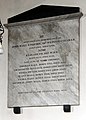
 St Mary, Weston Colville - Ledger slab - geograph.org.uk - 4663279.jpg 900 × 627; 224 KB
-
 St Mary, Weston Colville - Ledger slab - geograph.org.uk - 4663280.jpg 900 × 608; 251 KB
-
 St Mary, Weston Colville - Organ - geograph.org.uk - 4663269.jpg 900 × 598; 196 KB
-
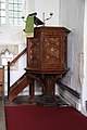 St Mary, Weston Colville - Pulpit - geograph.org.uk - 4663305.jpg 598 × 900; 212 KB
-
 St Mary, Weston Colville - Sanctuary - geograph.org.uk - 4663271.jpg 900 × 666; 267 KB
-
-

-
 St Mary, Weston Colville - Wall monument - geograph.org.uk - 4663275.jpg 603 × 900; 179 KB
-
 St Mary, Weston Colville - Wall monument - geograph.org.uk - 4663308.jpg 647 × 900; 202 KB
-
 Stop Wadlow Wind Farm - geograph.org.uk - 1009410.jpg 480 × 640; 51 KB
-
 Stubble field by Grange Road - geograph.org.uk - 5641060.jpg 640 × 480; 97 KB
-
 Thatched cottage, Horseshoes Lane, Weston Green - geograph.org.uk - 2812133.jpg 1,024 × 768; 228 KB
-
 The Lothbury Centre - geograph.org.uk - 1432739.jpg 640 × 417; 68 KB
-
 The Lothbury Centre - geograph.org.uk - 3495964.jpg 4,320 × 3,240; 2.88 MB
-
 The old Rectory, Weston Colville - geograph.org.uk - 1637714.jpg 640 × 480; 214 KB
-
 The road to Weston Colville - geograph.org.uk - 5499754.jpg 1,024 × 768; 847 KB
-
 The Three Horseshoes - geograph.org.uk - 2711709.jpg 1,024 × 768; 188 KB
-
 Through The Maize - geograph.org.uk - 3042627.jpg 1,024 × 768; 353 KB
-
 Timber by Lower Wood - geograph.org.uk - 2563360.jpg 1,600 × 1,200; 786 KB
-
 Towards Chilly Hill - geograph.org.uk - 4333362.jpg 819 × 1,024; 1.14 MB
-
 Towards Great Coven's Wood - geograph.org.uk - 3144406.jpg 1,024 × 747; 1.1 MB
-
 Towards Lark Hall Farm and Chilly Hill - geograph.org.uk - 5500127.jpg 1,024 × 768; 1,005 KB
-
 Towards Mill Hill - geograph.org.uk - 3144432.jpg 1,024 × 768; 1.23 MB
-
 Towards Six Mile Bottom - geograph.org.uk - 5500129.jpg 1,024 × 768; 919 KB
-
 Tree shelter belts on Weston Woods Farm - geograph.org.uk - 2950204.jpg 2,560 × 1,920; 1.02 MB
-
 Trees - geograph.org.uk - 3265963.jpg 768 × 1,024; 314 KB
-
 Trees on the horizon - geograph.org.uk - 1067193.jpg 640 × 427; 97 KB
-
 Unnamed road to Dullingham - geograph.org.uk - 1637347.jpg 640 × 480; 127 KB
-
 Up hill on Clamp's Lane - geograph.org.uk - 3144423.jpg 1,024 × 768; 1.24 MB
-
 Up hill to Carlton - geograph.org.uk - 3143105.jpg 1,024 × 768; 1.04 MB
-
 Upper Stour valley - geograph.org.uk - 1636939.jpg 640 × 480; 195 KB
-
 View from Brook Lane, Willingham Green - geograph.org.uk - 2812058.jpg 1,024 × 768; 195 KB
-
 View from Old Cambridge Road - geograph.org.uk - 2250779.jpg 800 × 600; 614 KB
-
 View towards Weston Colville - geograph.org.uk - 1067182.jpg 640 × 427; 97 KB
-
 Village Sign and Reading Room, Weston Colville - geograph.org.uk - 5580110.jpg 1,024 × 768; 250 KB
-
 Weston Colville - geograph.org.uk - 3042616.jpg 1,024 × 768; 251 KB
-
 Weston Colville - geograph.org.uk - 3213091.jpg 1,024 × 768; 224 KB
-

-
 Weston Colville church - geograph.org.uk - 4685073.jpg 640 × 480; 93 KB
-
 Weston Colville church - geograph.org.uk - 5640978.jpg 640 × 480; 134 KB
-
 Weston Colville cricket pavilion - geograph.org.uk - 1636669.jpg 640 × 480; 151 KB
-


_-_geograph.org.uk_-_2812108.jpg)
_-_geograph.org.uk_-_2812113.jpg)


_-_geograph.org.uk_-_5580198.jpg)


