Category:Westoning
village and civil parish in Bedfordshire, UK  | |||||
| Upload media | |||||
| Instance of | |||||
|---|---|---|---|---|---|
| Location | Central Bedfordshire, Bedfordshire, East of England, England | ||||
 | |||||
English: Westoning is a village in Bedfordshire located about two miles north-east of junction 12 of the M1 motorway, and beside the First Capital Connect railway line to London and beyond. The nearest railway station is located in Harlington, just over a mile to the south, although it is often considered easier to get to the railway station in Flitwick by foot.
Subcategories
This category has only the following subcategory.
Media in category "Westoning"
The following 141 files are in this category, out of 141 total.
-

-
 A5120 towards Ampthill - geograph.org.uk - 4882054.jpg 640 × 480; 85 KB
-
 A5120 towards Westoning - geograph.org.uk - 4882072.jpg 640 × 480; 94 KB
-
 Bell-Westoning.jpg 640 × 480; 70 KB
-
 Blasted Oak, Westoning - geograph.org.uk - 1981808.jpg 853 × 1,280; 468 KB
-
 Bridge taking the A5120 over the Flit - geograph.org.uk - 3516275.jpg 1,600 × 1,074; 564 KB
-
 Bridleway from the road to Harlington - geograph.org.uk - 3742094.jpg 1,600 × 1,069; 517 KB
-
 Bridleway to Mill Farm - geograph.org.uk - 3745406.jpg 1,600 × 1,066; 790 KB
-
 Bridleway to Wood End - geograph.org.uk - 3742086.jpg 1,600 × 1,068; 583 KB
-
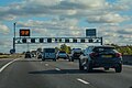
 Central Bedfordshire , M1 Motorway - geograph.org.uk - 5979134.jpg 6,000 × 4,000; 6.12 MB
-
 Central Bedfordshire , M1 Motorway - geograph.org.uk - 5979135.jpg 6,000 × 4,000; 6.17 MB
-
 Central Bedfordshire , M1 Motorway - geograph.org.uk - 5979138.jpg 6,000 × 4,000; 7.08 MB
-
 Children's Play Area - geograph.org.uk - 3448664.jpg 1,024 × 682; 230 KB
-
 Church Road, Westoning - geograph.org.uk - 5674738.jpg 5,202 × 3,465; 2.49 MB
-
 Church Road, Westoning, near to St Mary's church - geograph.org.uk - 5674795.jpg 5,202 × 3,465; 4.49 MB
-
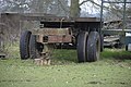 Disused trailer - geograph.org.uk - 2315343.jpg 3,872 × 2,592; 4.08 MB
-
 End of the A5120 slip - geograph.org.uk - 3742097.jpg 1,600 × 1,068; 472 KB
-
 Entrance to Westoning - geograph.org.uk - 5187619.jpg 640 × 488; 84 KB
-
 Exit from the parking area on the A5120, Westoning - geograph.org.uk - 5078486.jpg 2,238 × 1,636; 1.04 MB
-

-
 Farmland north of Goswell End - geograph.org.uk - 4737549.jpg 640 × 306; 38 KB
-
 Farmland north of Westoning - geograph.org.uk - 4737553.jpg 640 × 426; 67 KB
-
 Farmland towards the River Flit - geograph.org.uk - 4882060.jpg 640 × 480; 75 KB
-
 Farmland towards West View Farm - geograph.org.uk - 4882071.jpg 640 × 480; 80 KB
-
 Farmland, Westoning - geograph.org.uk - 4786212.jpg 640 × 344; 29 KB
-
 Field in Wood End - geograph.org.uk - 5313993.jpg 2,048 × 1,536; 1.08 MB
-
 Field of poppies - geograph.org.uk - 4545867.jpg 4,320 × 3,240; 6.08 MB
-
 Fields in Wood End - geograph.org.uk - 5314018.jpg 2,048 × 1,536; 975 KB
-
 Flat farmland - geograph.org.uk - 4737550.jpg 640 × 426; 60 KB
-
 Flitt Vale Nurseries and Farm Shop - geograph.org.uk - 4408219.jpg 1,024 × 682; 190 KB
-
 Flitwick from the air - geograph.org.uk - 3367499.jpg 640 × 480; 134 KB
-
 Flitwick Road between Flitwick and Westoning - geograph.org.uk - 5068000.jpg 2,234 × 1,630; 983 KB
-
 Flitwick Road, Westoning - geograph.org.uk - 5068001.jpg 2,266 × 1,676; 1.07 MB
-
 Flock of Geese, near Westoning - geograph.org.uk - 1981841.jpg 1,280 × 853; 622 KB
-
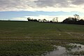 Flooded fields near Westoning - geograph.org.uk - 5673929.jpg 5,202 × 3,465; 3.77 MB
-
 Footbridge and land drain near Priestley farm - geograph.org.uk - 5674831.jpg 5,202 × 3,465; 4.87 MB
-
 Footbridge on the John Bunyan Trail - geograph.org.uk - 3516198.jpg 1,200 × 1,600; 608 KB
-
 Footbridge on the path to Priestly Farm - geograph.org.uk - 3516144.jpg 1,200 × 1,600; 823 KB
-
 Footbridge over the Flit - geograph.org.uk - 3516191.jpg 1,200 × 1,600; 726 KB
-
 Footbridge over the Flit - geograph.org.uk - 3516283.jpg 1,600 × 1,068; 651 KB
-
 Footbridge over the River Flit - geograph.org.uk - 1981836.jpg 853 × 1,280; 658 KB
-
 Footpath between Harlington Wood End and the A5120 - geograph.org.uk - 3336268.jpg 2,560 × 1,920; 965 KB
-
 Footpath from Westoning to Pulloxhill - geograph.org.uk - 3800598.jpg 4,320 × 3,240; 4.77 MB
-
 Footpath off Harlington Road (A5120) - geograph.org.uk - 4882044.jpg 640 × 480; 148 KB
-
 Footpath to Manor Farm - geograph.org.uk - 3516152.jpg 1,600 × 1,067; 691 KB
-
 Footpath to Westoning - geograph.org.uk - 3516155.jpg 1,600 × 1,068; 479 KB
-
 Footpath to Westoning - geograph.org.uk - 3516227.jpg 1,600 × 1,067; 538 KB
-
 Games on the Flitwick Cricket Ground - geograph.org.uk - 3516265.jpg 1,600 × 1,069; 443 KB
-
 God's Acre cemetery, Westoning - geograph.org.uk - 5674794.jpg 5,202 × 3,465; 4.64 MB
-
 Green area by the A5120. Westoning - geograph.org.uk - 6121779.jpg 1,920 × 1,280; 1.8 MB
-
 Green by the railway in Westoning - geograph.org.uk - 6132867.jpg 1,850 × 1,166; 1.9 MB
-
 Harlington Road (A5120) - geograph.org.uk - 4882049.jpg 640 × 480; 69 KB
-
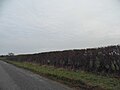
 Hedge maintenance - geograph.org.uk - 2359456.jpg 3,872 × 2,592; 4.73 MB
-
 Hedgerow in Wood End - geograph.org.uk - 5314002.jpg 2,048 × 1,536; 998 KB
-
 House on Flitwick Road, Westoning - geograph.org.uk - 5067997.jpg 2,304 × 1,728; 831 KB
-
 Houses on Flitwick Road, Westoning - geograph.org.uk - 5067996.jpg 2,304 × 1,728; 858 KB
-
 Houses on Park Road, Westoning - geograph.org.uk - 5060152.jpg 2,304 × 1,728; 875 KB
-
 Houses on Park Road, Westoning - geograph.org.uk - 5068002.jpg 2,304 × 1,728; 1,010 KB
-
 Houses, Lovett Green - geograph.org.uk - 4862622.jpg 640 × 428; 84 KB
-
 John Bunyan alongside the Midland main line at Westoning - geograph.org.uk - 5673924.jpg 5,202 × 3,465; 3.31 MB
-
 John Bunyan trail - geograph.org.uk - 5673702.jpg 5,202 × 3,465; 3.94 MB
-
 John Bunyan trail alongside the railway near Westoning - geograph.org.uk - 5674723.jpg 5,202 × 3,465; 3.46 MB
-
 John Bunyan trail approaching Westoning - geograph.org.uk - 5673796.jpg 5,202 × 3,465; 5.68 MB
-
 John Bunyan Trail by the paddocks - geograph.org.uk - 3516207.jpg 1,200 × 1,600; 646 KB
-
 John Bunyan trail goes into the plantation - geograph.org.uk - 3516203.jpg 1,200 × 1,600; 810 KB
-
 John Bunyan trail looking south near College Farm - geograph.org.uk - 5673923.jpg 5,202 × 3,465; 3.7 MB
-
 John Bunyan trail towards Manor Park House - geograph.org.uk - 5674805.jpg 5,202 × 3,465; 4.1 MB
-
 John Bunyan trail, stile into woods - geograph.org.uk - 5674813.jpg 5,202 × 3,465; 5.28 MB
-
 John Bunyan trail. A muddy section across a field. - geograph.org.uk - 5673791.jpg 5,202 × 3,465; 4.01 MB
-
 John Bunyan trail. Footbridge near Priestley Farm - geograph.org.uk - 5674818.jpg 5,202 × 3,465; 4.22 MB
-
 Lay-By on the A5120 - geograph.org.uk - 4299761.jpg 1,024 × 682; 260 KB
-
 Lazy cows lying in the pasture - geograph.org.uk - 3516223.jpg 1,600 × 1,067; 419 KB
-
 Lovett Green, Sharpenhoe - geograph.org.uk - 5309213.jpg 2,048 × 1,536; 931 KB
-
 M1 widening east of Home Farm - geograph.org.uk - 2418663.jpg 640 × 480; 81 KB
-
 Millbrook Vehicle Proving Ground - geograph.org.uk - 4549084.jpg 3,264 × 2,448; 3.28 MB
-
 Minor road near Wood End - geograph.org.uk - 4882066.jpg 640 × 480; 71 KB
-
 Park Road, Westoning - geograph.org.uk - 5054315.jpg 2,176 × 1,542; 922 KB
-
 Park Road, Westoning - geograph.org.uk - 5060178.jpg 2,304 × 1,728; 875 KB
-
 Park Road, Westoning - geograph.org.uk - 5068003.jpg 2,304 × 1,728; 915 KB
-
 Path to Church Road - geograph.org.uk - 3516248.jpg 1,600 × 1,073; 501 KB
-
 Path up to the Harlington Road - geograph.org.uk - 3516138.jpg 1,200 × 1,600; 571 KB
-
 Power lines in Wood End - geograph.org.uk - 5310556.jpg 2,048 × 1,536; 1.04 MB
-
 Power lines near Westoning - geograph.org.uk - 5673926.jpg 5,202 × 3,465; 3.16 MB
-
 Power lines off towards Priestley Farm - geograph.org.uk - 3516219.jpg 1,600 × 1,068; 373 KB
-
 Power to the railway - geograph.org.uk - 3516280.jpg 1,600 × 1,067; 291 KB
-
 Push me - geograph.org.uk - 2359447.jpg 3,872 × 2,592; 4.83 MB
-
 Pylon - geograph.org.uk - 4786216.jpg 640 × 366; 50 KB
-
 Pylon - geograph.org.uk - 4786222.jpg 640 × 504; 55 KB
-
 Pylon by a horse track - geograph.org.uk - 3516189.jpg 1,200 × 1,600; 427 KB
-
 Railway Bridge at Westoning - geograph.org.uk - 426072.jpg 640 × 427; 103 KB
-
 Railway bridge on Greenfield Road, Westoning - geograph.org.uk - 6110016.jpg 1,920 × 1,280; 1.47 MB
-
 Railway bridge over Sampshill Road - geograph.org.uk - 5674726.jpg 5,202 × 3,465; 2.97 MB
-
 Railway bridge to the north east of Westoning - geograph.org.uk - 3800587.jpg 4,320 × 3,240; 3.95 MB
-
 Railway line across the wheat field - geograph.org.uk - 3516259.jpg 1,600 × 1,067; 478 KB
-
 Rainy A5120 - geograph.org.uk - 4408204.jpg 1,024 × 682; 194 KB
-
 Redcaps house - geograph.org.uk - 3516149.jpg 1,600 × 1,068; 449 KB
-
 Redcaps, Westoning (51118909307).jpg 3,990 × 2,994; 3.92 MB
-
 River Flit - geograph.org.uk - 1981824.jpg 853 × 1,280; 699 KB
-
 Road to Tingrith - geograph.org.uk - 1554047.jpg 640 × 480; 67 KB
-
 Roadworks on the M1 near Tingrith - geograph.org.uk - 4326041.jpg 640 × 396; 48 KB
-
 Roadworks on the M1 near Tingrith - geograph.org.uk - 4327117.jpg 640 × 395; 65 KB
-
 Sampshill Road looking eastwards - geograph.org.uk - 5674729.jpg 5,202 × 3,465; 4.22 MB
-
 St Mary Magdalen, Westoning - geograph.org.uk - 4545839.jpg 4,320 × 3,240; 2.94 MB
-
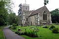 St Mary Magdalene church - geograph.org.uk - 3516210.jpg 1,600 × 1,069; 501 KB
-
 Tall pine on Church Road - geograph.org.uk - 3516246.jpg 1,200 × 1,600; 571 KB
-
 The A5120 south of Westoning - geograph.org.uk - 5068004.jpg 2,266 × 1,676; 958 KB
-
 The A5120 south of Westoning - geograph.org.uk - 5068005.jpg 2,304 × 1,728; 931 KB
-
 The A5120 south of Westoning - geograph.org.uk - 5070039.jpg 2,106 × 1,580; 807 KB
-
 The Chequers - geograph.org.uk - 5187626.jpg 640 × 458; 54 KB
-
 The Chequers pub, Westoning - geograph.org.uk - 3800584.jpg 4,320 × 3,240; 2.94 MB
-
 The Chequers pub, Westoning - geograph.org.uk - 4545788.jpg 4,320 × 3,240; 3.88 MB
-
 The Chequers, Westoning - geograph.org.uk - 5674741.jpg 5,202 × 3,465; 2.7 MB
-
 The Grange, Westoning - geograph.org.uk - 4545862.jpg 4,320 × 3,240; 2.92 MB
-
 The lane to Steppingley - geograph.org.uk - 5360772.jpg 2,592 × 1,944; 1.79 MB
-
 The lane to Steppingley - geograph.org.uk - 5360773.jpg 2,592 × 1,944; 1.89 MB
-
 The Old Hop Bine leafy cottage - geograph.org.uk - 3516254.jpg 1,600 × 1,069; 437 KB
-
 The Pyghtle, Westoning - geograph.org.uk - 5674734.jpg 4,956 × 3,060; 3.29 MB
-
 The tip of the plantation - geograph.org.uk - 3516213.jpg 1,600 × 1,068; 420 KB
-
 Track in to Westoning - geograph.org.uk - 3745410.jpg 1,600 × 1,068; 664 KB
-
 Unnamed road towards Ridgmont - geograph.org.uk - 5314035.jpg 1,944 × 1,386; 864 KB
-
 War memorial in St Mary's churchyard, Westoning - geograph.org.uk - 5674800.jpg 5,202 × 3,465; 5.05 MB
-
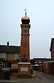 Westoning , The Clock Tower - geograph.org.uk - 116128.jpg 415 × 640; 52 KB
-
 Westoning - footpath to playing fields - geograph.org.uk - 5674789.jpg 5,202 × 3,465; 3.34 MB
-
 Westoning - The Chequers public house - geograph.org.uk - 871422.jpg 640 × 480; 71 KB
-
 Westoning Baptist Church - geograph.org.uk - 871449.jpg 640 × 480; 78 KB
-
 Westoning Playing Field - geograph.org.uk - 1554621.jpg 640 × 480; 67 KB
-
 Westoning village hall - geograph.org.uk - 5674744.jpg 5,202 × 3,465; 3.46 MB
-

-
 Westoning, The War Memorial - geograph.org.uk - 871460.jpg 640 × 480; 85 KB
-
 Westoria Court on Park Road, Westoning - geograph.org.uk - 5060163.jpg 2,304 × 1,728; 1.27 MB
-
 Westoria Court on Park Road, Westoning - geograph.org.uk - 5060166.jpg 2,304 × 1,728; 868 KB
-
 Woodland near Priestley Farm - geograph.org.uk - 5674824.jpg 5,202 × 3,465; 6.24 MB
-
 Working the field - geograph.org.uk - 2315328.jpg 3,872 × 2,592; 4.06 MB
-

-
 Bridleway - geograph.org.uk - 425725.jpg 640 × 427; 146 KB
-
 Field behind Lovett Green - geograph.org.uk - 396046.jpg 640 × 480; 179 KB
-
 Lay-by and mobile café near Harlington - geograph.org.uk - 225678.jpg 640 × 621; 109 KB
-
 Lone House - geograph.org.uk - 425728.jpg 640 × 427; 71 KB
-
 Nursery north of Westoning - geograph.org.uk - 225679.jpg 640 × 480; 80 KB
-
 Portobello Farm - geograph.org.uk - 437888.jpg 640 × 480; 73 KB
-
 Track to Coopers - geograph.org.uk - 219559.jpg 640 × 480; 83 KB


_-_geograph.org.uk_-_4882044.jpg)


_-_geograph.org.uk_-_4882049.jpg)


.jpg)


_-_geograph.org.uk_-_4882047.jpg)


