Category:Wet Mountains
mountain range in southern Colorado, United States  | |||||
| Upload media | |||||
| Instance of | |||||
|---|---|---|---|---|---|
| Location |
| ||||
| Mountain range | |||||
| Elevation above sea level |
| ||||
 | |||||
Subcategories
This category has the following 4 subcategories, out of 4 total.
Media in category "Wet Mountains"
The following 20 files are in this category, out of 20 total.
-
 Beulah southface-mountain.jpg 1,024 × 768; 446 KB
-
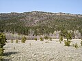 Beulah Valley - North Creek Mountain Range.jpg 1,000 × 750; 807 KB
-
 Cemetery-SilverCliffCO.jpg 2,100 × 1,575; 327 KB
-
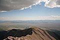 Cloudy peak.jpg 3,456 × 2,304; 2.38 MB
-
 Colorado State Highway 45.JPG 5,520 × 3,199; 12.82 MB
-
 Frontier Pathways Scenic and Historic Byway.JPG 5,184 × 3,456; 13.79 MB
-
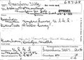 Greenhorn Mountain Decision Card 06446.pdf 958 × 679; 33 KB
-
 Greenhorn Mountain.JPG 4,951 × 2,662; 11.36 MB
-
 Hardscrabble Canyon.JPG 5,760 × 3,852; 17.34 MB
-
 Hardscrabble Pass.JPG 4,091 × 2,334; 7.4 MB
-
 I-25SBMM80CO.jpg 2,845 × 1,896; 1,019 KB
-
 Junction of Colorado state highways 96 and 165.JPG 5,772 × 3,927; 18.58 MB
-
 Low hanging clouds.jpg 3,456 × 2,304; 2.15 MB
-
 Road to the Wet Mountains.jpg 5,468 × 3,656; 22.6 MB
-
 Sangre de Cristo Range Looking West.jpg 4,516 × 481; 1.19 MB
-
 Tipi Sunset.jpg 5,468 × 3,656; 5.48 MB
-
 Tipi under the stars.jpg 5,468 × 3,656; 720 KB
-
 View from Lake Pueblo Dam.JPG 5,629 × 3,057; 11.09 MB
-
 Wetmore, Colorado.JPG 3,949 × 2,070; 6.15 MB
-
 Wetmtns.JPG 4,320 × 2,821; 1.77 MB


