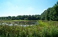
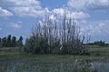
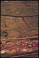
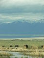
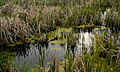
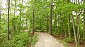
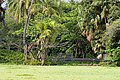
Category:Wetlands of the United States
Countries of the Americas: Argentina · The Bahamas · Belize · Bolivia · Brazil · Canada · Chile · Colombia · Costa Rica · Cuba · Ecuador · El Salvador · Guatemala · Honduras · Mexico · Paraguay · Peru · Trinidad and Tobago · United States of America · Uruguay · Venezuela
Other areas: Greenland
Other areas: Greenland
English: The Wetlands of the United States.
overview about the Wetlands of the United States | |||||
| Upload media | |||||
| |||||
Subcategories
This category has the following 19 subcategories, out of 19 total.
*
.
?
- RPA Historic Wetlands (183 F)
B
C
- Cheyenne Bottoms (6 F)
E
J
- Julie Metz Wetlands (469 F)
M
P
- Pocosin (5 F)
S
W
Media in category "Wetlands of the United States"
The following 200 files are in this category, out of 367 total.
(previous page) (next page)-
-
 20170707-USEPA-EV-0069 (35397623530).jpg 3,680 × 2,456; 1.9 MB
-
 412 DSP Scenic 052 - DPLA - 11fc8cb9c56ecd70451101a1aa40d770.jpg 3,872 × 2,592; 3.18 MB
-
 412 DSP Wetlands 008 - DPLA - 0e1ea6a7b91f4053b4faa1b6692d7232.jpg 3,872 × 2,592; 2.08 MB
-
 412 DSP Wetlands 017 - DPLA - da705a8fc9b5c527501e966c665aeca8.jpg 4,288 × 2,848; 3.12 MB
-
 412 DSP Wetlands 023 - DPLA - 89a6b5c75c5fbd842f038560b6da0ab2.jpg 4,256 × 2,832; 714 KB
-
 A bird looks for its meal at Buena Vista Lagoon - NARA - 557495 color.jpg 2,030 × 3,000; 654 KB
-
 A nutrias home.jpg 1,708 × 2,560; 421 KB
-
 A view of scenic landscape and waterfowl.jpg 5,332 × 3,554; 1,006 KB
-
 A view of the vegetation around the wetlands.jpg 4,256 × 2,832; 768 KB
-
 Abandoned bike (10861).jpg 4,211 × 3,262; 16.13 MB
-
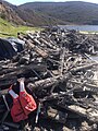
 Abandoned car at the Salt Marsh (10854p).jpg 6,987 × 2,926; 15.27 MB
-
 Aerial view of wetland pond.jpg 2,100 × 1,370; 268 KB
-
 Aerial-view-of-hazen-bay-wetlands.jpg 2,100 × 1,400; 156 KB
-
 Aerial-view-of-marsh.jpg 3,072 × 2,048; 241 KB
-
 Aerial-view-of-national-park-wetlands.jpg 2,100 × 1,398; 139 KB
-
 Aetna wetlands.jpg 2,288 × 1,712; 2.25 MB
-
 After wetland restored.jpg 3,658 × 2,400; 624 KB
-
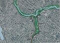
 Alewife Reservation and Alewife Brook master plan (2003) (17327107974).jpg 3,910 × 2,954; 3.72 MB
-
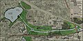
 Alewife Reservation and Alewife Brook master plan (2003) (17327115894).jpg 4,092 × 2,944; 3.64 MB
-
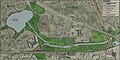
 Alewife Reservation and Alewife Brook master plan (2003) (17923139186).jpg 2,448 × 3,216; 2.27 MB
-
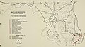
 Alewife Reservation and Alewife Brook master plan (2003) (17923165586).jpg 2,868 × 1,428; 994 KB
-
 Alewife Reservation and Alewife Brook master plan (2003) (17946487062).jpg 2,878 × 1,434; 1.06 MB
-
 Alewife Reservation and Alewife Brook master plan (2003) (17949533705).jpg 2,482 × 3,234; 2.4 MB
-
 Alewife Reservation and Alewife Brook master plan (2003) (17950191821).jpg 2,634 × 3,864; 3.88 MB
-
 Alewife Reservation and Alewife Brook master plan (2003) (17950367401).jpg 4,092 × 2,948; 3.34 MB
-
 Allens fresh zekiah.jpg 1,600 × 654; 207 KB
-

-
 AmongTheWeed.JPG 1,024 × 768; 287 KB
-

-
-

-
-
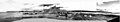 Asahel Curtis panorama from Centennial Mill showing Seattle in 1902.jpg 3,141 × 582; 339 KB
-
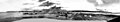
 Asahel Curtis panorama of harbor and shipyards, Seattle (1919).jpg 3,544 × 999; 395 KB
-
 Governor's Creek, Magnolia (NYPL b11707401-G90F125 018F).tiff 3,072 × 1,723; 15.15 MB
-
 Banque de compensationUSA2005.jpg 775 × 786; 131 KB
-
 Baumpilz.jpg 4,368 × 2,912; 3.82 MB
-
 Baylands.jpg 2,400 × 1,600; 1.61 MB
-
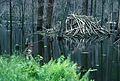 Beaver lodge (1).jpg 3,193 × 2,145; 775 KB
-
 Beginig of winter time in wetland area.jpg 2,100 × 1,400; 152 KB
-
 Bill Lawrence, trying to find a path through swamp.jpg 1,201 × 1,708; 1.44 MB
-
 Black Creek Wetlands Complex.jpg 2,848 × 2,128; 3.93 MB
-
 Blue sky creates a wonderful reflection in the marsh water.jpg 3,504 × 2,336; 929 KB
-
 Boy Scouts Summerfest 2013 (9369650587).jpg 4,518 × 3,342; 8.62 MB
-
 Boy Scouts Summerfest 2013 (9578954156).jpg 5,616 × 3,744; 7.93 MB
-
 Broadmoor wildlife sanctuary.jpg 3,024 × 4,032; 3.66 MB
-
 Brown colored swamp in summer.jpg 2,100 × 1,414; 169 KB
-
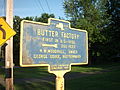 Butter Factory Historical Marker Campbell Hall NY Jun 11.jpg 2,048 × 1,536; 992 KB
-
 CanaanNight.jpg 1,922 × 2,478; 2.85 MB
-
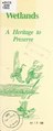 Wetlands, a heritage to preserve (IA CAT10656003).pdf 493 × 1,229, 8 pages; 414 KB
-
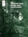 Wetland trail design and construction (IA CAT11118426).pdf 1,216 × 1,591, 92 pages; 6.08 MB
-
 A National policy of no net loss" of wetlands - what do agricultural economists have to contribute? " (IA CAT92983805).pdf 962 × 1,443, 50 pages; 2.33 MB
-
 Caw-caw-rice-fields-sc1.jpg 4,238 × 2,780; 5.9 MB
-
 CayCreekChristinaMansfield.jpg 480 × 360; 77 KB
-
 Checkerboard terraces.jpg 3,072 × 2,048; 215 KB
-
 Checking wetland soil (7067589349).jpg 4,800 × 3,200; 14.9 MB
-
 Chesapeake bay wetlands.jpg 3,000 × 1,974; 1.03 MB
-
 ChesapeakeTidalWetlands.jpg 2,272 × 1,704; 1.1 MB
-
 Children from primary schools enjoy a holiday in the nature.jpg 3,678 × 2,400; 868 KB
-
 Chilly Slough Wetlands, Whiskey Springs Stage Stop (23056331493).jpg 800 × 518; 149 KB
-
 Close view of aquatic plants on water surface in prairie wetland.jpg 4,056 × 2,700; 909 KB
-
 Coastal wetlands.jpg 3,000 × 1,962; 755 KB
-
 Colorado River in Colorado (9741119871).jpg 3,888 × 2,592; 3.43 MB
-
 Corkscrew - transition from wet prairie to pond cypress.jpg 4,608 × 3,456; 3.82 MB
-
 Creation of wetland habitats in northeastern Illinois (1982) (20089529393).jpg 2,278 × 3,518; 973 KB
-
 Creation of wetland habitats in northeastern Illinois (1982) (20522451518).jpg 1,916 × 3,038; 1.09 MB
-
 Creation of wetland habitats in northeastern Illinois (1982) (20522465980).jpg 2,664 × 3,504; 1.65 MB
-
 Creation of wetland habitats in northeastern Illinois (1982) (20522524818).jpg 2,202 × 3,294; 1.2 MB
-
 Creation of wetland habitats in northeastern Illinois (1982) (20684254866).jpg 2,500 × 3,416; 1.68 MB
-
 Creation of wetland habitats in northeastern Illinois (1982) (20701225132).jpg 2,600 × 3,520; 1.97 MB
-
 Creation of wetland habitats in northeastern Illinois (1982) (20701230472).jpg 2,268 × 3,336; 1.17 MB
-
 Creation of wetland habitats in northeastern Illinois (1982) (20710479905).jpg 2,700 × 3,514; 1.68 MB
-
 Creation of wetland habitats in northeastern Illinois (1982) (20717341351).jpg 2,536 × 2,910; 1.7 MB
-
 Cscr.jpg 704 × 442; 137 KB
-
 Curve of duckweed covered water edged with several bald cypress trees.jpg 2,336 × 3,504; 1.03 MB
-
 Dead melaleuca in a swamp area.jpg 3,000 × 1,990; 352 KB
-
 Delta wetlands.jpg 2,100 × 1,414; 205 KB
-
-

-

-
 Discussing wetland plants (7067596077).jpg 4,800 × 3,200; 13.01 MB
-
 Dow4.jpg 792 × 504; 325 KB
-
 Dr. J. C. Ayer and Co. (3092960551).jpg 798 × 413; 301 KB
-
 Dr. J.C. Ayer and Co. (3093575738).jpg 799 × 406; 254 KB
-
 Dr. J.C. Ayer and Co. (3093743754).jpg 799 × 403; 255 KB
-

-

-

-

-

-

-

-
-

-

-

-

-

-

-

-

-

-
 Dry wetlands in summer time.jpg 1,512 × 999; 97 KB
-
 Duck Potato (Sagittaria lancifolia) (6135184779).jpg 1,024 × 1,024; 969 KB
-
 Emiquon national reserve.jpg 3,671 × 2,400; 542 KB
-
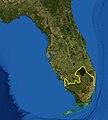 Everglades ecoregion.jpg 400 × 443; 145 KB
-
 Everglades national park Florida.jpg 1,512 × 996; 143 KB
-
 Expansive view of wetlands containing meandering waterways and vegetation.jpg 5,000 × 3,316; 672 KB
-
 Fairview Park, Lansing Michigan.JPG 3,264 × 2,448; 2.73 MB
-
 Fall Colors on Marsh Island.JPG 2,816 × 2,112; 4.88 MB
-
 Fireweed and spruce highlight this bog.jpg 2,048 × 1,362; 172 KB
-
 Firs and flowers around pond. (44f69b5b833f4a51ba1f329c810f6912).JPG 2,560 × 1,920; 2.23 MB
-
 Flood plain 7991.JPG 300 × 225; 32 KB
-
 Flowered wetland in California.jpg 1,512 × 1,023; 167 KB
-
 Flying above wetlands.jpg 1,420 × 2,100; 124 KB
-
 Fokechik bay wetlands.jpg 2,100 × 1,404; 215 KB
-
 Forest Flood Plain.JPG 4,926 × 1,094; 2.32 MB
-
 Fountain creek park Fountain CO.jpg 1,600 × 1,200; 786 KB
-
 Fults Hill Prairie and Kidd Lake 20161022 3360-3363.jpg 6,299 × 2,211; 4.14 MB
-
 Gadwall pair in wetland (5118391386).jpg 709 × 505; 267 KB
-
 GenevaCreekCO-IronFen.jpg 4,000 × 3,000; 4.18 MB
-
 WETLANDS- REVIEW OF REGULATORY CHANGES (IA gov.gpo.fdsys.CHRG-105shrg46779).pdf 1,275 × 1,650, 234 pages; 5.55 MB
-
 AGENCY IMPLEMENTATION OF THE SWANCC DECISION (IA gov.gpo.fdsys.CHRG-107hhrg88327).pdf 1,275 × 1,650, 213 pages; 5.77 MB
-

-
 SWANCC SUPREME COURT DECISION- IMPACT ON WETLANDS REGULATIONS (IA gov.gpo.fdsys.CHRG-108shrg92375).pdf 1,275 × 1,650, 310 pages; 25.43 MB
-
 Green lakes in mountain flats.jpg 2,100 × 1,400; 138 KB
-
 GRNA4576.JPG 1,024 × 768; 325 KB
-
 GSLview.JPG 2,448 × 3,264; 3.2 MB
-
 Habitat transition tabloid format.jpg 2,550 × 1,650; 827 KB
-
 HackensackWEtlands.JPG 1,024 × 768; 167 KB
-
 Image of wetland landscape with mountains in the background.jpg 4,980 × 3,160; 582 KB
-
 Impoundment at Back Bay NWR.jpg 200 × 150; 6 KB
-

-

-

-

-

-

-
 JBM2460-TOnWingsOfCareNonCommShareAlikewithAttrib.JPG 1,024 × 684; 329 KB
-
 JBM2471-TOnWingsOfCareNonCommShareAlikewithAttrib.JPG 1,024 × 684; 353 KB
-
 Jug Bay Wetlands Sanctuary.png 1,258 × 857; 2.42 MB
-
 Kanaha Pond.jpg 1,332 × 586; 256 KB
-
 Starr 020118-0003 Portulaca molokiniensis.jpg 1,600 × 1,200; 406 KB
-
 Starr 020118-0004 Portulaca molokiniensis.jpg 1,600 × 1,200; 439 KB
-
 Starr 020118-0010 Portulaca molokiniensis.jpg 1,600 × 1,200; 462 KB
-
 Starr 020118-0014 Portulaca molokiniensis.jpg 1,600 × 1,200; 455 KB
-
 Kennekuk Marshes, Lake Vermilion, Illinois.png 2,800 × 1,800; 9.24 MB
-
 Klamath Basin landscape.jpg 3,567 × 2,385; 3.15 MB
-
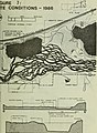
 LouisianaWetlandsLoss1976-99.jpg 540 × 756; 169 KB
-
 MarkJGuidry.JPG 1,024 × 768; 228 KB
-
 Marsh1.jpg 960 × 1,280; 532 KB
-
 MaryManor2 jgonzalez.jpg 2,816 × 2,112; 3.45 MB
-
 McNeil Slough WPA (13106313783).jpg 2,576 × 1,932; 1.25 MB
-
 Medium shot of wetlands.jpg 1,512 × 996; 99 KB
-
 Meijer Gardens October 2014 09 (Children's Garden).jpg 3,072 × 2,304; 1.38 MB
-
 Meijer Gardens October 2014 10 (Children's Garden).jpg 3,072 × 2,304; 1.4 MB
-
 Mendenhall Wetlands State Game Refuge 1.jpg 800 × 600; 123 KB
-
 MiddleSpring.JPG 3,264 × 2,448; 2.74 MB
-
 Mingo in Missouri national park wetland landscape.jpg 3,670 × 2,400; 629 KB
-
 Mingo national park wetlands.jpg 3,681 × 2,400; 612 KB
-
 Navigating-Ghost-River-section.jpg 1,749 × 1,189; 1.41 MB
-
 North Fork - Wetlands 04.jpg 900 × 600; 286 KB
-
 Northern Accokeek (8434889917).jpg 2,048 × 1,536; 780 KB
-
 Northern pintail (6893887705).jpg 698 × 460; 38 KB
-
 NPRA 2.jpg 512 × 384; 15 KB
-
 NRCSAR01007 - Arkansas (181)(NRCS Photo Gallery).jpg 2,100 × 1,500; 5.28 MB
-
 NRCSAR01007 - Arkansas (181)(NRCS Photo Gallery).tif 2,100 × 1,500; 12.02 MB
-
 NRCSAR01007(13916)(NRCS Photo Gallery).jpg 2,100 × 1,500; 201 KB
-
 NRCSMI01058 - Michigan (4705)(NRCS Photo Gallery).jpg 2,100 × 1,500; 6.07 MB
-
 Old Fort Bayou Preserve bladderwort (8435975316).jpg 3,072 × 2,304; 1.53 MB
-
 Painter Swamp.jpg 500 × 342; 146 KB
-
 Pair of Cinnamon Teal (5719260895).jpg 3,648 × 2,736; 2.99 MB
-

-
 Panorama of harbor and shipyards, Seattle (CURTIS 475).jpeg 768 × 602; 58 KB
-
 Panorama of Olympia (CURTIS 1665).jpeg 768 × 616; 68 KB
-
 Pearce WPA - Bowdoin WMD (13106591224).jpg 2,576 × 1,932; 1.13 MB
-
 Perham (2281573498).jpg 3,456 × 2,074; 6.74 MB
-
 Perham (2281577570).jpg 2,304 × 1,382; 3.5 MB
-
 Pinckney Island NWR (5121522666).jpg 1,500 × 928; 746 KB
-
 Pond swamp.jpg 3,264 × 2,448; 757 KB
-
 Pond, geese, osprey.jpg 1,024 × 768; 528 KB
-
 Poquoson, Virginia Museum Marsh Path.JPG 3,968 × 2,232; 3.99 MB
-
 Potter Marsh.jpg 3,072 × 2,304; 4.1 MB
-
 Prairie pothole wetland.jpg 3,000 × 1,972; 320 KB
-
 Prairie potholes in wetland aerial view.jpg 1,512 × 996; 92 KB
-
 Prudhoe Bay aerial FWS.jpg 504 × 331; 49 KB
-
 Punalu`u Beach Wetlands.jpg 900 × 600; 862 KB
-
 Rachel Carson national wildlife refuge maine.jpg 2,100 × 1,680; 215 KB
-

-

-
 RAritanBayMarshes.JPG 1,600 × 1,200; 567 KB
-
 RaritanBayMarshes2.JPG 1,600 × 1,200; 618 KB
-
 Red Knot (8435975046).jpg 2,896 × 1,944; 1.35 MB
-
 Red maple swamp (8435974372).jpg 3,072 × 2,304; 3.62 MB
-
 Restored wetlands.jpg 3,000 × 1,980; 402 KB
-
 Ribbit.jpg 2,240 × 1,488; 1.84 MB
-
 RIMG0505 (8383230977).jpg 1,536 × 2,048; 1.25 MB
-
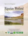 Riparian-wetland soils - riparian area management (IA riparianwetlands00unse).pdf 1,275 × 1,650, 124 pages; 3.07 MB
-
 Ruddy turnstone (8434891449).jpg 2,896 × 1,944; 2.23 MB
_412-DSP-2-WEDarials_135.jpg_-_DPLA_-_3d828d23aa374aa17686167e94b748b3.jpg)
.jpg)


.jpg)
.jpg)


_(17327107974).jpg)
_(17327115894).jpg)
_(17923139186).jpg)
_(17923165586).jpg)
_(17946487062).jpg)
_(17949533705).jpg)
_(17950191821).jpg)
_(17950367401).jpg)
.jpeg)

_(20325687152).jpg)
_(20340215261).jpg)


.jpg)


.jpg)
.jpg)


.jpg)


.jpg)


.jpg)
_(20089529393).jpg)
_(20522451518).jpg)
_(20522465980).jpg)
_(20522524818).jpg)
_(20684254866).jpg)
_(20701225132).jpg)
_(20701230472).jpg)
_(20710479905).jpg)
_(20717341351).jpg)


.jpg)

.jpg)
.jpg)
.jpg)
.jpg)
.jpg)
.jpg)
.jpg)
.jpg)
.jpg)
.jpg)
.jpg)
.jpg)
.jpg)
_-_January_1,_2015_(cb6e6610-b30a-fbf3-b85f-6f067b123c29).jpg)
.jpg)
.jpg)
.jpg)
.jpg)
.jpg)
.jpg)

_(6135184779).jpg)


.JPG)


.jpg)


.jpg)

.jpg)
.jpg)


.jpg)
.jpg)

(NRCS_Photo_Gallery).jpg)
(NRCS_Photo_Gallery).jpg)
(NRCS_Photo_Gallery).jpg)
.jpg)

.jpg)
.jpeg)
.jpeg)
.jpeg)
.jpg)
.jpg)
.jpg)
.jpg)


.jpeg)
.jpeg)


.jpg)
.jpg)


.jpg)
.jpg)
.jpg)
.jpg)