Category:Wharves and quays in Northern Ireland
Subcategories
This category has the following 5 subcategories, out of 5 total.
Media in category "Wharves and quays in Northern Ireland"
The following 24 files are in this category, out of 24 total.
-
 Ballydorn Quay - geograph.org.uk - 24124.jpg 640 × 427; 79 KB
-
 Ballymorran Quay - geograph.org.uk - 24139.jpg 640 × 427; 82 KB
-
 Bangor Castle I (8596471793).jpg 2,000 × 1,895; 1.54 MB
-
 Carnlough harbour - panoramio.jpg 4,000 × 2,104; 3.5 MB
-
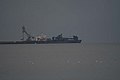
 Coleraine Harbour - geograph.org.uk - 24146.jpg 640 × 427; 45 KB
-
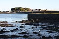
 Corradillar Quay - geograph.org.uk - 1270598.jpg 640 × 479; 49 KB
-
 Derryadd Quay - geograph.org.uk - 1270627.jpg 640 × 479; 59 KB
-
 Dunseverick Harbour - geograph.org.uk - 4059861.jpg 640 × 480; 171 KB
-

-
 Killroot Coal Jetty - geograph.org.uk - 350731.jpg 640 × 426; 61 KB
-
 Millbay Quay, Islandmagee - geograph.org.uk - 24177.jpg 640 × 427; 73 KB
-
 Mullagh Quay, Strangford Lough - geograph.org.uk - 24186.jpg 640 × 427; 63 KB
-
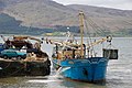 Mussel dredger at Rostrevor Quay - geograph.org.uk - 174331.jpg 640 × 426; 151 KB
-
 Portmuck harbour, Islandmagee - geograph.org.uk - 205632.jpg 640 × 426; 148 KB
-
 Quay at Quay Hill, Strangford Lough - geograph.org.uk - 24199.jpg 640 × 427; 71 KB
-
 Ringhaddy Quay - geograph.org.uk - 24200.jpg 640 × 427; 66 KB
-
 Ringneill, Comber, January 2011 (02).JPG 4,272 × 2,848; 4.9 MB
-
 Ringneill, Comber, January 2011 (10).JPG 4,272 × 2,848; 5.06 MB
-
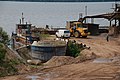 Sand quay, Lough Neagh - geograph.org.uk - 197818.jpg 640 × 426; 151 KB
-
 Sign, Corradillar Quay - geograph.org.uk - 1270601.jpg 640 × 479; 83 KB
-
 The quay at Rostrevor - geograph.org.uk - 264350.jpg 640 × 426; 150 KB
-
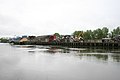
 Waterside from Derry Quay - geograph.org.uk - 304956.jpg 640 × 448; 135 KB
-
 Former sand quay at Toome - geograph.org.uk - 374146.jpg 640 × 426; 143 KB
-
 Quay - geograph.org.uk - 466929.jpg 640 × 418; 253 KB


.jpg)


.JPG)
.JPG)


