Category:Whichford
village in Warwickshire, England, UK  | |||||
| Upload media | |||||
| Instance of | |||||
|---|---|---|---|---|---|
| Location | Stratford-on-Avon, Warwickshire, West Midlands, England | ||||
| Population |
| ||||
| Area |
| ||||
| official website | |||||
 | |||||
Main Wikipedia article: Whichford.
Subcategories
This category has the following 4 subcategories, out of 4 total.
Media in category "Whichford"
The following 111 files are in this category, out of 111 total.
-
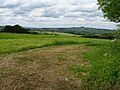
 Across the valley - geograph.org.uk - 1972146.jpg 4,000 × 3,000; 2.4 MB
-
 Across the valley - geograph.org.uk - 2630182.jpg 1,600 × 1,200; 601 KB
-
 Along the top of Whichford Wood - geograph.org.uk - 450335.jpg 640 × 477; 102 KB
-
 Arable farmland - geograph.org.uk - 5429334.jpg 1,024 × 768; 277 KB
-
 Bluebells in Whichford Wood - geograph.org.uk - 450325.jpg 640 × 477; 165 KB
-
 Brailes Hill - geograph.org.uk - 6174153.jpg 1,024 × 768; 245 KB
-
 Bridleway and track, Whichford - geograph.org.uk - 510957.jpg 640 × 426; 132 KB
-
 Bridleway meets road - geograph.org.uk - 2900719.jpg 4,320 × 3,240; 5.32 MB
-
 Chinslade Farm - geograph.org.uk - 1972242.jpg 4,000 × 3,000; 2.66 MB
-
 Climb the hill - geograph.org.uk - 1972145.jpg 4,000 × 3,000; 4.11 MB
-
 Contrail shadow - geograph.org.uk - 1973777.jpg 640 × 480; 50 KB
-
 Country junction - geograph.org.uk - 1973772.jpg 4,000 × 3,000; 4.14 MB
-
 Country junction - geograph.org.uk - 2729822.jpg 4,320 × 3,240; 5 MB
-
 Country road at Whichford - geograph.org.uk - 6177415.jpg 1,024 × 768; 364 KB
-
 Doctor's Barn (1) - geograph.org.uk - 2005778.jpg 4,000 × 3,000; 3.39 MB
-
 Doctor's Barn (2) - geograph.org.uk - 2005787.jpg 4,000 × 3,000; 3.28 MB
-
 Doctor's Barn (3) - geograph.org.uk - 2005788.jpg 4,000 × 3,000; 4.35 MB
-
 Doctor's Barn (4) - geograph.org.uk - 2005789.jpg 4,000 × 3,000; 3.38 MB
-
 Doctor's Barn - geograph.org.uk - 1656184.jpg 640 × 480; 54 KB
-
 Driveway to Farnicombe Farm - geograph.org.uk - 1973769.jpg 4,000 × 3,000; 2.85 MB
-
 Entrance drive to Whichford Pottery - geograph.org.uk - 3527135.jpg 2,000 × 1,500; 576 KB
-
 Entrance to Gottenham - geograph.org.uk - 512227.jpg 426 × 640; 127 KB
-
 Farm Drive - geograph.org.uk - 1973782.jpg 4,000 × 3,000; 3.3 MB
-
 Farmland and view - geograph.org.uk - 1735166.jpg 4,000 × 3,000; 2.6 MB
-
 Farmland and view - geograph.org.uk - 1735168.jpg 4,000 × 3,000; 3.21 MB
-
 Farmland around Farnicombe Farm - geograph.org.uk - 5429325.jpg 1,024 × 768; 320 KB
-
 Farmland near Cowpasture Farm - geograph.org.uk - 6174133.jpg 1,024 × 768; 258 KB
-
 Farmland patchwork - geograph.org.uk - 6174100.jpg 1,024 × 768; 289 KB
-
 Farmland track - geograph.org.uk - 6174109.jpg 1,024 × 768; 277 KB
-
 Field edge footpath - geograph.org.uk - 1975416.jpg 4,000 × 3,000; 3.47 MB
-
 Field edge path - geograph.org.uk - 1972152.jpg 4,000 × 3,000; 4.15 MB
-
 Field headland track - geograph.org.uk - 6174091.jpg 1,024 × 768; 285 KB
-

-
 Footpath junction - geograph.org.uk - 2900659.jpg 4,320 × 3,240; 5.2 MB
-
 Footpath meets road - geograph.org.uk - 1975424.jpg 4,000 × 3,000; 3.66 MB
-
 Footpath meets the road - geograph.org.uk - 1972178.jpg 4,000 × 3,000; 4.67 MB
-
 Footpath meets the road - geograph.org.uk - 1975413.jpg 4,000 × 3,000; 4.13 MB
-
 Footpath straight on - geograph.org.uk - 2005784.jpg 4,000 × 3,000; 3.3 MB
-
 Footpath to Whichford - geograph.org.uk - 1659743.jpg 640 × 480; 115 KB
-
 Footpaths merge - geograph.org.uk - 2005776.jpg 640 × 480; 117 KB
-
 From the bridleway, going towards Doctor's Barn - geograph.org.uk - 2630189.jpg 1,600 × 1,200; 501 KB
-
 Frozen footpath - geograph.org.uk - 1659761.jpg 640 × 480; 87 KB
-
 Half a haircut - geograph.org.uk - 1656167.jpg 640 × 480; 103 KB
-
 Harvesting Oil Seed Rape, near Whichford - geograph.org.uk - 510939.jpg 640 × 426; 120 KB
-
 Hidden stream - geograph.org.uk - 1972144.jpg 3,000 × 4,000; 3.86 MB
-
 Highwall Spinney from near Whichford - geograph.org.uk - 1656182.jpg 640 × 480; 43 KB
-
 Highwall Spinney from near Whichford - geograph.org.uk - 1972219.jpg 4,000 × 3,000; 2.72 MB
-
 Highwall Spinney from Whichford - geograph.org.uk - 2005780.jpg 4,000 × 3,000; 1.34 MB
-
 Horse training area and horses - geograph.org.uk - 1975418.jpg 4,000 × 3,000; 3.88 MB
-
 In the wood - geograph.org.uk - 2005777.jpg 4,000 × 3,000; 4.23 MB
-
 Lake alongside the footpath - geograph.org.uk - 1975421.jpg 4,000 × 3,000; 4.55 MB
-
 Lane to Stourton - geograph.org.uk - 3527811.jpg 2,000 × 1,500; 1.15 MB
-
 Late bluebells in Long Compton Woods - geograph.org.uk - 2395983.jpg 640 × 480; 142 KB
-
 Looking down to Whichford - geograph.org.uk - 450320.jpg 640 × 477; 107 KB
-
 Looking up the valley - geograph.org.uk - 2630178.jpg 1,600 × 1,200; 438 KB
-
 Mast near Green Lane Farm - geograph.org.uk - 6174120.jpg 1,024 × 768; 205 KB
-
 Minor road and tree - geograph.org.uk - 1975426.jpg 3,000 × 4,000; 3.67 MB
-
 New Barn - geograph.org.uk - 1973763.jpg 4,000 × 3,000; 2.62 MB
-
 New bridge - geograph.org.uk - 1654794.jpg 640 × 480; 144 KB
-
 The Norman Knight, Whichford - geograph.org.uk - 510954.jpg 640 × 426; 133 KB
-
 Overgrown footpath - geograph.org.uk - 1975422.jpg 4,000 × 3,000; 4.84 MB
-
 Overgrown junction - geograph.org.uk - 2005785.jpg 4,000 × 3,000; 4.57 MB
-
 Past the uncut maize - geograph.org.uk - 1654772.jpg 640 × 480; 125 KB
-
 Path in rough pasture - geograph.org.uk - 1659771.jpg 640 × 480; 64 KB
-
 Ragwort (Senecio jacobaea) - geograph.org.uk - 512238.jpg 426 × 640; 169 KB
-
 Road to Epwell - geograph.org.uk - 1972201.jpg 4,000 × 3,000; 4.21 MB
-
 Seven Shires Way - geograph.org.uk - 2693464.jpg 640 × 480; 64 KB
-
 Seven Shires Way - geograph.org.uk - 2693473.jpg 640 × 480; 77 KB
-
 Seven Shires Way - geograph.org.uk - 2693486.jpg 640 × 480; 120 KB
-
 Seven Shires Way - geograph.org.uk - 2693501.jpg 640 × 480; 70 KB
-
 Seven Shires Way - geograph.org.uk - 2693520.jpg 640 × 480; 121 KB
-
 Start of bridleway - geograph.org.uk - 2729855.jpg 4,320 × 3,240; 5.02 MB
-
 Stour valley - geograph.org.uk - 1859898.jpg 4,000 × 3,000; 2.23 MB
-
 The Macmillan Way (1) - geograph.org.uk - 1972142.jpg 4,000 × 3,000; 4.89 MB
-
 The Macmillan Way (2) - geograph.org.uk - 1972143.jpg 4,000 × 3,000; 4.64 MB
-
 The track past Gottenham - geograph.org.uk - 2630214.jpg 1,600 × 1,200; 609 KB
-
 The view to Whichford Wood - geograph.org.uk - 2730545.jpg 4,320 × 3,240; 4.41 MB
-
 Through the gate - geograph.org.uk - 1972148.jpg 4,000 × 3,000; 3.61 MB
-
 Through the wood - geograph.org.uk - 1659765.jpg 640 × 480; 129 KB
-
 Top of the hill - geograph.org.uk - 1972151.jpg 4,000 × 3,000; 4.02 MB
-
 Towards Doctor's Barn - geograph.org.uk - 2005786.jpg 4,000 × 3,000; 3.73 MB
-
 Towards Whichford Wood - geograph.org.uk - 1656166.jpg 640 × 480; 86 KB
-
 Track to North Leasow - geograph.org.uk - 6174151.jpg 1,024 × 768; 299 KB
-
 Track to the river - geograph.org.uk - 1972240.jpg 4,000 × 3,000; 4.16 MB
-
 Tunnel to the house - geograph.org.uk - 1973774.jpg 4,000 × 3,000; 4.53 MB
-
 Two hares - geograph.org.uk - 6174150.jpg 1,024 × 768; 200 KB
-
 Valley bottom farmland - geograph.org.uk - 1654749.jpg 640 × 480; 70 KB
-
 View over the Stour valley - geograph.org.uk - 6174147.jpg 1,024 × 768; 259 KB
-
 View to Brailes Hill - geograph.org.uk - 6177590.jpg 1,024 × 768; 276 KB
-
 View to Greenhill Covert - geograph.org.uk - 6174149.jpg 1,024 × 768; 289 KB
-
 Warwickshire farmland - geograph.org.uk - 1972248.jpg 4,000 × 3,000; 2.35 MB
-
 Whichford Hill Barn (1) - geograph.org.uk - 1975404.jpg 4,000 × 3,000; 3.39 MB
-
 Whichford Hill Barn (2) - geograph.org.uk - 1975406.jpg 4,000 × 3,000; 2.73 MB
-
 Whichford Hill Barn (3) - geograph.org.uk - 1975408.jpg 4,000 × 3,000; 2.65 MB
-
 Whichford Hill Barn - geograph.org.uk - 1659759.jpg 640 × 480; 81 KB
-
 Whichford Hill farmland - geograph.org.uk - 1659775.jpg 640 × 480; 58 KB
-
 Whichford Mill - geograph.org.uk - 1859968.jpg 4,000 × 3,000; 1.94 MB
-
 Whichford Pottery - geograph.org.uk - 3527130.jpg 2,000 × 1,411; 649 KB
-
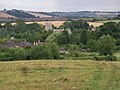 Whichford village - geograph.org.uk - 2005779.jpg 4,000 × 3,000; 3.04 MB
-
 Whichford Woods in the distance - geograph.org.uk - 2630161.jpg 1,600 × 1,200; 497 KB
-
 Whichford, entrance sign - geograph.org.uk - 2363996.jpg 640 × 480; 89 KB
-
 Whichford-The Norman Knight - geograph.org.uk - 5881857.jpg 1,600 × 992; 355 KB
-

-
 Farmland near Whichford - geograph.org.uk - 268961.jpg 640 × 480; 96 KB
-
 Farmland to the west of Whichford - geograph.org.uk - 512000.jpg 426 × 640; 129 KB
-
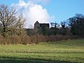
 Moat at Whichford - geograph.org.uk - 511999.jpg 640 × 426; 155 KB
-
 Redliff Hill - geograph.org.uk - 314031.jpg 640 × 480; 99 KB
-
 Track past Long Compton Woods - geograph.org.uk - 314029.jpg 640 × 480; 104 KB
-
 Weston Park - geograph.org.uk - 268953.jpg 640 × 480; 104 KB
-
 Whichford - geograph.org.uk - 102483.jpg 640 × 427; 131 KB
-
 Whichford Wood - geograph.org.uk - 102330.jpg 640 × 401; 92 KB


_-_geograph.org.uk_-_2005778.jpg)
_-_geograph.org.uk_-_2005787.jpg)
_-_geograph.org.uk_-_2005788.jpg)
_-_geograph.org.uk_-_2005789.jpg)


_-_geograph.org.uk_-_512238.jpg)


_-_geograph.org.uk_-_1972142.jpg)
_-_geograph.org.uk_-_1972143.jpg)


_-_geograph.org.uk_-_1975404.jpg)
_-_geograph.org.uk_-_1975406.jpg)
_-_geograph.org.uk_-_1975408.jpg)


