Category:Whitchurch, Cardiff
suburb and community in Cardiff, Wales, UK  | |||||
| Upload media | |||||
| Instance of | |||||
|---|---|---|---|---|---|
| Location | Cardiff, Wales | ||||
| Population |
| ||||
 | |||||
Subcategories
This category has the following 14 subcategories, out of 14 total.
A
- Afon Taff Viaduct (8 F)
C
H
L
M
- Maggie’s Centre, Cardiff (6 F)
P
S
- Shops in Whitchurch, Cardiff (16 F)
W
- Whitchurch Library, Cardiff (9 F)
- Whitchurch War Memorial, Cardiff (10 F)
Media in category "Whitchurch, Cardiff"
The following 200 files are in this category, out of 308 total.
(previous page) (next page)-
 2010 Wales Cardiff Community Whitchurch map.svg 512 × 546; 341 KB
-
 2024 Wales Cardiff Community Whitchurch map.svg 512 × 546; 319 KB
-
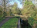
 Across Park Road bridge, Cardiff - geograph.org.uk - 6293692.jpg 1,600 × 1,200; 693 KB
-

-
 Afon Taff Viaduct, Whitchurch, Cardiff, September 2018 (7).jpg 4,032 × 3,024; 3.71 MB
-
 Alfreda Road, Whitchurch, Cardiff - geograph.org.uk - 5492408.jpg 800 × 600; 170 KB
-
 Apollo Cars, Cardiff - geograph.org.uk - 1965367.jpg 640 × 384; 60 KB
-
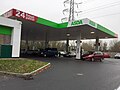
 Asda petrol station - geograph.org.uk - 5869418.jpg 6,000 × 4,000; 4.13 MB
-
 Athelstan Road, Whitchurch, Cardiff - geograph.org.uk - 5492411.jpg 800 × 600; 115 KB
-
 Autumn colours by the Glamorganshire Canal - geograph.org.uk - 2691425.jpg 4,000 × 3,000; 5.63 MB
-

-
 Barriered drive - Whitchurch - geograph.org.uk - 1806168.jpg 1,200 × 797; 1.13 MB
-
 Batleys Cash ^ Carry Cardiff Depot - geograph.org.uk - 2203953.jpg 640 × 480; 66 KB
-
 Beech House, Hollybush Estate, Cardiff - geograph.org.uk - 6293787.jpg 1,600 × 1,198; 409 KB
-
 Below a bridge - Coryton - geograph.org.uk - 1820986.jpg 1,200 × 784; 1.14 MB
-

-

-
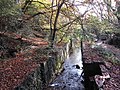
 Beside Forest Lock on the Glamorganshire Canal - geograph.org.uk - 6720042.jpg 5,184 × 3,888; 7.2 MB
-
 Beyond a locked gate - Whitchurch - geograph.org.uk - 1806177.jpg 1,200 × 797; 1.35 MB
-

-
 Bishop's Road, Whitchurch, Cardiff - geograph.org.uk - 5492242.jpg 800 × 571; 101 KB
-
 Bobath Centre, Whitchurch, Cardiff - geograph.org.uk - 1723878.jpg 640 × 468; 83 KB
-
 Bowling green at Whitchurch Hospital - geograph.org.uk - 1808228.jpg 1,200 × 803; 815 KB
-
 Bridge on Taff Trail near Llandaff - geograph.org.uk - 1900840.jpg 640 × 480; 103 KB
-

-
 Bridge over disused rail track - Coryton - geograph.org.uk - 1820962.jpg 1,200 × 797; 1.41 MB
-
 Bridge over former railway line near Coryton - geograph.org.uk - 6720016.jpg 5,184 × 3,888; 7.76 MB
-
 Bridge over former railway line near Coryton - geograph.org.uk - 6720046.jpg 5,184 × 3,888; 7.03 MB
-
 Bridge over former railway line near Coryton - geograph.org.uk - 6720067.jpg 5,184 × 3,888; 7.1 MB
-
 Bridge over former railway line near Coryton - geograph.org.uk - 6720085.jpg 5,184 × 3,888; 6.96 MB
-

-
 Bridge over rail track - Coryton - geograph.org.uk - 1820947.jpg 1,200 × 797; 1.08 MB
-
 Bridge over the Taff - geograph.org.uk - 6398288.jpg 2,048 × 1,536; 850 KB
-
 Brocastle Road, Whitchurch, Cardiff - geograph.org.uk - 6330932.jpg 1,338 × 1,134; 319 KB
-
 BT phonebox, Lon-y-celyn, Cardiff - geograph.org.uk - 6290748.jpg 1,600 × 1,200; 510 KB
-
 Burnt-out moped in an old railway cutting near Coryton - geograph.org.uk - 6720081.jpg 4,500 × 3,375; 6.78 MB
-
 Bus stop, shelter and trees, Coryton, Cardiff - geograph.org.uk - 6290766.jpg 1,600 × 1,200; 630 KB
-
 Camlas Morgannwg - Glamorgan Canal - geograph.org.uk - 4541693.jpg 640 × 451; 126 KB
-
 Camlas Morgannwg - Glamorgan Canal - geograph.org.uk - 4544963.jpg 640 × 467; 122 KB
-

-
 Cardiff ward location - Whitchurch Tongwynlais.png 800 × 570; 115 KB
-
 Cardiff's Northern Meadows - geograph.org.uk - 6720024.jpg 5,184 × 3,888; 6.18 MB
-
 Cedar House, Hollybush Estate, Cardiff - geograph.org.uk - 6290745.jpg 1,518 × 1,600; 476 KB
-

-
 Children's Playground - geograph.org.uk - 5235079.jpg 3,264 × 2,448; 3.28 MB
-
 Christmas Day 2019 advert for the Hollybush, Cardiff - geograph.org.uk - 6290796.jpg 1,205 × 1,500; 351 KB
-
 Clos Newydd, Whitchurch, Cardiff - geograph.org.uk - 5492399.jpg 800 × 589; 118 KB
-
 Clos Ystum Taf, Llandaff North, Cardiff - geograph.org.uk - 4920271.jpg 800 × 513; 104 KB
-

-

-
 Construction work at Radyr Weir - geograph.org.uk - 4757718.jpg 4,000 × 3,000; 3.55 MB
-

-
 Corner of Wauntreoda Rd and Heol-y-Gors, Cardiff - geograph.org.uk - 2431587.jpg 4,000 × 3,000; 1.41 MB
-
 Coryton Primary School entrance gates, Cardiff - geograph.org.uk - 6294175.jpg 1,600 × 1,272; 688 KB
-
 Coryton Primary School name sign, Cardiff - geograph.org.uk - 6294178.jpg 1,600 × 1,200; 607 KB
-
 Coryton railway station, Cardiff - geograph.org.uk - 3224087.jpg 800 × 600; 180 KB
-
 Cyfnewidfa Coryton Interchange - geograph.org.uk - 4541681.jpg 640 × 439; 83 KB
-
 Derelict barns at Forest Farm - geograph.org.uk - 1747998.jpg 1,200 × 797; 506 KB
-
 Development beside recreation ground - Coryton - geograph.org.uk - 1808241.jpg 1,200 × 797; 815 KB
-
 Drive Thru Starbucks - geograph.org.uk - 5869416.jpg 6,000 × 4,000; 7.56 MB
-

-
 Early morning on Cardiff's Northern Meadows - geograph.org.uk - 6720033.jpg 5,184 × 3,888; 3.96 MB
-
 Early morning on Cardiff's Northern Meadows - geograph.org.uk - 6720035.jpg 5,039 × 2,834; 2.91 MB
-
 Edwards bus on the A470, Whitchurch, Cardiff - geograph.org.uk - 6330983.jpg 1,600 × 1,112; 347 KB
-
 Ellesmere House old people's residence, Whitchurch.jpg 442 × 610; 62 KB
-

-

-

-
 Entrance to Whitchurch hospital - geograph.org.uk - 1988454.jpg 640 × 480; 68 KB
-
 ER II pillar box, 57 Merthyr Road, Whitchurch, Cardiff, July 2020.jpg 1,536 × 2,048; 931 KB
-
 Fiery sunset - geograph.org.uk - 6043905.jpg 2,048 × 1,536; 561 KB
-
 Firwood Close, Whitchurch, Cardiff - geograph.org.uk - 5492300.jpg 800 × 622; 156 KB
-

-

-
 Footbridge over the canal - geograph.org.uk - 2709333.jpg 640 × 480; 195 KB
-
 Footbridge over the Taff, near Radyr - geograph.org.uk - 1900869.jpg 640 × 480; 131 KB
-

-
 Footpath near Coryton station - geograph.org.uk - 1988444.jpg 480 × 640; 146 KB
-
 Footpath to Forest Farm Country Park - Coryton - geograph.org.uk - 1821317.jpg 1,200 × 797; 1.42 MB
-

-
 Forest Farm Nature Reserve - geograph.org.uk - 6720057.jpg 5,184 × 3,888; 5.38 MB
-
 Forest Farm Nature Reserve - geograph.org.uk - 6720061.jpg 5,182 × 2,915; 5.2 MB
-
 Forest Lock, Glamorganshire Canal - geograph.org.uk - 2691407.jpg 4,000 × 3,000; 5.14 MB
-
 Former railway cutting near Coryton - geograph.org.uk - 6720072.jpg 5,184 × 3,888; 6.94 MB
-
 Former railway cutting near Coryton - geograph.org.uk - 6720088.jpg 4,500 × 3,375; 7.15 MB
-
 Frosted entrance to Cardiff's Northern Meadows - geograph.org.uk - 6720052.jpg 4,500 × 3,375; 7.48 MB
-
 Gabalfa flyover, Cardiff - geograph.org.uk - 1896061.jpg 640 × 435; 66 KB
-
 Garden Wall, Privy and Gatepiers of Oak Cottage, Whitchurch, May 2020.jpg 4,032 × 3,024; 6.44 MB
-
 George V postbox, Whitchurch, Cardiff - geograph.org.uk - 1601887.jpg 480 × 640; 103 KB
-
 Glamorganshire Canal - geograph.org.uk - 2707153.jpg 640 × 480; 173 KB
-
 Glamorganshire Canal - geograph.org.uk - 3926765.jpg 2,400 × 1,592; 5.32 MB
-
 Glamorganshire Canal - Whitchurch, Cardiff - geograph.org.uk - 2240417.jpg 2,400 × 1,634; 1.79 MB
-
 Glamorganshire Canal - Whitchurch, Cardiff - geograph.org.uk - 2240432.jpg 2,400 × 1,594; 1.2 MB
-
 Glamorganshire Canal and abutments of former railway bridge - geograph.org.uk - 2691452.jpg 4,000 × 3,000; 4.57 MB
-
 Glamorganshire Canal Local Nature Reserve.jpg 4,000 × 6,000; 14.97 MB
-
 Glamorganshire Canal near Cardiff - geograph.org.uk - 2691396.jpg 4,000 × 3,000; 5.45 MB
-
 Glamorganshire Canal, looking towards Forest Lock - geograph.org.uk - 2691414.jpg 4,000 × 3,000; 5.58 MB
-
 Glamorganshire Canal, Whitchurch, Cardiff - geograph.org.uk - 2691371.jpg 4,000 × 3,000; 3.91 MB
-
 Glamorganshire Canal, Whitchurch, Cardiff - geograph.org.uk - 2691380.jpg 4,000 × 3,000; 4.86 MB
-
 Glamorganshire Canal-by-George-Tod.jpg 640 × 480; 101 KB
-
 Grey Heron, Forest Farm Country Park - geograph.org.uk - 5392769.jpg 1,024 × 768; 756 KB
-
 Grey squirrel at Forest Farm nature reserve - geograph.org.uk - 6714940.jpg 3,888 × 5,184; 5.18 MB
-
 Heol Don - Whitchurch - geograph.org.uk - 1806105.jpg 1,200 × 797; 772 KB
-
 Heol Don - Whitchurch - geograph.org.uk - 1806140.jpg 1,200 × 797; 846 KB
-
 Heol Don Bus Stops - geograph.org.uk - 1987493.jpg 1,024 × 768; 178 KB
-
 Heol Don Care Home, Whitchurch, Cardiff - geograph.org.uk - 5492421.jpg 800 × 557; 133 KB
-
 Heol Don Cottage, Whitchurch, Cardiff - geograph.org.uk - 5492381.jpg 800 × 648; 124 KB
-
 Heol Don Court, Whitchurch, Cardiff - geograph.org.uk - 5492315.jpg 800 × 542; 124 KB
-
 Heol Don houses, Whitchurch, Cardiff - geograph.org.uk - 5492928.jpg 800 × 540; 88 KB
-
 Heol Don Junction - geograph.org.uk - 1987512.jpg 1,024 × 768; 153 KB
-
 Hollybush estate - geograph.org.uk - 5574569.jpg 3,264 × 2,448; 2.36 MB
-
 Houses and trees, Pantmawr Road, Cardiff - geograph.org.uk - 6302478.jpg 1,024 × 869; 229 KB
-
 Hypermarket at Coryton - geograph.org.uk - 2497203.jpg 800 × 600; 350 KB
-
 Hypermarket car park at Coryton - geograph.org.uk - 2497204.jpg 800 × 600; 370 KB
-

-
 Into the Hollybush Estate, Cardiff - geograph.org.uk - 6290751.jpg 1,600 × 1,436; 445 KB
-

-

-
 Junction of Lon-y-celyn and Park Road, Cardiff - geograph.org.uk - 6293739.jpg 1,600 × 1,169; 463 KB
-
 Junction of Merthyr Rd and Mervyn Rd, Whitchurch, Cardiff - geograph.org.uk - 1889925.jpg 3,296 × 2,472; 1.94 MB
-
 K8's Short Bark 'N' Sides, Hollybush Estate, Cardiff - geograph.org.uk - 6290737.jpg 1,480 × 1,600; 545 KB
-
 Kelston Road, Whitchurch, Cardiff - geograph.org.uk - 5492931.jpg 800 × 609; 124 KB
-

-

-
 Kingsmill lorry on the A470, Whitchurch, Cardiff - geograph.org.uk - 6319446.jpg 1,600 × 1,242; 486 KB
-
 Lane off Heol Don - Whitchurch - geograph.org.uk - 1806115.jpg 1,200 × 797; 836 KB
-
 Larch House, Hollybush Estate, Cardiff - geograph.org.uk - 6293792.jpg 1,600 × 1,091; 397 KB
-

-

-
 Lloyds TSB, Whitchurch, Cardiff - geograph.org.uk - 1725282.jpg 633 × 640; 95 KB
-
 Lock 43, Forest Lock on the Glamorgan Canal - geograph.org.uk - 6028247.jpg 1,060 × 1,600; 569 KB
-
 Lock gate - geograph.org.uk - 2709313.jpg 640 × 480; 179 KB
-
 Lock on the Glamorganshire Canal - geograph.org.uk - 2708260.jpg 640 × 480; 177 KB
-
 Lon-y-Celyn, Cardiff - geograph.org.uk - 1715538.jpg 640 × 386; 71 KB
-
 Lon-y-celyn, Whitchurch, Cardiff - geograph.org.uk - 6290747.jpg 1,024 × 848; 156 KB
-
 Lon-y-Groes, Cardiff - geograph.org.uk - 1965476.jpg 640 × 377; 56 KB
-
 Longwood Drive, Radyr, Cardiff - geograph.org.uk - 2191446.jpg 640 × 480; 85 KB
-

-
 Makeshift entrance at Lady Cory Field - geograph.org.uk - 6720094.jpg 5,184 × 3,888; 7.16 MB
-
 McLays printers,Radyr, Cardiff - geograph.org.uk - 2191461.jpg 640 × 399; 55 KB
-
 Melingriffith Feeder (1), Cardiff - geograph.org.uk - 2204793.jpg 640 × 480; 114 KB
-
 Melingriffith Feeder (2), Cardiff - geograph.org.uk - 2204799.jpg 640 × 480; 123 KB
-
 Melingriffith Feeder - geograph.org.uk - 2704436.jpg 640 × 480; 162 KB
-
 Melingriffith Feeder near Radyr - geograph.org.uk - 2691465.jpg 4,000 × 3,000; 4.59 MB
-
 Melingriffith feeder stream, Cardiff - geograph.org.uk - 2203990.jpg 640 × 480; 140 KB
-
 Melingriffiths Feeder - Whitchurch - geograph.org.uk - 2240430.jpg 2,400 × 1,726; 1.87 MB
-
 Memorial Plaque - geograph.org.uk - 5586521.jpg 3,264 × 2,448; 3.45 MB
-
 Merthyr Rd, Whitchurch, Cardiff - geograph.org.uk - 1889933.jpg 3,296 × 2,472; 1.88 MB
-
 Merthyr Road semis, Cardiff - geograph.org.uk - 5003667.jpg 800 × 523; 97 KB
-
 Middle Lock on the Glamorganshire Canal geograph-6720063-by-Gareth-James.jpg 3,888 × 5,184; 6.96 MB
-
 Middle Lock, Glamorganshire Canal - geograph.org.uk - 2691435.jpg 4,000 × 3,000; 5.38 MB
-

-

-

-
 Motorway Junction - geograph.org.uk - 3141797.jpg 640 × 480; 480 KB
-

-
 New road and pavilion at Whitchurch Hospital - geograph.org.uk - 1808233.jpg 1,200 × 797; 916 KB
-

-
 NW along Northern Avenue, Cardiff - geograph.org.uk - 6316325.jpg 1,600 × 1,451; 617 KB
-
 Oak House, Hollybush Estate, Cardiff - geograph.org.uk - 6290744.jpg 1,600 × 1,182; 458 KB
-

-

-
 Ordnance Survey Cut Mark - geograph.org.uk - 5978800.jpg 1,024 × 930; 300 KB
-
 Ordnance Survey Cut Mark - geograph.org.uk - 5978806.jpg 1,024 × 851; 279 KB
-
 Ordnance Survey Cut Mark - geograph.org.uk - 5978811.jpg 1,024 × 746; 268 KB
-
 Ordnance Survey Cut Mark - geograph.org.uk - 5978814.jpg 1,024 × 696; 187 KB
-
 Ordnance Survey Cut Mark - geograph.org.uk - 5978820.jpg 1,024 × 764; 111 KB
-
 Ordnance Survey Cut Mark - geograph.org.uk - 5978824.jpg 1,024 × 864; 222 KB
-
 Ordnance Survey Cut Mark - geograph.org.uk - 5978836.jpg 576 × 1,024; 211 KB
-
 Ordnance Survey Cut Mark - geograph.org.uk - 5978870.jpg 1,024 × 776; 418 KB
-
 Ordnance Survey Cut Mark - geograph.org.uk - 5978873.jpg 1,024 × 877; 155 KB
-
 Ordnance Survey Cut Mark - geograph.org.uk - 5978877.jpg 1,024 × 930; 414 KB
-
 Ordnance Survey Cut Mark - geograph.org.uk - 5978882.jpg 1,024 × 876; 206 KB
-
 Ordnance Survey Cut Mark - geograph.org.uk - 5978883.jpg 1,005 × 1,024; 177 KB
-
 Ordnance Survey Cut Mark - geograph.org.uk - 5978886.jpg 574 × 1,024; 263 KB
-
 Ordnance Survey Cut Mark - geograph.org.uk - 5978892.jpg 1,024 × 756; 343 KB
-
 Ordnance Survey Cut Mark - geograph.org.uk - 5978895.jpg 1,024 × 609; 238 KB
-
 Ordnance Survey Cut Mark - geograph.org.uk - 5978899.jpg 1,024 × 721; 271 KB
-
 Ordnance Survey Cut Mark - geograph.org.uk - 6308237.jpg 1,024 × 716; 340 KB
-
 Ordnance Survey Cut Mark - geograph.org.uk - 6308240.jpg 1,024 × 792; 346 KB
-
 Ordnance Survey Cut Mark - geograph.org.uk - 6308242.jpg 1,024 × 749; 357 KB
-
 Ordnance Survey Cut Mark - geograph.org.uk - 6308243.jpg 655 × 1,024; 100 KB
-
 Ordnance Survey Cut Mark - geograph.org.uk - 6714621.jpg 1,024 × 808; 293 KB
-
 Ordnance Survey Cut Mark - geograph.org.uk - 6714623.jpg 1,024 × 847; 218 KB
-
 Ordnance Survey Rivet - geograph.org.uk - 6308239.jpg 585 × 1,024; 231 KB
-
 Pantmawr Road electricity substation, Cardiff - geograph.org.uk - 6290780.jpg 1,559 × 1,600; 518 KB
-
 Pantmawr Road, Coryton, Cardiff - geograph.org.uk - 6290753.jpg 1,508 × 1,526; 593 KB
-
 Park Crescent, Whitchurch, Cardiff - geograph.org.uk - 1723820.jpg 640 × 480; 79 KB
-
 Park Road (A4054) - Whitchurch - geograph.org.uk - 1803462.jpg 1,210 × 792; 796 KB
-
 Park Road (A4054) - Whitchurch - geograph.org.uk - 1804157.jpg 1,200 × 797; 992 KB
-
 Path beside the Taff - geograph.org.uk - 6081226.jpg 1,024 × 683; 256 KB
-
 Path junction and pylon, Cardiff - geograph.org.uk - 2183564.jpg 640 × 480; 132 KB
-

-
 Pen-y-Dre, Rhiwbina, Cardiff - geograph.org.uk - 1723066.jpg 640 × 480; 75 KB
-
 Pendwyallt Road bus stop and shelter, Cardiff - geograph.org.uk - 6302484.jpg 1,600 × 1,059; 374 KB
-
 Pendwyallt Road houses, Coryton, Cardiff - geograph.org.uk - 6290800.jpg 1,600 × 1,120; 308 KB
-
 Petrol Station - geograph.org.uk - 5217033.jpg 3,264 × 2,448; 1.88 MB
-
 Poplar House, Hollybush Estate, Cardiff - geograph.org.uk - 6290739.jpg 1,600 × 1,237; 335 KB
-
 Postbox cipher of Edward VIII - Whitchurch - geograph.org.uk - 1806079.jpg 1,200 × 797; 793 KB
-
 Protest flags in Cardiff's Northern Meadows - geograph.org.uk - 6720028.jpg 5,184 × 3,888; 5.4 MB


.jpg)


,_Whitchurch,_Cardiff_-_geograph.org.uk_-_1725256.jpg)
,_Whitchurch,_Cardiff_-_geograph.org.uk_-_1725265.jpg)


,_Cardiff_-_geograph.org.uk_-_2204793.jpg)
,_Cardiff_-_geograph.org.uk_-_2204799.jpg)


_-_Whitchurch_-_geograph.org.uk_-_1803462.jpg)
_-_Whitchurch_-_geograph.org.uk_-_1804157.jpg)


