Category:White Hill, Forest of Bowland
English: White Hill is a hill in the civil parishes of Bowland Forest High and Tatham, in the Ribble Valley and Lancaster districts, in the county of Lancashire, England.
hill in the Forest of Bowland, Lancashire, England, UK  | |||||
| Upload media | |||||
| Instance of | |||||
|---|---|---|---|---|---|
| Located in protected area | |||||
| Location |
| ||||
| Elevation above sea level |
| ||||
| Parent peak | |||||
 | |||||
Media in category "White Hill, Forest of Bowland"
The following 13 files are in this category, out of 13 total.
-
 Double access gate on White Hill - geograph.org.uk - 2163622.jpg 640 × 426; 416 KB
-
 Double Kissing Gate - geograph.org.uk - 770634.jpg 640 × 480; 105 KB
-
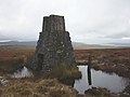
 Sighting tower on White Hill - geograph.org.uk - 2163637.jpg 640 × 426; 227 KB
-
 Sighting Tower White Hill - geograph.org.uk - 2163631.jpg 640 × 426; 191 KB
-
 Survey Tower on White Hill - geograph.org.uk - 1141705.jpg 480 × 640; 71 KB
-
 Survey Tower on White Hill - geograph.org.uk - 3579806.jpg 2,560 × 1,920; 2.34 MB
-
 Survey Tower White Hill - geograph.org.uk - 152700.jpg 640 × 480; 99 KB
-
 Survey tower, White Hill - geograph.org.uk - 3738196.jpg 640 × 480; 71 KB
-
 Trig pillar and survey pillar on White Hill - geograph.org.uk - 1852634.jpg 2,592 × 1,944; 1.23 MB
-
 Trig Pillar White Hill - geograph.org.uk - 117351.jpg 640 × 480; 77 KB
-
 Trig Pillar White Hill - geograph.org.uk - 152698.jpg 640 × 480; 81 KB
-
 Trig pillar, White Hill - geograph.org.uk - 770628.jpg 640 × 480; 63 KB
-
 Trig point on White Hill - geograph.org.uk - 2163639.jpg 640 × 426; 247 KB


