Category:Whitton, Scottish Borders

Media in category "Whitton, Scottish Borders"
The following 18 files are in this category, out of 18 total.
-
 A cairn on Andrew's Knowe - geograph.org.uk - 1306198.jpg 640 × 427; 145 KB
-
 A large grazing field at Whitton Edge - geograph.org.uk - 1322385.jpg 640 × 427; 149 KB
-
 Andrew's Knowe - geograph.org.uk - 1304553.jpg 640 × 427; 135 KB
-
 Craw Cleuch - geograph.org.uk - 418390.jpg 640 × 480; 115 KB
-

-
 Dere Street at Whitton Edge - geograph.org.uk - 416000.jpg 640 × 480; 77 KB
-
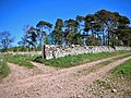
 Dry stane dyke, gate and Tanlaw Woods - geograph.org.uk - 495281.jpg 640 × 480; 111 KB
-
 Dyke Junction - geograph.org.uk - 495266.jpg 640 × 480; 87 KB
-
 Faw Laws summit - geograph.org.uk - 416850.jpg 640 × 480; 67 KB
-

-
 Summit of Heatherland Hill - geograph.org.uk - 416859.jpg 640 × 480; 83 KB
-
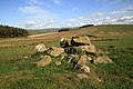
 The remains of Whitton Tower - geograph.org.uk - 1387304.jpg 640 × 427; 156 KB
-
 Whitton Farm, near Morebattle - geograph.org.uk - 191275.jpg 640 × 480; 70 KB
-
 Whitton Loch - geograph.org.uk - 1308556.jpg 427 × 640; 133 KB
-
 Whitton Loch - geograph.org.uk - 1388767.jpg 640 × 427; 144 KB
-
 Whitton Loch - geograph.org.uk - 78976.jpg 640 × 480; 52 KB
-

-
 Whitton Cottages - geograph.org.uk - 210244.jpg 640 × 480; 124 KB


