Category:Wilhelminapark, Breda
| Camera location | | View all coordinates using: OpenStreetMap |
|---|
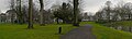
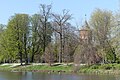
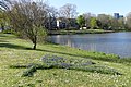
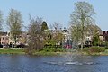
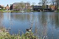
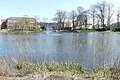
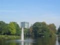
Nederlands: Afbeeldingen van het Wilhelminapark, Breda in Breda in de provincie Noord-Brabant in het zuiden van Nederland. Het Wilhelminapark is gelegen in de wijken Sportpark en Zandberg. Nabij de straten de Wilhelminasingel, Paul Windhausenweg en de Generaal Maczekstraat niet ver van het centrum van Breda. Het Wilhelminapark bestaat uit twee delen en is gescheiden door de straat het Wilhelminapark (bron ([1])
park in the Netherlands  | |||||
| Upload media | |||||
| Instance of | |||||
|---|---|---|---|---|---|
| Named after | |||||
| Location | Breda, North Brabant, Netherlands | ||||
 | |||||
Subcategories
This category has the following 7 subcategories, out of 7 total.
B
J
- Joods Monument, Breda (4 F)
M
- Maps of Wilhelminapark, Breda (empty)
O
- Onze Lieve Vrouwelyceum (15 F)
P
- Panzerkampfwagen V in Breda (30 F)
- Pools Monument (12 F)
W
Media in category "Wilhelminapark, Breda"
The following 40 files are in this category, out of 40 total.
-
 P1010561copyWilhelminapark.jpg 3,264 × 1,700; 1.3 MB
-
 P1010563copyWilhelminapark.jpg 3,264 × 2,448; 2.91 MB
-
 Wilhelminapark Breda P1010557copy.jpg 3,264 × 992; 831 KB
-
 Wilhelminapark Breda P1010558copy.jpg 3,264 × 2,448; 2.59 MB
-
 Wilhelminapark Breda P1050725.JPG 3,264 × 2,448; 3.7 MB
-
 Wilhelminapark Breda P1050726.JPG 3,264 × 2,448; 3.68 MB
-
 Wilhelminapark Breda P1050727.JPG 3,264 × 2,448; 3.64 MB
-
 Wilhelminapark Breda P1360766.jpg 4,000 × 2,672; 6.05 MB
-
 Wilhelminapark Breda P1360768.jpg 4,784 × 1,920; 5.53 MB
-
 Wilhelminapark Breda P1360769.jpg 4,000 × 2,672; 5.97 MB
-
 Wilhelminapark Breda P1360770.jpg 4,000 × 2,672; 6.2 MB
-
 Wilhelminapark Breda P1360773.jpg 2,672 × 4,000; 5.78 MB
-
 Wilhelminapark, Breda I01042.jpg 3,264 × 2,448; 3.81 MB
-
 Wilhelminapark, Breda P1360760.jpg 4,000 × 2,672; 4.97 MB
-
 Wilhelminapark, Breda P1360761.jpg 4,000 × 2,672; 5.03 MB
-
 Wilhelminapark, Breda P1360762.jpg 4,000 × 2,672; 4.96 MB
-
 Wilhelminapark, Breda P1360763.jpg 4,000 × 2,672; 4.96 MB
-
 Wilhelminapark, Breda P1360764.jpg 4,000 × 2,672; 5 MB
-
 Wilhelminapark, Breda P1360765.jpg 4,000 × 2,672; 5.11 MB
-
 Wilhelminapark, Breda P1360777.jpg 4,000 × 2,672; 6.14 MB
-
 Wilhelminapark, Breda P1360778.jpg 4,000 × 2,672; 5.85 MB
-
 Wilhelminapark, Breda P1360779.jpg 4,000 × 2,672; 6.09 MB
-
 Wilhelminapark, Breda P1360780.jpg 4,000 × 2,672; 5.03 MB
-
 Wilhelminapark, Breda P1360781.jpg 4,000 × 2,672; 5.91 MB
-
 Wilhelminapark, Breda P1360782.jpg 4,000 × 2,672; 5.6 MB
-
 Wilhelminapark, Breda P1360783.jpg 4,000 × 2,672; 6.36 MB
-
 Wilhelminapark, Breda P1360789.jpg 4,000 × 2,672; 6.06 MB
-
 Wilhelminapark, Breda P1360790.jpg 4,000 × 2,672; 6.18 MB
-
 Wilhelminapark, Breda P1360791.jpg 4,000 × 2,672; 6.28 MB
-
 Wilhelminapark, Breda P1460778.jpg 4,000 × 2,672; 6.1 MB
-
 Wilhelminapark, Breda P1460779.jpg 4,000 × 2,672; 6.15 MB
-
 Wilhelminapark, Breda P1460782.jpg 4,000 × 2,672; 5.94 MB
-
 Wilhelminapark, Breda P1460783.jpg 4,000 × 2,672; 6.27 MB
-
 Wilhelminapark, Breda P1460787.jpg 4,000 × 2,672; 5.87 MB
-
 Wilhelminapark, Breda P1460790.jpg 4,000 × 2,672; 5.94 MB
-
 Wilhelminapark, Breda P1460793.jpg 4,000 × 2,672; 5.9 MB
-
 Wilhelminapark, Breda P1460794.jpg 2,672 × 4,000; 6.05 MB
-
 Wilhelminapark, Breda P1460795.jpg 4,000 × 2,672; 5.92 MB
-
 Wilhelminapark, Breda P1460804.jpg 4,000 × 2,672; 5.04 MB
-
 Wilhelminapark.jpg 800 × 602; 101 KB


