Category:Wilhelminasluis (Andel)
| Object location | | View all coordinates using: OpenStreetMap |
|---|
lock in Andel, Netherlands  | |||||
| Upload media | |||||
| Instance of | |||||
|---|---|---|---|---|---|
| Location | Andel, Altena, North Brabant, Netherlands | ||||
| Located in or next to body of water | |||||
| Street address |
| ||||
| Located on street |
| ||||
| Maintained by | |||||
| Heritage designation |
| ||||
 | |||||
|
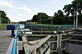
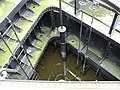
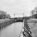
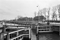
This is a category about rijksmonument number 521382
|
| Address |
|
Media in category "Wilhelminasluis (Andel)"
The following 17 files are in this category, out of 17 total.
-
 Andel - rijksmonument 521382 - Wilhelminasluis 20120630.jpg 800 × 530; 217 KB
-
 Andel Sluis (1).jpg 2,717 × 1,856; 2.54 MB
-
 Andel Sluis (2).jpg 1,360 × 2,048; 642 KB
-
 Andel Sluis (3).jpg 3,072 × 2,304; 3.44 MB
-
 Andel Sluis (4).jpg 3,072 × 2,304; 3.24 MB
-
 Andel Sluis (5).jpg 1,222 × 1,840; 461 KB
-
 Netherlands, Afgedamde Maas, Wilhelminasluis.JPG 2,573 × 1,709; 1.79 MB
-
 Overzicht - Giessen - 20347011 - RCE.jpg 1,200 × 1,200; 295 KB
-
 Overzicht - Giessen - 20348731 - RCE.jpg 1,198 × 1,200; 246 KB
-
 Overzicht - Op-Andel - 20177248 - RCE.jpg 1,200 × 788; 157 KB
-
 Overzicht - Op-Andel - 20177249 - RCE.jpg 1,200 × 788; 193 KB
-
 Overzicht sluis - Op-Andel - 20177247 - RCE.jpg 1,200 × 788; 176 KB
-
 Sluis met invarend passagiersschip - Giessen - 20347012 - RCE.jpg 1,188 × 1,200; 264 KB
-
 Sluis met invarend passagiersschip - Giessen - 20347015 - RCE.jpg 1,195 × 1,200; 244 KB
-
 Waaierdeur van sluis - Giessen - 20347013 - RCE.jpg 1,190 × 1,200; 252 KB
-
 Waaierdeur van sluis - Giessen - 20347014 - RCE.jpg 1,200 × 1,200; 241 KB
-
 Wilhelminasluis.Andel.jpg 4,000 × 3,000; 5.57 MB

.jpg)
.jpg)
.jpg)
.jpg)
.jpg)


