Category:Wilhermsdorf
municipality of Germany | |||||
| Upload media | |||||
| Instance of |
| ||||
|---|---|---|---|---|---|
| Part of |
| ||||
| Location | Fürth, Middle Franconia, Bavaria, Germany | ||||
| Population |
| ||||
| Area |
| ||||
| Elevation above sea level |
| ||||
| official website | |||||
 | |||||
Subcategories
This category has the following 7 subcategories, out of 7 total.
Media in category "Wilhermsdorf"
The following 25 files are in this category, out of 25 total.
-
DEU Wilhermsdorf COA.svg 512 × 565; 2 KB
-
Wappen von Wilhermsdorf.jpg 189 × 205; 14 KB
-
1876issue Bayern 2Mk Wilhermsdorf Mi44.jpg 414 × 467; 345 KB
-
2007-08-24 Zenngrundbahn RB35386 Bf Wilhemsdorf 1.jpg 800 × 600; 175 KB
-
Altkatterbach, Ortsausgang - 03 2020.jpg 3,000 × 4,000; 5.54 MB
-
Burgmilchlingstraße Wilhermsdorf.JPG 4,000 × 3,000; 3.56 MB
-
FÜWilhermsdorf02.jpg 4,272 × 2,848; 2.1 MB
-
Gaststätte Sudkeller Wilhermsdorf.JPG 4,000 × 3,000; 3.82 MB
-
Judentor Wilhermsdorf.jpg 612 × 351; 62 KB
-
Kirchfarrnbach A 25 und B 1.JPG 4,000 × 3,000; 3.91 MB
-
Milchhaus Unterulsenbach - panoramio.jpg 2,163 × 1,581; 490 KB
-
Schlosskulisse.jpg 533 × 328; 110 KB
-
Sudkeller neben Barockkirche Wilhermsdorf.JPG 4,000 × 3,000; 3.75 MB
-
Wilhermsdorf - Ritterhaus - Ansicht von Südwest.jpg 3,264 × 1,840; 1.68 MB
-
Wilhermsdorf - Ritterhaus - Eingangsportal.jpg 1,840 × 3,264; 1.38 MB
-
Wilhermsdorf - Ritterhaus - Schriftzug des Ritterkanton Altmühl.jpg 3,264 × 1,840; 2.01 MB
-
Wilhermsdorf - Ritterhaus - Wappen des Ritterkanton Altmühl.jpg 1,840 × 3,264; 1.67 MB
-
Wilhermsdorf - Ritterhaus von Osten.jpg 3,264 × 1,840; 2.12 MB
-
Wilhermsdorf in FÜ.svg 400 × 330; 962 KB
-
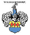
Wilhermsdorf Siebmacher072 - 1703 - Adel Franken.jpg 798 × 941; 220 KB
-
Wilhermsdorf, Feldweg bei Kreben - 03 2020.jpg 4,000 × 3,000; 4.58 MB
-
Zur Frischen Quelle Wilhermsdorf-Kirchfarrnbach.JPG 4,000 × 3,000; 3.87 MB
-
Zwerchbau-burgmilchling.jpg 533 × 229; 78 KB


