Category:Willington, County Durham
village in County Durham, England  | |||||
| Upload media | |||||
| Instance of | |||||
|---|---|---|---|---|---|
| Location | Greater Willington, County Durham, North East England, England | ||||
 | |||||

English: Willington is a former pit town in County Durham, England. It is in the foothills of the Pennines and near the River Wear close to Crook and Bishop Auckland. Like many communities in the area, Willington's economy was largely based on coal mining. The closure of the colliery in 1967 therefore hit the town hard. Similarly to many former mining communities this is a blow that Willington has struggled to recover from.
Nederlands: Willington is een plaats in het bestuurlijke gebied Wear Valley, in het Engelse graafschap Durham. De plaats telt 4534 inwoners.
Subcategories
This category has the following 3 subcategories, out of 3 total.
Media in category "Willington, County Durham"
The following 33 files are in this category, out of 33 total.
-
 A690, Willington - geograph.org.uk - 124390.jpg 640 × 480; 98 KB
-
 Armstrong Drive, Willington - geograph.org.uk - 2056560.jpg 640 × 480; 96 KB
-
 Belle Vue Terrace, Willington - geograph.org.uk - 2056555.jpg 640 × 480; 78 KB
-

-
 Filling station at Helmington Row - geograph.org.uk - 338245.jpg 640 × 480; 55 KB
-
 Fowlers DIY and Hardware shop in Willington - geograph.org.uk - 3564915.jpg 3,648 × 2,736; 1.48 MB
-
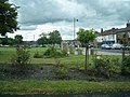
 Greenways, Willington - geograph.org.uk - 2056576.jpg 640 × 480; 95 KB
-
 Hall Lane Estate, Willington - geograph.org.uk - 2479544.jpg 640 × 480; 69 KB
-
 Hall Lane Estate, Willington - geograph.org.uk - 2479546.jpg 640 × 480; 64 KB
-
 Playground at Helmington Row - geograph.org.uk - 338240.jpg 640 × 480; 73 KB
-
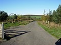
 Roman Road (Course of) Willington - geograph.org.uk - 1609426.jpg 640 × 480; 100 KB
-
 Sewage Works near Willington - geograph.org.uk - 2055526.jpg 640 × 480; 84 KB
-
 Sycamore Grove, Willington - geograph.org.uk - 2055535.jpg 640 × 480; 78 KB
-
 Sycamore Grove, Willington - geograph.org.uk - 2055548.jpg 640 × 480; 92 KB
-
 The River Wear at Willington - geograph.org.uk - 75704.jpg 640 × 427; 78 KB
-

-
 The Willington sculpture - geograph.org.uk - 124392.jpg 480 × 640; 88 KB
-
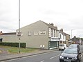
 Willington High Street - geograph.org.uk - 1346119.jpg 640 × 481; 85 KB
-
 A plantation road on Stockley Fell - geograph.org.uk - 272756.jpg 640 × 480; 58 KB
-
 Billy Hall, Crook - geograph.org.uk - 338041.jpg 640 × 480; 68 KB
-
 Black Hamilton, near Crook - geograph.org.uk - 338234.jpg 640 × 480; 80 KB
-
 Brancepeth Works, Willington - geograph.org.uk - 124387.jpg 640 × 480; 101 KB
-
 Crook Golf Club - geograph.org.uk - 338231.jpg 640 × 480; 68 KB
-
 Deerness Valley Path, above Crook - geograph.org.uk - 338045.jpg 640 × 480; 67 KB
-

-
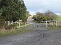
 Entrance to Stockley Fell Farm - geograph.org.uk - 272755.jpg 640 × 480; 51 KB
-
 Helmington Row - geograph.org.uk - 338236.jpg 640 × 480; 57 KB
-
 Lions at the gate, Hill House - geograph.org.uk - 338248.jpg 640 × 480; 74 KB
-
 Lower end of Crook Golf Club - geograph.org.uk - 338250.jpg 640 × 480; 67 KB
-
 Stonechester - geograph.org.uk - 338268.jpg 640 × 480; 70 KB
-
 Trail riding field - geograph.org.uk - 323204.jpg 640 × 480; 84 KB
-

-
 Woodland walk below Northwood House - geograph.org.uk - 338270.jpg 640 × 480; 91 KB


_Willington_-_geograph.org.uk_-_1609426.jpg)


