Category:Wilnecote
English: Wilnecote is a housing district about 3 km south east of Tamworth, Staffordshire. It is one of the largest communities in the town.
suburb of Tamworth, Staffordshire, United Kingdom  | |||||
| Upload media | |||||
| Instance of | |||||
|---|---|---|---|---|---|
| Location | Tamworth, Staffordshire, West Midlands, England | ||||
 | |||||
Subcategories
This category has the following 2 subcategories, out of 2 total.
H
W
- Wilnecote railway station (4 F)
Media in category "Wilnecote"
The following 94 files are in this category, out of 94 total.
-

-
 A View of the B5000 (20) - geograph.org.uk - 1519784.jpg 640 × 481; 77 KB
-
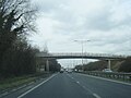 A5 westbound at Wilnecote - geograph.org.uk - 4877315.jpg 640 × 479; 51 KB
-
 Brent (1) - geograph.org.uk - 1530546.jpg 640 × 427; 53 KB
-
 Brent (2) - geograph.org.uk - 1530556.jpg 640 × 427; 64 KB
-
 Cap , Birch Coppice No.2 Shaft - geograph.org.uk - 727594.jpg 640 × 480; 188 KB
-

-
 CO - OP Superstore (1) - geograph.org.uk - 1527765.jpg 640 × 427; 49 KB
-
 CO-OP Superstore (2) - geograph.org.uk - 1527821.jpg 640 × 427; 63 KB
-
 CO-OP Superstore (3) - geograph.org.uk - 1530637.jpg 640 × 427; 86 KB
-
 CO-OP Superstore, Car park - geograph.org.uk - 1527829.jpg 640 × 427; 59 KB
-
 CO-OP, Signs (1) - geograph.org.uk - 1528220.jpg 427 × 640; 65 KB
-
 CO-OP, Signs (2) - geograph.org.uk - 1528225.jpg 427 × 640; 57 KB
-
 Forties (1) - geograph.org.uk - 1527700.jpg 640 × 427; 81 KB
-

-
 Gazebo over old mine workings - geograph.org.uk - 727582.jpg 640 × 497; 171 KB
-
 Glascote Lane and church, Wilncote - geograph.org.uk - 3168682.jpg 640 × 383; 70 KB
-
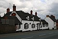
 Globe Inn - geograph.org.uk - 937679.jpg 640 × 419; 76 KB
-
 Hebden and The Dales School, Tamworth. - geograph.org.uk - 9961.jpg 640 × 480; 90 KB
-
 Heritage Sculpture - geograph.org.uk - 7939.jpg 640 × 373; 96 KB
-
 Hockley Road - geograph.org.uk - 3168670.jpg 640 × 480; 95 KB
-
 Hockley Road, Wilnecote - geograph.org.uk - 3168679.jpg 640 × 480; 71 KB
-
 Holy Trinity Sunday School - geograph.org.uk - 938380.jpg 640 × 594; 100 KB
-
 Houses on Hockley Road - geograph.org.uk - 3168665.jpg 640 × 480; 86 KB
-
 Ninefoot Lane (1) - geograph.org.uk - 1565092.jpg 427 × 640; 100 KB
-
 Ninian Way (2) - geograph.org.uk - 1528218.jpg 640 × 427; 99 KB
-
 Ninian Way (4) - geograph.org.uk - 1530429.jpg 640 × 427; 103 KB
-
 Ninian Way, Signs - geograph.org.uk - 1530532.jpg 427 × 640; 60 KB
-
 Ninian Way, Zebra Crossing - geograph.org.uk - 1530403.jpg 640 × 427; 70 KB
-
 Open Grassy area next to Ninian Way (1) - geograph.org.uk - 1529218.jpg 640 × 427; 107 KB
-

-
 Path outside Wilnecote Old Cemetery - geograph.org.uk - 1575135.jpg 427 × 640; 112 KB
-
 Planters garden centre Freasley - geograph.org.uk - 567185.jpg 640 × 506; 127 KB
-
 Pylon near A5 - geograph.org.uk - 3835421.jpg 2,066 × 3,598; 3.43 MB
-
 Red Lion - geograph.org.uk - 1253407.jpg 640 × 452; 69 KB
-
 Roman Court, Wilnecote - geograph.org.uk - 2183151.jpg 640 × 480; 111 KB
-
 Roman Court, Wilnecote - geograph.org.uk - 2183154.jpg 640 × 480; 40 KB
-
 St. Michael and All Angels, Wood End - geograph.org.uk - 110602.jpg 480 × 640; 76 KB
-

-
 Stoneydelph Lake, Tamworth - geograph.org.uk - 14873.jpg 640 × 480; 64 KB
-
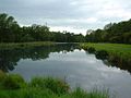
 Stonydelph Lakes - geograph.org.uk - 2908718.jpg 1,600 × 1,200; 589 KB
-
 The Centurion Bar and Restaurant - geograph.org.uk - 1763464.jpg 1,024 × 393; 100 KB
-
 The Post Office, Piccadilly - geograph.org.uk - 70101.jpg 640 × 480; 101 KB
-
 The Queens Head - geograph.org.uk - 937717.jpg 640 × 427; 53 KB
-
 The Railway Inn, Wilnecote - geograph.org.uk - 1371017.jpg 640 × 472; 57 KB
-
 Tippers, Builders Merchant (1) - geograph.org.uk - 1530451.jpg 640 × 427; 59 KB
-
 Topps Tiles, Superstore - geograph.org.uk - 1527835.jpg 640 × 427; 69 KB
-
 Walking around Stonydelph lakes - geograph.org.uk - 2908732.jpg 1,600 × 1,054; 611 KB
-
 Watling Street, Wilnecote - geograph.org.uk - 2183152.jpg 640 × 480; 69 KB
-
 Watling Street, Wilnecote - geograph.org.uk - 3168680.jpg 640 × 480; 80 KB
-
 Wbs2017.jpg 448 × 300; 31 KB
-
 Whateley Villas - geograph.org.uk - 43810.jpg 640 × 480; 118 KB
-
 Wilnecote Congregational Church - geograph.org.uk - 935258.jpg 640 × 427; 51 KB
-
 Wilnecote Old Cemetery (1) - geograph.org.uk - 1568253.jpg 640 × 427; 115 KB
-
 Wilnecote Old Cemetery (10) - geograph.org.uk - 1574005.jpg 640 × 427; 123 KB
-
 Wilnecote Old Cemetery (11) - geograph.org.uk - 1574017.jpg 427 × 640; 129 KB
-
 Wilnecote Old Cemetery (12) - geograph.org.uk - 1574024.jpg 640 × 427; 109 KB
-
 Wilnecote Old Cemetery (13) - geograph.org.uk - 1574029.jpg 640 × 427; 131 KB
-
 Wilnecote Old Cemetery (14) - geograph.org.uk - 1574036.jpg 640 × 427; 126 KB
-
 Wilnecote Old Cemetery (15) - geograph.org.uk - 1574041.jpg 640 × 427; 102 KB
-
 Wilnecote Old Cemetery (16) - geograph.org.uk - 1574050.jpg 640 × 427; 106 KB
-
 Wilnecote Old Cemetery (17) - geograph.org.uk - 1575119.jpg 640 × 427; 116 KB
-
 Wilnecote Old Cemetery (2) - geograph.org.uk - 1568787.jpg 640 × 427; 113 KB
-
 Wilnecote Old Cemetery (3) - geograph.org.uk - 1568795.jpg 640 × 427; 95 KB
-
 Wilnecote Old Cemetery (4) - geograph.org.uk - 1568801.jpg 640 × 427; 117 KB
-
 Wilnecote Old Cemetery (5) - geograph.org.uk - 1571282.jpg 640 × 427; 76 KB
-
 Wilnecote Old Cemetery (6) - geograph.org.uk - 1571284.jpg 640 × 427; 84 KB
-
 Wilnecote Old Cemetery (7) - geograph.org.uk - 1571286.jpg 640 × 427; 124 KB
-
 Wilnecote Old Cemetery (8) - geograph.org.uk - 1571292.jpg 640 × 427; 111 KB
-
 Wilnecote Old Cemetery (9) - geograph.org.uk - 1573992.jpg 640 × 427; 80 KB
-

-

-
 Wilnecote W.M.C. - geograph.org.uk - 3168677.jpg 640 × 480; 45 KB
-
 Birch Coppice - geograph.org.uk - 603325.jpg 640 × 480; 65 KB
-

-
 Bridge over the M42 at Birchmoor - geograph.org.uk - 66227.jpg 640 × 480; 127 KB
-
 Cap , Birch Coppice No.1 Shaft - geograph.org.uk - 727590.jpg 640 × 480; 172 KB
-
 Dosthill School - geograph.org.uk - 285527.jpg 640 × 480; 56 KB
-
 Filtration beds, Stoneydelph, Tamworth - geograph.org.uk - 14870.jpg 640 × 480; 71 KB
-
 House down Freasley Lane - geograph.org.uk - 94962.jpg 640 × 480; 144 KB
-
 Industrial Units, Centurion Park - geograph.org.uk - 94964.jpg 640 × 480; 85 KB
-
 New houses off Hedging Lane - geograph.org.uk - 43806.jpg 640 × 480; 94 KB
-
 New Street, Birchmoor - geograph.org.uk - 198912.jpg 640 × 480; 80 KB
-
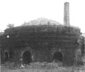
 Pie Kilns , Photo 1 - geograph.org.uk - 228087.jpg 628 × 640; 54 KB
-
 Pie Kilns , Photo 2 - geograph.org.uk - 228088.jpg 625 × 640; 58 KB
-
 Pie Kilns , Photo 3 - geograph.org.uk - 228090.jpg 640 × 540; 45 KB
-
 Planters Garden Centre - geograph.org.uk - 43813.jpg 640 × 480; 132 KB
-
 Railway Bridge, Dosthill - geograph.org.uk - 70141.jpg 640 × 480; 104 KB
-
 St. John's Church, Birchmoor - geograph.org.uk - 66222.jpg 640 × 480; 92 KB
-
 Stoneydelph Lane, Tamworth - geograph.org.uk - 14859.jpg 640 × 480; 123 KB
-
 Stoneydelph Primary School - geograph.org.uk - 43814.jpg 640 × 480; 68 KB
-
 The Game Cock Inn, Birchmoor - geograph.org.uk - 66215.jpg 640 × 480; 106 KB
-
 Top of New Street in winter - geograph.org.uk - 198915.jpg 640 × 480; 101 KB
-

_-_geograph.org.uk_-_1519799.jpg)
_-_geograph.org.uk_-_1519784.jpg)

_-_geograph.org.uk_-_1530546.jpg)
_-_geograph.org.uk_-_1530556.jpg)


_-_geograph.org.uk_-_1527765.jpg)
_-_geograph.org.uk_-_1527821.jpg)
_-_geograph.org.uk_-_1530637.jpg)

_-_geograph.org.uk_-_1528220.jpg)
_-_geograph.org.uk_-_1528225.jpg)
_-_geograph.org.uk_-_1527700.jpg)


_-_geograph.org.uk_-_1565092.jpg)
_-_geograph.org.uk_-_1528218.jpg)
_-_geograph.org.uk_-_1530429.jpg)


_-_geograph.org.uk_-_1529218.jpg)
_-_geograph.org.uk_-_1530376.jpg)


_-_geograph.org.uk_-_1530451.jpg)


_-_geograph.org.uk_-_1568253.jpg)
_-_geograph.org.uk_-_1574005.jpg)
_-_geograph.org.uk_-_1574017.jpg)
_-_geograph.org.uk_-_1574024.jpg)
_-_geograph.org.uk_-_1574029.jpg)
_-_geograph.org.uk_-_1574036.jpg)
_-_geograph.org.uk_-_1574041.jpg)
_-_geograph.org.uk_-_1574050.jpg)
_-_geograph.org.uk_-_1575119.jpg)
_-_geograph.org.uk_-_1568787.jpg)
_-_geograph.org.uk_-_1568795.jpg)
_-_geograph.org.uk_-_1568801.jpg)
_-_geograph.org.uk_-_1571282.jpg)
_-_geograph.org.uk_-_1571284.jpg)
_-_geograph.org.uk_-_1571286.jpg)
_-_geograph.org.uk_-_1571292.jpg)
_-_geograph.org.uk_-_1573992.jpg)


