Category:Wimborne St Giles
village in United Kingdom  | |||||
| Upload media | |||||
| Instance of | |||||
|---|---|---|---|---|---|
| Location | Dorset, South West England, England | ||||
 | |||||
English: Wimborne St Giles is a village in east Dorset, England, situated on Cranborne Chase seven miles north of Wimborne Minster, north of Poole. The village has a population of 366 (2001).
Subcategories
This category has the following 7 subcategories, out of 7 total.
C
M
- Monkton Up Wimborne (46 F)
S
T
- The Bull, Wimborne St Giles (5 F)
W
- Wimborne St Giles almshouses (13 F)
Media in category "Wimborne St Giles"
The following 200 files are in this category, out of 204 total.
(previous page) (next page)-
 A Roman milestone on Ackling Dyke - geograph.org.uk - 2070996.jpg 640 × 480; 482 KB
-
 A tumulus punctuates the landscape - geograph.org.uk - 533582.jpg 640 × 336; 44 KB
-
 A354 towards Blandford - geograph.org.uk - 5724488.jpg 640 × 428; 115 KB
-
 A354 towards Blandford - geograph.org.uk - 5724507.jpg 640 × 428; 87 KB
-
 All Hallows Farm - geograph.org.uk - 2410583.jpg 1,024 × 768; 145 KB
-
 All Hallows, Coach Road - geograph.org.uk - 1440190.jpg 640 × 480; 80 KB
-
 All Hallows, farm - geograph.org.uk - 1440215.jpg 640 × 480; 65 KB
-
 Apache over the Cursus - geograph.org.uk - 2070923.jpg 640 × 476; 348 KB
-

-
 B3078 passing woods of St Giles's Park - geograph.org.uk - 3992817.jpg 1,536 × 1,149; 1.16 MB
-
 B3081 at Nine Yews - geograph.org.uk - 3423581.jpg 640 × 422; 84 KB
-
 B3081 by Great Rough Copse - geograph.org.uk - 3992798.jpg 1,536 × 1,536; 1.85 MB
-
 B3081 looking northwest - geograph.org.uk - 3265087.jpg 640 × 480; 52 KB
-
 B3081 looking southeast - geograph.org.uk - 3265084.jpg 640 × 480; 62 KB
-
 B3081 north of Creech Hill junction - geograph.org.uk - 3423586.jpg 640 × 426; 59 KB
-
 B3081 passing Deer Park Farm - geograph.org.uk - 3992801.jpg 1,600 × 1,118; 586 KB
-
 Baileys Hill approaching Bull Bridge - geograph.org.uk - 5411568.jpg 640 × 427; 86 KB
-
 Baileys Hill beside Farringdon Copse - geograph.org.uk - 3501077.jpg 3,648 × 2,736; 2.3 MB
-

-
 Bridleway near Squirrel's Corner - geograph.org.uk - 2482176.jpg 640 × 481; 80 KB
-
 Buildings at Nine Yews - geograph.org.uk - 1160090.jpg 640 × 481; 132 KB
-
 By the stocks, Wimborne St Giles - geograph.org.uk - 5411562.jpg 640 × 427; 112 KB
-
 Cattle at Water Lake Bottom - geograph.org.uk - 2070865.jpg 640 × 480; 418 KB
-
 Coach Road - geograph.org.uk - 304219.jpg 480 × 640; 99 KB
-
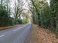
 Country lane, Wimborne St Giles - geograph.org.uk - 920442.jpg 640 × 446; 81 KB
-
 Drainage channel near Pentridge - geograph.org.uk - 1211533.jpg 640 × 481; 197 KB
-
 Edmondsham, gate ^ stile - geograph.org.uk - 2708892.jpg 1,024 × 768; 379 KB
-
 End of the 30mph limit for Verwood and Romford - geograph.org.uk - 3992749.jpg 1,536 × 1,153; 1.35 MB
-
 Farm buildings, Wimborne St Giles - geograph.org.uk - 2787599.jpg 640 × 480; 79 KB
-
 Farringdon Clump - geograph.org.uk - 1443658.jpg 640 × 480; 68 KB
-
 Field opposite The Bull Inn - geograph.org.uk - 5411558.jpg 640 × 427; 102 KB
-

-
 Fields on a wet day - geograph.org.uk - 3265939.jpg 640 × 480; 55 KB
-
 Ford at Cranborne Farm - geograph.org.uk - 4806881.jpg 1,086 × 724; 381 KB
-
 Ford at Waterlake Bottom - geograph.org.uk - 4806880.jpg 1,086 × 724; 418 KB
-
 Frenches Farm, Wimborne St Giles - geograph.org.uk - 367744.jpg 640 × 480; 109 KB
-
 Frenchs Farm, Wimborne St Giles - geograph.org.uk - 2787726.jpg 640 × 480; 71 KB
-
 George V Postbox, Wimborne St Giles - geograph.org.uk - 920433.jpg 480 × 640; 127 KB
-
 Gorse, Pentridge Hill - geograph.org.uk - 1210027.jpg 640 × 481; 152 KB
-
 Hay swaths Wimborne St Giles Dorset - geograph.org.uk - 192345.jpg 640 × 480; 139 KB
-
 Home Farm, St Giles Park, Wimborne St Giles.jpg 640 × 480; 125 KB
-
 House and road junction at Remedy Gate - geograph.org.uk - 3992785.jpg 1,600 × 795; 311 KB
-
 Jubilee Trail near Wimborne St Giles - geograph.org.uk - 1160113.jpg 640 × 481; 177 KB
-
 Junction of B3081 with Parsonage Lane - geograph.org.uk - 305201.jpg 640 × 480; 81 KB
-
 Lodge and drive for St Giles's Park and house - geograph.org.uk - 3992806.jpg 1,024 × 683; 194 KB
-
 Lodge by the drive to St Giles House - geograph.org.uk - 2410587.jpg 768 × 1,024; 251 KB
-
 Logging work near Wimborne St Giles - geograph.org.uk - 1690383.jpg 640 × 481; 143 KB
-
 Long straight from Ackling Dyke - geograph.org.uk - 3423566.jpg 640 × 416; 77 KB
-
 Milepost near Wimborne St Giles - geograph.org.uk - 1934143.jpg 640 × 480; 195 KB
-
 Milepost near Wimborne St Giles - geograph.org.uk - 1934186.jpg 640 × 480; 151 KB
-
 Milestone near Pentridge - geograph.org.uk - 1756499.jpg 640 × 480; 180 KB
-
 Milestone near Pentridge - geograph.org.uk - 1756514.jpg 480 × 640; 184 KB
-
 Mill House, Wimborne St Giles - geograph.org.uk - 367861.jpg 640 × 480; 122 KB
-

-
 Monkton Drove - geograph.org.uk - 2712589.jpg 1,024 × 768; 329 KB
-
 Monkton Drove - geograph.org.uk - 2712605.jpg 1,024 × 768; 231 KB
-
 Monkton Drove - geograph.org.uk - 2712650.jpg 1,024 × 768; 290 KB
-
 Monkton Drove - geograph.org.uk - 2712691.jpg 1,024 × 768; 304 KB
-
 Old apple tree, Frenchs Farm - geograph.org.uk - 2787824.jpg 480 × 640; 95 KB
-

-

-
 Old School House Wimborne St Giles.jpg 640 × 480; 153 KB
-
 Permissive path near Sutton Hill Campsite - geograph.org.uk - 5818771.jpg 1,600 × 1,200; 815 KB
-
 Ringwood Lane, Wimborne St Giles - geograph.org.uk - 1160140.jpg 640 × 480; 169 KB
-
 Ripening Oilseed Rape - geograph.org.uk - 2484699.jpg 480 × 640; 94 KB
-
 River Allen near Wimborne St Giles - geograph.org.uk - 5727041.jpg 1,600 × 1,068; 609 KB
-
 River Allen, Wimborne St Giles - geograph.org.uk - 2787617.jpg 640 × 480; 77 KB
-
 River Allen, Wimborne St Giles - geograph.org.uk - 2787641.jpg 640 × 480; 71 KB
-
 River Allen, Wimborne St Giles - geograph.org.uk - 367757.jpg 640 × 480; 106 KB
-
 River Allen, Wimborne St Giles - geograph.org.uk - 368912.jpg 640 × 480; 155 KB
-
 River Allen, Wimborne St Giles - geograph.org.uk - 368932.jpg 640 × 480; 136 KB
-
 River Allen, Wimborne St Giles - geograph.org.uk - 920475.jpg 640 × 480; 101 KB
-
 River Crane west of Cranborne Farm - geograph.org.uk - 6070858.jpg 1,024 × 683; 421 KB
-
 River Crane west of Cranborne Farm - geograph.org.uk - 6070862.jpg 1,024 × 683; 313 KB
-
 Road junction at Sutton Holms - geograph.org.uk - 3992757.jpg 1,536 × 1,153; 1.52 MB
-
 Road junction, B3081 - geograph.org.uk - 3088631.jpg 640 × 480; 101 KB
-
 Road junction, B3081 - geograph.org.uk - 3088644.jpg 640 × 394; 94 KB
-
 Romford, B road - geograph.org.uk - 2708791.jpg 1,024 × 768; 224 KB
-
 Romford, farm track - geograph.org.uk - 2708817.jpg 1,024 × 768; 256 KB
-
 Romford, gate and stile - geograph.org.uk - 2708811.jpg 1,024 × 768; 279 KB
-
 Romford, golf club entrance - geograph.org.uk - 2709159.jpg 1,024 × 768; 268 KB
-
 Romford, power lines - geograph.org.uk - 2708832.jpg 1,024 × 745; 143 KB
-
 Round and square bales, Nine Yews - geograph.org.uk - 2027101.jpg 640 × 480; 75 KB
-
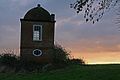 Round House Folly at sunrise 2 - geograph.org.uk - 318490.jpg 640 × 427; 78 KB
-
 Shaftesbury Estates running path.png 864 × 401; 677 KB
-
 Shaftesbury.jpg 740 × 1,002; 130 KB
-
 Sheep near Wimborne St Giles - geograph.org.uk - 1690392.jpg 640 × 481; 95 KB
-
 Sighting NNE along Ackling Dyke towards the A354 - geograph.org.uk - 2255131.jpg 1,600 × 1,200; 431 KB
-
 Sign, Bull Bridge - geograph.org.uk - 1806621.jpg 640 × 481; 103 KB
-
 Snowdrops, Wimborne St Giles - geograph.org.uk - 2787669.jpg 480 × 640; 125 KB
-
 Sutton Copse in Edmondsham - geograph.org.uk - 5812874.jpg 2,048 × 1,536; 1.57 MB
-
 Sutton Hill Farm - geograph.org.uk - 2709115.jpg 1,024 × 757; 188 KB
-
 Sutton Hill, B road - geograph.org.uk - 2709095.jpg 1,024 × 768; 326 KB
-
 Sutton Hill, fingerpost - geograph.org.uk - 2709131.jpg 1,024 × 757; 204 KB
-
 Sutton Hill, road junction - geograph.org.uk - 2709078.jpg 1,024 × 768; 267 KB
-
 Sutton Hill, sheep grazing - geograph.org.uk - 2709023.jpg 1,024 × 768; 206 KB
-
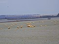
 Swans on River Allen at sunrise - geograph.org.uk - 393603.jpg 640 × 427; 106 KB
-
 Telephone box, Wimborne St Giles - geograph.org.uk - 1160147.jpg 480 × 640; 204 KB
-

-

-
 The Village Stocks - Wimborne St Giles - geograph.org.uk - 305374.jpg 640 × 480; 173 KB
-
 The Village Stocks, Wimborne St Giles - geograph.org.uk - 367863.jpg 640 × 480; 180 KB
-
 Timber piles near Blackbush Plantation - geograph.org.uk - 1211500.jpg 640 × 481; 193 KB
-
 Timber stack near Squirrel's Corner - geograph.org.uk - 2484721.jpg 640 × 480; 108 KB
-
 Track into Creech Hill Wood - geograph.org.uk - 272536.jpg 480 × 640; 144 KB
-
 Track on Bottlebrush Down - geograph.org.uk - 3057619.jpg 800 × 600; 170 KB
-
 Un-named lane at Bull Bridge - geograph.org.uk - 3502481.jpg 3,648 × 2,736; 2.18 MB
-
 Un-named lane junction with B3081 - geograph.org.uk - 3502501.jpg 3,648 × 2,736; 2.43 MB
-
 Village Hall - Wimborne St Giles - geograph.org.uk - 305186.jpg 640 × 480; 90 KB
-
 Village Hall, Wimborne St Giles - geograph.org.uk - 1160143.jpg 640 × 480; 118 KB
-
 Village hall, Wimborne St Giles - geograph.org.uk - 5411550.jpg 640 × 427; 89 KB
-
 Water meadows, Wimborne St Giles - geograph.org.uk - 920453.jpg 640 × 480; 100 KB
-
 Watercress beds, Wimborne St Giles - geograph.org.uk - 1285656.jpg 640 × 480; 135 KB
-
 Watercress beds, Wimborne St Giles - geograph.org.uk - 2787703.jpg 640 × 480; 77 KB
-
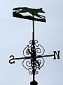 Weather vane, Wimborne St Giles - geograph.org.uk - 1160134.jpg 480 × 640; 75 KB
-
 West Wiltshire Downs from the air - geograph.org.uk - 3304436.jpg 3,264 × 2,448; 3.24 MB
-
 West Wiltshire Downs landscape - geograph.org.uk - 3304400.jpg 3,264 × 2,448; 3.19 MB
-
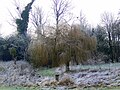 Willow beside the Allen - geograph.org.uk - 1690441.jpg 640 × 480; 171 KB
-
 Wimborne Gt Giles, railings - geograph.org.uk - 1439666.jpg 640 × 502; 100 KB
-
 Wimborne St Giles - geograph.org.uk - 38386.jpg 640 × 435; 134 KB
-

-

-
 Wimborne St Giles First School - geograph.org.uk - 303174.jpg 640 × 480; 106 KB
-
 Wimborne St Giles Park - geograph.org.uk - 368997.jpg 640 × 480; 82 KB
-
 Wimborne St Giles Village School.jpg 640 × 480; 107 KB
-
 Wimborne St Giles, cemetery - geograph.org.uk - 1439594.jpg 640 × 507; 91 KB
-
 Wimborne St Giles, chilli festival - geograph.org.uk - 3582350.jpg 1,024 × 768; 213 KB
-
 Wimborne St Giles, footbridge - geograph.org.uk - 3582287.jpg 1,024 × 768; 255 KB
-
 Wimborne St Giles, garden - geograph.org.uk - 3582316.jpg 1,024 × 768; 167 KB
-
 Wimborne St Giles, ha-ha - geograph.org.uk - 3582330.jpg 768 × 1,024; 274 KB
-
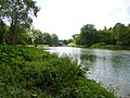 Wimborne St Giles, lake - geograph.org.uk - 3582298.jpg 1,024 × 768; 228 KB
-
 Wimborne St Giles, lych gate - geograph.org.uk - 1439584.jpg 640 × 480; 102 KB
-
 Wimborne St Giles, Manor Farm - geograph.org.uk - 1439632.jpg 640 × 480; 74 KB
-
 Wimborne St Giles, River Allen - geograph.org.uk - 1439644.jpg 640 × 480; 59 KB
-
 Wimborne St Giles, traffic - geograph.org.uk - 3582366.jpg 1,024 × 757; 139 KB
-
 Wimborne St Giles, watercress beds - geograph.org.uk - 1439557.jpg 640 × 480; 80 KB
-

-

-
 Wimborne St. Giles, farm track - geograph.org.uk - 2708847.jpg 1,024 × 768; 241 KB
-

-
 Wimborne St. Giles, footpath - geograph.org.uk - 2708865.jpg 1,024 × 768; 204 KB
-

-

-
-

-
 Wimborne St. Giles, the old schoolhouse - geograph.org.uk - 533575.jpg 640 × 429; 100 KB
-
-

-
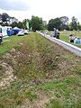
 Wimborne St. Giles, undulations - geograph.org.uk - 1369259.jpg 640 × 480; 75 KB
-

-
 Woodland by the B3078 west of Edmondsham - geograph.org.uk - 5812550.jpg 1,990 × 1,454; 1.75 MB
-
 All Hallows, farm cottages - geograph.org.uk - 1440201.jpg 640 × 480; 80 KB
-
 Barns on Glebe Farm - geograph.org.uk - 305193.jpg 640 × 480; 91 KB
-

-
 Brockington, field and wood - geograph.org.uk - 1443644.jpg 640 × 480; 94 KB
-
 Buildings on Glebe Farm - geograph.org.uk - 305197.jpg 640 × 480; 98 KB
-
 Bull Bridge - Wimborne St Giles - geograph.org.uk - 305406.jpg 640 × 480; 120 KB
-

-
 Dawn moon over Ackling Dyke - geograph.org.uk - 394352.jpg 427 × 640; 55 KB
-
 Down on the farm on Mead Lane - geograph.org.uk - 276753.jpg 640 × 480; 62 KB
-
 Down towards Bowerswain Farm - geograph.org.uk - 276754.jpg 640 × 480; 78 KB
-
 Downland near Wimborne St Giles - geograph.org.uk - 304216.jpg 640 × 480; 80 KB
-
 Evening sun on a windy Ackling Dyke - geograph.org.uk - 428116.jpg 427 × 640; 134 KB
-
 Faringdon Copse - geograph.org.uk - 303168.jpg 640 × 480; 89 KB
-
 Farmland near Wimborne Lodge - geograph.org.uk - 304639.jpg 640 × 480; 107 KB
-
 Farmland outside Wimborne St Giles - geograph.org.uk - 305441.jpg 640 × 480; 68 KB
-

-
 Glebe Farm from Parsonage Lane - geograph.org.uk - 305177.jpg 640 × 480; 59 KB
-
 Glebe Farm House - geograph.org.uk - 305199.jpg 640 × 480; 69 KB
-
 Hill outside Wimborne St Giles - geograph.org.uk - 305391.jpg 640 × 480; 75 KB
-
 House in Wimborne St Giles - geograph.org.uk - 305184.jpg 640 × 480; 94 KB
-

-

-

-
 New Growth - geograph.org.uk - 304628.jpg 640 × 480; 95 KB
-

-

-

-
 Old House in Wimborne St Giles - geograph.org.uk - 305428.jpg 640 × 480; 134 KB
-

-
 Parsonage Lane - geograph.org.uk - 305182.jpg 480 × 640; 53 KB
-
 Parsonage Lane towards Glebe Farm - geograph.org.uk - 305206.jpg 640 × 480; 67 KB
-

-
-
 Ringwood Lane (Track) - geograph.org.uk - 305179.jpg 480 × 640; 77 KB
-
 River Allen downstream from Bull Bridge - geograph.org.uk - 305415.jpg 640 × 480; 157 KB
-

-
 Road past The Drive Plantation - B3078 - geograph.org.uk - 304642.jpg 480 × 640; 136 KB
-
 Roundhouse near Wimborne St Giles - geograph.org.uk - 372552.jpg 640 × 480; 86 KB
-
 Silage pits at All Hallows Farm - geograph.org.uk - 304116.jpg 640 × 480; 88 KB
-

-
 Sunrise over Bottlebush Down - geograph.org.uk - 394357.jpg 640 × 427; 99 KB
-
 Tenantry Down - geograph.org.uk - 303178.jpg 640 × 480; 50 KB
-
 The Old School House, Wimborne St Giles - geograph.org.uk - 367830.jpg 640 × 480; 164 KB
-
 Track leading to Harley Down - geograph.org.uk - 304634.jpg 640 × 480; 83 KB
-
 Track to Wimborne Lodge - geograph.org.uk - 303167.jpg 480 × 640; 96 KB
-
 Up hill near Gussage Elms - geograph.org.uk - 276765.jpg 640 × 480; 81 KB
-
 View across the park, St Giles Estate - geograph.org.uk - 369010.jpg 640 × 480; 93 KB
-
 View north from Coach Road - geograph.org.uk - 304217.jpg 640 × 480; 68 KB
-
 View towards Harley Wood - geograph.org.uk - 304630.jpg 640 × 480; 50 KB


_-_geograph.org.uk_-_305179.jpg)


