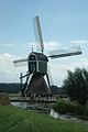
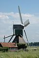
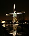
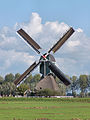
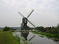
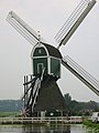
Category:Wingerdse Molen, Bleskensgraaf
| Object location | | View all coordinates using: OpenStreetMap |
|---|
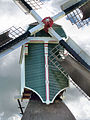
windmill in Bleskensgraaf, Netherlands  | |||||
| Upload media | |||||
| Instance of | |||||
|---|---|---|---|---|---|
| Location | Bleskensgraaf, South Holland, Netherlands | ||||
| Street address |
| ||||
| Located on street |
| ||||
| Has use |
| ||||
| Heritage designation |
| ||||
| Source of energy | |||||
 | |||||
|
This is a category about rijksmonument number 9639
|
| Address |
|
Media in category "Wingerdse Molen, Bleskensgraaf"
The following 108 files are in this category, out of 108 total.
-
 Bleskensgraaf - ondertoren Wingerdse Molen.jpg 1,800 × 1,200; 1.03 MB
-
 Bleskensgraaf - Wijngaardse molen - panoramio - Rokus C (1).jpg 1,500 × 2,256; 301 KB
-
 Bleskensgraaf - Wijngaardse molen - panoramio - Rokus C (2).jpg 2,256 × 1,500; 317 KB
-
 Bleskensgraaf - Wijngaardse molen - panoramio - Rokus C (3).jpg 1,500 × 2,256; 349 KB
-
 Bleskensgraaf - Wijngaardse molen - panoramio - Rokus C (4).jpg 1,500 × 2,256; 320 KB
-
 Bleskensgraaf - Wijngaardse molen - panoramio - Rokus C (5).jpg 2,256 × 1,500; 279 KB
-
 Bleskensgraaf - Wijngaardse molen - panoramio - Rokus C (6).jpg 2,256 × 1,500; 364 KB
-
 Bleskensgraaf - Wijngaardse molen - panoramio - Rokus C.jpg 1,500 × 2,256; 271 KB
-
 Bleskensgraaf - Wijngaardse molen - panoramio.jpg 2,000 × 3,008; 2.36 MB
-
 Bleskensgraaf Wingerdse molen bij nacht 2.jpg 1,210 × 1,763; 902 KB
-
 Bleskensgraaf Wingerdse molen bij nacht.jpg 1,295 × 1,607; 937 KB
-
 Bleskensgraaf Wingerdse Molen.jpg 4,608 × 3,456; 6.31 MB
-
 Close-up van de ondertoren van wipmolen - AMR Molenfoto - 20541914 - RCE.jpg 1,200 × 900; 188 KB
-
 De Wingerdse Molen, 8 september 2012.jpg 1,324 × 993; 311 KB
-
 Exterieur OVERZICHT - Bleskensgraaf - 20290170 - RCE.jpg 1,200 × 1,200; 243 KB
-
 Interieur van wipmolen - AMR Molenfoto - 20541915 - RCE.jpg 1,200 × 900; 145 KB
-
 Molen De Hoop, Oud-Alblas links, Wingerdse Molen rechts 29-09-2012.jpg 3,264 × 2,448; 1.39 MB
-
 Molen De Wingerdse Molen 29-09-2012 (1).jpg 3,214 × 2,368; 1,013 KB
-
 Molen De Wingerdse Molen 29-09-2012 (2).jpg 3,264 × 2,448; 1.62 MB
-
 Molen De Wingerdse Molen 29-09-2012.jpg 2,320 × 3,158; 1.05 MB
-
 Molen van de Wijngaarderpolder, aanzicht - Bleskensgraaf - 20035565 - RCE.jpg 1,188 × 1,200; 243 KB
-
 Molen Wingerdse Molen 29-09-2012 (4).jpg 2,448 × 3,264; 1.45 MB
-
 Molen Wingerdse Molen 29-09-2012 (5).jpg 2,448 × 3,264; 1.49 MB
-
 Molen Wingerdse Molen 29-09-2012.jpg 2,271 × 3,084; 1.1 MB
-
 Molen Wingerdse Molen bovenhuis onderkant.jpg 3,264 × 2,448; 2.11 MB
-
 Molen Wingerdse Molen met tjasker 29-09-2012 (1).jpg 3,264 × 2,448; 1.94 MB
-
 Molen Wingerdse Molen tjasker ton.jpg 2,448 × 3,264; 3.42 MB
-
 Molen Wingerdse Molen tjasker, De Peilmolen (links), De Hoop (rechts) (1).jpg 2,448 × 3,264; 1.93 MB
-
 Molen Wingerdse Molen tjasker, De Peilmolen (links), De Hoop (rechts).jpg 3,214 × 2,377; 1.52 MB
-
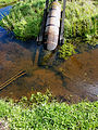
 Molen Wingerdse Molen, achterwaterloop vijzel.jpg 2,201 × 3,074; 1.35 MB
-
 Molen Wingerdse Molen, achterwaterloop.jpg 3,264 × 2,448; 2.2 MB
-
 Molen Wingerdse Molen, bovenas halslager.jpg 2,448 × 3,264; 1.91 MB
-
 Molen Wingerdse Molen, bovenas penbalk (1).jpg 3,264 × 2,448; 2.34 MB
-
 Molen Wingerdse Molen, bovenas penbalk.jpg 2,448 × 3,264; 2.21 MB
-
 Molen Wingerdse Molen, bovenas penlager taats.jpg 3,264 × 2,448; 1.72 MB
-
 Molen Wingerdse Molen, bovenas penlager.jpg 3,264 × 2,448; 2.58 MB
-
 Molen Wingerdse Molen, bovenas steenbed (1).jpg 3,264 × 2,448; 2.03 MB
-
 Molen Wingerdse Molen, bovenas steenbed.jpg 3,264 × 2,448; 1.66 MB
-
 Molen Wingerdse Molen, bovenwiel achterkant.jpg 2,448 × 3,264; 2.27 MB
-
 Molen Wingerdse Molen, bovenwiel lendestut.jpg 2,448 × 3,264; 2.2 MB
-
 Molen Wingerdse Molen, bovenwiel vulstuk.jpg 3,071 × 2,285; 1.29 MB
-
 Molen Wingerdse Molen, bovenwiel.jpg 3,264 × 2,448; 2.43 MB
-
 Molen Wingerdse Molen, dakspant keuvelens.jpg 3,264 × 2,448; 1.82 MB
-
 Molen Wingerdse Molen, fokwiek regelbord open.jpg 2,448 × 3,264; 1.28 MB
-
 Molen Wingerdse Molen, fokwiek regelbord verankering handmatig.jpg 2,448 × 3,264; 1.5 MB
-
 Molen Wingerdse Molen, fokwiek regelbord verankering.jpg 3,264 × 2,448; 1.06 MB
-
 Molen Wingerdse Molen, fokwiek roeplaatje.jpg 2,448 × 3,264; 1.42 MB
-
 Molen Wingerdse Molen, fokwiek spleet.jpg 2,448 × 3,264; 1.3 MB
-
 Molen Wingerdse Molen, fokwiek voorkant closeup.jpg 2,193 × 3,026; 982 KB
-
 Molen Wingerdse Molen, fokwiek voorkant.jpg 2,448 × 3,264; 1.66 MB
-
 Molen Wingerdse Molen, fokwiek.jpg 2,448 × 3,264; 1.54 MB
-
 Molen Wingerdse Molen, ijzerbalk daklijst links.jpg 3,264 × 2,448; 2.15 MB
-
 Molen Wingerdse Molen, ijzerbalk daklijst rechts.jpg 3,264 × 2,448; 2.31 MB
-
 Molen Wingerdse Molen, ijzerbalk koningsspil.jpg 3,264 × 2,448; 2.08 MB
-
 Molen Wingerdse Molen, koker bovenzetel (1).jpg 3,264 × 2,448; 2.58 MB
-
 Molen Wingerdse Molen, koker bovenzetel (2).jpg 2,448 × 3,264; 2.11 MB
-
 Molen Wingerdse Molen, koker bovenzetel (3).jpg 3,264 × 2,448; 3.38 MB
-
 Molen Wingerdse Molen, koker bovenzetel console.jpg 2,118 × 3,017; 999 KB
-
 Molen Wingerdse Molen, koker bovenzetel.jpg 2,448 × 3,264; 1.96 MB
-
 Molen Wingerdse Molen, ondertoren.jpg 2,448 × 3,264; 2.73 MB
-
 Molen Wingerdse Molen, stormbint borstnaald.jpg 2,448 × 3,264; 1.3 MB
-
 Molen Wingerdse Molen, stormbint kruisbalk.jpg 3,264 × 2,448; 2.49 MB
-
 Molen Wingerdse Molen, stormbint tempelbalk kruisbalk.jpg 2,448 × 3,264; 1.39 MB
-
 Molen Wingerdse Molen, stormbint tempelbalk.jpg 3,264 × 2,448; 1.43 MB
-
 Molen Wingerdse Molen, stormbint windpeluw blokkeel.jpg 2,448 × 3,264; 1.31 MB
-
 Molen Wingerdse Molen, stormbint windpeluw tempelbalk.jpg 2,448 × 3,264; 1.62 MB
-
 Molen Wingerdse Molen, stormbint windpeluw.jpg 2,448 × 3,264; 3.72 MB
-
 Molen Wingerdse Molen, stormbint.jpg 2,448 × 3,264; 1.25 MB
-
 Molen Wingerdse Molen, trap rookkanaal.jpg 3,203 × 2,371; 1.68 MB
-
 Molen Wingerdse Molen, trap staartbalk hangbomen.jpg 2,273 × 3,143; 1.72 MB
-
 Molen Wingerdse Molen, trap staartbalk.jpg 3,201 × 2,392; 1.78 MB
-
 Molen Wingerdse Molen, trap.jpg 2,448 × 3,264; 1.96 MB
-
 Molen Wingerdse Molen, trapschoor.jpg 2,448 × 3,264; 1.88 MB
-
 Molen Wingerdse Molen, vang lendestut (2).jpg 2,448 × 3,264; 1.79 MB
-
 Molen Wingerdse Molen, vang lendestut koebout.jpg 3,137 × 2,344; 1.56 MB
-
 Molen Wingerdse Molen, vang lendestut.jpg 2,448 × 3,264; 2.8 MB
-
 Molen Wingerdse Molen, vang rust rijklamp (1).jpg 2,448 × 3,264; 1.9 MB
-
 Molen Wingerdse Molen, vang rust rijklamp.jpg 1,989 × 2,899; 1.3 MB
-
 Molen Wingerdse Molen, vangbalk evenaar (1).jpg 3,264 × 2,448; 2.22 MB
-
 Molen Wingerdse Molen, vangbalk evenaar (2).jpg 3,264 × 2,448; 2.13 MB
-
 Molen Wingerdse Molen, vangbalk evenaar.jpg 3,264 × 2,448; 2.46 MB
-
 Molen Wingerdse Molen, vangbalk ezel.jpg 2,448 × 3,264; 1.85 MB
-
 Molen Wingerdse Molen, vangbalk sabelijzer.jpg 2,448 × 3,264; 2.41 MB
-
 Molen Wingerdse Molen, zijweeg (1).jpg 2,448 × 3,264; 950 KB
-
 Molen Wingerdse Molen, zijweeg (2).jpg 2,448 × 3,264; 1.32 MB
-
 Molen Wingerdse Molen, zijweeg (3).jpg 3,264 × 2,448; 1.04 MB
-
 Molen Wingerdse Molen, zijweeg.jpg 2,448 × 3,264; 1.12 MB
-
 Overzicht van de molen - Bleskensgraaf - 20421098 - RCE.jpg 1,200 × 800; 147 KB
-
 Overzicht van de molen - Bleskensgraaf - 20421101 - RCE.jpg 1,200 × 800; 143 KB
-

-

-

-

-

-
 Wijngaardse molen Bleskensgraaf - panoramio.jpg 1,010 × 1,515; 375 KB
-
 Wijngaardse molen in reparatie - panoramio (1).jpg 4,000 × 3,000; 2.42 MB
-
 Wijngaardse molen in reparatie - panoramio (2).jpg 4,000 × 3,000; 2.4 MB
-
 Wijngaardse molen in reparatie - panoramio.jpg 4,000 × 3,000; 2.46 MB
-
 Wingerdse Molen bovenwiel.jpg 5,184 × 3,456; 14.73 MB
-
 Wipmolen schuin van achteren gefotografeerd - AMR Molenfoto - 20541908 - RCE.jpg 1,200 × 900; 124 KB
-
 Wipmolen schuin van achteren gefotografeerd - AMR Molenfoto - 20541909 - RCE.jpg 900 × 1,200; 139 KB
-
 Wipmolen van achteren gefotografeerd - AMR Molenfoto - 20541913 - RCE.jpg 1,200 × 900; 89 KB
-
 Wipmolen van opzij gefotografeerd - AMR Molenfoto - 20541905 - RCE.jpg 1,200 × 900; 116 KB
-
 Wipmolen van opzij gefotografeerd - AMR Molenfoto - 20541912 - RCE.jpg 1,200 × 900; 138 KB
-

-
 Wipmolen van voren gefotografeerd - AMR Molenfoto - 20541906 - RCE.jpg 1,200 × 900; 138 KB
-
 Wipmolen van voren gefotografeerd - AMR Molenfoto - 20541907 - RCE.jpg 1,200 × 900; 128 KB
-
 Wipmolen van voren gefotografeerd - AMR Molenfoto - 20541911 - RCE.jpg 1,200 × 900; 145 KB

.jpg)
.jpg)
.jpg)
.jpg)
.jpg)
.jpg)


.jpg)
.jpg)


.jpg)
.jpg)


.jpg)

,_De_Hoop_(rechts)_(1).jpg)
,_De_Hoop_(rechts).jpg)


.jpg)


.jpg)


.jpg)
.jpg)
.jpg)


.jpg)


.jpg)

.jpg)
.jpg)


.jpg)
.jpg)
.jpg)


.jpg)
.jpg)


