Category:Wisbech and March Bramley Line
English: The Wisbech and March line is a former railway line between Wisbech and the town of March in Cambridgeshire, England. It has been proposed to reopen the line as a heritage railway to be called the Bramley Line. Other proposals suggest reopening the line as a commuter feeder line for Cambridge.
disused railway in East Anglia, England  | |||||
| Upload media | |||||
| Instance of | |||||
|---|---|---|---|---|---|
| Part of |
| ||||
| Location | England | ||||
| Owned by | |||||
| Date of official opening |
| ||||
| Date of official closure |
| ||||
| Terminus | |||||
 | |||||
Subcategories
This category has the following 2 subcategories, out of 2 total.
W
- Wisbech East railway station (11 F)
- Wisbech Level Crossing (A47) (5 F)
Media in category "Wisbech and March Bramley Line"
The following 58 files are in this category, out of 58 total.
-
 Bramley Line - geograph.org.uk - 2576380.jpg 1,600 × 1,200; 832 KB
-
 Bramley Line from B1101 level crossing - geograph.org.uk - 2061048.jpg 1,600 × 1,200; 636 KB
-
 Bramley Line heading towards Coldham. - geograph.org.uk - 670936.jpg 640 × 480; 73 KB
-
 Bramley Line level crossing - geograph.org.uk - 2061033.jpg 1,600 × 1,200; 705 KB
-
 Bramley Line level crossing - geograph.org.uk - 2576351.jpg 1,600 × 1,200; 641 KB
-
 Bramley Line Logo.png 467 × 153; 7 KB
-
 Bramley Line Waldersea Depot on Long Drove - geograph.org.uk - 2780217.jpg 4,320 × 3,240; 5.82 MB
-
 Bridge WIG 2319 - geograph.org.uk - 3378134.jpg 900 × 612; 225 KB
-
 Broad Drove Crossing - geograph.org.uk - 3504055.jpg 800 × 600; 160 KB
-
 Coldham level crossing looking towards Wisbech - geograph.org.uk - 2780270.jpg 4,320 × 3,240; 5.76 MB
-
 Crooked Bank level crossing, Wisbech - geograph.org.uk - 2927091.jpg 4,320 × 3,240; 5.75 MB
-
 Dandelions on the Bramley Line near Wisbech - geograph.org.uk - 2926757.jpg 4,320 × 3,240; 5.48 MB
-
 Derailed - The Wisbech to March railway - geograph.org.uk - 2927008.jpg 4,320 × 3,240; 5.63 MB
-
 Disused level crossing on Long Drove - geograph.org.uk - 3981936.jpg 640 × 480; 59 KB
-
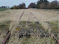
 Disused railway - geograph.org.uk - 3981937.jpg 640 × 480; 89 KB
-
 Disused railway - geograph.org.uk - 3982639.jpg 640 × 480; 76 KB
-
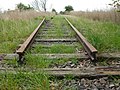
 Disused railway track between Wisbech and March - geograph.org.uk - 2926117.jpg 4,320 × 3,240; 5.96 MB
-
 Dry Culvert - geograph.org.uk - 3457352.jpg 800 × 600; 250 KB
-
 Elm Road level crossing, Wisbech to March line.jpg 4,302 × 2,868; 7.08 MB
-
 Excursion on the Wisbech branch - geograph.org.uk - 926417.jpg 640 × 398; 67 KB
-
 Going round the bend - The Bramley Line - geograph.org.uk - 2324616.jpg 2,848 × 2,136; 3.11 MB
-
 Goods Line - geograph.org.uk - 296914.jpg 640 × 427; 100 KB
-
 Level crossing at Coldham - geograph.org.uk - 2780295.jpg 4,320 × 3,240; 5.39 MB
-
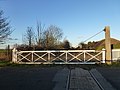
 Level crossing gate at Waldersea - geograph.org.uk - 2780223.jpg 4,320 × 3,240; 5.58 MB
-
 Level crossing on Elm Road (B1101) - geograph.org.uk - 4106576.jpg 640 × 375; 47 KB
-
 Level crossing on the B1101 - geograph.org.uk - 4106582.jpg 640 × 414; 50 KB
-
 Level crossing on the Wisbech to March railway - geograph.org.uk - 2926686.jpg 4,320 × 3,240; 5.82 MB
-
 Level crossing, Begdale - geograph.org.uk - 178773.jpg 640 × 480; 94 KB
-
 March to Wisbech railway bridge - geograph.org.uk - 2061027.jpg 1,600 × 1,200; 829 KB
-
 Nature Triumphant - geograph.org.uk - 1818245.jpg 640 × 480; 240 KB
-
 New Bridge Lane railway crossing, Wisbech - geograph.org.uk - 1975633.jpg 2,848 × 2,136; 3.11 MB
-
 Overgrown railway south of Wisbech - geograph.org.uk - 1349131.jpg 551 × 640; 142 KB
-
 Passenger train for Wisbech - geograph.org.uk - 926391.jpg 640 × 394; 75 KB
-
 Phone at Elm Road level crossing, Wisbech to March line.jpg 4,302 × 2,868; 4.92 MB
-
-
 Railway Bridge - geograph.org.uk - 1607182.jpg 640 × 480; 134 KB
-
 Railway bridge and level crossing near March - geograph.org.uk - 2780324.jpg 4,320 × 3,240; 5.47 MB
-
 Railway bridge over the Twenty Foot River near March - geograph.org.uk - 2780326.jpg 4,320 × 3,240; 5.76 MB
-
 Railway Culvert - geograph.org.uk - 3393195.jpg 800 × 600; 209 KB
-
 Redmoor Lane level crossing - geograph.org.uk - 1818243.jpg 640 × 480; 180 KB
-
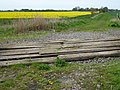
 Rolling Stock - geograph.org.uk - 3706205.jpg 800 × 450; 141 KB
-

-
 Rusting railway tracks near Coldham - geograph.org.uk - 2839265.jpg 4,320 × 3,240; 5.8 MB
-
 The Bramley Line - No trains or road traffic - geograph.org.uk - 2839214.jpg 4,320 × 3,240; 5.94 MB
-
 The Bramley Line looks more like the bramble line^ - geograph.org.uk - 2780219.jpg 4,320 × 3,240; 5.77 MB
-
 The Brown Cow at Wisbech sidings 2.jpg 6,954 × 4,506; 4.97 MB
-
 The Brown Cow at Wisbech sidings.jpg 7,515 × 4,472; 5.18 MB
-
 The March-Wisbech line crosses this drain just north of Whitemoor.jpg 5,314 × 2,437; 1.52 MB
-
 The Wisbech to March railway - Rusting and dipping - geograph.org.uk - 2926104.jpg 4,320 × 3,240; 5.85 MB
-
 Thing attached to the rails near Elm Road level crossing, Wisbech to March line.jpg 4,302 × 2,868; 7.11 MB
-
 Track near Elm Road level crossing, Wisbech to March line.jpg 4,302 × 2,868; 7.04 MB
-
 Waldersea level crossing on Long Drove - geograph.org.uk - 2780215.jpg 4,320 × 3,240; 5.77 MB
-
 Wisbech line bridge.jpg 4,397 × 2,528; 2.2 MB
-
 Wisbech to March line near Gravel House - geograph.org.uk - 396074.jpg 480 × 640; 212 KB
-
 Wisbech to March line near Whitemoor - geograph.org.uk - 396064.jpg 480 × 640; 210 KB
-
 Wisbech to March railway - Crooked rails near Crooked Bank - geograph.org.uk - 2927076.jpg 4,320 × 3,240; 5.57 MB
-
 Wisbech to March railway near Rutlands Farm, Coldham - geograph.org.uk - 2780317.jpg 4,320 × 3,240; 5.91 MB
-
 Yellow 25 - The Bramley Line near March. - geograph.org.uk - 2324646.jpg 2,848 × 2,136; 3.04 MB


_-_geograph.org.uk_-_4106576.jpg)


