Category:Wisconsin Highway 21
 | number: | (twenty-one) |
|---|---|---|
| State highways in Wisconsin: | 11 · 12 · 13 · 14 · 15 · 16 · 17 · 19 · 20 · 21 · 22 · 23 · 24 · 25 · 26 · 27 · 28 · 29 · 30 · 31 · 32 · 33 · 34 · 35 · 36 · 37 · 38 · 39 · 40 |
state highway in Wisconsin, United States  | |||||
| Upload media | |||||
| Instance of | |||||
|---|---|---|---|---|---|
| Location |
| ||||
| Transport network | |||||
| Owned by | |||||
| Maintained by | |||||
| Length |
| ||||
| |||||
English: Media related to Wisconsin Highway 21, a 123.4-mile (198.6 km) state highway in central Wisconsin, United States.
Subcategories
This category has only the following subcategory.
Media in category "Wisconsin Highway 21"
The following 35 files are in this category, out of 35 total.
-
 Arkdale Wisconsin Looking North US21.jpg 1,936 × 1,288; 1.66 MB
-
 Arkdale Wisconsin Sign looking north on WIS21.jpg 2,592 × 1,728; 1.78 MB
-
 Arkdale Wisconsin sign looking south on WIS21.jpg 2,592 × 1,728; 2.35 MB
-
 Aurora, Wisconsin.jpg 3,072 × 1,674; 911 KB
-
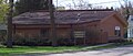 CarterMemorialLibraryOmroWisconsinWIS21.jpg 1,613 × 692; 781 KB
-
 Cole's Watch Tower is located at 7631 Wisconsin Highway 21, Omro, Wisconsin 54963.JPG 3,456 × 2,304; 4.53 MB
-
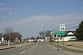
 Coloma Wisconsin Downtown Looking West WIS21.jpg 1,894 × 1,220; 880 KB
-
 Coloma Wisconsin sign looking east on WIS21.jpg 2,592 × 1,728; 2 MB
-
 Coloma Wisconsin Sign Looking West WIS 21.jpg 1,936 × 1,288; 1.14 MB
-
 Highway41atHighway21Wisconsin.jpg 2,304 × 1,728; 776 KB
-
 Necedah Wisconsin Looking West WIS21.jpg 1,936 × 1,288; 866 KB
-
 Necedah Wisconsin Sign WIS21.jpg 1,936 × 1,288; 1.01 MB
-
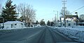 Omro winter.jpg 2,997 × 1,512; 1,007 KB
-
 OmroMainStHistoricDistrict2010WIS21WIS116.jpg 1,936 × 1,288; 1.18 MB
-
 OmroVillageHallAndEngineHouseWIS21WIS116.jpg 1,276 × 1,262; 587 KB
-
 OmroWisconsinDowntownWIS21.jpg 2,304 × 1,728; 709 KB
-
 Redgranite sign.jpg 1,438 × 803; 328 KB
-
 RedGraniteWisconsinDOTSignWIS21.jpg 2,304 × 1,728; 815 KB
-
 RedGraniteWisconsinDowntownWIS21.jpg 1,997 × 973; 1.11 MB
-
 Shennington Wisconsin Sign Monroe County WIS21.jpg 1,936 × 1,288; 981 KB
-
 ShipRock.jpg 3,801 × 2,401; 2.24 MB
-
 Tomah Wisconsin Sign WIS21.jpg 1,920 × 1,280; 781 KB
-
 Wautoma Wisconsin Sign Looking West WIS21.jpg 1,936 × 1,288; 1.06 MB
-
 WautomaWisconsinDowntown1WIS21.jpg 2,304 × 1,728; 731 KB
-
 WIS 21.svg 384 × 384; 2 KB
-
 WIS-173 and WIS-21 junction.jpg 4,000 × 3,000; 7.47 MB
-
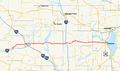 Wis-21-map.png 960 × 569; 289 KB
-
 Wis116atWis21.jpg 2,304 × 1,728; 661 KB
-
 Wisconsin Highway 152 West Terminus WIS21 Wautoma Wisconsin.jpg 1,936 × 1,288; 1.08 MB
-
 Wisconsin Highway 21.jpg 4,000 × 3,000; 8.21 MB
-
 Wisconsin River WIS21 bridge at Necedah.jpg 1,920 × 1,280; 1.24 MB
-
 Wisconsin State Highway 21 in Tomah.jpg 5,173 × 2,182; 9.2 MB
-
 WisconsinHighway21EastTerminus.jpg 2,304 × 1,728; 781 KB
-
 Wyeville Wisconsin Downtown Looking West WIS21.jpg 1,936 × 1,288; 1.14 MB
-
 Wyeville Wisconsin Sign WIS21.jpg 1,916 × 1,204; 802 KB


