Category:Witley
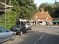
English: Witley, in Surrey, England is a village south west of Godalming. The village lies just east of the A3 that runs from Guildford to Petersfield. Witley together with the neighbouring area of Hambledon have a population of about 4,000. Neighbouring villages include Milford, Chiddingfold and Grayswood.

village and parish in Borough of Waverley, Surrey, England  | |||||
| Upload media | |||||
| Instance of | |||||
|---|---|---|---|---|---|
| Location | Waverley, Surrey, South East England, England | ||||
| Area |
| ||||
| Said to be the same as | Witley (Wikimedia duplicated page, civil parish) | ||||
 | |||||
Subcategories
This category has the following 14 subcategories, out of 14 total.
- Enton (12 F)
A
B
G
- Witley Gospel Hall (5 F)
K
S
- The Star, Witley (6 F)
W
- White Hart, Witley (7 F)
- Witley Camp (18 F)
- Witley railway station (31 F)
Media in category "Witley"
The following 200 files are in this category, out of 656 total.
(previous page) (next page)-
 2016, a year on Geograph (Day 351) - geograph.org.uk - 5231806.jpg 640 × 480; 46 KB
-
 2016, a year on Geograph (Day 57) - geograph.org.uk - 4841746.jpg 640 × 480; 56 KB
-

-
 A glorious winter's morning on Mare Hill - geograph.org.uk - 1626366.jpg 480 × 640; 127 KB
-
 A Lutyens cottage, Little Leat - geograph.org.uk - 2566789.jpg 1,024 × 775; 253 KB
-

-
 A snowy scene at the bottom of Mare Hill - geograph.org.uk - 1626729.jpg 640 × 480; 135 KB
-

-
 A snowy scene in Sunnydown - geograph.org.uk - 1625876.jpg 640 × 480; 94 KB
-
 A snowy scene on Mare Hill - geograph.org.uk - 1626364.jpg 640 × 480; 145 KB
-
 A Spring view of Sweetwater Pond Witley.jpg 5,504 × 3,800; 6.28 MB
-
 A sunken way Witley, England..jpg 4,146 × 3,020; 5.73 MB
-

-
 A283 at Wormley - geograph.org.uk - 3227060.jpg 3,648 × 2,048; 1.78 MB
-
 A283 east of Milford Heath - geograph.org.uk - 3226888.jpg 3,648 × 2,048; 1.86 MB
-
 A283 north to Wormley, Witley and Milford - geograph.org.uk - 2738487.jpg 4,000 × 3,000; 4.39 MB
-
 A283 passes the Esso Service Station - geograph.org.uk - 4054102.jpg 3,648 × 2,736; 1.59 MB
-
 A283 passing through Witley - geograph.org.uk - 1545974.jpg 640 × 480; 88 KB
-
 A283 Petworth Road north through Witley - geograph.org.uk - 2735697.jpg 4,000 × 3,000; 3.5 MB
-
 A283 south of Orchard Farm - geograph.org.uk - 3227166.jpg 3,648 × 2,048; 1.66 MB
-
 A283 southeast of Witley - geograph.org.uk - 3226906.jpg 3,648 × 2,048; 1.57 MB
-
 A283, northbound - geograph.org.uk - 5642779.jpg 640 × 426; 91 KB
-
 A283, northbound - geograph.org.uk - 5642787.jpg 640 × 426; 90 KB
-
 A283, Petworth Rd - geograph.org.uk - 3209439.jpg 640 × 430; 90 KB
-
 A283, Witley - geograph.org.uk - 5642783.jpg 640 × 426; 60 KB
-
 A283, Wormley - geograph.org.uk - 5642776.jpg 640 × 365; 50 KB
-
 A286 - geograph.org.uk - 5658333.jpg 640 × 577; 125 KB
-
 A286 - geograph.org.uk - 5658370.jpg 640 × 426; 86 KB
-
 A286 - geograph.org.uk - 5658387.jpg 640 × 426; 81 KB
-
 A286 by Stroud - geograph.org.uk - 3038085.jpg 640 × 428; 129 KB
-
 A3 at Borough Farm Road - geograph.org.uk - 2965263.jpg 640 × 480; 140 KB
-
 A3 crash barriers, Witley Common - geograph.org.uk - 2965276.jpg 640 × 480; 147 KB
-
 A3 near Milford looking north - geograph.org.uk - 2299129.jpg 800 × 600; 103 KB
-
 A3 near Milford looking south - geograph.org.uk - 2299131.jpg 800 × 600; 86 KB
-
 A3 northbound - geograph.org.uk - 3104009.jpg 640 × 480; 51 KB
-
 A3 northbound - geograph.org.uk - 3104012.jpg 640 × 480; 49 KB
-
 A3 northbound - geograph.org.uk - 3104015.jpg 640 × 480; 57 KB
-
 A3 northbound - geograph.org.uk - 3104017.jpg 640 × 442; 38 KB
-
 A3 northbound - geograph.org.uk - 3104022.jpg 640 × 438; 52 KB
-

-
 A3, Milford bypass - geograph.org.uk - 4261445.jpg 640 × 531; 51 KB
-
 A3, Milford bypass - geograph.org.uk - 4261454.jpg 640 × 353; 31 KB
-
 A3, northbound - geograph.org.uk - 4261442.jpg 640 × 379; 35 KB
-
 A3, turning for Milford - geograph.org.uk - 2795625.jpg 640 × 383; 39 KB
-
 Access land alongside the Greensand Way - geograph.org.uk - 2739488.jpg 4,000 × 3,000; 3.24 MB
-
 Across the Golf Course - geograph.org.uk - 2960389.jpg 3,300 × 2,200; 5.51 MB
-
 All Saints Church Witley - geograph.org.uk - 2735654.jpg 4,000 × 3,000; 3.55 MB
-
 All Saints Church, Witley, Surrey - geograph.org.uk - 2959712.jpg 3,900 × 2,600; 5.1 MB
-
 All Saints Church, Witley, Surrey - geograph.org.uk - 2959717.jpg 3,900 × 2,600; 4.67 MB
-
 An icy Khartoum Road - geograph.org.uk - 1626818.jpg 640 × 480; 95 KB
-

-

-
 An icy scene in Chichester Close - geograph.org.uk - 1625905.jpg 640 × 480; 70 KB
-
 An icy scene in Merryacres - geograph.org.uk - 1626853.jpg 640 × 480; 73 KB
-
 An icy scene on the Newlands Estate - geograph.org.uk - 1626103.jpg 640 × 480; 85 KB
-
 Approaching a bend in Rake Lane - geograph.org.uk - 1625501.jpg 640 × 480; 94 KB
-
 Approaching Harrison's in Station Lane - geograph.org.uk - 1625484.jpg 640 × 480; 101 KB
-

-

-
 Approaching the "summit" of Mare Hill - geograph.org.uk - 1626723.jpg 640 × 480; 101 KB
-

-

-

-

-

-
-

-

-

-

-

-
-

-

-

-

-

-

-

-

-

-

-

-
 Approaching Witley on the A283 - geograph.org.uk - 1545946.jpg 640 × 480; 72 KB
-
 Autumn Colours in Witley - geograph.org.uk - 1572974.jpg 640 × 480; 138 KB
-
 Autumn comes to Cherry Tree Road - geograph.org.uk - 4248308.jpg 800 × 600; 120 KB
-
 Autumn in New Road - geograph.org.uk - 1543819.jpg 640 × 480; 89 KB
-
 Autumn in Station Approach - geograph.org.uk - 1543804.jpg 640 × 480; 82 KB
-
 Autumn on the A283 at Witley - geograph.org.uk - 1546003.jpg 640 × 480; 84 KB
-

-

-
 B3001 roundabout junction with A283 - geograph.org.uk - 4052855.jpg 2,880 × 2,223; 840 KB
-
 B3001 south of Hazel Copse - geograph.org.uk - 4052814.jpg 3,648 × 2,736; 1.97 MB
-
 B3001 southeast of Oxenford Farm - geograph.org.uk - 4052833.jpg 3,320 × 2,431; 1.73 MB
-
 B3001 southeast of Oxenford Grange - geograph.org.uk - 4052847.jpg 3,648 × 2,736; 1.59 MB
-
 Back on Tarmac - geograph.org.uk - 2963570.jpg 3,000 × 2,000; 6.68 MB
-
 Bagmoor Wood - geograph.org.uk - 2251474.jpg 2,560 × 1,920; 1.78 MB
-
 Bags of leaves on footpath 140 by Fintry - geograph.org.uk - 2739957.jpg 4,000 × 3,000; 3.46 MB
-
 Banacle Hill Road - geograph.org.uk - 3926998.jpg 768 × 1,024; 382 KB
-
 Barn and pond at Oxenford Grange - geograph.org.uk - 5658647.jpg 763 × 1,024; 247 KB
-
 Barn at Oxenford Grange.jpg 3,215 × 2,404; 1.28 MB
-
 Beech Hill joining Park Lane from the right - geograph.org.uk - 2859636.jpg 4,000 × 3,000; 3.55 MB
-
 Bend in Brook Road - geograph.org.uk - 1546221.jpg 640 × 480; 99 KB
-
 Bend in Cramhurst Lane - geograph.org.uk - 1626786.jpg 640 × 480; 93 KB
-
 Bend in Sunnydown - geograph.org.uk - 1625862.jpg 640 × 480; 108 KB
-

-
 Bend on the A283 approaching Witley - geograph.org.uk - 1545927.jpg 640 × 480; 62 KB
-
 Beside the tracks near Witley Station - geograph.org.uk - 4057095.jpg 800 × 600; 211 KB
-
 Birch trees on Witley Common - geograph.org.uk - 2858306.jpg 4,000 × 3,000; 3.27 MB
-
 Birch Wood Near Borough Farm - geograph.org.uk - 2252618.jpg 2,560 × 1,920; 1.86 MB
-
 Birch Woodland by Borough Farm - geograph.org.uk - 2252650.jpg 2,560 × 1,920; 1.8 MB
-
 Blackhill Pond, Milford Heath - geograph.org.uk - 2840232.jpg 1,024 × 789; 378 KB
-
 Boot-scraper at Witley church - geograph.org.uk - 3042020.jpg 640 × 479; 121 KB
-
 Borough Farm Road End - geograph.org.uk - 2252654.jpg 2,560 × 1,920; 1.75 MB
-
 Bottom of Mare Hill - geograph.org.uk - 1626727.jpg 640 × 480; 125 KB
-
 Bridge over the A3, Milford bypass - geograph.org.uk - 4261452.jpg 640 × 502; 57 KB
-
 Bridleway 117 to Lea Coach road - geograph.org.uk - 2865655.jpg 4,000 × 3,000; 3.51 MB
-
 Bridleway by Mistlebrooks Wood - geograph.org.uk - 2252674.jpg 2,560 × 1,920; 1.77 MB
-
 Bridleway by Mousehill Corner - geograph.org.uk - 2252741.jpg 2,560 × 1,920; 1.76 MB
-
 Bridleway by Thursley Lake - geograph.org.uk - 1172418.jpg 640 × 480; 167 KB
-
 Bridleway by Witley park boundary wall - geograph.org.uk - 2865652.jpg 4,000 × 3,000; 3.46 MB
-
 Bridleway in Mousehill Down - geograph.org.uk - 2252751.jpg 2,560 × 1,920; 1.76 MB
-
 Bridleway Near Rodborough Hill - geograph.org.uk - 2252661.jpg 2,560 × 1,920; 1.67 MB
-
 Bridleway off Lea Coach Road - geograph.org.uk - 1536841.jpg 640 × 360; 92 KB
-
 Bridleway on edge of Witley Common - geograph.org.uk - 2858302.jpg 4,000 × 3,000; 3.65 MB
-
 Bridleway on Rodborough Hill - geograph.org.uk - 2252669.jpg 2,560 × 1,920; 1.71 MB
-
 Bridleway south of Creedhole Farm - geograph.org.uk - 2594857.jpg 768 × 1,024; 364 KB
-
 Bridleway stream - geograph.org.uk - 2269458.jpg 1,704 × 2,272; 3.39 MB
-
 Brook Road at the junction of Petworth Road - geograph.org.uk - 5095905.jpg 2,304 × 1,728; 799 KB
-
 Brook Road housing - geograph.org.uk - 1543890.jpg 640 × 480; 75 KB
-
 Brook Road near Brook in Surrey - geograph.org.uk - 1351874.jpg 640 × 360; 73 KB
-
 Brook Road, Sandhills - geograph.org.uk - 5096048.jpg 2,304 × 1,728; 814 KB
-
 Building at Milford Cemetery - geograph.org.uk - 1351913.jpg 360 × 640; 56 KB
-
 Building at Witley Station - geograph.org.uk - 3209480.jpg 640 × 430; 87 KB
-
 Buildings by the Pond, Oxenford Grange - geograph.org.uk - 5672068.jpg 3,309 × 2,587; 2.52 MB
-

-

-
 Car park at Secrett's garden centre - geograph.org.uk - 3080501.jpg 1,600 × 1,200; 497 KB
-
 Car park at Witley Recreation Ground - geograph.org.uk - 1545949.jpg 640 × 480; 71 KB
-

-

-

-
 Cars in Cramhurst Lane - geograph.org.uk - 1626799.jpg 640 × 480; 78 KB
-

-

-
 Changing the street lamps. Milford - geograph.org.uk - 2965289.jpg 640 × 480; 106 KB
-
 Chichester Hall, Witley - geograph.org.uk - 1572935.jpg 640 × 480; 103 KB
-
 Church Lane - geograph.org.uk - 1546071.jpg 640 × 480; 105 KB
-
 Church Lane near Sandhills - geograph.org.uk - 2739967.jpg 4,000 × 3,000; 3.73 MB
-
 Church Lane SW out of Witley - geograph.org.uk - 2735647.jpg 4,000 × 3,000; 3.34 MB
-
 Church Lane, Sandhills - geograph.org.uk - 2970935.jpg 640 × 480; 165 KB
-
 Church Lane, Sandhills, Surrey - geograph.org.uk - 2963988.jpg 3,600 × 2,400; 7.1 MB
-
 Church Lane, Sandhills, Surrey - geograph.org.uk - 2963999.jpg 3,600 × 2,400; 7.67 MB
-
 Church Lane, Witley - geograph.org.uk - 1571567.jpg 640 × 480; 125 KB
-
 Church Lane, Witley, Surrey - geograph.org.uk - 2964021.jpg 3,600 × 2,400; 7.28 MB
-
 Church path at All Saints, Witley - geograph.org.uk - 1543164.jpg 480 × 640; 74 KB
-
 Church Road, Milford - geograph.org.uk - 2251321.jpg 2,560 × 1,920; 1.92 MB
-
 Cleared area, Hurthill Copse - geograph.org.uk - 3038309.jpg 640 × 480; 142 KB
-
 Clockhouse Apartments and Clockhouse Cottages - geograph.org.uk - 2736764.jpg 4,000 × 3,000; 3.57 MB
-
 Closeup of culvert under railway embankment - geograph.org.uk - 2859831.jpg 4,000 × 3,000; 3.66 MB
-
 Coat of arms on post by footpath 119 - geograph.org.uk - 2860751.jpg 4,000 × 3,000; 3.39 MB
-
 Combe Lane - geograph.org.uk - 3214094.jpg 640 × 430; 104 KB
-
 Combe Lane - geograph.org.uk - 3214097.jpg 640 × 430; 111 KB
-
 Combe Lane - geograph.org.uk - 3214102.jpg 640 × 430; 76 KB
-
 Commonland on Mare Hill - geograph.org.uk - 1172790.jpg 640 × 480; 128 KB
-
 Communications mast by old barn at South Park Farm - geograph.org.uk - 2859821.jpg 4,000 × 3,000; 3.34 MB
-

-
 Converted farm buildings, Witley - geograph.org.uk - 3042055.jpg 1,024 × 726; 190 KB
-
 Coppice woodland - geograph.org.uk - 2862706.jpg 4,000 × 3,000; 3.51 MB
-
 Coppiced chestnut trees on Hindhead Common - geograph.org.uk - 2594667.jpg 1,024 × 768; 241 KB
-
 Corner Shop, Witley - geograph.org.uk - 1571468.jpg 640 × 480; 100 KB
-
 Corner Shops - geograph.org.uk - 1571491.jpg 640 × 480; 110 KB
-
 Cottage on Brook Road, Sandhills - geograph.org.uk - 5096251.jpg 2,304 × 1,728; 1.44 MB
-
 Cottage on Brook Road, Sandhills - geograph.org.uk - 5096252.jpg 2,304 × 1,728; 819 KB
-
 Cottages at Wheelerstreet - geograph.org.uk - 1625772.jpg 640 × 480; 85 KB
-
 Cottages in Petworth Road - geograph.org.uk - 1626159.jpg 640 × 480; 90 KB
-
 Cottages on the Petworth Road - geograph.org.uk - 1571475.jpg 640 × 480; 86 KB
-

-
 Countryside South of Witley - geograph.org.uk - 1571582.jpg 640 × 480; 131 KB
-
 An icy scene in Cramhurst Lane - geograph.org.uk - 1626791.jpg 640 × 480; 83 KB
-
 Cramhurst Lane - geograph.org.uk - 1626807.jpg 640 × 480; 98 KB
-
 Creedhole Farm House - geograph.org.uk - 3926472.jpg 3,264 × 2,448; 2.98 MB
-
 Cricket ground and pavilion at Brook - geograph.org.uk - 1963230.jpg 800 × 455; 108 KB
-
 Crossing of paths below Gibbet Hill - geograph.org.uk - 2080453.jpg 3,968 × 2,976; 2.8 MB
-
 Crossways at Witley - geograph.org.uk - 1325591.jpg 640 × 360; 85 KB
-
 Culvert under railway embankment - geograph.org.uk - 2859827.jpg 4,000 × 3,000; 3.53 MB
-
 Date stone on Fosters at Witley - geograph.org.uk - 1545986.jpg 480 × 640; 100 KB
-
 Dentists in Roke Lane - geograph.org.uk - 1626040.jpg 640 × 480; 100 KB
-

-
 Discreet protest in Rake Lane - geograph.org.uk - 1625526.jpg 640 × 480; 115 KB
-
 Distant postbox on the A283 - geograph.org.uk - 1545846.jpg 640 × 480; 115 KB
-
 Doorway at Tigbourne Court (1) - geograph.org.uk - 3748115.jpg 768 × 1,024; 265 KB
-
 Drink Tea and Eat Cake - geograph.org.uk - 2933409.jpg 4,288 × 3,216; 2.97 MB
-
 Drive to Fintry - geograph.org.uk - 2739962.jpg 4,000 × 3,000; 3.85 MB
-
 Early evening in Church Lane - geograph.org.uk - 1546104.jpg 640 × 480; 100 KB
-
 Elstead Road - geograph.org.uk - 3053068.jpg 640 × 428; 101 KB
-
 Elstead Road - geograph.org.uk - 3053072.jpg 640 × 428; 104 KB
-
 Elstead Road entering Elstead - geograph.org.uk - 3178588.jpg 2,048 × 1,536; 1.48 MB
-
 Elstead Road leaving Milford - geograph.org.uk - 3178569.jpg 2,048 × 1,536; 1.4 MB
-
 Empty seat on Mare Hill - geograph.org.uk - 1626726.jpg 640 × 480; 115 KB
_-_geograph.org.uk_-_5231806.jpg)
_-_geograph.org.uk_-_4841746.jpg)


_-_geograph.org.uk_-_3748115.jpg)


