Category:Witte kerk (Heiloo)
| Object location | | View all coordinates using: OpenStreetMap |
|---|
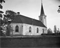
church building in Heiloo, Netherlands   | |||||
| Upload media | |||||
| Instance of | |||||
|---|---|---|---|---|---|
| Location | Heiloo, North Holland, Netherlands | ||||
| Street address |
| ||||
| Located on street |
| ||||
| Heritage designation |
| ||||
| Adjacent building | |||||
 | |||||
Nederlands: Witte Kerk Heiloo - anno 1630
Kerk:
|
This is a category about rijksmonument number 21346
|
Toren:
|
This is a category about rijksmonument number 21347
|
| Address |
|
Media in category "Witte kerk (Heiloo)"
The following 31 files are in this category, out of 31 total.
-
 Exterieur naar het noord-westen - Heiloo - 20106865 - RCE.jpg 939 × 1,200; 253 KB
-
 Exterieur naar het zuid-westen - Heiloo - 20106859 - RCE.jpg 968 × 1,200; 269 KB
-
 Exterieur naar het zuid-westen - Heiloo - 20106860 - RCE.jpg 1,200 × 959; 216 KB
-
 Exterieur NOORDGEVEL - Heiloo - 20287409 - RCE.jpg 1,200 × 953; 351 KB
-
 Exterieur OOSTGEVEL - Heiloo - 20287407 - RCE.jpg 952 × 1,200; 399 KB
-
 Exterieur TEKENING (PLATTEGROND) - Heiloo - 20263128 - RCE.jpg 1,200 × 514; 72 KB
-

-
 Exterieur ZUIDGEVEL - Heiloo - 20287408 - RCE.jpg 1,200 × 953; 297 KB
-
 Exterieur ZUIDGEVEL, OOSTGEVEL - Heiloo - 20287406 - RCE.jpg 960 × 1,200; 318 KB
-
 Heiloo - 18-5-2010 - panoramio (22).jpg 1,536 × 2,048; 1.32 MB
-
 Interieur naar het oosten - Heiloo - 20106861 - RCE.jpg 963 × 1,200; 227 KB
-
 Interieur naar het oosten - Heiloo - 20106863 - RCE.jpg 1,200 × 946; 166 KB
-
 Interieur naar het westen - Heiloo - 20106862 - RCE.jpg 1,200 × 930; 214 KB
-
 Interieur naar het westen - Heiloo - 20106864 - RCE.jpg 1,200 × 942; 186 KB
-

-
 Interieur, aanzicht orgel, orgelnummer 649 - Heiloo - 20359287 - RCE.jpg 956 × 1,200; 214 KB
-
 INTERIEUR, KOOR, KAPITEEL, DETAIL - Heiloo - 20287415 - RCE.jpg 1,200 × 1,194; 238 KB
-
 INTERIEUR, ORGEL - Heiloo - 20287413 - RCE.jpg 960 × 1,200; 246 KB
-
 INTERIEUR, ORGEL - Heiloo - 20287414 - RCE.jpg 1,194 × 1,200; 253 KB
-
 INTERIEUR, OVERZICHT NAAR HET OOSTEN - Heiloo - 20287410 - RCE.jpg 1,200 × 948; 220 KB
-
 INTERIEUR, OVERZICHT NAAR HET WESTEN - Heiloo - 20287411 - RCE.jpg 955 × 1,200; 236 KB
-
 INTERIEUR, PREEKSTOEL MET DOOPTUIN - Heiloo - 20287412 - RCE.jpg 1,200 × 953; 184 KB
-

-

-
 Overzicht noordoostgevel - Heijen - 20112452 - RCE.jpg 1,200 × 894; 208 KB
-
 Plattegrond - Heiloo - 20106866 - RCE.jpg 1,200 × 575; 112 KB
-
 Witte kerk Heiloo.jpg 640 × 1,350; 125 KB
-
 Witte Kerk, Heiloo.JPG 640 × 480; 85 KB
-
 Witte Kerkje en Willibrordusput in de mist.png 640 × 480; 559 KB
-
 Witte Kerkje en Willibrordusput.jpg 4,608 × 2,592; 3.54 MB
-
 Witte kerkje.jpg 3,024 × 4,032; 2.5 MB


_-_Heiloo_-_20263128_-_RCE.jpg)


.jpg)


