Category:Wolvercote
village in Oxfordshire, part of the City of Oxford, England  | |||||
| Upload media | |||||
| Instance of |
| ||||
|---|---|---|---|---|---|
| Location | Oxford, Oxfordshire, South East England, England | ||||
| Located in or next to body of water | |||||
| official website | |||||
 | |||||
English: Wolvercote ( Oxfordshire, England) is a village that is now part of the City of Oxford, England, though still retaining its own identity. It is about 3 miles (5 km) northwest of the centre of Oxford, on the northern edge of Port Meadow.
Subcategories
This category has the following 18 subcategories, out of 18 total.
A
- A34 Road Bridge (6 F)
B
- Buses in Wolvercote (11 F)
G
- Godstow Bridge (12 F)
- Godstow Lock (26 F)
K
- King's Lock (12 F)
O
- Oxford Canal Bridge 233 (6 F)
- Oxford Canal Bridge 234 (4 F)
- Oxford Canal Bridge 235 (8 F)
- Oxford Canal Bridge 236 (7 F)
- Oxford Canal Bridge 236A (9 F)
T
- The Plough, Wolvercote (5 F)
W
- Toll Bridge, Wolvercote (8 F)
- Wolvercote Common (13 F)
- Wolvercote Junction (7 F)
- Wolvercote Tunnel (7 F)
- Wolvercote War Memorial (1 F)
Media in category "Wolvercote"
The following 95 files are in this category, out of 95 total.
-
 139, Godstow Rd - geograph.org.uk - 5944222.jpg 1,024 × 681; 207 KB
-

-
 A34 bridge over the Oxford Canal, Wolvercote 01.jpg 4,128 × 3,096; 5.48 MB
-
 A34 bridge over the Oxford Canal, Wolvercote 02.jpg 4,128 × 3,096; 4.54 MB
-
 A34 bridge over the Oxford Canal, Wolvercote 03.jpg 4,128 × 3,096; 4.53 MB
-
 A40 - geograph.org.uk - 5944013.jpg 1,024 × 681; 135 KB
-
 A40 - geograph.org.uk - 5965791.jpg 1,024 × 681; 119 KB
-

-
 A44 - geograph.org.uk - 5943998.jpg 1,024 × 681; 113 KB
-
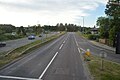 A44 - geograph.org.uk - 5965799.jpg 1,024 × 681; 132 KB
-
 A44, Woodstock Road Roundabout - geograph.org.uk - 5944012.jpg 1,024 × 681; 138 KB
-
 Allotments opposite The Trout Inn - geograph.org.uk - 5836120.jpg 1,024 × 683; 322 KB
-
 Allotments, Godstow Rd - geograph.org.uk - 5618182.jpg 640 × 426; 94 KB
-
 Almost as good as a Moat - geograph.org.uk - 4274251.jpg 3,888 × 2,592; 1.98 MB
-
 Approaching the village green, Lower Wolvercote - geograph.org.uk - 5216525.jpg 1,024 × 768; 127 KB
-
 Baptist Church - geograph.org.uk - 5944220.jpg 1,024 × 680; 185 KB
-
 Bathers in Wolvercote Mill Stream - geograph.org.uk - 5836119.jpg 1,024 × 683; 320 KB
-
 Below King's Lock - geograph.org.uk - 909137.jpg 640 × 475; 76 KB
-
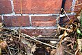 Benchmark on Wolvercote Primary School - geograph.org.uk - 6005216.jpg 1,024 × 683; 231 KB
-
 Beneath the Wolvercote Viaduct - geograph.org.uk - 1387808.jpg 640 × 426; 65 KB
-
 Blandford Avenue - geograph.org.uk - 4015194.jpg 640 × 430; 76 KB
-
 BMW dealership on the A40, Wolvercote - geograph.org.uk - 3575733.jpg 2,048 × 1,536; 1.4 MB
-
 Boundary stone on south side of Godstow Road - geograph.org.uk - 3245960.jpg 683 × 1,024; 215 KB
-
 Bridge carrying First Turn, Wolvercote - geograph.org.uk - 5216653.jpg 1,024 × 768; 131 KB
-
-
 Bridleway at Wolvercote - geograph.org.uk - 1387816.jpg 640 × 426; 121 KB
-
 Car dealership on the A40, Wolvercote - geograph.org.uk - 3575730.jpg 2,048 × 1,536; 1.45 MB
-
 College Pond, Wolvercote Green - geograph.org.uk - 4712027.jpg 1,280 × 1,280; 1,003 KB
-
 Container train heads north through Wolvercote - geograph.org.uk - 3243801.jpg 1,024 × 683; 214 KB
-
 Cottages, Lower Wolvercote - geograph.org.uk - 5618190.jpg 640 × 426; 81 KB
-
 Dedication stone, Wolvercote Community Orchard - geograph.org.uk - 4712101.jpg 1,280 × 960; 638 KB
-
 Edge of the Nature Reserve - geograph.org.uk - 4275336.jpg 1,600 × 1,242; 925 KB
-
 Elmthorpe Rd - geograph.org.uk - 5618198.jpg 640 × 426; 69 KB
-
 First Turn - geograph.org.uk - 4015201.jpg 640 × 430; 83 KB
-
 First Turn railway bridge and houses - geograph.org.uk - 3246166.jpg 1,024 × 683; 219 KB
-
 First Turn, Wolvercote - geograph.org.uk - 4015264.jpg 640 × 430; 92 KB
-
 Flats at Lower Wolvercote - geograph.org.uk - 3382441.jpg 640 × 427; 195 KB
-
 Flats on Godstow Road, Wolvercote - geograph.org.uk - 4837643.jpg 2,304 × 1,728; 1.32 MB
-

-
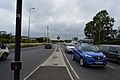
 Godstow Road at the Wolvercote Roundabout - geograph.org.uk - 4835725.jpg 2,220 × 1,610; 893 KB
-
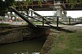
 Godstow Road bridges - geograph.org.uk - 4711562.jpg 1,280 × 960; 459 KB
-
 Godstow Road from carpark entrance - geograph.org.uk - 3245708.jpg 1,024 × 683; 272 KB
-
 Godstow Road with autumn colours - geograph.org.uk - 4712123.jpg 1,280 × 883; 584 KB
-
 Godstow Road, Lower Wolvercote - geograph.org.uk - 4711521.jpg 1,280 × 944; 318 KB
-
 Godstow Road, Lower Wolvercote 01.jpg 4,128 × 3,096; 6.04 MB
-
 Godstow Road, Wolvercote - geograph.org.uk - 4835557.jpg 2,304 × 1,728; 824 KB
-
 Godstow Road, Wolvercote - geograph.org.uk - 4835711.jpg 2,304 × 1,728; 837 KB
-
 Godstow Road, Wolvercote - geograph.org.uk - 4836123.jpg 2,304 × 1,728; 851 KB
-
 Godstow Road, Wolvercote - geograph.org.uk - 5216605.jpg 1,024 × 768; 148 KB
-
 Grey heron (Ardea cinerea).jpg 4,878 × 3,252; 3.58 MB
-
 Greylag geese by Wolvercote Millstream - geograph.org.uk - 1897233.jpg 1,000 × 1,500; 164 KB
-
 Greylag goose in Wolvercote - geograph.org.uk - 3915232.jpg 1,500 × 979; 175 KB
-
 Home Close, Lower Wolvercote - geograph.org.uk - 5216592.jpg 1,024 × 768; 132 KB
-
 Home Close, Wolvercote - geograph.org.uk - 4275357.jpg 1,600 × 1,144; 387 KB
-
 Home Close, Wolvercote - geograph.org.uk - 4711548.jpg 1,280 × 960; 329 KB
-
 Humber Imperial Wolvercote1.jpg 1,024 × 683; 354 KB
-
 Humber Imperial Wolvercote2.jpg 1,024 × 614; 295 KB
-
 King's Weir - geograph.org.uk - 909045.jpg 640 × 426; 55 KB
-
 Lakeside, Wolvercote - geograph.org.uk - 4275384.jpg 2,048 × 1,536; 853 KB
-
 Looking downstream from Godstow - geograph.org.uk - 1907736.jpg 1,500 × 992; 216 KB
-
 Looking downstream from Godstow Bridge (west) - geograph.org.uk - 1897308.jpg 1,500 × 1,000; 253 KB
-
 Looking south from Godstow Road - geograph.org.uk - 4711565.jpg 1,280 × 960; 661 KB
-
 Looking upstream from Godstow Bridge (east) - geograph.org.uk - 1897300.jpg 1,500 × 1,000; 323 KB
-
 Looking upstream from Godstow Bridge (west) - geograph.org.uk - 1897313.jpg 1,500 × 997; 257 KB
-
 M&S filling station on the A40, Wolvercote - geograph.org.uk - 3575729.jpg 2,048 × 1,536; 1.45 MB
-
 Maisonettes on St Peters Road, Wolvercote - geograph.org.uk - 4839442.jpg 1,752 × 1,208; 548 KB
-
 Maisonettes on St Peters Road, Wolvercote - geograph.org.uk - 4839443.jpg 1,772 × 1,232; 389 KB
-
 Mallards (Anas platyrhynchos), Wolvercote Lakes.jpg 4,341 × 2,221; 3.08 MB
-
 Memorial to 1912 aircraft crash, Wolvercote.jpg 4,128 × 3,096; 7.33 MB
-
 Mere road (3557441317).jpg 800 × 744; 226 KB
-
 Mute swan (Cygnus olor) taking off.jpg 4,970 × 3,313; 4.04 MB
-
 Mute swans (Cygnus olor) and cygnets.jpg 4,185 × 2,790; 3.75 MB
-
 Nature reserve at Upper Wolvercote - geograph.org.uk - 3382404.jpg 427 × 640; 216 KB
-
 New builds on a flood plain! - geograph.org.uk - 4421452.jpg 1,600 × 1,048; 315 KB
-

-
 Oxford , First Turn - geograph.org.uk - 4060723.jpg 3,849 × 2,556; 5.2 MB
-
 Oxford , Godstow Road - geograph.org.uk - 4060735.jpg 4,288 × 2,848; 5.89 MB
-
 Oxford New North Junction - geograph.org.uk - 961940.jpg 640 × 407; 88 KB
-
 Railway line from Godstow Road, Wolvercote 01.jpg 4,128 × 3,096; 6.42 MB
-
 Railway line from Godstow Road, Wolvercote 02.jpg 4,128 × 3,096; 6.39 MB
-

-
 The Oxford Canal - geograph.org.uk - 841053.jpg 640 × 425; 87 KB
-
 Bridge at Wolvercote - geograph.org.uk - 1345708.jpg 640 × 422; 82 KB
-

-
 First Turn Bridge over the railway - geograph.org.uk - 1502339.jpg 640 × 427; 103 KB
-
 Wolvercote canal near plough inn.jpg 1,380 × 931; 281 KB
-
 Wolvercote GodstowRd postbox.jpg 1,650 × 2,750; 2.02 MB
-
 Wolvercote Green - geograph.org.uk - 1387820.jpg 640 × 426; 110 KB
-
 Wolvercote Junction up Parcels train geograph-2911626-by-Ben-Brooksbank.jpg 2,394 × 1,262; 1.51 MB
-
 Wolvercote Junction with Hereford express geograph-2904702-by-Ben-Brooksbank.jpg 2,394 × 1,457; 1.26 MB
-
 Wolvercote Lock 01.jpg 4,128 × 3,096; 7.16 MB
-
 Wolvercote Lock 02.jpg 4,128 × 3,096; 7.18 MB
-
 Wolvercote TollBridge Monument PeterStone.jpg 4,000 × 3,200; 5.79 MB
-
 Wolvercote Trout BoundaryMark.JPG 1,890 × 2,520; 1.74 MB
-
 Wolvercote Village Hall - geograph.org.uk - 1388652.jpg 640 × 426; 84 KB


.jpg)


_-_geograph.org.uk_-_1897308.jpg)

_-_geograph.org.uk_-_1897300.jpg)
_-_geograph.org.uk_-_1897313.jpg)


,_Wolvercote_Lakes.jpg)

.jpg)
_taking_off.jpg)
_and_cygnets.jpg)


