Category:Womenswold
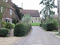
English: Womenswold is a village and civil parish situated about south-east of Canterbury, Kent, England, 1 mile to the east of the A2 road. The parish consists of three hamlets; Womenswold, Woolage Village and Woolage Green.
village and civil parish in Kent, United Kingdom  | |||||
| Upload media | |||||
| Instance of | |||||
|---|---|---|---|---|---|
| Location | Canterbury, Kent, South East England, England | ||||
| Area |
| ||||
 | |||||
Subcategories
This category has the following 4 subcategories, out of 4 total.
Media in category "Womenswold"
The following 200 files are in this category, out of 211 total.
(previous page) (next page)-
 1 of 2 Two Sawyers Pub Signs, Woolage Green - geograph.org.uk - 2255556.jpg 2,304 × 3,072; 1.45 MB
-
 A descent of The North Downs Way - geograph.org.uk - 4002941.jpg 979 × 734; 268 KB
-
 A strip of maize - geograph.org.uk - 4913057.jpg 640 × 426; 103 KB
-
 A2 Dual Carriageway to Canterbury - geograph.org.uk - 2141234.jpg 3,072 × 2,304; 1.66 MB
-
 Access road towards Denne Hill - geograph.org.uk - 2141450.jpg 3,072 × 2,304; 1.87 MB
-
 Adisham Rd, B2046 - geograph.org.uk - 4913047.jpg 640 × 426; 63 KB
-
 Anti Tank Obstacles - geograph.org.uk - 1970234.jpg 1,024 × 768; 298 KB
-
 Arable land near Womenswold - geograph.org.uk - 4913051.jpg 640 × 426; 59 KB
-
 Arable landscape - geograph.org.uk - 4913092.jpg 640 × 426; 60 KB
-
 Area of newly-planted woodland - geograph.org.uk - 5127201.jpg 3,264 × 2,448; 3.62 MB
-
 B2046, Adisham Road - geograph.org.uk - 1970257.jpg 1,024 × 768; 228 KB
-
 Barn by North Downs Way - geograph.org.uk - 4913067.jpg 640 × 426; 96 KB
-
 Barn, Womenswold - geograph.org.uk - 4913066.jpg 640 × 426; 70 KB
-
 Barns on Woolage Farm - geograph.org.uk - 1123702.jpg 640 × 480; 159 KB
-
 Bridleway and footpath junction near Denne Hill Farm - geograph.org.uk - 2141429.jpg 3,072 × 2,304; 2.21 MB
-
 Bridleway beside the A2 towards Denne Hill - geograph.org.uk - 2141255.jpg 3,072 × 2,304; 2.71 MB
-
 Bridleway in Wick Wood - geograph.org.uk - 2255527.jpg 3,072 × 2,304; 3.57 MB
-
 Bridleway in Woolwich Wood - geograph.org.uk - 2255544.jpg 3,072 × 2,304; 2.84 MB
-
 Bridleway to Denne Hill Farm - geograph.org.uk - 2141316.jpg 3,072 × 2,304; 1.69 MB
-
 Bridleway to Woolage Green - geograph.org.uk - 2255533.jpg 3,072 × 2,304; 2.64 MB
-
 Bridleway turns at the A2 - geograph.org.uk - 2141264.jpg 3,072 × 2,304; 3.39 MB
-
 Byway to Woolage Green - geograph.org.uk - 4918391.jpg 640 × 426; 94 KB
-
 Chalk Wood - geograph.org.uk - 4913081.jpg 640 × 426; 62 KB
-
 Chalk Wood - geograph.org.uk - 4913084.jpg 640 × 426; 57 KB
-
 Chalk Wood - geograph.org.uk - 4913086.jpg 640 × 426; 75 KB
-
 Chapel Cottage, Woolage Green - geograph.org.uk - 2255552.jpg 3,072 × 2,304; 1.96 MB
-
 Church House - geograph.org.uk - 2255549.jpg 3,072 × 2,304; 1.27 MB
-
 Crop Field off Nethersole Road - geograph.org.uk - 1970248.jpg 1,024 × 768; 207 KB
-
 Cross Country horse jump in Denne Hill Farm - geograph.org.uk - 2141269.jpg 3,072 × 2,304; 3.22 MB
-
 Cross Country route in Denne Hill Farm - geograph.org.uk - 2141503.jpg 3,072 × 2,304; 2.1 MB
-
 Crossroads in Woolage Village - geograph.org.uk - 3739101.jpg 1,044 × 783; 217 KB
-
 Denne Hill Farm - geograph.org.uk - 2141468.jpg 3,072 × 2,304; 1.6 MB
-
 Denne Hill Farm Barn - geograph.org.uk - 2141462.jpg 3,072 × 2,304; 1.9 MB
-

-
 Entering Woolage Village - geograph.org.uk - 4918332.jpg 640 × 426; 73 KB
-
 Entering Woolage Village, Firs Rd - geograph.org.uk - 4918363.jpg 640 × 426; 117 KB
-
 Entrance to Nethersole Farm, Womenswold - geograph.org.uk - 644217.jpg 640 × 480; 278 KB
-
 Entrance to The Street, Womenswold. - geograph.org.uk - 311242.jpg 640 × 480; 275 KB
-
 Entrance to Woolage Farm - geograph.org.uk - 1123698.jpg 640 × 480; 161 KB
-
 Fallow field - geograph.org.uk - 4913053.jpg 640 × 426; 68 KB
-
 Fallow field - geograph.org.uk - 4913060.jpg 640 × 426; 77 KB
-
 Farm machinery, Snow Down - geograph.org.uk - 4918307.jpg 640 × 426; 85 KB
-
 Farm track near Denne Hill Farm - geograph.org.uk - 2141361.jpg 3,072 × 2,304; 1.9 MB
-
 Farm track to Denne Hill Farm - geograph.org.uk - 2141485.jpg 3,072 × 2,304; 1.99 MB
-
 Farmland by Nethersole Rd - geograph.org.uk - 4918382.jpg 640 × 426; 65 KB
-
 Farmland near Chalk Wood - geograph.org.uk - 4918304.jpg 640 × 426; 61 KB
-
 Farmland near Woolage - geograph.org.uk - 4913088.jpg 640 × 345; 56 KB
-

-
 Farmland, Leightongate Bottom - geograph.org.uk - 4918417.jpg 640 × 356; 54 KB
-
 Farmland, Snow Down - geograph.org.uk - 4918343.jpg 640 × 426; 60 KB
-
 Footpath beside Snowdown Firs - geograph.org.uk - 2057034.jpg 3,072 × 2,304; 1.65 MB
-

-
 Footpath crosses Firs Road - geograph.org.uk - 2141547.jpg 3,072 × 2,304; 1.96 MB
-
 Footpath in Woolwich Wood - geograph.org.uk - 2141538.jpg 2,304 × 3,072; 3.3 MB
-
 Footpath off The North Downs Way - geograph.org.uk - 4913065.jpg 640 × 426; 127 KB
-
 Footpath on Westcourt Lane - geograph.org.uk - 2255564.jpg 3,072 × 2,304; 1.39 MB
-
 Footpath to Aylesham Corner - geograph.org.uk - 2058052.jpg 3,072 × 2,304; 2.21 MB
-
 Footpath towards Wick Lane - geograph.org.uk - 2141478.jpg 3,072 × 2,304; 2.13 MB
-
 Forstal Road to Woolage Green - geograph.org.uk - 2141552.jpg 3,072 × 2,304; 1.34 MB
-
 Forstal Road, Woolage Village - geograph.org.uk - 3739113.jpg 1,125 × 662; 195 KB
-
 Gate near Wick Lane - geograph.org.uk - 2141515.jpg 3,072 × 2,304; 2.16 MB
-
 Green, Woolage Village - geograph.org.uk - 4509776.jpg 640 × 480; 121 KB
-
 H's Cafe and Honda Store - geograph.org.uk - 2255523.jpg 3,072 × 2,304; 1.7 MB
-
 Harvested arable field - geograph.org.uk - 4913090.jpg 640 × 426; 75 KB
-
 Harvesting - geograph.org.uk - 4913076.jpg 640 × 426; 54 KB
-
 Hay making - geograph.org.uk - 4913089.jpg 640 × 426; 56 KB
-
 Hedge on the bridleway to Wick Wood - geograph.org.uk - 2255538.jpg 3,072 × 2,304; 1.79 MB
-
 House in Womenswold - geograph.org.uk - 4913068.jpg 640 × 426; 99 KB
-
 Houses along The Street (geograph 3688490).jpg 1,077 × 807; 174 KB
-
 Houses on Firs Road - geograph.org.uk - 1970253.jpg 1,024 × 768; 181 KB
-
 Houses on Firs Road, Woolage Village - geograph.org.uk - 1123736.jpg 640 × 480; 173 KB
-
 Junction at Woolage Village - geograph.org.uk - 1966767.jpg 1,024 × 768; 207 KB
-
 Lane near Frogham - geograph.org.uk - 3027601.jpg 4,320 × 3,240; 4.31 MB
-
 Lane to Snowdown - geograph.org.uk - 4918329.jpg 640 × 426; 61 KB
-
 Lane to Woolage Village - geograph.org.uk - 4918331.jpg 640 × 426; 83 KB
-
 Large fallow field - geograph.org.uk - 4913055.jpg 640 × 426; 57 KB
-
 Leaving Womenswold, North Downs Way - geograph.org.uk - 4913074.jpg 640 × 426; 110 KB
-
 Leighgate Bottom - geograph.org.uk - 4918387.jpg 640 × 426; 77 KB
-
 Leighgate Bottom - geograph.org.uk - 4918398.jpg 640 × 426; 62 KB
-
 Long Lane in Three Barrows Down Wood - geograph.org.uk - 2141631.jpg 3,072 × 2,304; 3.4 MB
-
 Long Lane towards Leighgate Bottom - geograph.org.uk - 2141607.jpg 3,072 × 2,304; 1.98 MB
-
 Looking E near Woolage Village - geograph.org.uk - 1123362.jpg 640 × 480; 172 KB
-
 Looking NE along road to Snowdown - geograph.org.uk - 1123432.jpg 640 × 480; 166 KB
-

-
 Maize field - geograph.org.uk - 4913063.jpg 640 × 426; 105 KB
-
 Muddy track into Oxney Wood - geograph.org.uk - 1115370.jpg 640 × 480; 376 KB
-
 Narrow lane - geograph.org.uk - 4918309.jpg 640 × 426; 88 KB
-
 Narrow lane - geograph.org.uk - 4918323.jpg 640 × 426; 82 KB
-
 Nethersole Rd - geograph.org.uk - 4918358.jpg 640 × 426; 60 KB
-
 Nethersole Rd - geograph.org.uk - 4918359.jpg 640 × 426; 73 KB
-
 Nethersole Rd - geograph.org.uk - 4918365.jpg 640 × 426; 114 KB
-
 Nethersole Rd - geograph.org.uk - 4918369.jpg 640 × 426; 105 KB
-
 Nethersole Rd - geograph.org.uk - 4918372.jpg 640 × 426; 80 KB
-
 Nethersole Rd - geograph.org.uk - 4918395.jpg 640 × 426; 92 KB
-
 Nethersole Rd - geograph.org.uk - 4918407.jpg 640 × 426; 92 KB
-
 Nethersole Rd, Firs Rd junction - geograph.org.uk - 4918362.jpg 640 × 426; 79 KB
-
 Nethersole Road, Woolage Village - geograph.org.uk - 3027598.jpg 4,320 × 3,240; 3.56 MB
-
 Nethersole Road, Woolage Village - geograph.org.uk - 3739120.jpg 1,011 × 758; 193 KB
-
 North Downs Way - geograph.org.uk - 4913052.jpg 640 × 426; 75 KB
-
 North Downs Way - geograph.org.uk - 4913059.jpg 640 × 426; 88 KB
-
 North Downs Way - geograph.org.uk - 4913061.jpg 640 × 426; 104 KB
-
 North Downs Way - geograph.org.uk - 4913077.jpg 640 × 426; 88 KB
-
 North Downs Way - geograph.org.uk - 4913091.jpg 640 × 426; 99 KB
-
 North Downs Way - geograph.org.uk - 4918305.jpg 640 × 426; 101 KB
-
 North Downs Way - geograph.org.uk - 4918341.jpg 640 × 426; 88 KB
-
 North Downs way - geograph.org.uk - 4918346.jpg 640 × 426; 89 KB
-
 North Downs Way - geograph.org.uk - 4918350.jpg 640 × 426; 93 KB
-
 North Downs Way - geograph.org.uk - 4918409.jpg 640 × 426; 145 KB
-
 North Downs Way - geograph.org.uk - 4918429.jpg 640 × 426; 121 KB
-
 North Downs Way along field boundary - geograph.org.uk - 4913083.jpg 640 × 426; 96 KB
-
 North Downs Way along field boundary - geograph.org.uk - 4913085.jpg 640 × 426; 96 KB
-
 North Downs Way beside Nethersole Road - geograph.org.uk - 2141563.jpg 3,072 × 2,304; 2.62 MB
-
 North Downs Way enters Dyson Hall Wood - geograph.org.uk - 2057068.jpg 3,072 × 2,304; 2.6 MB
-
 North Downs Way heading towards Womenswold - geograph.org.uk - 2057081.jpg 3,072 × 2,304; 2.42 MB
-
 North Downs Way near Womenswold - geograph.org.uk - 2057054.jpg 3,072 × 2,304; 2.18 MB
-
 North Downs Way near Woolage Village Recreation Ground - geograph.org.uk - 2057046.jpg 3,072 × 2,304; 2.1 MB
-
 North Downs Way stile beside Nethersole Road - geograph.org.uk - 2141590.jpg 3,072 × 2,304; 2.14 MB
-
 North Downs Way to Leighton Bottom - geograph.org.uk - 2141570.jpg 3,072 × 2,304; 2.02 MB
-
 North Downs Way to Womenswold - geograph.org.uk - 4913050.jpg 640 × 426; 78 KB
-
 North Downs Way towards Dyson Hall Wood - geograph.org.uk - 2057059.jpg 3,072 × 2,304; 1.7 MB
-
 North Downs Way towards Woolage Village - geograph.org.uk - 2141579.jpg 3,072 × 2,304; 1.57 MB
-
 North Downs Way turns in Woolage Village - geograph.org.uk - 2057063.jpg 3,072 × 2,304; 1.67 MB
-
 North Downs way, Three Barrows Down - geograph.org.uk - 4918440.jpg 640 × 426; 127 KB
-
 North Downs Way, Three Barrows Down - geograph.org.uk - 4918443.jpg 640 × 426; 130 KB
-
 On Three Barrows Down - geograph.org.uk - 4918454.jpg 640 × 426; 75 KB
-
 One of the Three Barrows - geograph.org.uk - 4918453.jpg 640 × 426; 121 KB
-
 Outbuildings, Nethersole Farm, The Street - geograph.org.uk - 3685574.jpg 1,077 × 807; 194 KB
-
 Pine tree on the bridleway - geograph.org.uk - 2255535.jpg 3,072 × 2,304; 1.55 MB
-
 Pond Lane - geograph.org.uk - 4913072.jpg 640 × 426; 117 KB
-
 Pond Lane in Well Wood - geograph.org.uk - 644258.jpg 640 × 480; 351 KB
-

-

-
 Railway line near Frogham - geograph.org.uk - 3027604.jpg 4,320 × 3,240; 4.77 MB
-
 Railway Line to Snowdown - geograph.org.uk - 1970244.jpg 1,024 × 768; 268 KB
-
 Road across railway line near Frogham - geograph.org.uk - 3027605.jpg 4,320 × 3,240; 4.55 MB
-

-
 Road to Woolage Green - geograph.org.uk - 1123685.jpg 640 × 480; 129 KB
-
 Rosedene, The Street - geograph.org.uk - 3689720.jpg 1,077 × 807; 172 KB
-
 Route of the North Downs Way to Snow Down - geograph.org.uk - 644208.jpg 640 × 480; 227 KB
-
 Route of the North Downs Way, Womenswold - geograph.org.uk - 643243.jpg 480 × 640; 209 KB
-
 S of Woolwich Wood - geograph.org.uk - 2255541.jpg 3,072 × 1,728; 1.37 MB
-
 Sheep and sugar beet crop - geograph.org.uk - 2255565.jpg 3,072 × 2,304; 1.63 MB
-
 Snow Down - geograph.org.uk - 4918349.jpg 640 × 426; 72 KB
-

-

-
 St Margaret’s church carpark - geograph.org.uk - 4213916.jpg 946 × 668; 211 KB
-
 Start of public byway to Adisham - geograph.org.uk - 4509806.jpg 640 × 480; 120 KB
-

-
 Thatched cottage, The Street, Womenswold (geograph 3007699).jpg 640 × 480; 116 KB
-
 Thatched cottage, Womenswold - geograph.org.uk - 4913071.jpg 640 × 426; 106 KB
-
 The 2nd - Two Sawyers Pub Sign, Woolage Green - geograph.org.uk - 2255558.jpg 2,304 × 3,072; 1.55 MB
-
 The A2 Dual Carriageway towards Dover - geograph.org.uk - 2141226.jpg 3,072 × 2,304; 1.69 MB
-
 The A260 bridge over the A2 Dual Carriageway - geograph.org.uk - 2141217.jpg 3,072 × 2,304; 1.6 MB
-
 The Cottage, The Street (geograph 3688460).jpg 1,077 × 807; 262 KB
-
 The North Downs Way crosses Adisham Road - geograph.org.uk - 2058059.jpg 3,072 × 2,304; 2.05 MB
-
 The North Downs Way heads towards Woolage Village - geograph.org.uk - 2057088.jpg 3,072 × 2,304; 1.92 MB
-
 The North Downs Way leads along Long Lane - geograph.org.uk - 2141598.jpg 3,072 × 2,304; 1.69 MB
-
 The North Downs Way past Aylesham Farm (geograph 2057093).jpg 3,072 × 2,304; 2.59 MB
-
 The North Downs Way to Adisham Road - geograph.org.uk - 2057099.jpg 3,072 × 2,304; 2.05 MB
-
 Three Barrows Down - geograph.org.uk - 4918431.jpg 640 × 426; 69 KB
-
 Three Barrows Down - geograph.org.uk - 4918433.jpg 640 × 426; 84 KB
-

-
 Tumulus in Three Barrows Down Wood - geograph.org.uk - 2141646.jpg 3,072 × 2,304; 3.26 MB
-
 Vegetation covered reservoir - geograph.org.uk - 1123375.jpg 640 × 480; 148 KB
-
 View along Firs Road, Woolage Village - geograph.org.uk - 1123872.jpg 640 × 480; 161 KB
-
 View along lane near Well Wood - geograph.org.uk - 644225.jpg 480 × 640; 286 KB
-

-
 View along The Street, Womenswold - geograph.org.uk - 643245.jpg 640 × 480; 215 KB
-
 View from Dyson Hall Wood - geograph.org.uk - 2057074.jpg 3,072 × 1,728; 1,019 KB
-
 View from Long Lane - geograph.org.uk - 2141612.jpg 3,072 × 1,728; 1.45 MB
-
 View NW along North Downs Way, NW of Womenswold - geograph.org.uk - 6336511.jpg 5,184 × 2,920; 6.9 MB
-
 View of Aylesham Wood - geograph.org.uk - 2057025.jpg 3,072 × 1,728; 1.34 MB
-
 View towards Woolage Village - geograph.org.uk - 1123721.jpg 640 × 480; 161 KB
-
 Westcourt Lane - geograph.org.uk - 1966762.jpg 1,024 × 768; 244 KB
-
 Wheat Field off Nethersole Road - geograph.org.uk - 1968181.jpg 1,024 × 768; 233 KB
-
 Wheat field off Spinney Lane - geograph.org.uk - 1970062.jpg 1,024 × 768; 296 KB
-
 Wick Lane - geograph.org.uk - 1966703.jpg 1,024 × 768; 253 KB
-
 Wick Lane is closed - geograph.org.uk - 4509756.jpg 640 × 480; 158 KB
-
 Wick Lane towards Woolwich Wood - geograph.org.uk - 2141528.jpg 3,072 × 2,304; 2.11 MB
-
 Wold House, The Street (geograph 3688449).jpg 1,077 × 807; 208 KB
-
 Womenswold - geograph.org.uk - 4913069.jpg 640 × 426; 68 KB
-
 Womenswold - St Margaret's Church - geograph.org.uk - 6336508.jpg 5,184 × 2,920; 5.8 MB
-
 Womenswold Beacon (geograph 2219367).jpg 3,072 × 2,304; 1.51 MB
-
 Womenswold church under repair - geograph.org.uk - 4509793.jpg 640 × 480; 187 KB
-
 Woodland by Nethersole Rd - geograph.org.uk - 4918375.jpg 640 × 426; 123 KB
-
 Woodland, Woolage Village - geograph.org.uk - 4918327.jpg 640 × 426; 114 KB
-
 Woodside Cottage - geograph.org.uk - 2255547.jpg 3,072 × 2,304; 2.43 MB
-
 Woolage Village - geograph.org.uk - 4918338.jpg 640 × 426; 56 KB
-
 Woolage Village - geograph.org.uk - 4918357.jpg 640 × 426; 63 KB
-
 Workers on Railway Line - geograph.org.uk - 1970227.jpg 1,024 × 768; 286 KB
-
 Adisham reservoir - geograph.org.uk - 1133345.jpg 640 × 480; 170 KB
-
 Aylesham cemetery - geograph.org.uk - 311257.jpg 640 × 480; 170 KB
-

-
 Farm track leading from Woolage Farm - geograph.org.uk - 362323.jpg 640 × 480; 79 KB
-
 Field boundary - geograph.org.uk - 359830.jpg 640 × 480; 75 KB
-
 Field of sheep at Womenswold - geograph.org.uk - 644221.jpg 640 × 480; 211 KB
-
 Footpath across the field - geograph.org.uk - 362350.jpg 640 × 480; 83 KB
-
 Footpath on Three Barrows Down - geograph.org.uk - 359822.jpg 640 × 480; 92 KB
-
 Junction of Pond Lane at Aylesham Corner. - geograph.org.uk - 311271.jpg 640 × 480; 139 KB
-


.jpg)


.jpg)


.jpg)


.jpg)


.jpg)


.jpg)