Category:Woodbastwick
English: Woodbastwick is a village and civil parish in the English county of Norfolk. It is located on the River Bure between Cockshoot Broad and Salhouse Broad, within The Broads National Park and close to Bure Marshes NNR (National Nature Reserve). The city of Norwich lies to the south-east.
village in United Kingdom  | |||||
| Upload media | |||||
| Instance of | |||||
|---|---|---|---|---|---|
| Location | Broadland, Norfolk, East of England, England | ||||
| Area |
| ||||
 | |||||
Subcategories
This category has the following 2 subcategories, out of 2 total.
R
- Ranworth Old Hall (3 F)
Media in category "Woodbastwick"
The following 200 files are in this category, out of 359 total.
(previous page) (next page)-
 A bend in the River Bure - geograph.org.uk - 3724499.jpg 640 × 480; 63 KB
-
 A glimpse of Hall Farm - geograph.org.uk - 2119203.jpg 640 × 480; 176 KB
-
 A piece of dead wood beside the path - geograph.org.uk - 4499712.jpg 640 × 480; 376 KB
-
 A row of poplars by Owl's Grove - geograph.org.uk - 3713454.jpg 640 × 480; 225 KB
-
-
 A willow tree on the River Bure - geograph.org.uk - 3724508.jpg 640 × 480; 70 KB
-
 Access road to Hall Farm - geograph.org.uk - 2119105.jpg 640 × 480; 125 KB
-
 Alders growing alongside Fleet Dike - geograph.org.uk - 4381917.jpg 640 × 480; 347 KB
-
 Always worth a stop - geograph.org.uk - 3601539.jpg 800 × 525; 114 KB
-
 Approaching Primrose Corner - geograph.org.uk - 3713426.jpg 640 × 480; 226 KB
-

-
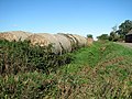 Baled straw beside ditch - geograph.org.uk - 3713423.jpg 640 × 480; 219 KB
-
 Baled straw by Mouseholdheath Farm - geograph.org.uk - 3713411.jpg 640 × 480; 178 KB
-
 Bend on the River Bure - geograph.org.uk - 4031500.jpg 640 × 480; 53 KB
-

-
 Board Walk to NWT Centre - geograph.org.uk - 2392194.jpg 800 × 531; 211 KB
-
 Board Walk to Ranworth Centre - geograph.org.uk - 2392243.jpg 800 × 531; 139 KB
-
 Boardwalk to Ranworth Broad - geograph.org.uk - 5492663.jpg 1,600 × 1,200; 779 KB
-
 Boardwalk, Ranworth Broad - geograph.org.uk - 5492647.jpg 1,600 × 1,200; 519 KB
-
 Boathouse near Decoy Cottages - geograph.org.uk - 4735764.jpg 640 × 480; 512 KB
-
 Boats and boathouse, Malthouse Broad - geograph.org.uk - 5492662.jpg 1,600 × 1,200; 339 KB
-
 Boats on Malthouse Broad - geograph.org.uk - 5492654.jpg 1,600 × 1,200; 289 KB
-
 Boats on the River Broad near Horning - geograph.org.uk - 2152964.jpg 1,600 × 1,200; 378 KB
-

-

-
 Brick Kilns - geograph.org.uk - 3134016.jpg 640 × 480; 68 KB
-
 Bridleway fingerpost by Leist's Farm - geograph.org.uk - 4499745.jpg 640 × 480; 509 KB
-
 Bridleway leading to South Walsham Broad - geograph.org.uk - 4382116.jpg 640 × 595; 427 KB
-

-
 Bridleway past Leist's Farm - geograph.org.uk - 4499746.jpg 640 × 480; 346 KB
-
 Bridleway to Malthouse Broad - geograph.org.uk - 4499718.jpg 640 × 480; 515 KB
-
 Bridleway to Malthouse Broad - geograph.org.uk - 4499733.jpg 640 × 480; 481 KB
-
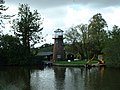
 Broadland Conservation Centre (1986) - geograph.org.uk - 4772310.jpg 3,599 × 2,393; 1.04 MB
-
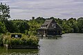
 Broadland Conservation Centre - geograph.org.uk - 1141048.jpg 640 × 480; 116 KB
-
 Bure Marshes - geograph.org.uk - 3216643.jpg 1,600 × 1,066; 402 KB
-
 Bure Marshes - geograph.org.uk - 5479706.jpg 1,600 × 1,262; 514 KB
-
 Burefield - geograph.org.uk - 3724518.jpg 640 × 480; 81 KB
-
 Burefield - geograph.org.uk - 5670039.jpg 1,000 × 665; 903 KB
-
 Burefield - geograph.org.uk - 5670040.jpg 1,000 × 665; 731 KB
-
 Burefield House - geograph.org.uk - 5660194.jpg 1,599 × 2,399; 988 KB
-
 Cask Filling Machine - geograph.org.uk - 3431833.jpg 424 × 640; 64 KB
-
 Churchyard cross - geograph.org.uk - 5189205.jpg 452 × 640; 364 KB
-
 Close up, Elizabeth II postbox, Panxworth - geograph.org.uk - 4934639.jpg 1,296 × 2,548; 740 KB
-
 Closed Fermenting Vessels - geograph.org.uk - 3431790.jpg 424 × 640; 58 KB
-
 Cockshoot Broad - geograph.org.uk - 3625303.jpg 640 × 480; 51 KB
-
 Cockshoot Broad, Norfolk - geograph.org.uk - 3635042.jpg 640 × 316; 40 KB
-
 Cockshoot Dike off the River Bure - geograph.org.uk - 2681945.jpg 800 × 600; 243 KB
-
 Cockshoot Dyke - geograph.org.uk - 3639761.jpg 460 × 640; 74 KB
-
 Cockshoot Dyke - geograph.org.uk - 5670042.jpg 1,000 × 665; 842 KB
-
 Cold Store - geograph.org.uk - 3431838.jpg 424 × 640; 56 KB
-
 Copper ^ Hop Back - geograph.org.uk - 3431828.jpg 424 × 640; 47 KB
-
 Cormorant taking off - geograph.org.uk - 2279980.jpg 640 × 427; 32 KB
-
 Cottage by Primrose Corner - geograph.org.uk - 3713437.jpg 640 × 480; 207 KB
-
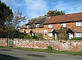
 Cottages at Woodbastwick - geograph.org.uk - 1564470.jpg 640 × 480; 169 KB
-
 Cottages in Horning Road, Woodbastwick - geograph.org.uk - 5189199.jpg 640 × 476; 133 KB
-
 Cottages in Horning Road, Woodbastwick - geograph.org.uk - 5189202.jpg 640 × 480; 129 KB
-
 Cow parsley beside the bridleway - geograph.org.uk - 4499690.jpg 640 × 480; 549 KB
-

-
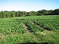
 Crop field and hedgerow - geograph.org.uk - 4933891.jpg 640 × 480; 67 KB
-
 Crop field off Plumstead Road - geograph.org.uk - 4933896.jpg 640 × 480; 61 KB
-
 Daffodil Fields in Woodbastwick - geograph.org.uk - 3431882.jpg 640 × 424; 54 KB
-
 Didler's Mill, Hoveton Marshes - geograph.org.uk - 4734860.jpg 640 × 480; 581 KB
-
 Downstream on the River Bure - geograph.org.uk - 682815.jpg 613 × 440; 127 KB
-
 Drainage ditch in marsh pasture - geograph.org.uk - 4499742.jpg 640 × 550; 574 KB
-

-
 Drilled field beside Woodbastwick Road - geograph.org.uk - 4382050.jpg 640 × 480; 348 KB
-
 Drilled field with a windbreak of trees - geograph.org.uk - 4382070.jpg 640 × 585; 482 KB
-
 Dusk at The Fur ^ Feather Inn - geograph.org.uk - 3431856.jpg 640 × 424; 56 KB
-

-
 Dydler's Mill - geograph.org.uk - 2380457.jpg 1,600 × 1,200; 382 KB
-

-
 Elizabeth II postbox and telephone box, Panxworth - geograph.org.uk - 4934633.jpg 3,648 × 2,736; 2.34 MB
-
 Empties^ - geograph.org.uk - 3431842.jpg 424 × 640; 40 KB
-
 Entering Panxworth - geograph.org.uk - 4933911.jpg 640 × 480; 72 KB
-
 Entrance to Ranworth Broad - geograph.org.uk - 5670043.jpg 1,000 × 665; 741 KB
-
 Entrance to Ranworth Broad - geograph.org.uk - 5670044.jpg 1,000 × 665; 716 KB
-

-
 Exiting Pedham village on Pedham Road - geograph.org.uk - 2119211.jpg 640 × 480; 166 KB
-

-

-
 Farm track off Plumstead Road - geograph.org.uk - 4933886.jpg 640 × 480; 69 KB
-
 Ferry Inn - geograph.org.uk - 5669750.jpg 1,000 × 665; 814 KB
-
 Ferry Inn - geograph.org.uk - 5669756.jpg 1,000 × 665; 774 KB
-
 Ferry Road - geograph.org.uk - 5479697.jpg 1,600 × 1,217; 430 KB
-
 Ferry Road into Bure Marshes - geograph.org.uk - 5479705.jpg 1,600 × 1,200; 460 KB
-
 Ferry Road past Ferry Farm - geograph.org.uk - 5479779.jpg 1,600 × 1,200; 338 KB
-
 Field near Panxworth - geograph.org.uk - 4933901.jpg 640 × 480; 54 KB
-
 Field off Plumstead Road - geograph.org.uk - 4933888.jpg 640 × 480; 58 KB
-
 Field south of Woodbastwick Road - geograph.org.uk - 4382074.jpg 640 × 480; 338 KB
-
 Fields by Old Hall Wood - geograph.org.uk - 4382062.jpg 640 × 428; 281 KB
-
 Fields by Old Hall Wood - geograph.org.uk - 4382089.jpg 640 × 480; 411 KB
-
 Fields by Primrose Corner - geograph.org.uk - 3713431.jpg 640 × 480; 216 KB
-
 Fields by Primrose Corner - geograph.org.uk - 3713435.jpg 640 × 410; 185 KB
-
 Fields by Salhouse Road - geograph.org.uk - 5479640.jpg 1,600 × 1,200; 483 KB
-
 Fields north of Salhouse Road, Panxworth - geograph.org.uk - 3713503.jpg 640 × 480; 137 KB
-
 Fishing on the Bank of The Bure - geograph.org.uk - 4734774.jpg 640 × 480; 554 KB
-
 Fleet Dyke - geograph.org.uk - 6122150.jpg 1,024 × 768; 146 KB
-
 Flowering hawthorn beside the bridleway - geograph.org.uk - 4499686.jpg 640 × 480; 529 KB
-
 Footpath from Panxworth to Pedham - geograph.org.uk - 2119172.jpg 640 × 480; 134 KB
-
 Footpath from Ranworth Road - geograph.org.uk - 5480759.jpg 1,600 × 1,200; 505 KB
-
 Forage maize silage harvesting - geograph.org.uk - 3713474.jpg 640 × 480; 218 KB
-
 Forage maize silage harvesting - geograph.org.uk - 3713477.jpg 640 × 501; 209 KB
-
 Forage maize silage harvesting - geograph.org.uk - 3713478.jpg 640 × 461; 190 KB
-
 Forage maize silage harvesting - geograph.org.uk - 3713483.jpg 640 × 480; 196 KB
-
 Forage maize silage harvesting - geograph.org.uk - 3713486.jpg 640 × 480; 183 KB
-
 Ford at Woodbastwick Marshes - geograph.org.uk - 3189420.jpg 3,872 × 2,592; 2.36 MB
-
 Former Duck Decoy - geograph.org.uk - 2392207.jpg 800 × 531; 198 KB
-

-
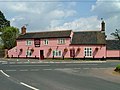
 Fur and Feather Inn, Woodbastwick - geograph.org.uk - 1564464.jpg 640 × 480; 173 KB
-
 Fur and Feather Inn, Woodbastwick - geograph.org.uk - 3917078.jpg 640 × 480; 76 KB
-

-
 Gate into a pasture - geograph.org.uk - 2119180.jpg 640 × 480; 177 KB
-

-
 Gate into pastures by Ranworth Marshes - geograph.org.uk - 4499727.jpg 640 × 565; 531 KB
-
 Gate on the footpath to Pedham Road - geograph.org.uk - 2119185.jpg 640 × 480; 172 KB
-
 Gated private farm road - geograph.org.uk - 4499723.jpg 640 × 480; 511 KB
-
 Grit bin beside Ranworth Road - geograph.org.uk - 4382105.jpg 640 × 480; 388 KB
-
 Hardstanding beside Woodbastwick Road - geograph.org.uk - 4382054.jpg 640 × 480; 342 KB
-
 Hay meadow by South Walsham Broad - geograph.org.uk - 4499683.jpg 640 × 571; 376 KB
-
 Heading down Ranworth Dam - geograph.org.uk - 2681966.jpg 800 × 600; 273 KB
-
 Heading south east from Panxworth - geograph.org.uk - 4933914.jpg 640 × 480; 102 KB
-
 Hedge beside Woodbastwick Road - geograph.org.uk - 4382076.jpg 640 × 480; 406 KB
-
 Heifers in pasture by Leist's Farm - geograph.org.uk - 4499752.jpg 640 × 597; 589 KB
-
 Hide at South Walsham Fen Nature Reserve - geograph.org.uk - 1258311.jpg 640 × 427; 134 KB
-
 Hobbs Mill - geograph.org.uk - 5670053.jpg 665 × 1,000; 873 KB
-
 Holding-Conditioning Tanks - geograph.org.uk - 3431804.jpg 424 × 640; 49 KB
-
 Horning Ferry - geograph.org.uk - 1056628.jpg 640 × 594; 109 KB
-
 Horse paddocks by Ferry Road - geograph.org.uk - 5479783.jpg 1,600 × 1,177; 367 KB
-
 Horses grazing pasture by Hall Farm - geograph.org.uk - 2119208.jpg 640 × 574; 197 KB
-
 House and Barn from Ranworth Church - geograph.org.uk - 2391994.jpg 800 × 531; 133 KB
-
 House in Ranworth - geograph.org.uk - 4382106.jpg 640 × 480; 337 KB
-
 House in Ranworth - geograph.org.uk - 4382108.jpg 640 × 480; 365 KB
-
 House next to Ranworth Broad - geograph.org.uk - 2391953.jpg 800 × 531; 148 KB
-
 House on the B1140, Panxworth - geograph.org.uk - 4933906.jpg 640 × 480; 81 KB
-
 Hunter's Fleet on the River Bure - geograph.org.uk - 259725.jpg 640 × 481; 169 KB
-

-
 Large Field at Ranworth - geograph.org.uk - 2392033.jpg 800 × 531; 75 KB
-
 Large house near Horning Church - geograph.org.uk - 2152965.jpg 1,600 × 1,200; 463 KB
-
 Leist's farmhouse - geograph.org.uk - 4499748.jpg 640 × 526; 364 KB
-

-
 Looking upstream along the River Bure - geograph.org.uk - 2681951.jpg 800 × 600; 192 KB
-
 Lustre - geograph.org.uk - 5459966.jpg 1,024 × 683; 112 KB
-
 Maize crop by Pondhead Plantation - geograph.org.uk - 3713466.jpg 640 × 480; 181 KB
-
 Maize field - geograph.org.uk - 5479786.jpg 1,600 × 1,145; 556 KB
-
 Maize harvest by Pondhead Plantation - geograph.org.uk - 3713460.jpg 640 × 480; 237 KB
-
 Malthouse Broad - geograph.org.uk - 5459437.jpg 1,024 × 681; 244 KB
-
 Malthouse Broad - geograph.org.uk - 5675062.jpg 3,599 × 2,399; 823 KB
-
 Marsh pastures by Leist's Farm - geograph.org.uk - 4499736.jpg 640 × 480; 419 KB
-
 Meadow by South Walsham Broad - geograph.org.uk - 4499679.jpg 640 × 524; 461 KB
-
 Memorial to Anne Cator - geograph.org.uk - 5674934.jpg 2,399 × 3,599; 1.33 MB
-
 Mud on Pit Road - geograph.org.uk - 3713458.jpg 640 × 480; 186 KB
-
 Muddy field entrance beside Pit Road - geograph.org.uk - 3713463.jpg 640 × 450; 159 KB
-
 Negotiating the river junction - geograph.org.uk - 3009673.jpg 3,648 × 2,736; 4.03 MB
-
 New Cottages, Woodbastwick Road - geograph.org.uk - 5479811.jpg 1,600 × 1,263; 444 KB
-
 New Inn - geograph.org.uk - 5669055.jpg 1,000 × 665; 814 KB
-
 New thatched cottage in Ranworth Road - geograph.org.uk - 4382102.jpg 640 × 480; 384 KB
-
 Old Hall Broad - geograph.org.uk - 4590483.jpg 800 × 600; 135 KB
-
 Old Hall Wood - geograph.org.uk - 4382057.jpg 640 × 480; 346 KB
-
 Old oak trees beside the bridleway - geograph.org.uk - 4499706.jpg 640 × 480; 525 KB
-
 On safari in South Walsham Broad - geograph.org.uk - 2279996.jpg 640 × 427; 109 KB
-
 On The Bure At Horning - geograph.org.uk - 5660939.jpg 2,399 × 1,599; 615 KB
-
 Open Fermenting Tanks - geograph.org.uk - 3431763.jpg 424 × 640; 34 KB
-
 Ordnance Survey Cut Mark - geograph.org.uk - 4222946.jpg 640 × 480; 119 KB
-
 Padlocked gate beside the path - geograph.org.uk - 4499694.jpg 640 × 480; 529 KB
-
 Panxworth World War One Memorial - geograph.org.uk - 4774191.jpg 2,449 × 1,892; 1.68 MB
-
 Panxworth, All Saints Church tower (disused) - geograph.org.uk - 4875514.jpg 3,678 × 2,456; 5.54 MB
-
 Panxworth, All Saints Church tower (disused) - geograph.org.uk - 4875516.jpg 3,678 × 2,455; 5.2 MB
-
 Passing place on Pedham Road - geograph.org.uk - 2119149.jpg 640 × 480; 105 KB
-
 Pasture by South Walsham Broad - geograph.org.uk - 4499697.jpg 640 × 480; 329 KB
-
 Pastures by Ranworth Marshes - geograph.org.uk - 4499729.jpg 640 × 480; 316 KB
-
 Pastures by South Walsham Broad - geograph.org.uk - 4499705.jpg 640 × 480; 406 KB
-
 Pastures north of South Walsham Broad - geograph.org.uk - 4499699.jpg 640 × 480; 297 KB
-
 Pastures south of Ranworth Marshes - geograph.org.uk - 4499725.jpg 640 × 500; 335 KB
-
 Path to Pedham - geograph.org.uk - 2119199.jpg 640 × 480; 153 KB
-
 Path to the Church - geograph.org.uk - 2391729.jpg 531 × 800; 218 KB
-
 Pedham Road - geograph.org.uk - 4933902.jpg 640 × 480; 46 KB
-

-
 Phone box, Woodbastwick - geograph.org.uk - 5479682.jpg 1,600 × 1,200; 315 KB
-
 Plumstead Road - geograph.org.uk - 4933882.jpg 640 × 480; 101 KB
-
 Plumstead Road - geograph.org.uk - 4933889.jpg 640 × 480; 58 KB
-
 Plumstead Road - geograph.org.uk - 4933899.jpg 640 × 480; 50 KB
-
 Pond and Cottages in Woodbastwick - geograph.org.uk - 3431865.jpg 640 × 424; 47 KB
-

-
-

-
 Private moorings, Horning Hall - geograph.org.uk - 259720.jpg 640 × 480; 160 KB
-
 Private track to Old Hall - geograph.org.uk - 4382093.jpg 640 × 480; 515 KB
-
 Public bridleway to Norton Hill - geograph.org.uk - 4499675.jpg 640 × 480; 525 KB
-

-
 Public footpath to Panxworth - geograph.org.uk - 2119160.jpg 640 × 480; 118 KB
-
 Pumping station near Leist's Farm - geograph.org.uk - 4382110.jpg 640 × 480; 441 KB
-
 Pumping Station, near Horning - geograph.org.uk - 3742681.jpg 640 × 480; 106 KB
-
 Ranworth - geograph.org.uk - 5670045.jpg 1,000 × 665; 683 KB
-
 Ranworth - geograph.org.uk - 5670050.jpg 1,000 × 665; 764 KB
-
 Ranworth and Malthouse Broad - geograph.org.uk - 5537230.jpg 640 × 480; 85 KB
-
 Ranworth Antiphoner - geograph.org.uk - 2392107.jpg 800 × 531; 90 KB
-
 Ranworth Antiphoner - geograph.org.uk - 2392119.jpg 800 × 531; 128 KB
-
 Ranworth Antiphoner - geograph.org.uk - 2392136.jpg 800 × 531; 106 KB
-
 Ranworth Broad - geograph.org.uk - 5460029.jpg 1,024 × 666; 156 KB
-
 Ranworth Broad - geograph.org.uk - 5460067.jpg 1,024 × 683; 326 KB


,_Woodbastwick_-_geograph.org.uk_-_5189217.jpg)


_-_geograph.org.uk_-_4772310.jpg)


_-_geograph.org.uk_-_4875514.jpg)
_-_geograph.org.uk_-_4875516.jpg)


_-_geograph.org.uk_-_2119103.jpg)


