Category:Worplesdon
English: Worplesdon is a village in Surrey, England, located three miles (5 km) north of Guildford. Worplesdon is also the name of the parish that also includes the settlements of Fairlands, Jacobs Well and Wood Street Village. Nearby villages include Pirbright and Deepcut, with significant military presences.
village and civil parish in Surrey, England, UK  | |||||
| Upload media | |||||
| Instance of | |||||
|---|---|---|---|---|---|
| Location | Guildford, Surrey, South East England, England | ||||
| Area |
| ||||
 | |||||
Subcategories
This category has the following 9 subcategories, out of 9 total.
F
- Fairlands (2 F)
J
- Jacobs Well, Surrey (23 F)
L
- Littlefield Manor (4 F)
W
- Worplesdon railway station (20 F)
Media in category "Worplesdon"
The following 200 files are in this category, out of 618 total.
(previous page) (next page)-
 "Hollow Trees", Worplesdon - geograph.org.uk - 640591.jpg 640 × 480; 97 KB
-
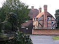 "The Old Post House", Worplesdon - geograph.org.uk - 640594.jpg 640 × 480; 98 KB
-
 "The Old Stables", Worplesdon - geograph.org.uk - 640624.jpg 640 × 480; 71 KB
-
 14th tee at Worplesdon - geograph.org.uk - 1394744.jpg 640 × 427; 83 KB
-

-
 A Pair of Jacks - geograph.org.uk - 3004270.jpg 4,288 × 3,216; 2.27 MB
-
 A322 Rickford - geograph.org.uk - 4480604.jpg 640 × 480; 268 KB
-
 A322 Worplesdon Road - geograph.org.uk - 6177228.jpg 1,024 × 684; 348 KB
-
 A322 Worplesdon Road - geograph.org.uk - 6177313.jpg 1,024 × 684; 444 KB
-
 A322 Worplesdon Road, Worplesdon - geograph.org.uk - 2886220.jpg 4,320 × 3,240; 3.73 MB
-
 A322 Worplesdon Road, Worplesdon - geograph.org.uk - 2886229.jpg 4,320 × 3,240; 4.35 MB
-
 A322, Parish of Worplesdon - geograph.org.uk - 4480589.jpg 640 × 480; 397 KB
-
 A322, Rickford - geograph.org.uk - 6177344.jpg 1,024 × 684; 312 KB
-
 A322, Worplesdon - geograph.org.uk - 6177325.jpg 1,024 × 684; 405 KB
-
 A322, Worplesdon Road - geograph.org.uk - 4480601.jpg 640 × 480; 315 KB
-
 A323, Littlefield Common - geograph.org.uk - 2857505.jpg 640 × 430; 78 KB
-
 Access road to Liddington Hall - geograph.org.uk - 4188407.jpg 2,048 × 1,536; 3.04 MB
-
 Acer rubrum, Clay Lane - geograph.org.uk - 3213501.jpg 1,433 × 1,911; 695 KB
-
 Acer rubrum, Jacobs Well - geograph.org.uk - 4718058.jpg 2,000 × 1,333; 2.86 MB
-
 Alexander Dennis factory - geograph.org.uk - 4716730.jpg 2,000 × 1,333; 2.33 MB
-
 Antiques Shop, Perry Hill - geograph.org.uk - 2729885.jpg 2,417 × 1,425; 371 KB
-
 Appearances Can Be Deceptive - geograph.org.uk - 2259467.jpg 2,560 × 1,920; 1.73 MB
-
 Assault course, Merrist Wood - geograph.org.uk - 4936964.jpg 2,000 × 1,333; 2.87 MB
-
 Autumn colours at Merrist Wood - geograph.org.uk - 2167618.jpg 2,272 × 1,704; 3 MB
-
 Backside Common, Woodstreet - geograph.org.uk - 2392094.jpg 640 × 480; 334 KB
-
 Barn, Hollybush Farm - geograph.org.uk - 5632646.jpg 640 × 480; 183 KB
-
 Bend at Frog Grove Lane - geograph.org.uk - 2259629.jpg 2,560 × 1,920; 1.78 MB
-
 Bend on Frog Grove Lane with bus stop - geograph.org.uk - 3833342.jpg 800 × 600; 124 KB
-
 Blackwell Farm - geograph.org.uk - 3004728.jpg 4,288 × 3,216; 3.68 MB
-
 Blackwell Farm - geograph.org.uk - 3642692.jpg 2,048 × 1,536; 1.39 MB
-
 Boardwalk, Whitmoor Common - geograph.org.uk - 2794607.jpg 4,288 × 3,216; 3.62 MB
-
 Bower's Lock - geograph.org.uk - 4078865.jpg 2,048 × 1,536; 1.13 MB
-
 Bower's Lock, Wey Navigation - geograph.org.uk - 2716540.jpg 640 × 430; 90 KB
-
 Bridge by Rickford Mill - geograph.org.uk - 4936921.jpg 2,000 × 1,333; 3.11 MB
-
 Bridge over Salt Box Road - geograph.org.uk - 4755857.jpg 2,000 × 1,333; 3.14 MB
-
 Bridge over Stanford Brook - geograph.org.uk - 4936917.jpg 2,000 × 1,333; 2.78 MB
-
 Bridge over stream in Frog Grove Lane - geograph.org.uk - 4446116.jpg 640 × 427; 101 KB
-

-

-

-

-

-
 Bridleway leading to Gooserye - geograph.org.uk - 4912737.jpg 3,264 × 1,840; 2.74 MB
-
 Bridleway leads off Goose Rye Road - geograph.org.uk - 4093162.jpg 800 × 600; 234 KB
-
 Bridleway reaches Goose Rye Road - geograph.org.uk - 4093220.jpg 800 × 600; 262 KB
-
 Britten's Pond - geograph.org.uk - 1956032.jpg 640 × 480; 282 KB
-
 Britten's Pond - geograph.org.uk - 1956038.jpg 640 × 480; 144 KB
-
 Britten's Pond - geograph.org.uk - 1956047.jpg 640 × 480; 362 KB
-
 Britten's Pond - geograph.org.uk - 1956050.jpg 480 × 640; 356 KB
-
 Britten's Pond - geograph.org.uk - 1956060.jpg 640 × 480; 326 KB
-
 Britten's Pond - geograph.org.uk - 1956072.jpg 640 × 480; 326 KB
-
 Britten's Pond - geograph.org.uk - 2383816.jpg 2,560 × 1,920; 1.74 MB
-
 Britten's Pond - geograph.org.uk - 4163570.jpg 640 × 480; 79 KB
-
 Britten's Pond - geograph.org.uk - 4302981.jpg 1,961 × 1,471; 2.53 MB
-
 Britten's Pond - geograph.org.uk - 4302990.jpg 2,048 × 1,536; 2.42 MB
-
 Britten's Pond - geograph.org.uk - 4302991.jpg 2,048 × 1,536; 2.46 MB
-
 Britten's Pond, Guildford - geograph.org.uk - 2384386.jpg 2,560 × 1,920; 1.8 MB
-
 Britten's Pond, Guildford - geograph.org.uk - 3051284.jpg 3,216 × 4,288; 3.57 MB
-
 Britten's Pond, northeast corner - geograph.org.uk - 4302984.jpg 2,048 × 1,536; 3.05 MB
-
 Broad Street - geograph.org.uk - 1812608.jpg 640 × 480; 94 KB
-
 Broad Street, Wood Street Village - geograph.org.uk - 4155536.jpg 2,560 × 1,920; 1.98 MB
-
 Broadacres, Guildford - geograph.org.uk - 2259519.jpg 2,560 × 1,920; 1.81 MB
-
 Broadstreet Common - geograph.org.uk - 1812475.jpg 640 × 480; 154 KB
-
 Broadstreet Common - geograph.org.uk - 1812490.jpg 640 × 480; 120 KB
-
 Broadstreet Common - geograph.org.uk - 1812492.jpg 640 × 480; 121 KB
-
 Broadstreet Common - geograph.org.uk - 1812513.jpg 640 × 480; 165 KB
-
 Broadstreet Common - geograph.org.uk - 1812517.jpg 640 × 480; 151 KB
-
 Broadstreet Common - geograph.org.uk - 1812531.jpg 480 × 640; 124 KB
-
 Broadstreet Common - geograph.org.uk - 1812555.jpg 640 × 480; 69 KB
-
 Broadstreet Common - geograph.org.uk - 1812562.jpg 640 × 480; 143 KB
-
 Broadstreet Common - geograph.org.uk - 1812597.jpg 480 × 640; 143 KB
-
 Broadstreet Common - geograph.org.uk - 1812604.jpg 640 × 480; 92 KB
-
 Broadstreet Common - geograph.org.uk - 1812629.jpg 640 × 480; 93 KB
-
 Broadstreet Common - geograph.org.uk - 2259574.jpg 2,560 × 1,920; 1.93 MB
-
 Broadstreet Common - geograph.org.uk - 2986249.jpg 2,048 × 1,536; 1.36 MB
-
 Broadstreet Common - geograph.org.uk - 2986306.jpg 2,048 × 1,536; 1.34 MB
-
 Broadstreet Common - geograph.org.uk - 4424443.jpg 2,048 × 1,536; 3.78 MB
-
 Broadstreet Common - geograph.org.uk - 4424475.jpg 2,048 × 1,536; 2.59 MB
-
 Broadstreet Common - geograph.org.uk - 4426888.jpg 2,048 × 1,536; 3.37 MB
-
 Broadstreet Common - geograph.org.uk - 6210729.jpg 2,436 × 1,686; 2.71 MB
-
 Broadstreet Common with notice board - geograph.org.uk - 5632650.jpg 640 × 480; 196 KB
-
 Brook Farm, Worplesdon - geograph.org.uk - 4936923.jpg 2,000 × 1,333; 2.73 MB
-
 Burdenshott Road - geograph.org.uk - 4762122.jpg 4,000 × 2,250; 7.6 MB
-
 Burdenshott Road, Worplesdon - geograph.org.uk - 2885931.jpg 4,320 × 3,240; 4.83 MB
-
 Burpham Cottages - geograph.org.uk - 3213521.jpg 2,048 × 1,536; 553 KB
-

-

-

-
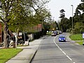
 Bus stops on the A323 - geograph.org.uk - 4104762.jpg 800 × 600; 163 KB
-
 Bushy Farm - geograph.org.uk - 1881474.jpg 480 × 640; 84 KB
-
 Bushy Farm - geograph.org.uk - 1881480.jpg 640 × 480; 317 KB
-
 By Hook Farm - geograph.org.uk - 3005536.jpg 4,288 × 3,216; 3.46 MB
-
 Canal footbridge, Bower's Lock - geograph.org.uk - 3446093.jpg 1,988 × 1,491; 1.04 MB
-
 Chapel Farm estate - geograph.org.uk - 5111105.jpg 2,000 × 1,333; 3.6 MB
-
 Chitty's Common - geograph.org.uk - 2481868.jpg 640 × 480; 99 KB
-
 Chitty's Common - geograph.org.uk - 2481873.jpg 480 × 640; 365 KB
-
 Church at Wood Street - geograph.org.uk - 3833413.jpg 800 × 662; 145 KB
-
 Clasford Farm - geograph.org.uk - 2260057.jpg 2,560 × 1,920; 1.7 MB
-
 Clasford Farm - geograph.org.uk - 2391568.jpg 640 × 480; 79 KB
-
 Clasford Farm - geograph.org.uk - 2391583.jpg 640 × 480; 75 KB
-
 Clay Lane at the junction of Jacobs Well Road - geograph.org.uk - 4155353.jpg 2,560 × 1,920; 1.93 MB
-
 Clay Lane, Jacob's Well - geograph.org.uk - 3213509.jpg 2,048 × 1,536; 3.2 MB
-
 Cobbett Hill Road - geograph.org.uk - 2630773.jpg 640 × 480; 350 KB
-
 Cobbett's Close - geograph.org.uk - 5111429.jpg 2,000 × 1,333; 2.26 MB
-
 Cobbett's Hill Rd of the A323 - geograph.org.uk - 2857511.jpg 640 × 430; 119 KB
-
 Combe Lane, Worplesdon - geograph.org.uk - 2152354.jpg 1,600 × 1,200; 595 KB
-
 Common Geese - geograph.org.uk - 2794460.jpg 4,288 × 3,216; 3.66 MB
-

-
 Cool Guildford - geograph.org.uk - 3051295.jpg 4,288 × 3,216; 3.3 MB
-
 Coombe Lane, Worplesdon - geograph.org.uk - 2586146.jpg 640 × 480; 314 KB
-
 Coombe Lane, Worplesdon - geograph.org.uk - 2586154.jpg 640 × 480; 333 KB
-
 Cottage on Wood Street Village Green - geograph.org.uk - 4155521.jpg 2,560 × 1,920; 2.06 MB
-
 Cottages at Perry Hill - geograph.org.uk - 1463527.jpg 640 × 427; 82 KB
-
 Cottages on Goose Rye Road, Worplesdon - geograph.org.uk - 4155517.jpg 2,560 × 1,920; 1.98 MB
-
 Cottages, Perry Hill - geograph.org.uk - 2729889.jpg 2,385 × 961; 220 KB
-
 Crastock Bridge - geograph.org.uk - 1415964.jpg 640 × 427; 119 KB
-
 Crastock Manor - geograph.org.uk - 45802.jpg 640 × 427; 98 KB
-
 Crooksburycommon1.jpg 2,304 × 3,072; 2.41 MB
-
 Daffodils beside the A320 - geograph.org.uk - 713297.jpg 640 × 480; 117 KB
-
 Deer in the fields - geograph.org.uk - 4186121.jpg 2,048 × 1,536; 3.08 MB
-
 Downland by Misley Copse - geograph.org.uk - 3004647.jpg 4,288 × 3,216; 3.52 MB
-
 Drain on Whitmoor Common - geograph.org.uk - 2794527.jpg 3,216 × 4,288; 3.64 MB
-
 Drake and Duck - geograph.org.uk - 2260073.jpg 949 × 754; 266 KB
-

-
 Drive to Wildfields Farm - geograph.org.uk - 5632695.jpg 640 × 480; 191 KB
-

-
 Duck (2223939114).jpg 3,296 × 2,472; 5.72 MB
-
 Ducks (2223927152).jpg 3,296 × 2,472; 4.15 MB
-
 Ducks (2223933000).jpg 2,532 × 1,948; 5.49 MB
-
 Early autumn colours - geograph.org.uk - 2612464.jpg 640 × 480; 331 KB
-
 Easter at St Mary's - geograph.org.uk - 2384288.jpg 2,560 × 1,920; 1.77 MB
-
 Electricity poles, Broadstreet Common - geograph.org.uk - 4426899.jpg 2,048 × 1,536; 2.68 MB
-
 Entering Wood Street Village - geograph.org.uk - 2259563.jpg 2,560 × 1,920; 1.88 MB
-
 Entrance to a field at Jacobs Well - geograph.org.uk - 2959167.jpg 1,024 × 674; 176 KB
-

-
 Entrance to The Pines industrial estate on Broad Street - geograph.org.uk - 4155537.jpg 2,560 × 1,920; 2.06 MB
-
 Entrance to Wood Street Village - geograph.org.uk - 2208182.jpg 2,816 × 1,880; 2.79 MB
-
 Fairlands Community Centre - geograph.org.uk - 4049720.jpg 800 × 600; 108 KB
-
 Fairlands Garage - geograph.org.uk - 2904686.jpg 800 × 533; 250 KB
-
 Fairlands, Parish of Worplesdon - geograph.org.uk - 2259480.jpg 2,560 × 1,920; 1.77 MB
-
 Farm access road, Broadstreet Common - geograph.org.uk - 4426910.jpg 2,048 × 1,536; 3.04 MB
-
 Farmland, Woodstreet - geograph.org.uk - 2392138.jpg 640 × 480; 287 KB
-
 Field by Aldershot Road, Fairlands - geograph.org.uk - 5104742.jpg 2,048 × 1,536; 915 KB
-
 Field by Coombe Lane, Worplesdon - geograph.org.uk - 2152374.jpg 1,600 × 1,200; 572 KB
-
 Field by Rokers Animal Feeds, Fairlands - geograph.org.uk - 5151486.jpg 2,014 × 1,490; 1.12 MB
-
 Field edge near Woodstreet - geograph.org.uk - 3642559.jpg 2,048 × 1,536; 1.38 MB
-
 Field Near Worplesdon - geograph.org.uk - 6196675.jpg 3,260 × 2,174; 7.66 MB
-
 Fields near Merrist Wood - geograph.org.uk - 4937787.jpg 2,000 × 1,333; 2.7 MB
-
 Fields near Perry Hill - geograph.org.uk - 2481906.jpg 640 × 480; 294 KB
-
 Fields near Perry Hill - geograph.org.uk - 2481908.jpg 640 × 480; 314 KB
-
 Fields near Perry Hill - geograph.org.uk - 2483252.jpg 480 × 640; 316 KB
-
 Fields near Perry Hill - geograph.org.uk - 2483264.jpg 640 × 480; 326 KB
-
 Fields near Perry Hill - geograph.org.uk - 2483268.jpg 640 × 480; 325 KB
-
 Fields on Whitmoor Common - geograph.org.uk - 2794480.jpg 4,288 × 3,216; 3.49 MB
-
 Fields south of Holly Lane - geograph.org.uk - 2612423.jpg 640 × 480; 221 KB
-
 Fields west of Stoughton - geograph.org.uk - 4187224.jpg 2,048 × 1,536; 2.59 MB
-
 Flats on Oak Hill, Wood Street Village - geograph.org.uk - 4155524.jpg 2,560 × 1,920; 2.13 MB
-

-
 Footbridge on Whitmoor Common - geograph.org.uk - 2794556.jpg 4,288 × 3,216; 3.55 MB
-
 Footpath 452 heads south - geograph.org.uk - 3046521.jpg 640 × 480; 113 KB
-
 Footpath around Britten's Pond - geograph.org.uk - 4163587.jpg 640 × 480; 153 KB
-
 Footpath beside "Hill View" - geograph.org.uk - 4104714.jpg 800 × 600; 191 KB
-
 Footpath crosses Keens Lane - geograph.org.uk - 4049651.jpg 800 × 600; 200 KB
-

-
 Footpath from Holly Lane - geograph.org.uk - 2612415.jpg 480 × 640; 348 KB
-
 Footpath from Merrist Wood - geograph.org.uk - 4937805.jpg 2,000 × 1,333; 3.55 MB
-
 Footpath goes north from Chitty's Common - geograph.org.uk - 4049658.jpg 800 × 600; 161 KB
-
 Footpath leaves Frog Grove Lane - geograph.org.uk - 3833348.jpg 800 × 600; 139 KB
-
 Footpath near Wood Street - geograph.org.uk - 5111094.jpg 2,000 × 1,333; 3.56 MB
-
 Footpath near Worplesdon church - geograph.org.uk - 2483271.jpg 640 × 480; 303 KB
-
 Footpath on Whitmoor Common - geograph.org.uk - 2383821.jpg 2,560 × 1,920; 1.7 MB
-
 Footpath past Liddington Hall Farm - geograph.org.uk - 4186112.jpg 2,048 × 1,536; 2.77 MB
-
 Footpath sign and owl - geograph.org.uk - 2167622.jpg 1,704 × 2,272; 3.14 MB
-
 Footpath to Keens Lane - geograph.org.uk - 4187194.jpg 2,048 × 1,536; 3.01 MB
-
 Footpath to Merrist Wood - geograph.org.uk - 4936929.jpg 2,000 × 1,333; 2.46 MB
-
 Footpath to Merrist Wood - geograph.org.uk - 4936957.jpg 2,000 × 1,333; 3.91 MB
-
 Footpath to Perry Hill - geograph.org.uk - 1463459.jpg 640 × 427; 97 KB
-
 Footpath with parking by day nursery - geograph.org.uk - 3833363.jpg 800 × 600; 90 KB
-
 Footpath, Anger's Hill, Woodstreet - geograph.org.uk - 2395401.jpg 640 × 480; 311 KB
-
 Footpath, Broadstreet Common - geograph.org.uk - 4425061.jpg 2,048 × 1,536; 3.38 MB
-
 Footpath, Merrist Wood College - geograph.org.uk - 4936971.jpg 2,000 × 1,333; 3.72 MB
-
 Footpath, Woodstreet - geograph.org.uk - 2393678.jpg 640 × 480; 288 KB
-
 Footpath, Woodstreet - geograph.org.uk - 2393689.jpg 640 × 480; 331 KB
-
 Footpath, Woodstreet - geograph.org.uk - 2393709.jpg 640 × 480; 371 KB
-
 Fox Corner Wildlife Area - geograph.org.uk - 2353366.jpg 480 × 640; 367 KB
-
 Fox Corner Wildlife Area - geograph.org.uk - 2353376.jpg 480 × 640; 361 KB
-
 Fox Corner, Bullswater Bridge - geograph.org.uk - 698196.jpg 640 × 480; 124 KB
-
 Fox Corner, Community Wildlife Area - geograph.org.uk - 699249.jpg 640 × 480; 103 KB
-
 Fox Corner, Community Wildlife Area - geograph.org.uk - 702761.jpg 640 × 480; 121 KB
-

-
 Fox Way, Merrist Wood - geograph.org.uk - 2587571.jpg 640 × 480; 330 KB
-
 Frog Grove Lane - geograph.org.uk - 2259647.jpg 2,560 × 1,920; 1.8 MB
-
 Frog Grove Lane - geograph.org.uk - 2259657.jpg 2,560 × 1,920; 1.96 MB
-
 Frog Grove Lane - geograph.org.uk - 4446260.jpg 640 × 427; 97 KB
-
 Frog Grove Lane looking south - geograph.org.uk - 3833326.jpg 800 × 600; 134 KB
-
 Frog Grove Lane, Wood Street - geograph.org.uk - 2259617.jpg 2,560 × 1,920; 1.72 MB
-
 Frog Grove Lane, Wood Street - geograph.org.uk - 2259637.jpg 2,560 × 1,920; 1.86 MB
-
 Frog Grove Lane, Wood Street - geograph.org.uk - 5111056.jpg 2,000 × 1,333; 3.2 MB
-
 Frog Grove Lane, Wood Street Village - geograph.org.uk - 2208177.jpg 2,816 × 1,880; 2.73 MB
-
 Frog Grove Lane, Wood Street Village - geograph.org.uk - 4155143.jpg 2,560 × 1,920; 2.03 MB


.jpg)
.jpg)
.jpg)


