Category:Wrightington
English: Wrightington is a civil parish in West Lancashire, England, with an area of 3,915½ acres. The surface is hilly, rising to over 400 ft. at Harrock on the border of Parbold, and then falling to the north, north-east and south-east. On the southern border, the boundary at Appley Bridge touches the River Douglas. Wrightington Hall is to the north of this point. Tunley and Broadhurst lie to the north of the park, and Fairhurst, to the west of Harrock, reaches down to the Douglas. At the 2001 census, Wrightington had a population of 4,055. (→Wrightington)
hamlet and civil parish in West Lancashire, England  | |||||
| Upload media | |||||
| Instance of | |||||
|---|---|---|---|---|---|
| Location | West Lancashire, Lancashire, North West England, England | ||||
| Population |
| ||||
| Area |
| ||||
 | |||||
Subcategories
This category has the following 9 subcategories, out of 9 total.
Media in category "Wrightington"
The following 200 files are in this category, out of 312 total.
(previous page) (next page)-
 "We've got it all in West Lancashire" - geograph.org.uk - 3284719.jpg 4,608 × 3,456; 3.25 MB
-
 'We've got it all in West Lancashire' - geograph.org.uk - 5172506.jpg 800 × 526; 126 KB
-
 32 ton weight limit, Wrightington, Lancs..jpg 4,608 × 2,304; 3.94 MB
-
 A5209, Crow Orchard Road - geograph.org.uk - 2970916.jpg 640 × 462; 81 KB
-
 Afternoon sun, Courage Low Lane - geograph.org.uk - 4234662.jpg 2,240 × 1,575; 627 KB
-
 Alternative Route - geograph.org.uk - 4318230.jpg 1,024 × 768; 308 KB
-
 Appledene - geograph.org.uk - 4502126.jpg 1,000 × 750; 219 KB
-
 Appley Bridge allotments - geograph.org.uk - 5493251.jpg 1,280 × 960; 1.51 MB
-
 Appley Bridge Community Centre - geograph.org.uk - 2777840.jpg 640 × 480; 432 KB
-
 Appley Bridge No 42 - geograph.org.uk - 5172564.jpg 800 × 622; 113 KB
-
 Appley Bridge railway station - geograph.org.uk - 5492940.jpg 1,280 × 960; 1.04 MB
-
 Appley Bridge railway station - geograph.org.uk - 5892623.jpg 1,600 × 1,065; 686 KB
-
 Appley Bridge station buildings - geograph.org.uk - 5724179.jpg 1,024 × 768; 136 KB
-
 Appley Bridge War Memorial - geograph.org.uk - 2777842.jpg 640 × 480; 670 KB
-
 Appley Lane North - geograph.org.uk - 2462675.jpg 640 × 480; 362 KB
-
 Appley Lane North - geograph.org.uk - 3284541.jpg 4,601 × 2,758; 2.67 MB
-
 Appley Lane South - geograph.org.uk - 2459317.jpg 640 × 480; 258 KB
-

-
 Appley Moor , Coalgate Cottages - geograph.org.uk - 6298122.jpg 6,000 × 4,000; 5.63 MB
-
 Appley Moor , Hall Lane A5209 - geograph.org.uk - 6298083.jpg 6,000 × 4,000; 6.2 MB
-
 Appley Moor , Hall Lane A5209 - geograph.org.uk - 6298085.jpg 6,000 × 4,000; 7.66 MB
-
 Appley Moor , Hall Lane A5209 - geograph.org.uk - 6298121.jpg 6,000 × 4,000; 6.41 MB
-
 Appley Moor , Hall Lane A5209 - geograph.org.uk - 6298124.jpg 6,000 × 4,000; 6.64 MB
-
 Appley Moor , West Lodge - geograph.org.uk - 6298084.jpg 6,000 × 4,000; 6.02 MB
-
 B5250 Mossy Lea Road - geograph.org.uk - 2712082.jpg 640 × 480; 81 KB
-
 B5250 near Wrightington Bar - geograph.org.uk - 4068144.jpg 1,600 × 1,200; 394 KB
-
 Back Skull House Lane, Appley Bridge - geograph.org.uk - 4338791.jpg 1,024 × 768; 358 KB
-
 Boar's Den Farm - geograph.org.uk - 1827660.jpg 3,504 × 2,336; 1.62 MB
-
 Boar's Den tumulus - geograph.org.uk - 1827652.jpg 3,504 × 2,336; 4.29 MB
-
 Boar's Den Tumulus - geograph.org.uk - 3419490.jpg 1,000 × 667; 568 KB
-
 Boar's Den Tumulus.JPG 2,848 × 2,136; 1.44 MB
-

-
 Boundary Lane Bridge, M6 - geograph.org.uk - 4506528.jpg 640 × 367; 20 KB
-

-

-
 Bungalows on Mossy Lea Road - geograph.org.uk - 4222396.jpg 640 × 416; 66 KB
-
 Bus Shelter on B5375 Appley Lane North - geograph.org.uk - 4337618.jpg 1,024 × 768; 558 KB
-
 Butteries Wood from path to High Moor - geograph.org.uk - 3798742.jpg 1,024 × 768; 382 KB
-
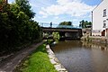
 Canal at Appley Bridge - geograph.org.uk - 2168295.jpg 420 × 640; 125 KB
-
 Canal Bank - geograph.org.uk - 2777972.jpg 640 × 480; 411 KB
-
 Canal Bank, Appley Bridge - geograph.org.uk - 3172053.jpg 640 × 480; 135 KB
-
 Canal Bank, Appley Bridge - geograph.org.uk - 3172061.jpg 640 × 480; 141 KB
-
 Chisnall Lane, Mossy Lea - geograph.org.uk - 4476140.jpg 1,024 × 768; 253 KB
-
 Church Hall - geograph.org.uk - 3848245.jpg 4,432 × 3,186; 5.96 MB
-
 Church Hall, Wrightington - geograph.org.uk - 4495648.jpg 2,000 × 1,327; 541 KB
-
 Church Lane - geograph.org.uk - 2711756.jpg 640 × 480; 108 KB
-
 Church Lane-Mossy Lea Road junction - geograph.org.uk - 2711762.jpg 640 × 480; 61 KB
-
 Communication mast on Harrock Hill, Wrightington - geograph.org.uk - 4317439.jpg 1,024 × 768; 264 KB
-
 Communications mast, Harrock Hill - geograph.org.uk - 1827857.jpg 3,504 × 2,336; 3.67 MB
-
 Cooper's Lane - geograph.org.uk - 4218764.jpg 640 × 480; 134 KB
-
 Cottage, Wrightington - geograph.org.uk - 4222384.jpg 640 × 480; 61 KB
-
 Cottages on layby on A5209 - geograph.org.uk - 2110960.jpg 1,600 × 1,198; 596 KB
-
 Crow Orchard Road (A5209) - geograph.org.uk - 2088391.jpg 800 × 480; 222 KB
-
 Crow Orchard Road (A5209) - geograph.org.uk - 4222394.jpg 640 × 480; 109 KB
-

-
 Dangerous Corner, Wrightington - geograph.org.uk - 2465357.jpg 3,530 × 2,340; 5.51 MB
-

-
 Dicconson Arms at Dangerous Corner - geograph.org.uk - 2110950.jpg 1,600 × 1,198; 322 KB
-
 Diverted Footpath near Dwerty House - geograph.org.uk - 5931031.jpg 1,024 × 770; 402 KB
-
 Dobson Close, Wrightington - geograph.org.uk - 4337589.jpg 1,024 × 768; 325 KB
-
 Door, Halliwell Farm - geograph.org.uk - 4503989.jpg 750 × 1,000; 212 KB
-
 Double bends on the A5209 near Fairy Glen - geograph.org.uk - 2110969.jpg 1,600 × 1,198; 699 KB
-
 Douglas Bank - geograph.org.uk - 5399709.jpg 5,160 × 3,081; 1.85 MB
-
 Douglas Bank Farm - geograph.org.uk - 4502141.jpg 1,000 × 750; 254 KB
-
 East Quarry,Appley Bridge - geograph.org.uk - 4446342.jpg 2,560 × 1,920; 2.86 MB
-
 Evening shadows, Harrock Hill - geograph.org.uk - 1827957.jpg 3,504 × 2,336; 1.47 MB
-
 Farm road (footpath) - geograph.org.uk - 4222373.jpg 640 × 480; 53 KB
-
 Farmland by the Leeds and Liverpool Canal - geograph.org.uk - 5528336.jpg 1,280 × 960; 1.09 MB
-
 Farmland by the Leeds and Liverpool Canal - geograph.org.uk - 5528338.jpg 1,280 × 960; 993 KB
-
 Farmland north of Butteries Wood, Wrightington - geograph.org.uk - 4317436.jpg 1,024 × 768; 434 KB
-
 Farmland south of High Moor Lane - geograph.org.uk - 4222368.jpg 640 × 480; 81 KB
-
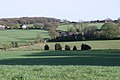
 Farmland, Shevington Moor - geograph.org.uk - 1635344.jpg 640 × 359; 70 KB
-
 Farmland, Wrightington - geograph.org.uk - 4222375.jpg 640 × 480; 66 KB
-
 Farmland, Wrightington - geograph.org.uk - 4222381.jpg 640 × 441; 47 KB
-
 Field entrance off Cooper's Lane - geograph.org.uk - 4218766.jpg 640 × 480; 109 KB
-
 Flood gaps in the wall - geograph.org.uk - 1828169.jpg 3,504 × 2,336; 1.97 MB
-
 Footpath alternatives at Boars Den Farm - geograph.org.uk - 4318229.jpg 1,024 × 768; 404 KB
-

-
 Footpath beside River Douglas in Winter - geograph.org.uk - 2219661.jpg 1,024 × 768; 194 KB
-

-

-
 Footpath Diversion Notice - geograph.org.uk - 4326798.jpg 1,024 × 768; 367 KB
-

-
 Footpath into Appley Bridge - geograph.org.uk - 1492162.jpg 640 × 480; 92 KB
-
 Footpath off High Moor Lane - geograph.org.uk - 4222365.jpg 640 × 480; 96 KB
-
 Footpath off Hill House Fold Lane, Wrightington - geograph.org.uk - 4317474.jpg 1,024 × 768; 387 KB
-
 Footpath on Harrock Hill - geograph.org.uk - 4326915.jpg 1,024 × 768; 243 KB
-
 Footpath on Harrock Hill - geograph.org.uk - 4326925.jpg 1,024 × 768; 235 KB
-
 Footpath on Harrock Hill - geograph.org.uk - 5939970.jpg 720 × 540; 175 KB
-
 Footpath to Boar's Den Tumulus - geograph.org.uk - 4318237.jpg 1,024 × 768; 450 KB
-
 Footpath to The Boar's Den - geograph.org.uk - 2465432.jpg 4,592 × 3,056; 4.66 MB
-
 Gate on path to High Moor joins Harrock Lane - geograph.org.uk - 3798746.jpg 1,024 × 768; 347 KB
-
 Gate on path up to Harrock Hill - geograph.org.uk - 3798731.jpg 1,024 × 768; 315 KB
-
 Gateway, Hall Lane A5209, Wrightington, West Lancashire - geograph.org.uk - 2533021.jpg 3,066 × 1,983; 1.23 MB
-
 Gloria at the Water's Edge - geograph.org.uk - 2777939.jpg 640 × 480; 345 KB
-
 Graveyard at St James the Great Church, Wrightington - geograph.org.uk - 4495641.jpg 2,000 × 1,327; 499 KB
-
 Grazing near High Moor - geograph.org.uk - 4222371.jpg 640 × 480; 58 KB
-
 Grazing off Cooper's Lane - geograph.org.uk - 4218767.jpg 640 × 480; 100 KB
-
 Grazing, Tunley Moss - geograph.org.uk - 4222388.jpg 640 × 480; 59 KB
-
 Hall Lane (A5209) - geograph.org.uk - 2088396.jpg 640 × 480; 227 KB
-
 Hall Lane (A5209), Appley Bridge - geograph.org.uk - 2088403.jpg 800 × 480; 170 KB
-
 Hall Lane looking west - geograph.org.uk - 2710626.jpg 640 × 480; 78 KB
-
 Harrock Hall - Geograph 1828156.jpg 3,504 × 2,336; 2.03 MB
-
 Harrock Hill - geograph.org.uk - 3283708.jpg 1,600 × 1,200; 1.02 MB
-
 Harrock Hill trig point - geograph.org.uk - 1827848.jpg 3,504 × 2,336; 3.32 MB
-
 Harrock Hill Windmill - panoramio.jpg 3,072 × 2,304; 3.01 MB
-
 Harrock Hill Wrightington - panoramio.jpg 3,072 × 2,304; 2.94 MB
-
 Harrock Hill, Wrightington - panoramio (1).jpg 3,072 × 2,304; 3 MB
-
 Harrock Hill, Wrightington - panoramio.jpg 2,304 × 3,072; 2.89 MB
-

-
 Haymaking, Tunley Moss - geograph.org.uk - 4357781.jpg 800 × 600; 425 KB
-
 Hesketh House Farm - geograph.org.uk - 3848256.jpg 2,126 × 1,977; 2.05 MB
-
 High Moor Lane - geograph.org.uk - 3347315.jpg 640 × 481; 552 KB
-
 High Moor Lane - geograph.org.uk - 4222369.jpg 640 × 480; 74 KB
-
 High Moor Lane - geograph.org.uk - 4357764.jpg 800 × 600; 457 KB
-
 High Moor Lane at Boggart House - geograph.org.uk - 2710669.jpg 640 × 480; 87 KB
-

-
 High Moor, The Rigbye Arms - geograph.org.uk - 3347320.jpg 640 × 481; 426 KB
-
 Hill House Fold and old quarry - geograph.org.uk - 1827771.jpg 3,454 × 2,263; 1.38 MB
-
 Hill House Fold Farm, Wrightington - geograph.org.uk - 4317454.jpg 1,024 × 768; 467 KB
-
 Hill House Fold Lane - geograph.org.uk - 2707998.jpg 4,592 × 3,056; 6.37 MB
-
 Hill House Fold Lane, Wrightington - geograph.org.uk - 4222378.jpg 640 × 480; 86 KB
-
 Hill House Fold Lane, Wrightington - geograph.org.uk - 4317468.jpg 1,024 × 768; 329 KB
-
 Hill House Lane footpath, Harrock Hill - geograph.org.uk - 5939972.jpg 720 × 540; 152 KB
-
 House at Higher Barn Farm - geograph.org.uk - 3848272.jpg 3,840 × 2,014; 4.18 MB
-
 House on Church Lane Wrightington Bar - geograph.org.uk - 3848238.jpg 4,596 × 2,473; 5.66 MB
-
 House on Hall Lane, Wrightington - geograph.org.uk - 4337604.jpg 1,024 × 768; 410 KB
-
 House on Wrightington Pond - geograph.org.uk - 4336578.jpg 1,024 × 772; 326 KB
-
 Houses on Mossy Lea Road, Wrightington Bar - geograph.org.uk - 4495607.jpg 2,000 × 1,327; 457 KB
-
 Houses on Wood Lane, Wrightington Bar - geograph.org.uk - 4495473.jpg 2,000 × 1,327; 408 KB
-
 Hunger Hill - geograph.org.uk - 2708261.jpg 640 × 362; 96 KB
-
 Hunger Hill, Mossy Lea Road - geograph.org.uk - 3347261.jpg 640 × 481; 494 KB
-
 In Touch Cafe, Appley Bridge, Lancashire - geograph.org.uk - 2638794.jpg 1,024 × 538; 111 KB
-
 J27 overbridge, M6 - geograph.org.uk - 4506517.jpg 640 × 375; 25 KB
-
 Junction in the woods - geograph.org.uk - 2121608.jpg 1,600 × 1,198; 817 KB
-

-
 Junction on Jackson's Lane - geograph.org.uk - 4326688.jpg 1,024 × 769; 348 KB
-
 Ladder stile near the top of Harrock Hill - geograph.org.uk - 3798585.jpg 1,024 × 768; 335 KB
-
 Leaving Harrock Hill, windmill. - panoramio.jpg 3,072 × 2,304; 2.9 MB
-
 Leeds and Liverpool Canal - geograph.org.uk - 4446360.jpg 2,560 × 1,920; 3.03 MB
-

-

-

-

-

-

-
 Leeds and Liverpool Canal, Appley Bridge - geograph.org.uk - 2777844.jpg 640 × 480; 448 KB
-
 Leeds and Liverpool Canal, Appley Bridge - geograph.org.uk - 3677031.jpg 5,184 × 3,456; 2.44 MB
-
 Leeds ^ Liverpool Canal - geograph.org.uk - 6182119.jpg 1,600 × 1,065; 483 KB
-
 Leeds ^ Liverpool Canal - geograph.org.uk - 6182126.jpg 1,600 × 1,065; 466 KB
-
 Leeds ^ Liverpool Canal - geograph.org.uk - 6182129.jpg 1,600 × 1,065; 537 KB
-
 Leeds ^ Liverpool Canal - geograph.org.uk - 6182133.jpg 1,600 × 1,065; 595 KB
-
 Leeds ^ Liverpool Canal - geograph.org.uk - 6182136.jpg 1,600 × 1,065; 561 KB
-
 Leeds ^ Liverpool Canal - geograph.org.uk - 6182139.jpg 1,600 × 1,065; 503 KB
-
 Leeds ^ Liverpool Canal - geograph.org.uk - 6182142.jpg 1,600 × 1,065; 747 KB
-
 Leeds ^ Liverpool Canal - geograph.org.uk - 6182146.jpg 1,600 × 1,065; 766 KB
-
 Leeds ^ Liverpool Canal - geograph.org.uk - 6182148.jpg 1,600 × 1,065; 731 KB
-
 Leeds ^ Liverpool Canal - geograph.org.uk - 6182151.jpg 1,600 × 1,065; 681 KB
-
 Leeds ^ Liverpool Canal - geograph.org.uk - 6182153.jpg 1,600 × 1,065; 522 KB
-
 Leeds ^ Liverpool Canal at Appley Bridge - geograph.org.uk - 3172058.jpg 640 × 480; 144 KB
-
 Leeds ^ Liverpool Canal, Appley Bridge - geograph.org.uk - 3168271.jpg 640 × 480; 139 KB
-
 Leeds ^ Liverpool Canal, Appley Bridge - geograph.org.uk - 3172059.jpg 640 × 480; 148 KB
-
 Leeds ^ Liverpool Canal, Appley Bridge - geograph.org.uk - 3172063.jpg 640 × 480; 139 KB
-

-
 Locks on the Leeds and Liverpool Canal - geograph.org.uk - 2126257.jpg 4,592 × 3,056; 6.36 MB
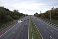
-
 Looking south on the M6 at Shevington Moor - geograph.org.uk - 2724984.jpg 4,592 × 3,056; 7.74 MB
-
 Looking towards Robin Hood - geograph.org.uk - 1827782.jpg 3,504 × 2,336; 2.87 MB
-
 Lower Barn off Jackson's Lane - geograph.org.uk - 3848282.jpg 3,422 × 2,631; 3.36 MB
-

-
 Lunevalley DA caravan meet 2009 Tunley Moss - panoramio.jpg 600 × 450; 103 KB
-
 Lunevalleyda caravan meet Tunley Moss - panoramio.jpg 600 × 450; 107 KB
-
 M6 from Boundary Lane Bridge - geograph.org.uk - 2009759.jpg 640 × 480; 118 KB
-
 M6 northbound from Boundary Lane bridge - geograph.org.uk - 2121591.jpg 1,600 × 1,198; 391 KB
-
 M6 northbound, Shevington Moor - geograph.org.uk - 4222401.jpg 640 × 436; 52 KB
-
 M6 Southbound near Shevington Moor - geograph.org.uk - 4458145.jpg 640 × 480; 219 KB
-
 Marshland near High Moor - geograph.org.uk - 1827631.jpg 3,504 × 2,336; 5.5 MB
-
 Master Bunbury.TIF 810 × 1,080; 3.34 MB
-
 Miles Lane, Appley Bridge - geograph.org.uk - 3172076.jpg 640 × 480; 147 KB
-
 Mill Lane passes under the railway line - geograph.org.uk - 3322816.jpg 640 × 480; 125 KB
-
 Moss Lane - geograph.org.uk - 4222385.jpg 640 × 480; 85 KB
-
 Moss Lane - geograph.org.uk - 4222390.jpg 640 × 480; 48 KB
-
 Mossy Lea (South Tunley Farm) - geograph.org.uk - 3347271.jpg 640 × 481; 671 KB
-
 Mossy Lea Road (B5250) - geograph.org.uk - 4222398.jpg 640 × 480; 74 KB
-
 Mossy Lea Road - geograph.org.uk - 2712057.jpg 640 × 480; 82 KB
-
 Mossy Lea Road - geograph.org.uk - 2712071.jpg 640 × 480; 63 KB
-
 Mossy Lea, Tunley Brook - geograph.org.uk - 3347282.jpg 640 × 481; 645 KB
-
 Muddy footpath at the end of Old Mill Lane - geograph.org.uk - 4326846.jpg 767 × 1,024; 521 KB
-
 Near Boar's Den - geograph.org.uk - 1827639.jpg 3,648 × 2,736; 2.49 MB
-
 Newly planted Sweetcorn - geograph.org.uk - 4502151.jpg 750 × 1,000; 254 KB
-
 North east from Harrock Hill - geograph.org.uk - 1827812.jpg 3,504 × 2,336; 3.44 MB
-
 Not just any farm entrance.... - geograph.org.uk - 1828135.jpg 3,504 × 2,336; 2.38 MB
-
 Not the weather for a children's play area - geograph.org.uk - 2708237.jpg 4,592 × 3,056; 5.94 MB
-
 Novel road names at Wrightington - geograph.org.uk - 2110058.jpg 1,600 × 1,198; 385 KB
-
 Old door, Douglass Bank Farm - geograph.org.uk - 4503978.jpg 761 × 1,000; 213 KB
-

-
 Old stone post on footpath to Harrock Hill - geograph.org.uk - 4317430.jpg 1,024 × 768; 530 KB
-
 Pastureland on Harrock Hill - geograph.org.uk - 5939961.jpg 720 × 540; 124 KB
-
 Path between Worthington's Farm and Draper's Farm House - geograph.org.uk - 6344423.jpg 1,600 × 1,200; 511 KB
-
 Path to Dwerty House from Sanderson Lane - geograph.org.uk - 5931022.jpg 1,024 × 768; 349 KB
-
 Pheasant in field South of High Moor Lane - geograph.org.uk - 5217679.jpg 1,024 × 820; 178 KB


_-_geograph.org.uk_-_2088391.jpg)
_-_geograph.org.uk_-_4222394.jpg)


_-_geograph.org.uk_-_4222373.jpg)


_-_geograph.org.uk_-_2088396.jpg)
,_Appley_Bridge_-_geograph.org.uk_-_2088403.jpg)


.jpg)


_-_geograph.org.uk_-_3347271.jpg)
_-_geograph.org.uk_-_4222398.jpg)


