Category:Zandpad 3, Breukelen
| Object location | | View all coordinates using: OpenStreetMap |
|---|
farmhouse in Stichtse Vecht, Netherlands  | |||||
| Upload media | |||||
| Instance of | |||||
|---|---|---|---|---|---|
| Location | Breukelen, Utrecht, Netherlands | ||||
| Street address |
| ||||
| Located on street |
| ||||
| Heritage designation |
| ||||
 | |||||
|
This is a category about rijksmonument number 10627
|
| Address |
|
Media in category "Zandpad 3, Breukelen"
The following 3 files are in this category, out of 3 total.
-
 Aanzicht - Breukelen - 20042250 - RCE.jpg 1,200 × 803; 280 KB
-
 Aanzicht - Breukelen - 20042251 - RCE.jpg 1,200 × 802; 285 KB
-
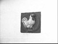 Gevelsteen. (HAAN) - Breukelen - 20494354 - RCE.jpg 1,200 × 900; 66 KB

_-_Breukelen_-_20494354_-_RCE.jpg)