Charta Principateloru Unite ale României
The geographic and statistic map Chartei Principateloru Unite ale României published under Alexander John Cuza's reign, by the cartographers de George Filipescu-Dubău & Anton Parteni-Antoninu, shows the United Principalities of [Moldavia & Wallachia, from this time called] Romania. This map (size 2m x 2m) consists of 54 pages, distributed in 9 groups of 6 pages each. It is cited as "published 1864 since the 1859-1860 census" here: Marin Popescu-Spineni, România în izvoare geografice și cartografice, p. 231 - [1] archive copy at the Wayback Machine.
Gallery edit
-
 The 54 files of the Charta Principateloru Unite ale României
 -
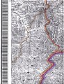
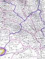
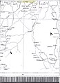
 "Charta Principateloru Unite ale României" -file 1
 -
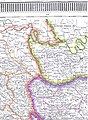
 idem -file 2- Oaş (Ugocea)
 -
 idem -file 3- Maramureş
 -
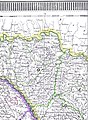
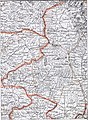
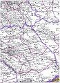
 idem -file 4- Bihor/Sălaj
 -
 idem -file 5- Șimleu/Zalău
 -
 idem -file 6- Dej/Bistriţa
 -
 idem -file 7- North-Western Bucovina
 -
 idem -file 8- North-Eastern Bucovina
 -
 idem -file 9- Northern Bessarabia
 -
 idem -file 10- South-Western Bucovina
 -
 idem -file 11- South-Eastern Bucovina
 -
 idem -file 12- Iaşi and around
 -
 idem -file 13- Soroca and around
 -
 idem -file 14- Statistics and Legend
 -
 idem -file 15- Legend
 -
 idem -file 16- Bălţi/Orhei
 -
 idem -file 17- Chişinău/Dubăsari and Statistics
 -
 idem -file 18- Statistics
 -
 idem -file 19- Eastern Bihor
 -
 idem -file 20- Cluj/Moţs county/Alba-Iulia
 -
 idem -file 21- Country of the Târnave rivers
 -
 idem -file 22- Caransebeş/Mehadia
 -
 idem -file 23- Hunedoara/Haţeg country/Târgu-Jiu
 -
 idem -file 24- Sibiu/Râmnicu-Vâlcea
 -
 idem -file 25- Western Székely county
 -
 idem -file 26- Eastern Székely & Csángó counties/Piatra-Neamţ
 -
 idem -file 27- Roman/Vaslui/Bârlad
 -
 idem -file 28- Braşov/Câmpulung/Câmpina
 -
 idem -file 29- Covasna/Vrancea/Buzău
 -
 idem -file 30- Tecuci/Focşani/Râmnicu-Sărat
 -
 idem -file 31- Hânceşti/Huşi/Leova/Comrat
 -
 idem -file 32- Chişinău/Tighina-Bender/Căuşeni
 -
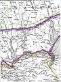
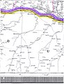
 idem -file 33- Mouths of the Dniestr
 -
 idem -file 34- Galaţi/Reni/Bolgrad
 -
 idem -file 35- Izmail/Chilia/Chilia & Sulina branchs
 -
 idem -file 36- Tuzla in Budzak/Snakes Is.
 -
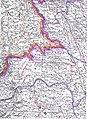
 idem -file 37- Orşova/Turnu-Severin/Vidin/Iron Gates
 -
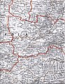
 idem -file 38- Central Oltenia/Craiova
 -
 idem -file 39- Piteşti/Slatina/Caracal
 -
 idem -file 40- North-Western Bulgaria in the Ottoman Empire
 -
 idem -file 41- North-Western Bulgaria/Danube
 -
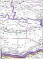
 idem -file 42- Islaz/Turnu-Măgurele/Danube/Northern Bulgaria
 -
 idem -file 43- Central Muntenia/Târgovişte/Vlaşca county
 -
 idem -file 44- Bucharest/Ploieşti/Olteniţa
 -
 idem -file 45- Slobozia/Călăraşi/Bărăgan
 -
 idem -file 46- Alexandria/Zimnicea/Giurgiu
 -
 idem -file 47- Northern Bulgaria between Ruse/Tutrakan/Razgrad
 -
 idem -file 48- North-Eastern Bulgaria around Silistra
 -
 idem -file 49- Central Dobrudja
 -
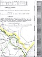
 idem -file 50- North-Eastern Dobrudja/St-George branch and Statistics
 -
 idem -file 51- Statistics
 -
 idem -file 52- Southern Dobrudja around Mangalia
 -
 idem -file 53- Statistics
 -
 idem -file 54- Statistics


See also edit
- Keith M. Hitchins, The Romanians, 1774–1866 (1996) online archive copy at the Wayback Machine
- 2004 Romanian Statistical Yearbook - Geography, Meteorology and Environment