Category:Coastal erosion
(Redirected from Coastal erosion)
loss or displacement of land along a coastline  | |||||
| Upload media | |||||
| Instance of | |||||
|---|---|---|---|---|---|
| Subclass of | |||||
| |||||
Subcategories
This category has the following 20 subcategories, out of 20 total.
*
+
B
C
F
G
I
L
R
S
W
Media in category "Coastal erosion"
The following 69 files are in this category, out of 69 total.
-
 15.10.11 Falaise Octeville-sur-mer - panoramio (1).jpg 4,608 × 3,456; 5.54 MB
-
 At the beach - Boomer Depp.jpg 1,024 × 1,024; 821 KB
-
 Blow hole and thunder cave zz.JPG 3,072 × 1,728; 2.48 MB
-
 Bồi tụ ven biển.svg 1,481 × 697; 13 KB
-
 Cabo Ledo beach, Angola 01.jpg 1,024 × 768; 333 KB
-
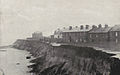
 Coastal erosion - geograph.org.uk - 106046.jpg 640 × 480; 141 KB
-
 Coastal erosion - geograph.org.uk - 1290643.jpg 640 × 425; 122 KB
-
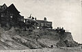
 Coastal erosion - geograph.org.uk - 552090.jpg 640 × 424; 86 KB
-
 Coastal Erosion at Atherington - geograph.org.uk - 1294184.jpg 640 × 552; 98 KB
-
 Coastal erosion courtown co wexford aug13 2015.jpg 3,264 × 2,448; 3.51 MB
-
 Coastal erosion threatens the North Frisian Islands.jpg 3,820 × 2,559; 4.58 MB
-
 Coastal erosion^ - geograph.org.uk - 571694.jpg 480 × 640; 43 KB
-
 COASTAL TRANSGRESSION-REGRESSION SEQUENCE STRATIGRAPHY.png 1,280 × 720; 116 KB
-
 Coastal-erosion-inland.jpg 1,200 × 797; 1.22 MB
-
 Common physical and anthropogenic causes of coastal land loss.png 1,827 × 2,522; 17.58 MB
-
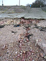
 Cordova Bay Manhole Cover.jpg 4,032 × 3,024; 6.45 MB
-
 Cottesloe beach errosion gnangarra.JPG 4,672 × 3,104; 9.78 MB
-
 DamageAreaVanderMeer.jpg 1,153 × 828; 97 KB
-
 Dune damage at Amagansett National Wildlife Refuge (NY) (8152080217).jpg 4,000 × 3,000; 2.17 MB
-
 Dune damage at Target Rock National Wildlife Refuge (NY) (8152097024).jpg 4,000 × 3,000; 4.57 MB
-
 Dyrhólaey 03.JPG 3,444 × 2,586; 3.04 MB
-
 Dyrhólaey 04.JPG 2,586 × 3,440; 3 MB
-
 Dyrhólaey 09.JPG 3,440 × 2,576; 1.72 MB
-
 Emine01.jpg 600 × 800; 56 KB
-
 Eroded peat at low tide (15572651857).jpg 3,008 × 2,000; 2.92 MB
-
 Erosion exposed at low tide.jpg 800 × 600; 98 KB
-
 ErosionStClair beach.jpg 1,800 × 1,243; 503 KB
-
 Folded strata below Allt Wen - geograph.org.uk - 1750056.jpg 768 × 1,024; 454 KB
-
 Freeport, NY - Waterfront Park erosion 01.jpg 4,288 × 2,848; 6.17 MB
-
 Granite outcrop - geograph.org.uk - 554979.jpg 600 × 450; 39 KB
-
 Greenala Point - geograph.org.uk - 1567145.jpg 640 × 443; 127 KB
-
 Household experiencing coastal erosion on South Tarawa.JPG 3,264 × 2,448; 2.47 MB
-
 Israel National Trail coast of Mediterranean.jpg 1,437 × 942; 166 KB
-
 Keshet neal island india.jpg 2,592 × 1,944; 1.59 MB
-
 Le Gouffre.jpg 440 × 274; 33 KB
-
 Malta - Kalkara - Fort Ricasoli (MSTHC) 02 ies.jpg 5,616 × 3,744; 17.7 MB
-
 Measurement of sea level in Grand Popo Benin.jpg 5,472 × 3,072; 4.86 MB
-
 Meschers 17 Falaise&forêt Suzac 2013.jpg 8,144 × 3,170; 24.5 MB
-
 Moruga coastline.jpg 4,320 × 3,240; 3.58 MB
-
 Mykines coastal erosion.jpg 6,000 × 4,000; 16.23 MB
-
 Ocean waves clouds rocks.jpg 1,000 × 666; 136 KB
-
 Ocean waves water coast.jpg 1,000 × 750; 178 KB
-
 Pake-erosion1.jpg 1,600 × 1,003; 873 KB
-
 Pake-erosion2.jpg 1,622 × 1,031; 859 KB
-
 Pake-erosion3.jpg 1,594 × 1,015; 874 KB
-
 Pohnpei (Federated States of Micronesia).jpg 3,216 × 4,288; 2.97 MB
-
 Porto Covo July 2011-1.jpg 3,181 × 1,951; 4.36 MB
-
 Precipitous Inlet - geograph.org.uk - 187216.jpg 640 × 424; 118 KB
-
 Prevention of coastal erosion.jpg 3,264 × 2,176; 3.16 MB
-
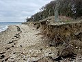 Retreating coastline - geograph.org.uk - 370271.jpg 640 × 480; 110 KB
-
 Saint Lucy, Barbados 22.jpg 2,729 × 4,173; 8.55 MB
-
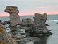 Seastacks.JPG 736 × 556; 106 KB
-
 Solomon Shoreline.jpg 5,616 × 3,744; 15.74 MB
-
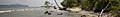 Solomone banner.jpg 4,749 × 679; 2.78 MB
-
 Spricka med diabas, Mörholmen; Dolerite dykes.jpg 2,816 × 2,112; 1.04 MB
-
 Storm backwash, Portishead - geograph.org.uk - 314955.jpg 480 × 640; 173 KB
-
 Sunset at Allt Wen - geograph.org.uk - 1751729.jpg 1,024 × 768; 217 KB
-

-
 Twin micro-fold axes below Allt Wen - geograph.org.uk - 1750069.jpg 1,024 × 768; 340 KB
-
 Valahnukur, Suðurnes, Islandia, 2014-08-13, DD 038.JPG 5,616 × 3,744; 6.62 MB
-
 Varing Osmussaar.JPG 3,072 × 2,304; 1.33 MB
-
 Waterfall at Waterfall Cave - geograph.org.uk - 1099780.jpg 427 × 640; 99 KB
-
 Wave-cut platform below Allt Wen - geograph.org.uk - 1748657.jpg 768 × 1,024; 200 KB
-
 Wave-cut platform below Allt Wen - geograph.org.uk - 1750017.jpg 1,024 × 768; 516 KB
-
 Wave-cut platform below Allt Wen - geograph.org.uk - 1751658.jpg 768 × 1,024; 474 KB
-
 Wave-cut platform below Allt Wen - geograph.org.uk - 1751689.jpg 1,024 × 768; 372 KB
-
 Coastal erosion on the Langness Peninsula - geograph.org.uk - 490714.jpg 640 × 480; 127 KB
-
 جرف بحري.jpg 2,576 × 1,932; 2.66 MB
-
 นรม.ตรวจดูแนวชายหาดและป่าสนที่ถูกคลื่นกัดเซาะได้รับควา - Flickr - Abhisit Vejjajiva (1).jpg 5,120 × 3,413; 6.36 MB
.jpg)


_(8152080217).jpg)
_(8152097024).jpg)


.jpg)


_02_ies.jpg)


.jpg)


.jpg)