Commons:Wiki4Alps/Alpthal
| KGS-Nr | Upload | Foto | Object | Other | Cov. | Cat. | Type | Address | Town | Coordinates | |||
|---|---|---|---|---|---|---|---|---|---|---|---|---|---|
| 4762 | 
|
Pfarrkirche St. Apollonia | B | G | Dorfstrasse | [[:Category:|]] |
| ||||||
| 12762 | 
|
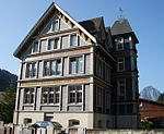
Schulhaus | B | G | Dorfstrasse 17 | [[:Category:|]] |
|
- Übrige Baudenkmäler
| KGS-Nr | Upload | Foto | Object | Other | Cov. | Cat. | Type | Address | Town | Coordinates | |||
|---|---|---|---|---|---|---|---|---|---|---|---|---|---|
| Kapelle Brunni | G | Brüglenweg | [[:Category:|]] |
| |||||||||
| Kapelle Bruust | G | Haggeneggweg | [[:Category:|]] |
| |||||||||
| Kapelle Holzegg | G | Holzegg | [[:Category:|]] |
| |||||||||
| Haus | G | Schnürlismattweg 2 | [[:Category:|]] |
| |||||||||
| Haus Eigen | G | Alpthalerstrasse 4 | [[:Category:|]] |
| |||||||||
| Haus Eigen | G | Eigenweg 2 | [[:Category:|]] |
|