| KGS-Nr
|
Upload
|
Foto
|
|
Object
|
Other
|
Cov.
|
Cat.
|
Type
|
Address
|
Town
|
Coordinates
|
| 9909
|

|
yes
|

|
Bauernhaus
|
|

|
A
|
G
|
Ballmoos 47
|
[[:Category:|]]
|
|
| 411
|
|
yes
|
|
Ehemaliges Kaufmannshaus Gruber
|
|
|
A
|
G
|
Schwantlern 5
|
[[:Category:|]]
|
|
| 9908
|
|
yes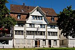
|
|
Gasthaus Zum Falken
|
|
|
A
|
G
|
Dorfplatz 15
|
[[:Category:|]]
|
|
| 408
|
|
yes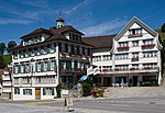
|
|
Gasthof Krone
|
|
|
A
|
G
|
Dorfplatz 6
|
[[:Category:|]]
|
|
| 407
|
|
yes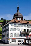
|
|
Haus zum Neuen Ochsen
|
|
|
A
|
G
|
Dorfplatz 14
|
[[:Category:|]]
|
|
| 409
|
|
yes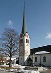
|
|
Reformierte Kirche
|
|
|
A
|
G
|
Dorfplatz
|
[[:Category:|]]
|
|
| 11306
|
|
|
|
Bauernhaus
|
|
|
B
|
G
|
Buchen 2
|
[[:Category:|]]
|
|
| 11309
|
|
|
|
Bauernhaus
|
|
|
B
|
G
|
Luser
|
[[:Category:|]]
|
|
| 11316
|
|
|
|
Bauernhaus
|
|
|
B
|
G
|
Mühlpass
|
[[:Category:|]]
|
|
| 11307
|
|
|
|
Bauernhaus
|
|
|
B
|
G
|
Zwislenstrasse 1
|
[[:Category:|]]
|
|
| 11311
|
|
|
|
Doppelhaus
|
|
|
B
|
G
|
Schlipf-Rotenwies
|
[[:Category:|]]
|
|
| 11305
|
|
yes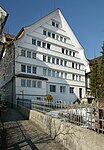
|
|
Haus zur Blume
|
|
|
B
|
G
|
Dorfplatz 2
|
[[:Category:|]]
|
|
| 14844
|
|
|
|
Heidenhaus
|
|
|
B
|
G
|
Ballmoos 747
|
[[:Category:|]]
|
|
| 14845
|
|
|
|
Heidenhaus
|
|
|
B
|
G
|
Ballmoos 748
|
[[:Category:|]]
|
|
| 11308
|
|
|
|
Heidenhaus
|
|
|
B
|
G
|
Hebrig
|
[[:Category:|]]
|
|
| 14846
|
|
|
|
Museum Gais
|
|
|
B
|
S
|
Dorfplatz 2
|
[[:Category:|]]
|
|
| 11315
|
|
yes
|
|
Schlachtdenkmal
|
|
|
B
|
K
|
Stoss
|
[[:Category:Stoss|{{{Town}}}]]
|
|
| 11314
|
|
yes
|
|
Schlachtkapelle
|
|
|
B
|
G
|
Stoss
|
{{{Town}}}
|
|
| 14847
|
|
|
|
Tätschdachhaus
|
|
|
B
|
G
|
Riesern
|
[[:Category:|]]
|
|
| 11313
|
|
yes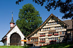
|
|
Wirtshaus
|
|
|
B
|
G
|
Stoss
|
{{{Town}}}
|
|
|
|
|
yes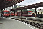
|
|
Bahnhof
|
|
|
|
G
|
Bahnhofplatz
|
[[:Category:|]]
|
|
|
|
|
yes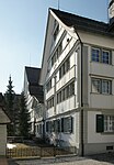
|
|
Haus
|
|
|
|
G
|
Dorfplatz 1
|
[[:Category:|]]
|
|
|
|
|
|
|
Haus
|
|
|
|
G
|
Dorfplatz 3
|
[[:Category:|]]
|
|
|
|
|
yes
|
|
Haus
|
|
|
|
G
|
Dorfplatz 4
|
[[:Category:|]]
|
|
|
|
|
|
|
Haus
|
|
|
|
G
|
Dorfplatz 8
|
[[:Category:|]]
|
|
|
|
|
|
|
Haus
|
|
|
|
G
|
Dorfplatz 9
|
[[:Category:|]]
|
|
|
|
|
|
|
Haus
|
|
|
|
G
|
Dorfplatz 10
|
[[:Category:|]]
|
|
|
|
|
|
|
Haus
|
|
|
|
G
|
Dorfplatz 11
|
[[:Category:|]]
|
|
|
|
|
|
|
Haus
|
|
|
|
G
|
Dorfplatz 12
|
[[:Category:|]]
|
|
|
|
|
|
|
Haus
|
|
|
|
G
|
Dorfplatz 14
|
[[:Category:|]]
|
|
|
|
|
|
|
Haus
|
|
|
|
G
|
Dorfplatz 15
|
[[:Category:|]]
|
|
|
|
|
|
|
Haus
|
|
|
|
G
|
Geiserau 10
|
[[:Category:|]]
|
|
|
|
|
|
|
Haus
|
|
|
|
G
|
Geiserau 50
|
[[:Category:|]]
|
|
|
|
|
|
|
Haus
|
|
|
|
G
|
Gansbach 8
|
[[:Category:|]]
|
|
|
|
|
|
|
Haus
|
|
|
|
G
|
Schulhausstrasse 3
|
[[:Category:|]]
|
|
|
|
|
yes
|
|
Haus
|
|
|
|
G
|
Schwantlern 23
|
[[:Category:|]]
|
|
|
|
|
|
|
Haus
|
|
|
|
G
|
Schwantlernegg 7
|
[[:Category:|]]
|
|
|
|
|
|
|
Haus
|
|
|
|
G
|
Stossstrasse 17
|
[[:Category:|]]
|
|


.jpg)


