Commons:Wiki Loves Monuments in Switzerland/Schwyz/A-M

Alpthal

Location Upload Photo Object Cat. Coordinates KGS-Nr
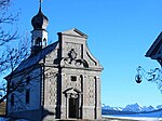
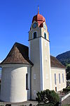
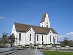
Alpthal Upload a file Pfarrkirche St. Apollonia
Pfarrkirche St. Apollonia B 47°04′15″N 8°42′58″E / 47.07075°N 8.71599°E / 47.07075; 8.71599 4762
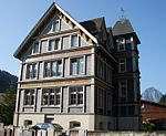
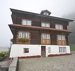
Alpthal Upload a file Schulhaus
Schulhaus B 47°04′18″N 8°35′03″E / 47.071761°N 8.584089°E / 47.071761; 8.584089 12762

Altendorf

Location Upload Photo Object Cat. Coordinates KGS-Nr
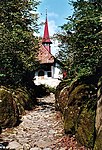
Altendorf Upload a file Kapelle St. Johann und Sigristenhaus
Kapelle St. Johann und Sigristenhaus A 47°11′06″N 8°50′28″E / 47.184953°N 8.841181°E / 47.184953; 8.841181 4763
Altendorf Upload a file Haus am See
Haus am See B 47°11′37″N 8°50′00″E / 47.19361°N 8.83334°E / 47.19361; 8.83334 12763
Altendorf Upload a file Haus Engel
Haus Engel B 47°11′41″N 8°49′54″E / 47.19462°N 8.83164°E / 47.19462; 8.83164 12764
Altendorf Upload a file Haus Freihof
Haus Freihof B 47°11′25″N 8°50′13″E / 47.19022°N 8.83696°E / 47.19022; 8.83696 12765
Altendorf Upload a file Haus Seestatt (ehem. zur Krone)
Haus Seestatt (ehem. zur Krone) B 47°11′42″N 8°49′54″E / 47.19496°N 8.8318°E / 47.19496; 8.8318 12766
Altendorf Upload a file
Haus Züger, Talstrasse B 47°11′40″N 8°48′25″E / 47.19451°N 8.80685°E / 47.19451; 8.80685 12767
Altendorf Upload a file Kapelle St. Anna, Beinhaus
Kapelle St. Anna, Beinhaus B 47°11′32″N 8°49′51″E / 47.1921°N 8.83082°E / 47.1921; 8.83082 12768
Altendorf Upload a file
Kapelle St. Jakob B 47°11′31″N 8°49′54″E / 47.19193°N 8.83155°E / 47.19193; 8.83155 12769
Altendorf Upload a file Pfarrhaus
Pfarrhaus B 47°11′31″N 8°49′50″E / 47.19182°N 8.83043°E / 47.19182; 8.83043 12770
Altendorf Upload a file Pfarrkirche St. Michael
Pfarrkirche St. Michael B 47°11′31″N 8°49′51″E / 47.19183°N 8.8308°E / 47.19183; 8.8308 4764
Altendorf Upload a file Serafinahaus
Serafinahaus B 47°11′41″N 8°49′56″E / 47.1946°N 8.83234°E / 47.1946; 8.83234 12771
Altendorf Upload a file Sigristenhaus
Sigristenhaus B 47°11′06″N 8°50′25″E / 47.18487°N 8.84041°E / 47.18487; 8.84041 12772
Altendorf Upload a file
Alt Rapperswil A 47°11′06″N 8°50′28″E / 47.184953°N 8.841181°E / 47.184953; 8.841181 10482

Arth

Location Upload Photo Object Cat. Coordinates KGS-Nr
Arth Upload a file Bergsturzmuseum
Bergsturzmuseum B 47°03′05″N 8°33′13″E / 47.05145°N 8.55351°E / 47.05145; 8.55351 4769
Arth Upload a file Haus (Alte Post)
Haus (Alte Post) A 47°03′21″N 8°32′05″E / 47.055932°N 8.534784°E / 47.055932; 8.534784 11625
Arth Upload a file Hochperron der Rigibahn
Hochperron der Rigibahn A 47°02′57″N 8°32′52″E / 47.049159°N 8.54778°E / 47.049159; 8.54778 10175
Arth Upload a file Kapelle Reding
Kapelle Reding A 47°03′24″N 8°32′03″E / 47.056614°N 8.53406°E / 47.056614; 8.53406 11626
Arth Upload a file Mittelalterliche Letzinen
Mittelalterliche Letzinen A 47°03′23″N 8°32′04″E / 47.056312°N 8.534528°E / 47.056312; 8.534528 9673
Arth Upload a file Pfarrkirche St. Georg und Zeno
Pfarrkirche St. Georg und Zeno A 47°03′49″N 8°31′23″E / 47.063618°N 8.523092°E / 47.063618; 8.523092 4766
Arth Upload a file Altersheim Hofmatt
Altersheim Hofmatt B 47°03′46″N 8°31′29″E / 47.0627°N 8.52479°E / 47.0627; 8.52479 12773
Arth Upload a file Brücke Unterstetten, Rigi
Brücke Unterstetten, Rigi B 47°01′55″N 8°29′27″E / 47.032°N 8.49094°E / 47.032; 8.49094 12774
Arth Upload a file Haus
Haus B 47°03′42″N 8°31′21″E / 47.06174°N 8.52262°E / 47.06174; 8.52262 12778
Arth Upload a file Haus
Haus B 47°03′49″N 8°31′28″E / 47.06352°N 8.52434°E / 47.06352; 8.52434 12779
Arth Upload a file Haus
Haus B 47°03′46″N 8°31′20″E / 47.06273°N 8.52235°E / 47.06273; 8.52235 12776
Arth Upload a file Haus
Haus B 47°03′44″N 8°31′23″E / 47.06213°N 8.523°E / 47.06213; 8.523 12775
Arth Upload a file Haus
Haus B 47°03′36″N 8°31′39″E / 47.05998°N 8.52743°E / 47.05998; 8.52743 12777
Arth Upload a file Haus (alter Rossstall)
Haus (alter Rossstall) B 47°03′38″N 8°31′35″E / 47.0606°N 8.52638°E / 47.0606; 8.52638 12780
Arth Upload a file Haus (Fischlin)
Haus (Fischlin) B 47°03′40″N 8°31′34″E / 47.06107°N 8.52599°E / 47.06107; 8.52599 12781
Arth Upload a file Haus (Schulweg)
Haus (Schulweg) B 47°03′44″N 8°31′31″E / 47.06225°N 8.52517°E / 47.06225; 8.52517 12782
Arth Upload a file
Haus (St. Georg, altes Armenhaus) B 47°03′37″N 8°31′14″E / 47.06022°N 8.52046°E / 47.06022; 8.52046 12783
Arth Upload a file Haus (St. Georgshof)
Haus (St. Georgshof) B 47°03′38″N 8°31′17″E / 47.06044°N 8.52138°E / 47.06044; 8.52138 12784
Arth Upload a file Haus (Zay-Reding)
Haus (Zay-Reding) B 47°03′54″N 8°31′28″E / 47.06487°N 8.52437°E / 47.06487; 8.52437 12785
Arth Upload a file Haus alter Pilgerweg (Reding)
Haus alter Pilgerweg (Reding) B 47°03′31″N 8°31′31″E / 47.05861°N 8.52516°E / 47.05861; 8.52516 12786
Arth Upload a file Haus Baltisberg
Haus Baltisberg B 47°04′12″N 8°32′13″E / 47.06997°N 8.53686°E / 47.06997; 8.53686 12787
Arth Upload a file
Haus Gengigen B 47°04′42″N 8°31′32″E / 47.0783°N 8.52543°E / 47.0783; 8.52543 12788
Arth Upload a file Haus Rindelstrasse (Ehrli)
Haus Rindelstrasse (Ehrli) B 47°03′26″N 8°31′29″E / 47.05719°N 8.52484°E / 47.05719; 8.52484 12789
Arth Upload a file Haus St. Adrian
Haus St. Adrian B 47°04′53″N 8°31′26″E / 47.08145°N 8.52402°E / 47.08145; 8.52402 12790
Arth Upload a file Haus Vorgasse
Haus Vorgasse B 47°04′19″N 8°31′55″E / 47.07199°N 8.53189°E / 47.07199; 8.53189 12791
Arth Upload a file Haus, Goldau (Altes Pfrundhaus)
Haus, Goldau (Altes Pfrundhaus) B 47°02′49″N 8°32′46″E / 47.04689°N 8.54598°E / 47.04689; 8.54598 12792
Arth Upload a file Kapelle Maria zum Schnee, Rigi-Klösterli
Kapelle Maria zum Schnee, Rigi-Klösterli B 47°02′36″N 8°29′08″E / 47.04344°N 8.4856°E / 47.04344; 8.4856 4773
Arth Upload a file Kapelle St. Georg
Kapelle St. Georg B 47°03′36″N 8°31′15″E / 47.06013°N 8.52092°E / 47.06013; 8.52092 4770
Arth Upload a file Kapelle Wegscheide
Kapelle Wegscheide B 47°03′36″N 8°31′54″E / 47.06°N 8.53156°E / 47.06; 8.53156 12793
Arth Upload a file Kloster/Klosterkirche St. Avgin (ehem. Zeno)
Kloster/Klosterkirche St. Avgin (ehem. Zeno) B 47°03′56″N 8°31′28″E / 47.06548°N 8.52449°E / 47.06548; 8.52449 4771
Arth Upload a file Pfarrkirche Herz-Jesu, Goldau
Pfarrkirche Herz-Jesu, Goldau B 47°02′48″N 8°32′42″E / 47.04654°N 8.54492°E / 47.04654; 8.54492 12794
Arth Upload a file Rathaus
Rathaus B 47°03′46″N 8°31′23″E / 47.06272°N 8.52307°E / 47.06272; 8.52307 4772
Arth Upload a file Reformierte Kirche, Oberarth
Reformierte Kirche, Oberarth B 47°03′22″N 8°32′01″E / 47.05601°N 8.53356°E / 47.05601; 8.53356 12795
Arth Upload a file Bahnhof Arth-Goldau
Bahnhof Arth-Goldau B 47°02′57″N 8°32′58″E / 47.04915°N 8.54939°E / 47.04915; 8.54939 4768

Bezirk Einsiedeln

Location Upload Photo Object Cat. Coordinates KGS-Nr
Bezirk Einsiedeln Upload a file
Einsiedeln ISOS 47°07′43″N 8°44′50″E / 47.12849°N 8.74735°E / 47.12849; 8.74735
Bezirk Einsiedeln Upload a file Etzelpass
Etzelpass ISOS 47°10′24″N 8°46′20″E / 47.1733°N 8.77222°E / 47.1733; 8.77222

Bezirk March

Location Upload Photo Object Cat. Coordinates KGS-Nr
Bezirk March Upload a file
Altendorf ISOS 47°11′41″N 8°49′54″E / 47.1948°N 8.83175°E / 47.1948; 8.83175
Bezirk March Upload a file Lachen
Lachen ISOS 47°11′28″N 8°51′24″E / 47.191111111°N 8.856666666°E / 47.191111111; 8.856666666

Bezirk Schwyz

Location Upload Photo Object Cat. Coordinates KGS-Nr
Bezirk Schwyz Upload a file
Steinen ISOS 47°02′59″N 8°36′44″E / 47.04975°N 8.61214°E / 47.04975; 8.61214
Bezirk Schwyz Upload a file
Muotathal ISOS 46°58′36″N 8°45′54″E / 46.97676°N 8.76499°E / 46.97676; 8.76499
Bezirk Schwyz Upload a file Schwyz
Schwyz ISOS 47°01′14″N 8°39′30″E / 47.020546°N 8.658332°E / 47.020546; 8.658332
Bezirk Schwyz Upload a file Arth
Arth ISOS 47°03′52″N 8°31′27″E / 47.064444444°N 8.524166666°E / 47.064444444; 8.524166666

Einsiedeln

Location Upload Photo Object Cat. Coordinates KGS-Nr
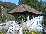
Einsiedeln Upload a file Teufelsbrücke
Teufelsbrücke A 47°10′03″N 8°46′02″E / 47.167388°N 8.767246°E / 47.167388; 8.767246 4777
Einsiedeln Upload a file Kloster in der Au
Kloster in der Au B 47°06′53″N 8°43′43″E / 47.11475°N 8.72865°E / 47.11475; 8.72865 12802
Einsiedeln Upload a file Bibliothek der Stiftung Werner Oechslin
Bibliothek der Stiftung Werner Oechslin A 47°07′31″N 8°44′51″E / 47.125142°N 8.747626°E / 47.125142; 8.747626 9309
Einsiedeln Upload a file Kloster Einsiedeln, Klosterarchiv
Kloster Einsiedeln, Klosterarchiv A 47°07′37″N 8°45′11″E / 47.12683°N 8.75293°E / 47.12683; 8.75293 8913
Einsiedeln Upload a file
Sammlung der Benediktinerabtei Einsiedeln A 47°07′37″N 8°45′10″E / 47.12682°N 8.75278°E / 47.12682; 8.75278 8520
Einsiedeln Upload a file Stiftsbibliothek Einsiedeln
Stiftsbibliothek Einsiedeln A 47°07′37″N 8°45′11″E / 47.12685°N 8.75311°E / 47.12685; 8.75311 9308
Einsiedeln Upload a file Haus zur Ilge
Haus zur Ilge A 47°07′34″N 8°44′59″E / 47.126232°N 8.749854°E / 47.126232; 8.749854 9400
Einsiedeln Upload a file Meinradskapelle und Pilgerhaus St. Meinrad
Meinradskapelle und Pilgerhaus St. Meinrad A 47°10′24″N 8°46′20″E / 47.17324°N 8.772286°E / 47.17324; 8.772286 4778
Einsiedeln Upload a file Chärnehus
Chärnehus B 47°07′34″N 8°44′35″E / 47.1261°N 8.74296°E / 47.1261; 8.74296 4783
Einsiedeln Upload a file Altes Schulhaus
Altes Schulhaus B 47°07′42″N 8°45′05″E / 47.12844°N 8.75138°E / 47.12844; 8.75138 10176
Einsiedeln Upload a file Friedhofkapelle
Friedhofkapelle B 47°07′46″N 8°45′26″E / 47.12931°N 8.75734°E / 47.12931; 8.75734 4780
Einsiedeln Upload a file
Haus Euthal B 47°05′56″N 8°47′31″E / 47.09884°N 8.79203°E / 47.09884; 8.79203 12800
Einsiedeln Upload a file
Haus Haldeli, Euthal B 47°04′42″N 8°50′22″E / 47.07846°N 8.83945°E / 47.07846; 8.83945 12796
Einsiedeln Upload a file
Haus Klostermühle B 47°07′59″N 8°44′51″E / 47.13316°N 8.74755°E / 47.13316; 8.74755 12797
Einsiedeln Upload a file Haus Tüfelsbrugg, Egg
Haus Tüfelsbrugg, Egg B 47°10′02″N 8°46′04″E / 47.16712°N 8.76781°E / 47.16712; 8.76781 12798
Einsiedeln Upload a file Haus Tulipan
Haus Tulipan B 47°07′36″N 8°44′53″E / 47.12663°N 8.74804°E / 47.12663; 8.74804 12799
Einsiedeln Upload a file
Kapelle Hl. Dreifaltigkeit, Trachslau B 47°06′52″N 8°44′10″E / 47.11447°N 8.73612°E / 47.11447; 8.73612 12801
Einsiedeln Upload a file Kapelle St. Gangulf
Kapelle St. Gangulf B 47°07′53″N 8°45′09″E / 47.13143°N 8.7526°E / 47.13143; 8.7526 4781
Einsiedeln Upload a file
Kapelle St. Josef B 47°07′26″N 8°44′20″E / 47.12399°N 8.73895°E / 47.12399; 8.73895 4782
Einsiedeln Upload a file Kirche St. Josef, Willerzell
Kirche St. Josef, Willerzell B 47°07′47″N 8°47′38″E / 47.12981°N 8.79401°E / 47.12981; 8.79401 4784
Einsiedeln Upload a file Pfarrkirche St. Nepomuk, Gross
Pfarrkirche St. Nepomuk, Gross B 47°06′57″N 8°46′35″E / 47.11574°N 8.77635°E / 47.11574; 8.77635 12803
Einsiedeln Upload a file Rathaus
Rathaus B 47°07′35″N 8°44′59″E / 47.12652°N 8.74962°E / 47.12652; 8.74962 12804
Einsiedeln Upload a file Viertelskirche Johannes der Täufer, Egg
Viertelskirche Johannes der Täufer, Egg B 47°09′41″N 8°46′51″E / 47.16134°N 8.78073°E / 47.16134; 8.78073 4776
Einsiedeln Upload a file Viertelskirche St. Sebastian, Bennau
Viertelskirche St. Sebastian, Bennau B 47°08′55″N 8°43′48″E / 47.14874°N 8.73012°E / 47.14874; 8.73012 4775
Einsiedeln Upload a file Viertelskirche St. Stefan, Trachslau
Viertelskirche St. Stefan, Trachslau B 47°05′52″N 8°43′30″E / 47.09779°N 8.72494°E / 47.09779; 8.72494 12805
Einsiedeln Upload a file
Viertelskirche zur schmerzhaften Muttergottes B 47°05′45″N 8°48′58″E / 47.0958°N 8.81622°E / 47.0958; 8.81622 4779
Einsiedeln Upload a file [[File:|150x150px|Villa Oechslin]]
Villa Oechslin B 47°07′31″N 8°44′51″E / 47.12515°N 8.74761°E / 47.12515; 8.74761 12806
Einsiedeln Upload a file Kloster Einsiedeln
Kloster Einsiedeln A 47°07′36″N 8°45′05″E / 47.126666666°N 8.751472222°E / 47.126666666; 8.751472222 4774

Feusisberg

Location Upload Photo Object Cat. Coordinates KGS-Nr
Feusisberg Upload a file St.-Anna-Kirche
St.-Anna-Kirche B 47°10′27″N 8°42′47″E / 47.1743°N 8.71296°E / 47.1743; 8.71296 4786
Feusisberg Upload a file Alte Säge, Schindellegi
Alte Säge, Schindellegi B 47°10′25″N 8°42′47″E / 47.17352°N 8.71303°E / 47.17352; 8.71303 12807
Feusisberg Upload a file Gemeindekanzlei, Schindellegi
Gemeindekanzlei, Schindellegi B 47°10′29″N 8°42′43″E / 47.17471°N 8.71206°E / 47.17471; 8.71206 12808
Feusisberg Upload a file Haus
Haus B 47°11′19″N 8°45′31″E / 47.18859°N 8.75854°E / 47.18859; 8.75854 12809
Feusisberg Upload a file Haus
Haus B 47°11′18″N 8°45′33″E / 47.18828°N 8.75909°E / 47.18828; 8.75909 12810
Feusisberg Upload a file
Haus First B 47°11′22″N 8°44′03″E / 47.18935°N 8.73427°E / 47.18935; 8.73427 12811
Feusisberg Upload a file Hotel Hirschen, Schindellegi
Hotel Hirschen, Schindellegi B 47°10′28″N 8°42′42″E / 47.17455°N 8.71178°E / 47.17455; 8.71178 12812
Feusisberg Upload a file Kapelle zum Grossen Herrgott, Schindellegi
Kapelle zum Grossen Herrgott, Schindellegi B 47°10′51″N 8°42′18″E / 47.18087°N 8.705°E / 47.18087; 8.705 12813
Feusisberg Upload a file Pfarrhaus
Pfarrhaus B 47°11′15″N 8°44′50″E / 47.18755°N 8.74716°E / 47.18755; 8.74716 12814
Feusisberg Upload a file Pfarrkirche St. Jakobus
Pfarrkirche St. Jakobus B 47°11′15″N 8°44′52″E / 47.18762°N 8.74764°E / 47.18762; 8.74764 4785

Freienbach

Location Upload Photo Object Cat. Coordinates KGS-Nr
Freienbach Upload a file [[File:|150x150px|Holzbrücke Rapperswil–Hurden]]
Holzbrücke Rapperswil–Hurden A 47°13′14″N 8°48′43″E / 47.220558333°N 8.811883333°E / 47.220558333; 8.811883333 9669
Freienbach Upload a file Pfarrkirche St. Peter und Paul und Martinskapelle
Pfarrkirche St. Peter und Paul und Martinskapelle A 47°13′05″N 8°46′43″E / 47.217993°N 8.77867°E / 47.217993; 8.77867 4787
Freienbach Upload a file St. Meinrad
St. Meinrad B 47°12′01″N 8°46′40″E / 47.20028°N 8.77783°E / 47.20028; 8.77783 4792
Freienbach Upload a file Stiftsstatthalterei mit Schlossturm und Wassergraben
Stiftsstatthalterei mit Schlossturm und Wassergraben A 47°12′17″N 8°46′29″E / 47.204642°N 8.774851°E / 47.204642; 8.774851 4788
Freienbach Upload a file
Arnstein B 47°13′00″N 8°46′50″E / 47.21668°N 8.7805°E / 47.21668; 8.7805 13393
Freienbach Upload a file
Bahnhof, Bäch B 47°12′03″N 8°43′37″E / 47.20095°N 8.72707°E / 47.20095; 8.72707 12815
Freienbach Upload a file
Feusi-Haus B 47°11′33″N 8°46′45″E / 47.19244°N 8.77909°E / 47.19244; 8.77909 12816
Freienbach Upload a file Friedhofkapelle
Friedhofkapelle B 47°12′19″N 8°45′38″E / 47.20535°N 8.76064°E / 47.20535; 8.76064 12817
Freienbach Upload a file
Haus B 47°11′56″N 8°44′15″E / 47.19893°N 8.73753°E / 47.19893; 8.73753 12818
Freienbach Upload a file
Haus B 47°11′57″N 8°46′42″E / 47.19909°N 8.77828°E / 47.19909; 8.77828 12821
Freienbach Upload a file
Haus B 47°11′52″N 8°46′34″E / 47.19778°N 8.77618°E / 47.19778; 8.77618 12819
Freienbach Upload a file
Haus B 47°12′07″N 8°43′55″E / 47.20202°N 8.73186°E / 47.20202; 8.73186 12820
Freienbach Upload a file
Haus B 47°11′18″N 8°44′08″E / 47.18821°N 8.7355°E / 47.18821; 8.7355 12822
Freienbach Upload a file
Haus Buchberg B 47°11′42″N 8°46′56″E / 47.19502°N 8.7823°E / 47.19502; 8.7823 12823
Freienbach Upload a file
Haus zu den zwei Raben B 47°13′01″N 8°46′42″E / 47.21689°N 8.77842°E / 47.21689; 8.77842 13391
Freienbach Upload a file
Kapelle St. Konrad und Ulrich B 47°11′49″N 8°44′05″E / 47.19693°N 8.73476°E / 47.19693; 8.73476 12824
Freienbach Upload a file
Kapelle unserer lieben Frau B 47°12′51″N 8°48′21″E / 47.21427°N 8.80577°E / 47.21427; 8.80577 4793
Freienbach Upload a file Leutschenhaus
Leutschenhaus B 47°12′06″N 8°45′03″E / 47.20162°N 8.75074°E / 47.20162; 8.75074 4790
Freienbach Upload a file
Mauern B 47°13′04″N 8°46′43″E / 47.21771°N 8.77857°E / 47.21771; 8.77857 13394
Freienbach Upload a file
Pfäffikon, Bauernhaus Lindenhof B 47°12′13″N 8°44′06″E / 47.20348°N 8.73505°E / 47.20348; 8.73505 4791
Freienbach Upload a file Pfarrhaus
Pfarrhaus B 47°12′20″N 8°45′35″E / 47.20559°N 8.75981°E / 47.20559; 8.75981 12825
Freienbach Upload a file Pfarrkirche St. Adelrich
Pfarrkirche St. Adelrich B 47°12′19″N 8°45′37″E / 47.20519°N 8.76028°E / 47.20519; 8.76028 4789
Freienbach Upload a file
Stallgebäude B 47°13′01″N 8°46′41″E / 47.21687°N 8.77793°E / 47.21687; 8.77793 13392
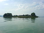
Freienbach Upload a file Ufenau
Ufenau A+ISOS 47°13′05″N 8°46′54″E / 47.218055555°N 8.781666666°E / 47.218055555; 8.781666666 9670
Freienbach Upload a file
Pfäffikon Unterdorf ISOS 47°12′20″N 8°46′30″E / 47.2055°N 8.775°E / 47.2055; 8.775
Freienbach Upload a file Freienbach-Hurden-Seefeld
Freienbach-Hurden-Seefeld A 47°12′25″N 8°47′31″E / 47.2069°N 8.79208°E / 47.2069; 8.79208 9669

Galgenen

Location Upload Photo Object Cat. Coordinates KGS-Nr
Galgenen Upload a file Kapelle St. Jost
Kapelle St. Jost A 47°10′42″N 8°52′26″E / 47.178387°N 8.873876°E / 47.178387; 8.873876 4795
Galgenen Upload a file Katholische Pfarrkirche St. Martin
Katholische Pfarrkirche St. Martin A 47°10′56″N 8°52′28″E / 47.182294°N 8.874363°E / 47.182294; 8.874363 4794
Galgenen Upload a file
Haus B 47°10′51″N 8°52′38″E / 47.18091°N 8.87736°E / 47.18091; 8.87736 12826
Galgenen Upload a file
Haus Chromenhof B 47°10′58″N 8°52′32″E / 47.18267°N 8.87565°E / 47.18267; 8.87565 12827
Galgenen Upload a file
Haus Chürzi B 47°10′57″N 8°51′58″E / 47.18259°N 8.86599°E / 47.18259; 8.86599 12828
Galgenen Upload a file
Haus Fuchsrons B 47°10′36″N 8°51′48″E / 47.17676°N 8.86326°E / 47.17676; 8.86326 12829
Galgenen Upload a file Siebnen
Siebnen ISOS 47°10′28″N 8°53′49″E / 47.174444444°N 8.896944444°E / 47.174444444; 8.896944444

Gersau

Location Upload Photo Object Cat. Coordinates KGS-Nr
Gersau Upload a file
Gersau ISOS 46°59′39″N 8°31′30″E / 46.99419°N 8.525°E / 46.99419; 8.525
Gersau Upload a file Pfarrkirche St. Marzellus
Pfarrkirche St. Marzellus A 46°59′28″N 8°31′45″E / 46.991232°N 8.529256°E / 46.991232; 8.529256 4799
Gersau Upload a file Altes Rathaus
Altes Rathaus B 46°59′30″N 8°31′39″E / 46.99165°N 8.52741°E / 46.99165; 8.52741 12831
Gersau Upload a file
Gross-Landammannhaus B 46°59′29″N 8°31′39″E / 46.99127°N 8.52751°E / 46.99127; 8.52751 12832
Gersau Upload a file
Haus B 46°59′30″N 8°31′36″E / 46.99156°N 8.52673°E / 46.99156; 8.52673 12833
Gersau Upload a file
Haus Hof B 46°59′30″N 8°31′38″E / 46.99166°N 8.52711°E / 46.99166; 8.52711 4796
Gersau Upload a file Haus Minerva
Haus Minerva B 46°59′28″N 8°31′42″E / 46.99102°N 8.52833°E / 46.99102; 8.52833 4798
Gersau Upload a file
Kapelle Mariahilf, Kindli B 46°59′23″N 8°33′03″E / 46.98959°N 8.55088°E / 46.98959; 8.55088 4800
Gersau Upload a file
Majorenhaus B 46°59′29″N 8°31′42″E / 46.99144°N 8.52839°E / 46.99144; 8.52839 12834
Gersau Upload a file
Pfarrhaus B 46°59′29″N 8°31′44″E / 46.99149°N 8.52883°E / 46.99149; 8.52883 10182
Gersau Upload a file
Pfarrhelferhaus B 46°59′29″N 8°32′30″E / 46.9914°N 8.54177°E / 46.9914; 8.54177 10183
Gersau Upload a file
Villa Flora B 46°59′32″N 8°31′26″E / 46.99214°N 8.52378°E / 46.99214; 8.52378 12835

Illgau

Location Upload Photo Object Cat. Coordinates KGS-Nr
Illgau Upload a file Sigristenhaus
Sigristenhaus B 46°59′15″N 8°43′26″E / 46.987453°N 8.723813°E / 46.987453; 8.723813 4802

Ingenbohl

Location Upload Photo Object Cat. Coordinates KGS-Nr
Ingenbohl Upload a file Bahnhof Brunnen
Bahnhof Brunnen B 46°59′57″N 8°36′36″E / 46.99925°N 8.61002°E / 46.99925; 8.61002 4803
Ingenbohl Upload a file
Institut Ingenbohl, Archiv B 46°59′58″N 8°37′01″E / 46.9995°N 8.61691°E / 46.9995; 8.61691 8915
Ingenbohl Upload a file
Beinhaus B 47°00′02″N 8°36′57″E / 47.00052°N 8.61571°E / 47.00052; 8.61571 12836
Ingenbohl Upload a file
Brunnen, Letzimauer B 46°59′42″N 8°36′13″E / 46.99509°N 8.60349°E / 46.99509; 8.60349 4806
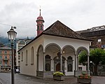
Ingenbohl Upload a file Dorfkapelle Brunnen
Dorfkapelle Brunnen B 46°59′39″N 8°36′18″E / 46.99417°N 8.60505°E / 46.99417; 8.60505 12837
Ingenbohl Upload a file
Haus B 46°59′40″N 8°36′21″E / 46.99436°N 8.60584°E / 46.99436; 8.60584 12839
Ingenbohl Upload a file
Haus B 46°59′49″N 8°36′26″E / 46.99703°N 8.60735°E / 46.99703; 8.60735 12840
Ingenbohl Upload a file
Haus B 47°00′05″N 8°35′29″E / 47.00133°N 8.5914°E / 47.00133; 8.5914 12842
Ingenbohl Upload a file
Haus B 47°00′42″N 8°36′57″E / 47.01179°N 8.61595°E / 47.01179; 8.61595 12843
Ingenbohl Upload a file
Haus B 46°59′56″N 8°38′06″E / 46.999°N 8.63487°E / 46.999; 8.63487 12844
Ingenbohl Upload a file
Haus B 46°59′39″N 8°36′19″E / 46.99428°N 8.60534°E / 46.99428; 8.60534 12838
Ingenbohl Upload a file
Haus B 47°00′22″N 8°37′55″E / 47.00613°N 8.632°E / 47.00613; 8.632 12841
Ingenbohl Upload a file Haus (Gasthaus zur Taube)
Haus (Gasthaus zur Taube) B 46°59′39″N 8°36′21″E / 46.99403°N 8.60572°E / 46.99403; 8.60572 12845
Ingenbohl Upload a file
Haus (Grabachern) B 47°00′01″N 8°37′57″E / 47.00038°N 8.63256°E / 47.00038; 8.63256 12846
Ingenbohl Upload a file
Haus (Hotel Rütli) B 46°59′39″N 8°36′21″E / 46.99428°N 8.60583°E / 46.99428; 8.60583 12847
Ingenbohl Upload a file Haus (Hotel Waldstätterhof)
Haus (Hotel Waldstätterhof) B 46°59′38″N 8°36′13″E / 46.993799°N 8.603659°E / 46.993799; 8.603659 4807
Ingenbohl Upload a file Haus (Hotel Weisses Rössli)
Haus (Hotel Weisses Rössli) B 46°59′39″N 8°36′21″E / 46.9942°N 8.60578°E / 46.9942; 8.60578 12848
Ingenbohl Upload a file
Haus (Restaurant Poststübli) B 46°59′39″N 8°36′21″E / 46.99415°N 8.60572°E / 46.99415; 8.60572 12849
Ingenbohl Upload a file
Haus (Theresianum) B 46°59′50″N 8°36′55″E / 46.99722°N 8.61537°E / 46.99722; 8.61537 4810
Ingenbohl Upload a file
Haus (Villa Schoeck) B 46°59′37″N 8°36′28″E / 46.99363°N 8.60765°E / 46.99363; 8.60765 12850
Ingenbohl Upload a file
Haus Grand Palais B 46°59′34″N 8°36′32″E / 46.99288°N 8.60875°E / 46.99288; 8.60875 4805
Ingenbohl Upload a file
Kapelle St. Laurentius B 47°00′24″N 8°36′33″E / 47.00657°N 8.60907°E / 47.00657; 8.60907 4812
Ingenbohl Upload a file Kapelle St. Wendelin
Kapelle St. Wendelin B 46°59′55″N 8°37′51″E / 46.99862°N 8.63079°E / 46.99862; 8.63079 4811
Ingenbohl Upload a file
Pfarrhaus B 47°00′01″N 8°36′58″E / 47.00036°N 8.61623°E / 47.00036; 8.61623 12851
Ingenbohl Upload a file Pfarrkirche St. Leonhard
Pfarrkirche St. Leonhard B 47°00′02″N 8°36′55″E / 47.00055°N 8.61518°E / 47.00055; 8.61518 4809
Ingenbohl Upload a file
Sigristenhaus B 47°00′01″N 8°36′52″E / 47.00034°N 8.61435°E / 47.00034; 8.61435 12852
Ingenbohl Upload a file
Wylerbrücke B 47°00′11″N 8°36′16″E / 47.003°N 8.60458°E / 47.003; 8.60458 4808
Ingenbohl Upload a file Brunnen
Brunnen ISOS 46°59′43″N 8°36′17″E / 46.995277777°N 8.604722222°E / 46.995277777; 8.604722222

Innerthal

Location Upload Photo Object Cat. Coordinates KGS-Nr
Innerthal Upload a file Pfarrhaus
Pfarrhaus B 47°06′22″N 8°55′07″E / 47.10616°N 8.91864°E / 47.10616; 8.91864 12853
Innerthal Upload a file Pfarrkirche St. Katharina
Pfarrkirche St. Katharina B 47°06′22″N 8°55′09″E / 47.10616°N 8.91917°E / 47.10616; 8.91917 12854

Küssnacht

Location Upload Photo Object Cat. Coordinates KGS-Nr
Küssnacht Upload a file
Archiv Bethlehem Mission B 47°05′35″N 8°27′17″E / 47.09308°N 8.45482°E / 47.09308; 8.45482 8774
Küssnacht Upload a file "Hohle Gasse" and Tell Chapel
"Hohle Gasse" and Tell Chapel A 47°05′33″N 8°27′11″E / 47.092602°N 8.453169°E / 47.092602; 8.453169 4815
Küssnacht Upload a file Gesslerburg
Gesslerburg A 47°04′55″N 8°26′55″E / 47.082018°N 8.448663°E / 47.082018; 8.448663 4813
Küssnacht Upload a file
Gasthaus Rössli B 47°04′51″N 8°26′28″E / 47.08092°N 8.441°E / 47.08092; 8.441 10186
Küssnacht Upload a file
Haus B 47°05′27″N 8°25′06″E / 47.09074°N 8.41827°E / 47.09074; 8.41827 12856
Küssnacht Upload a file
Haus B 47°03′53″N 8°26′28″E / 47.06481°N 8.4411°E / 47.06481; 8.4411 9752
Küssnacht Upload a file
Haus B 47°04′52″N 8°26′26″E / 47.08099°N 8.44056°E / 47.08099; 8.44056 10189
Küssnacht Upload a file
Haus B 47°05′53″N 8°25′33″E / 47.09796°N 8.42578°E / 47.09796; 8.42578 12855
Küssnacht Upload a file
Haus B 47°04′52″N 8°26′30″E / 47.08117°N 8.44169°E / 47.08117; 8.44169 10187
Küssnacht Upload a file
Haus B 47°05′24″N 8°25′06″E / 47.09003°N 8.41843°E / 47.09003; 8.41843 12857
Küssnacht Upload a file
Haus B 47°03′58″N 8°24′30″E / 47.0661°N 8.40837°E / 47.0661; 8.40837 12858
Küssnacht Upload a file
Haus B 47°04′07″N 8°26′15″E / 47.06853°N 8.43761°E / 47.06853; 8.43761 4816
Küssnacht Upload a file
Haus B 47°04′50″N 8°26′28″E / 47.08065°N 8.44106°E / 47.08065; 8.44106 13395
Küssnacht Upload a file
Haus Grossmatt B 47°04′01″N 8°24′35″E / 47.06685°N 8.40964°E / 47.06685; 8.40964 12859
Küssnacht Upload a file Haus Husmatt
Haus Husmatt B 47°03′56″N 8°24′27″E / 47.06542°N 8.4076°E / 47.06542; 8.4076 12860
Küssnacht Upload a file
Haus Merlischachen B 47°03′59″N 8°24′31″E / 47.06631°N 8.40871°E / 47.06631; 8.40871 12864
Küssnacht Upload a file
Haus Räber B 47°03′58″N 8°24′33″E / 47.0661°N 8.40904°E / 47.0661; 8.40904 12861
Küssnacht Upload a file
Haus Seehof B 47°04′49″N 8°26′21″E / 47.0803°N 8.43915°E / 47.0803; 8.43915 12862
Küssnacht Upload a file
Haus zur Sonne B 47°04′53″N 8°26′30″E / 47.08136°N 8.44168°E / 47.08136; 8.44168 12863
Küssnacht Upload a file
Heimatmuseum B 47°04′50″N 8°26′26″E / 47.08065°N 8.44047°E / 47.08065; 8.44047 4818
Küssnacht Upload a file
Hotel Adler B 47°04′52″N 8°26′29″E / 47.08109°N 8.44127°E / 47.08109; 8.44127 10191
Küssnacht Upload a file Hotel Engel
Hotel Engel B 47°04′52″N 8°26′28″E / 47.08124°N 8.441°E / 47.08124; 8.441 10192
Küssnacht Upload a file
Hotel Hirschen B 47°04′51″N 8°26′27″E / 47.08074°N 8.44074°E / 47.08074; 8.44074 12865
Küssnacht Upload a file
Kapelle St. Katharina B 47°05′25″N 8°25′05″E / 47.09037°N 8.41817°E / 47.09037; 8.41817 12866
Küssnacht Upload a file
Kapelle St. Martin im Tal B 47°06′00″N 8°26′42″E / 47.09992°N 8.445°E / 47.09992; 8.445 4820
Küssnacht Upload a file
Kappelmatt B 47°04′00″N 8°24′33″E / 47.06653°N 8.40903°E / 47.06653; 8.40903 12867
Küssnacht Upload a file
Nühus B 47°05′50″N 8°26′17″E / 47.09714°N 8.43804°E / 47.09714; 8.43804 12868
Küssnacht Upload a file Pfarrhaus
Pfarrhaus B 47°04′49″N 8°26′26″E / 47.08036°N 8.44068°E / 47.08036; 8.44068 10193
Küssnacht Upload a file Pfarrkirche St. Peter und Paul
Pfarrkirche St. Peter und Paul B 47°04′49″N 8°26′24″E / 47.0803°N 8.44011°E / 47.0803; 8.44011 4819
Küssnacht Upload a file Pfarrkirche St. Sebastian
Pfarrkirche St. Sebastian B 47°05′44″N 8°27′42″E / 47.09563°N 8.46171°E / 47.09563; 8.46171 12869
Küssnacht Upload a file Rathaus I
Rathaus I B 47°04′48″N 8°26′24″E / 47.07991°N 8.44006°E / 47.07991; 8.44006 4822
Küssnacht Upload a file Rathaus II
Rathaus II B 47°04′47″N 8°26′26″E / 47.07984°N 8.44046°E / 47.07984; 8.44046 10194
Küssnacht Upload a file Swiss Chalet
Swiss Chalet B 47°03′56″N 8°24′28″E / 47.06555°N 8.40775°E / 47.06555; 8.40775 12870
Küssnacht Upload a file
Küssnacht am Rigi ISOS 47°04′59″N 8°26′22″E / 47.083°N 8.4395°E / 47.083; 8.4395
Küssnacht Upload a file Merlischachen
Merlischachen ISOS 47°03′56″N 8°24′29″E / 47.065555555°N 8.408055555°E / 47.065555555; 8.408055555

Lachen

Location Upload Photo Object Cat. Coordinates KGS-Nr
Lachen Upload a file Katholische Pfarrkirche Heilig-Kreuz
Katholische Pfarrkirche Heilig-Kreuz A 47°11′33″N 8°51′03″E / 47.192391°N 8.850879°E / 47.192391; 8.850879 4823
Lachen Upload a file Gemeindehaus
Gemeindehaus B 47°11′36″N 8°51′02″E / 47.19324°N 8.85066°E / 47.19324; 8.85066 12871
Lachen Upload a file
Haus B 47°11′35″N 8°51′05″E / 47.19309°N 8.85149°E / 47.19309; 8.85149 12873
Lachen Upload a file
Haus B 47°11′30″N 8°50′56″E / 47.19159°N 8.84875°E / 47.19159; 8.84875 12874
Lachen Upload a file
Haus B 47°11′34″N 8°51′09″E / 47.19279°N 8.8525°E / 47.19279; 8.8525 12872
Lachen Upload a file
Haus Hirschen B 47°11′33″N 8°51′07″E / 47.19258°N 8.85182°E / 47.19258; 8.85182 12875
Lachen Upload a file
Haus Riethöfli B 47°11′37″N 8°51′13″E / 47.19374°N 8.85359°E / 47.19374; 8.85359 12876
Lachen Upload a file
Haus Schlössli B 47°11′33″N 8°51′13″E / 47.19247°N 8.8536°E / 47.19247; 8.8536 12877
Lachen Upload a file
Haus Traube B 47°11′34″N 8°51′08″E / 47.19286°N 8.85212°E / 47.19286; 8.85212 12878
Lachen Upload a file
Haus, Adler, Katholisches Vereinshaus B 47°11′35″N 8°51′06″E / 47.19302°N 8.85167°E / 47.19302; 8.85167 12879
Lachen Upload a file
Haus, ehem. Storchen B 47°11′34″N 8°51′07″E / 47.19289°N 8.85199°E / 47.19289; 8.85199 12880
Lachen Upload a file Kapelle zur schmerzhaften Muttergottes, Ried
Kapelle zur schmerzhaften Muttergottes, Ried B 47°11′41″N 8°51′24″E / 47.1947°N 8.85676°E / 47.1947; 8.85676 4824
Lachen Upload a file
Marienbrunnen B 47°11′37″N 8°51′11″E / 47.19353°N 8.85302°E / 47.19353; 8.85302 4825
Lachen Upload a file
Rathaus B 47°11′34″N 8°51′06″E / 47.19275°N 8.85168°E / 47.19275; 8.85168 4826
Lachen Upload a file
Schwesternhaus, ehem. Villa Stählin B 47°11′30″N 8°51′10″E / 47.19179°N 8.85272°E / 47.19179; 8.85272 12881

Lauerz

Location Upload Photo Object Cat. Coordinates KGS-Nr
Lauerz Upload a file Burgruine
Burgruine B 47°01′57″N 8°35′51″E / 47.032459°N 8.597367°E / 47.032459; 8.597367 10195
Lauerz Upload a file Haus
Haus B 47°02′06″N 8°34′51″E / 47.035018°N 8.580738°E / 47.035018; 8.580738 12882
Lauerz Upload a file Haus Ahornberg
Haus Ahornberg B 47°01′22″N 8°35′18″E / 47.022735°N 8.588357°E / 47.022735; 8.588357 12883
Lauerz Upload a file
Haus Schwanau B 47°01′57″N 8°35′50″E / 47.032362°N 8.597181°E / 47.032362; 8.597181 12884
Lauerz Upload a file
Kapelle B 47°01′57″N 8°35′49″E / 47.032364°N 8.596984°E / 47.032364; 8.596984 10196
Lauerz Upload a file Pfarrkirche St. Nikolaus
Pfarrkirche St. Nikolaus B 47°02′07″N 8°34′49″E / 47.035357°N 8.580206°E / 47.035357; 8.580206 12759

Morschach

Location Upload Photo Object Cat. Coordinates KGS-Nr
Morschach Upload a file Haus Silbergasse
Haus Silbergasse A 46°58′58″N 8°37′21″E / 46.982868°N 8.622457°E / 46.982868; 8.622457 11627
Morschach Upload a file Haus Tannen
Haus Tannen A 46°57′43″N 8°37′10″E / 46.961866°N 8.619471°E / 46.961866; 8.619471 11628
Morschach Upload a file Haus Tannen (Sträbismattli)
Haus Tannen (Sträbismattli) A 46°57′42″N 8°37′14″E / 46.961667°N 8.620426°E / 46.961667; 8.620426 11629
Morschach Upload a file Beinhaus
Beinhaus B 46°58′53″N 8°37′12″E / 46.98142°N 8.62001°E / 46.98142; 8.62001 10197
Morschach Upload a file Kapelle Franz-Xaverius
Kapelle Franz-Xaverius B 46°58′30″N 8°37′06″E / 46.97499°N 8.61825°E / 46.97499; 8.61825 4830
Morschach Upload a file
Pfarrhaus B 46°58′53″N 8°37′08″E / 46.98148°N 8.61892°E / 46.98148; 8.61892 10199
Morschach Upload a file Pfarrkirche St. Gallus
Pfarrkirche St. Gallus B 46°58′54″N 8°37′12″E / 46.98154°N 8.62002°E / 46.98154; 8.62002 10198

Muotathal

Location Upload Photo Object Cat. Coordinates KGS-Nr
Muotathal Upload a file
Wüstungen im Kanton Schwyz B 46°57′55″N 8°50′57″E / 46.96516°N 8.84924°E / 46.96516; 8.84924 9671
Muotathal Upload a file Katholische Pfarrkirche St. Sigismund und Walpurga
Katholische Pfarrkirche St. Sigismund und Walpurga A 46°58′39″N 8°45′36″E / 46.97738°N 8.760048°E / 46.97738; 8.760048 4833
Muotathal Upload a file
Alphütte, Äbnetmatt B 46°57′18″N 8°47′25″E / 46.95508°N 8.79024°E / 46.95508; 8.79024 9754
Muotathal Upload a file Frauenkloster St. Josef
Frauenkloster St. Josef B 46°58′33″N 8°45′48″E / 46.97572°N 8.76342°E / 46.97572; 8.76342 4831
Muotathal Upload a file
Führungsbunker Selgis A 7444 (Wandbilder) B 46°59′33″N 8°41′13″E / 46.99259°N 8.68689°E / 46.99259; 8.68689 4832
Muotathal Upload a file Haus
Haus B 46°58′40″N 8°45′34″E / 46.97766°N 8.75944°E / 46.97766; 8.75944 10202
Muotathal Upload a file Haus
Haus B 46°58′38″N 8°45′39″E / 46.97715°N 8.7607°E / 46.97715; 8.7607 10203
Muotathal Upload a file Haus
Haus B 46°58′30″N 8°46′18″E / 46.97501°N 8.77169°E / 46.97501; 8.77169 9753
Muotathal Upload a file Haus (Gasthaus Hirschen)
Haus (Gasthaus Hirschen) B 46°58′40″N 8°45′33″E / 46.97766°N 8.75913°E / 46.97766; 8.75913 10201
Muotathal Upload a file Haus Niedermatt, Ried (Kleinhaus)
Haus Niedermatt, Ried (Kleinhaus) B 46°59′15″N 8°42′46″E / 46.98754°N 8.71271°E / 46.98754; 8.71271 12760
Muotathal Upload a file Haus, Hinterthal
Haus, Hinterthal B 46°58′35″N 8°46′01″E / 46.97649°N 8.76699°E / 46.97649; 8.76699 12891
Muotathal Upload a file
Haus, Ried B 46°58′45″N 8°43′58″E / 46.97914°N 8.73267°E / 46.97914; 8.73267 12892
Muotathal Upload a file Kapelle Kerchel
Kapelle Kerchel B 46°58′40″N 8°45′31″E / 46.97767°N 8.75861°E / 46.97767; 8.75861 10200
Muotathal Upload a file Kirche Herz-Jesu, Bisisthal
Kirche Herz-Jesu, Bisisthal B 46°56′38″N 8°49′53″E / 46.94388°N 8.83147°E / 46.94388; 8.83147 12893
Muotathal Upload a file Pfarrhaus
Pfarrhaus B 46°58′39″N 8°45′30″E / 46.9774°N 8.75821°E / 46.9774; 8.75821 10205
Muotathal Upload a file Pfarrhelferhaus
Pfarrhelferhaus B 46°58′39″N 8°45′30″E / 46.9774°N 8.75847°E / 46.9774; 8.75847 12894
Muotathal Upload a file Sigristenhaus
Sigristenhaus B 46°58′40″N 8°45′30″E / 46.97767°N 8.75835°E / 46.97767; 8.75835 10207