File:Überblicks-Karte zu den Aktionen der Fırka-i Islahiye 1865.jpg

Size of this preview: 800 × 500 pixels. Other resolutions: 320 × 200 pixels | 640 × 400 pixels | 1,024 × 640 pixels | 1,280 × 801 pixels | 1,813 × 1,134 pixels.
Original file (1,813 × 1,134 pixels, file size: 599 KB, MIME type: image/jpeg)
Captions
Captions
Add a one-line explanation of what this file represents
Summary edit
| Description |
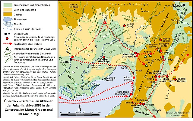
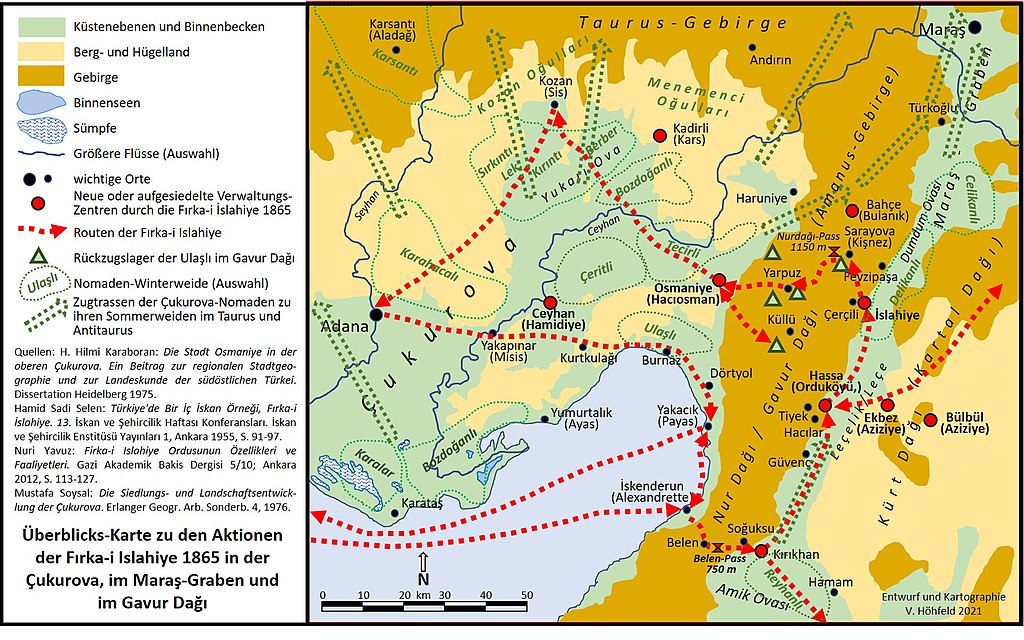
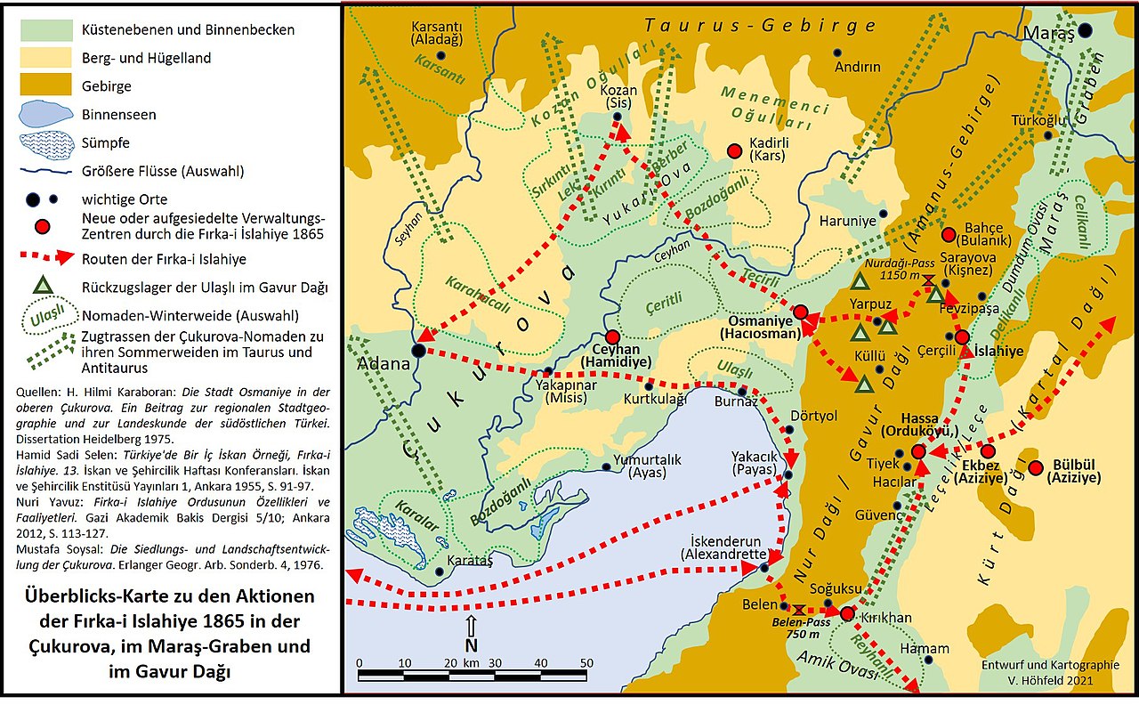
Deutsch: Die Karte skizziert den Ablauf und einzelne Stationen der militärischen Befriedungs-Aktionen der Fırka-i Islahiye 1865 in der Çukurova, im Maraş-Graben, im Gavur Dağı (Amanus-Gebirge) und in der Taurus-Region von Kozan unter der Leitung von Derviş Pascha und Ahmet Cevdet Pascha. |
| Date | |
| Source | Own work |
| Author | Volker Höhfeld |
Licensing edit
I, the copyright holder of this work, hereby publish it under the following license:
This file is licensed under the Creative Commons Attribution-Share Alike 4.0 International license.
- You are free:
- to share – to copy, distribute and transmit the work
- to remix – to adapt the work
- Under the following conditions:
- attribution – You must give appropriate credit, provide a link to the license, and indicate if changes were made. You may do so in any reasonable manner, but not in any way that suggests the licensor endorses you or your use.
- share alike – If you remix, transform, or build upon the material, you must distribute your contributions under the same or compatible license as the original.
File history
Click on a date/time to view the file as it appeared at that time.
| Date/Time | Thumbnail | Dimensions | User | Comment | |
|---|---|---|---|---|---|
| current | 17:06, 18 August 2021 | | 1,813 × 1,134 (599 KB) | Volker Höhfeld (talk | contribs) | Uploaded own work with UploadWizard |
You cannot overwrite this file.
File usage on Commons
There are no pages that use this file.
File usage on other wikis
The following other wikis use this file:
- Usage on de.wikipedia.org