File:Šķilbēnu ciemi 1979.jpg
Size of this preview: 800 × 600 pixels. Other resolutions: 320 × 240 pixels | 640 × 480 pixels | 1,024 × 768 pixels | 1,280 × 960 pixels | 2,560 × 1,920 pixels | 4,160 × 3,120 pixels.
Original file (4,160 × 3,120 pixels, file size: 3.65 MB, MIME type: image/jpeg)
Captions
Captions
Add a one-line explanation of what this file represents
Summary edit
| Description |
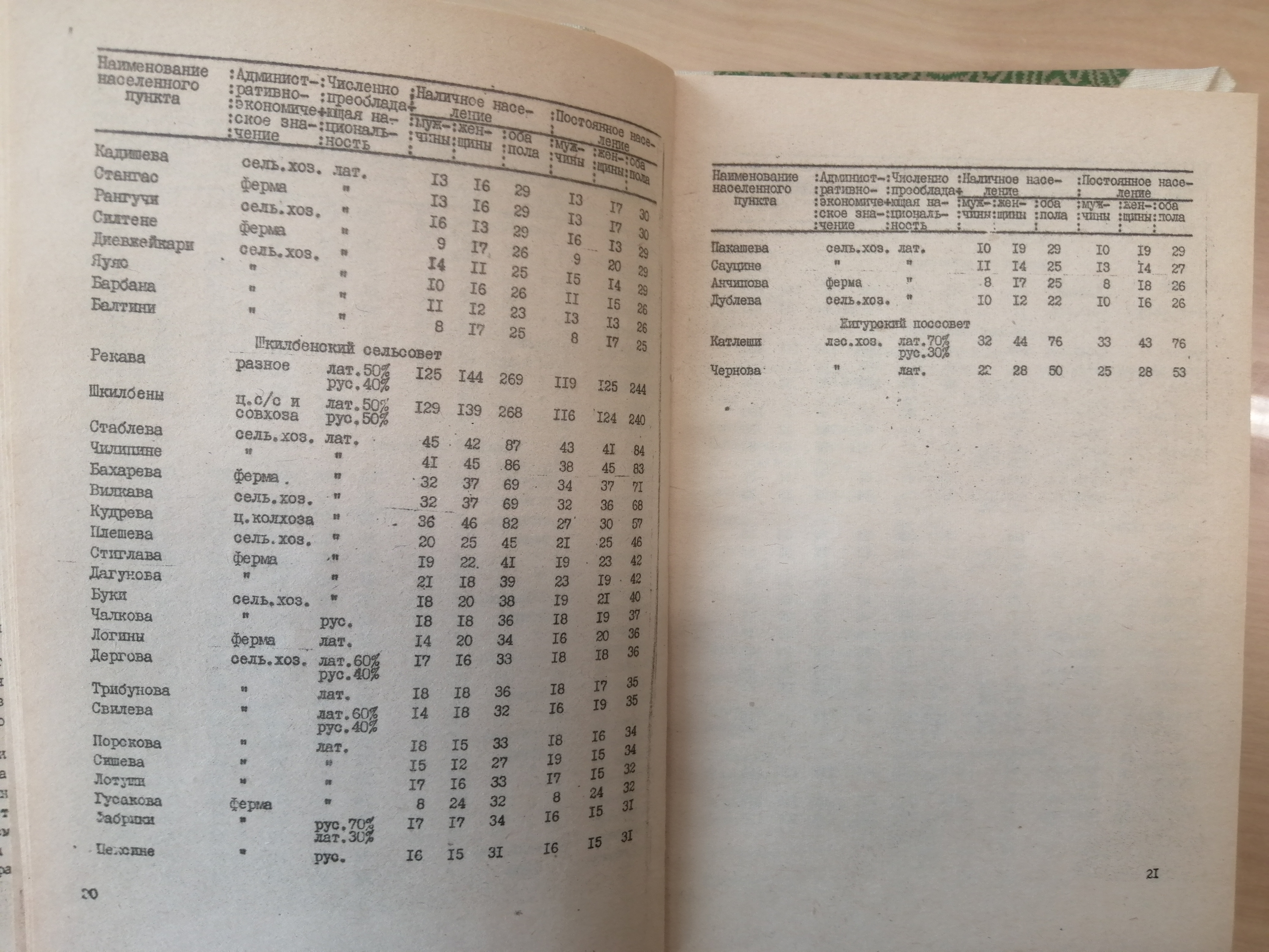
Latviešu: 1979.gadā tautas skaitīšana. |
| Date | |
| Source | Крупнейшие сельские населённые пункты Латвийской ССР. По данным Всесоюзной переписи 1979 года. |
| Author | ЦСУ Латвийской ССР 1980 год. |
| Camera location | | View this and other nearby images on: OpenStreetMap |
|---|
Licensing edit
This file is licensed under the Creative Commons Attribution-Share Alike 4.0 International license.
- You are free:
- to share – to copy, distribute and transmit the work
- to remix – to adapt the work
- Under the following conditions:
- attribution – You must give appropriate credit, provide a link to the license, and indicate if changes were made. You may do so in any reasonable manner, but not in any way that suggests the licensor endorses you or your use.
- share alike – If you remix, transform, or build upon the material, you must distribute your contributions under the same or compatible license as the original.
File history
Click on a date/time to view the file as it appeared at that time.
| Date/Time | Thumbnail | Dimensions | User | Comment | |
|---|---|---|---|---|---|
| current | 14:06, 13 August 2022 | | 4,160 × 3,120 (3.65 MB) | Prieditis2012 (talk | contribs) | Uploaded a work by ЦСУ Латвийской ССР 1980 год. from Крупнейшие сельские населённые пункты Латвийской ССР. По данным Всесоюзной переписи 1979 года. with UploadWizard |
You cannot overwrite this file.
File usage on Commons
There are no pages that use this file.