File:Škarda, Ist, Molat, Tun Veli.jpg
No higher resolution available.
Škarda,_Ist,_Molat,_Tun_Veli.jpg (700 × 500 pixels, file size: 144 KB, MIME type: image/jpeg)
Captions
Captions
Add a one-line explanation of what this file represents
Summary edit
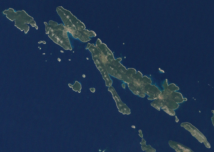
| Description |
English: This picture shows some of the Croatian Islands in the Adriatic Sea. Image captured by the Enhanced Thematic Mapper (ETM) on NASA’s Landsat 7 satellite. Landsat data provided by the United States Geological Survey. |
| Date | |
| Source | NASA Earth Observatory |
| Author | Jesse Allen and Robert Simmon |
| Other versions |

Licensing edit
| This file is in the public domain in the United States because it was solely created by NASA. NASA copyright policy states that "NASA material is not protected by copyright unless noted". (See Template:PD-USGov, NASA copyright policy page or JPL Image Use Policy.) | ||
 |
Warnings:
|
| Annotations | This image is annotated: View the annotations at Commons |
File history
Click on a date/time to view the file as it appeared at that time.
| Date/Time | Thumbnail | Dimensions | User | Comment | |
|---|---|---|---|---|---|
| current | 10:45, 29 April 2022 | | 700 × 500 (144 KB) | Argo Navis (talk | contribs) | File:Islands off the Croatian Coast.jpg cropped 83 % horizontally, 88 % vertically using CropTool with precise mode. |
You cannot overwrite this file.
File usage on Commons
The following page uses this file:
File usage on other wikis
The following other wikis use this file:
- Usage on hr.wikipedia.org