File:Австрійська карта Шманьківчиків з місцевістю Струсівка, 1.jpg

Size of this preview: 739 × 600 pixels. Other resolutions: 296 × 240 pixels | 591 × 480 pixels | 946 × 768 pixels | 1,262 × 1,024 pixels | 2,523 × 2,048 pixels | 20,257 × 16,444 pixels.
Original file (20,257 × 16,444 pixels, file size: 134.69 MB, MIME type: image/jpeg)
Captions
Captions
Add a one-line explanation of what this file represents
Summary edit
| Warning | The original file is very high-resolution. It might not load properly or could cause your browser to freeze when opened at full size. |
|---|
| Description |
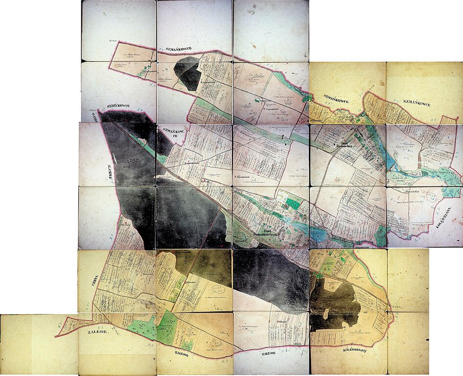
Українська: Австрійська карта XIX ст. Шманьківчиків з місцевістю Струсівка |
| Date | |
| Source | ДАТО Ф-146 Оп-1 спр. 910 |
| Author | Unknown author |
Licensing edit
|
This work is in the public domain in its country of origin and other countries and areas where the copyright term is the author's life plus 70 years or fewer. This work is in the public domain in the United States because it was published (or registered with the U.S. Copyright Office) before January 1, 1929. | |
| This file has been identified as being free of known restrictions under copyright law, including all related and neighboring rights. | |
File history
Click on a date/time to view the file as it appeared at that time.
| Date/Time | Thumbnail | Dimensions | User | Comment | |
|---|---|---|---|---|---|
| current | 04:00, 13 May 2021 | | 20,257 × 16,444 (134.69 MB) | Максим Огородник (talk | contribs) | Uploaded a work by Державний архів Тернопільської области from ДАТО Ф-146 Оп-1 спр. 910 with UploadWizard |
You cannot overwrite this file.
File usage on Commons
The following 7 pages use this file:
- File:Австрійська карта Шманьківчиків з місцевістю Струсівка, 6.jpg
- File:Австрійська карта Шманьківчиків з місцевістю Струсівка, Катеринівка (хутір) та Загуменки (ліс).jpg
- File:Австрійська карта Шманьківчиків з місцевістю Струсівка, Місцевість на Струсівці, де була церква, 13.jpg
- File:Австрійська карта Шманьківчиків з місцевістю Струсівка, Палац Плятнера, 14.jpg
- File:Австрійська карта Шманьківчиків з місцевістю Струсівка, Петрівка (хутір), 8.jpg
- File:Австрійська карта Шманьківчиків з місцевістю Струсівка, Фрідріхівка (хутір), 7.jpg
- File:Австрійська карта Шманьківчиків з місцевістю Струсівка, Церква св. Юрія Побідоносця, 15.jpg
_%D1%82%D0%B0_%D0%97%D0%B0%D0%B3%D1%83%D0%BC%D0%B5%D0%BD%D0%BA%D0%B8_(%D0%BB%D1%96%D1%81).jpg)
,_8.jpg)
,_7.jpg)