File:Карта Терской области (составлена по карте 1868 года).jpg
Size of this preview: 800 × 533 pixels. Other resolutions: 320 × 213 pixels | 640 × 427 pixels | 1,024 × 683 pixels | 1,280 × 853 pixels | 2,560 × 1,707 pixels | 6,300 × 4,200 pixels.
Original file (6,300 × 4,200 pixels, file size: 7.89 MB, MIME type: image/jpeg)
Captions
Captions
Add a one-line explanation of what this file represents
Summary edit
.jpg&action=edit§ion=1)
| Description |
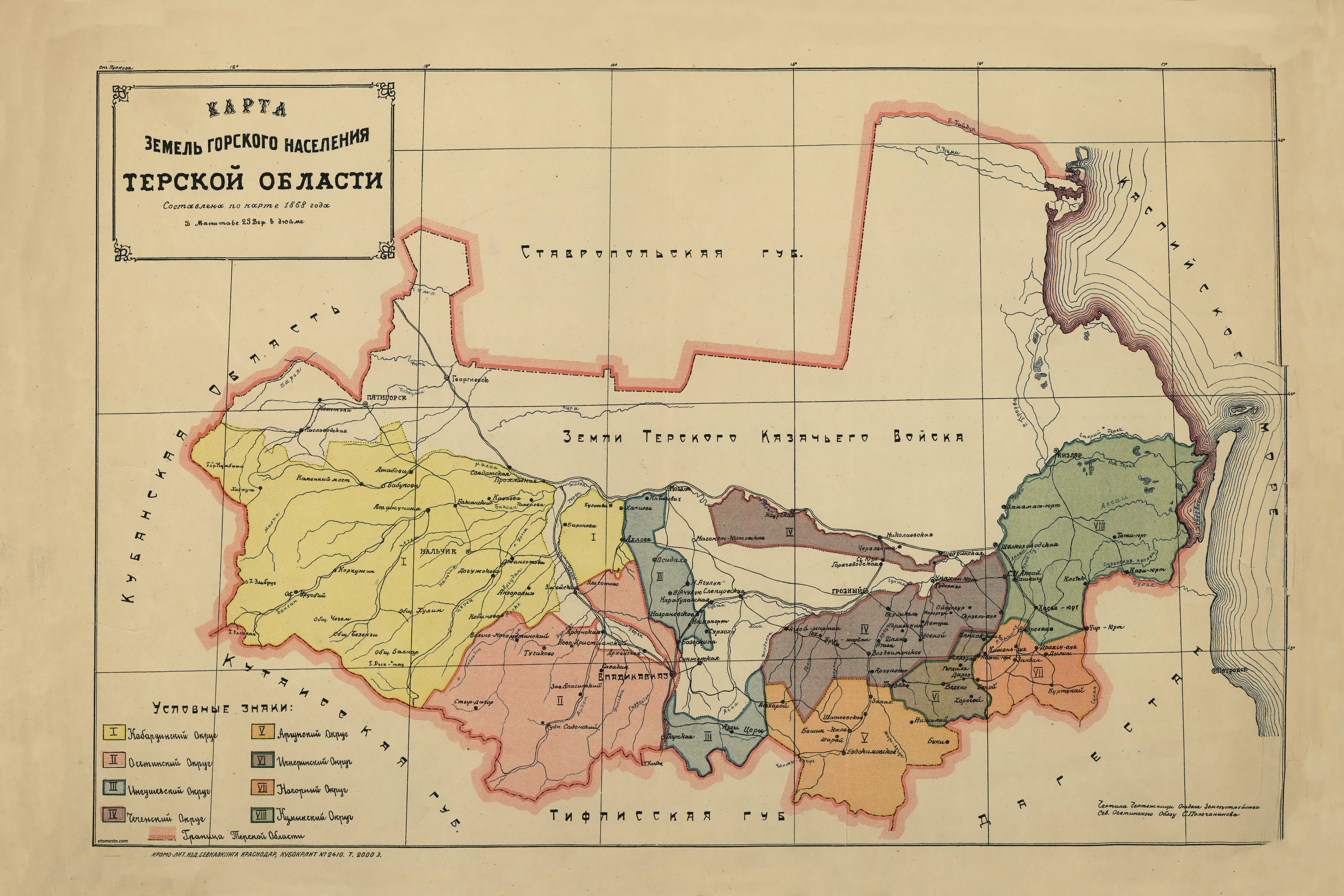
Русский: Карта земель горского населения Терской области составлена по карте 1868 года в масштабе 25 верст в дюйме. Чертила чертежница Отдела землеустройства Северо-Осетинского Облзу С. Полочанинова. Размер листа 53x35 см. Хромолитография издательства Севкавказкнига, Краснодар. Тираж 2000 экз. |
| Date | |
| Source | [1] |
| Author | С. Полочанинова |
Licensing edit
.jpg&action=edit§ion=2)
|
This work is in the public domain in its country of origin and other countries and areas where the copyright term is the author's life plus 70 years or fewer. This work is in the public domain in the United States because it was published (or registered with the U.S. Copyright Office) before January 1, 1929. | |
| This file has been identified as being free of known restrictions under copyright law, including all related and neighboring rights. | |
File history
Click on a date/time to view the file as it appeared at that time.
| Date/Time | Thumbnail | Dimensions | User | Comment | |
|---|---|---|---|---|---|
| current | 14:07, 19 July 2021 | | 6,300 × 4,200 (7.89 MB) | Staraya map (talk | contribs) | Uploaded a work by С. Полочанинова from [http://www.etomesto.ru/map-kuban_osetia_terskaya-obl-1920/] with UploadWizard |
You cannot overwrite this file.
File usage on Commons
There are no pages that use this file.
.jpg&oldid=873934550)