File:План генерального межевания (ПГМ) уездов Казанской губернии.jpg

Size of this preview: 800 × 570 pixels. Other resolutions: 320 × 228 pixels | 640 × 456 pixels | 1,024 × 730 pixels | 1,280 × 913 pixels | 2,285 × 1,629 pixels.
Original file (2,285 × 1,629 pixels, file size: 1.46 MB, MIME type: image/jpeg)
Captions
Captions
Add a one-line explanation of what this file represents
Summary edit
_%D1%83%D0%B5%D0%B7%D0%B4%D0%BE%D0%B2_%D0%9A%D0%B0%D0%B7%D0%B0%D0%BD%D1%81%D0%BA%D0%BE%D0%B9_%D0%B3%D1%83%D0%B1%D0%B5%D1%80%D0%BD%D0%B8%D0%B8.jpg&action=edit§ion=1)
| Description |
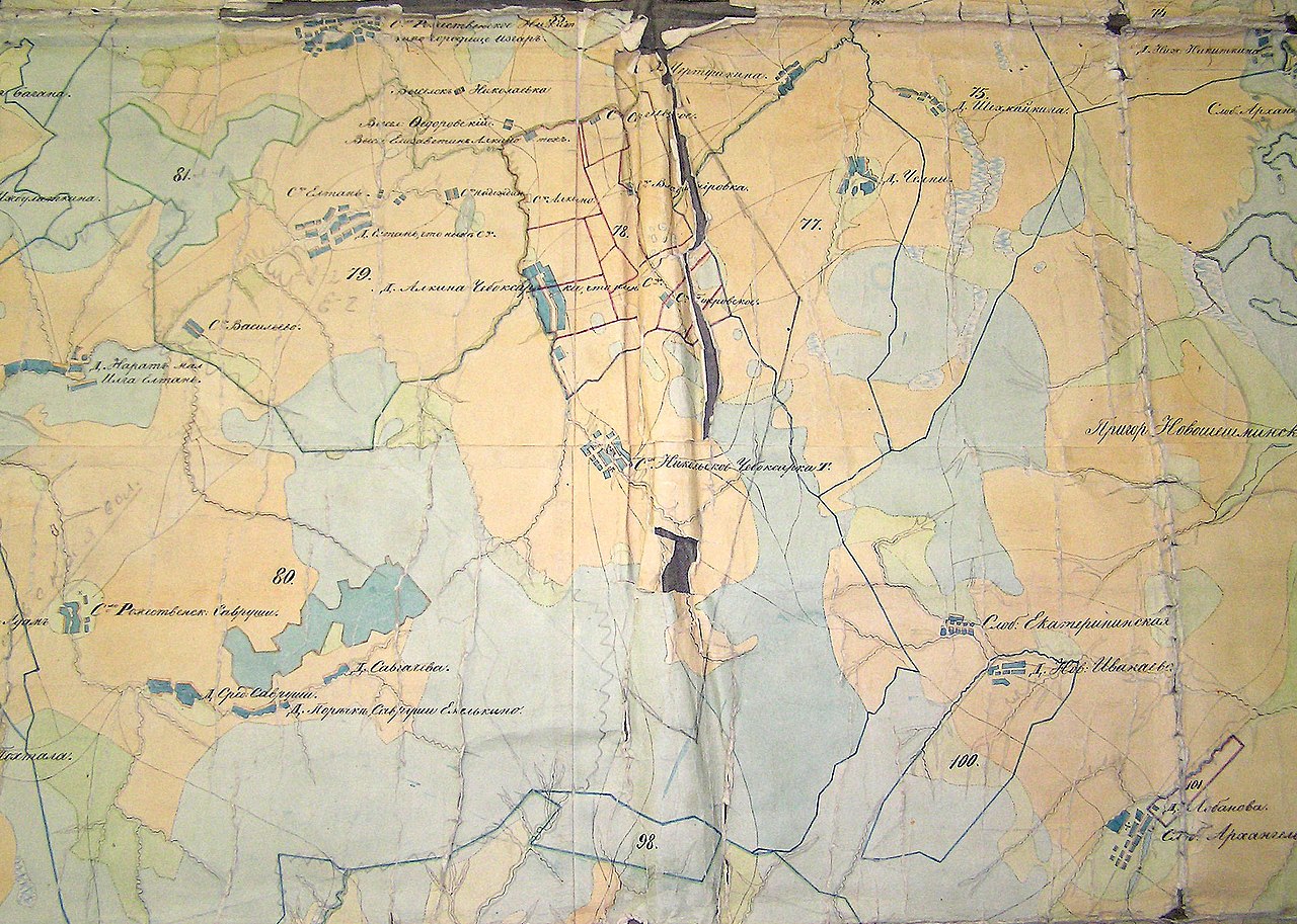
Русский: Село Старые Савруши и его окрестности. Фрагмент плана Генерального Межевания уездов и губерний Российской Империи |
| Date | between 1766 and 1836 |
| Source | http://maps.southklad.ru/plany-generalnogo-mezhevaniya |
| Author | Комиссии о государственном межевании |
Licensing edit
_%D1%83%D0%B5%D0%B7%D0%B4%D0%BE%D0%B2_%D0%9A%D0%B0%D0%B7%D0%B0%D0%BD%D1%81%D0%BA%D0%BE%D0%B9_%D0%B3%D1%83%D0%B1%D0%B5%D1%80%D0%BD%D0%B8%D0%B8.jpg&action=edit§ion=2)
|
This work is in the public domain in its country of origin and other countries and areas where the copyright term is the author's life plus 70 years or fewer. This work is in the public domain in the United States because it was published (or registered with the U.S. Copyright Office) before January 1, 1929. | |
| This file has been identified as being free of known restrictions under copyright law, including all related and neighboring rights. | |
File history
Click on a date/time to view the file as it appeared at that time.
| Date/Time | Thumbnail | Dimensions | User | Comment | |
|---|---|---|---|---|---|
| current | 06:07, 20 March 2015 | | 2,285 × 1,629 (1.46 MB) | Савруш (talk | contribs) | User created page with UploadWizard |
You cannot overwrite this file.
File usage on Commons
There are no pages that use this file.
_уездов_Казанской_губернии.jpg&oldid=342786428)