File:خريطة محافظة الإسماعيلية.jpg

Size of this preview: 669 × 599 pixels. Other resolutions: 268 × 240 pixels | 536 × 480 pixels | 857 × 768 pixels | 1,143 × 1,024 pixels | 2,002 × 1,794 pixels.
Original file (2,002 × 1,794 pixels, file size: 1.12 MB, MIME type: image/jpeg)
Captions
Captions
Add a one-line explanation of what this file represents
Summary edit
| Description |
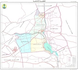
العربية: خريطة محافظة الإسماعيلية، مصر. |
| Date | |
| Source | إدارة المساحة العسكرية، وزارة الدفاع، مصر |
| Author | إدارة المساحة العسكرية، وزارة الدفاع، مصر |
Licensing edit
| This work is not an object of copyright in Egypt because it is an official document. Regardless of their source or target language, all official documents are ineligible for protection in Egypt, including laws, regulations, resolutions and decisions, international conventions, court decisions, award of arbitrators and decisions of administrative committees having judicial competence. (Article 141 of Intellectual Property Law 82 of 2002) | 
|
File history
Click on a date/time to view the file as it appeared at that time.
| Date/Time | Thumbnail | Dimensions | User | Comment | |
|---|---|---|---|---|---|
| current | 17:05, 30 January 2015 | | 2,002 × 1,794 (1.12 MB) | Faris knight (talk | contribs) | User created page with UploadWizard |
You cannot overwrite this file.
File usage on Commons
There are no pages that use this file.
File usage on other wikis
The following other wikis use this file:
- Usage on ar.wikipedia.org