File:武華山までの尾根道 - panoramio.jpg

Size of this preview: 800 × 600 pixels. Other resolutions: 320 × 240 pixels | 640 × 480 pixels | 1,024 × 768 pixels | 1,280 × 960 pixels | 1,600 × 1,200 pixels.
Original file (1,600 × 1,200 pixels, file size: 452 KB, MIME type: image/jpeg)
Captions
Captions
Add a one-line explanation of what this file represents
Summary edit
| Description |
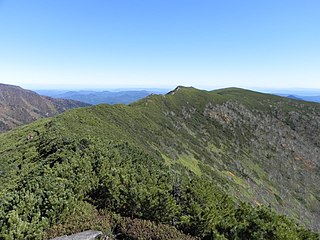
日本語: 武華山の山頂から東北東を望む。前ムカ方向を向いている。左端に見えているのが武利岳の裾野。
English: Looking ENE from the top of Mukayama. |
||
| Date | Taken on 8 October 2012 | ||
| Source | https://web.archive.org/web/20161027104945/http://www.panoramio.com/photo/80443963 | ||
| Author | pakku | ||
| Permission (Reusing this file) |
This file is licensed under the Creative Commons Attribution 3.0 Unported license. Attribution: pakku
|
| Camera location | | View this and other nearby images on: OpenStreetMap |
|---|
File history
Click on a date/time to view the file as it appeared at that time.
| Date/Time | Thumbnail | Dimensions | User | Comment | |
|---|---|---|---|---|---|
| current | 18:37, 9 January 2017 | | 1,600 × 1,200 (452 KB) | Panoramio upload bot (talk | contribs) | == {{int:filedesc}} == {{Information |description=武華山までの尾根道 |date={{Taken on|2012-10-08}} |source=http://www.panoramio.com/photo/80443963 |author=[http://www.panoramio.com/user/1029415?with_photo_id=80443963 pakku] |permission={{cc-by... |
You cannot overwrite this file.
File usage on Commons
There are no pages that use this file.