File:野辺山駅 - panoramio.jpg

Size of this preview: 800 × 600 pixels. Other resolutions: 320 × 240 pixels | 640 × 480 pixels | 1,024 × 768 pixels | 1,280 × 960 pixels | 2,560 × 1,920 pixels | 3,648 × 2,736 pixels.
Original file (3,648 × 2,736 pixels, file size: 1.99 MB, MIME type: image/jpeg)
Captions
Captions
Add a one-line explanation of what this file represents
Summary edit
| Description |
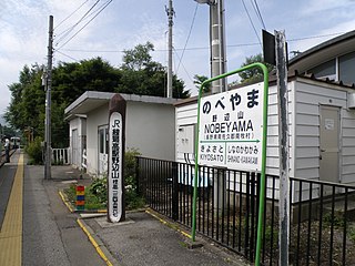
English: The platform at Nobeyama Station on the Koumi Line with a sign indicating it as the highest JR station in Japan, at an altitude of 1,345.67 m above sea level
日本語: 野辺山駅 |
| Date | Taken on 2 August 2008 |
| Source | https://web.archive.org/web/20161012113430/http://www.panoramio.com/photo/12719438 |
| Author | くろふね (Kurofune) |
| Camera location | | View this and other nearby images on: OpenStreetMap |
|---|
Licensing edit
This file is licensed under the Creative Commons Attribution 3.0 Unported license.
Attribution: くろふね
- You are free:
- to share – to copy, distribute and transmit the work
- to remix – to adapt the work
- Under the following conditions:
- attribution – You must give appropriate credit, provide a link to the license, and indicate if changes were made. You may do so in any reasonable manner, but not in any way that suggests the licensor endorses you or your use.
| This image, which was originally posted to Panoramio, was automatically reviewed on 13 June 2016 by Panoramio upload bot, who confirmed that it was available on Panoramio under the above license on that date. |
File history
Click on a date/time to view the file as it appeared at that time.
| Date/Time | Thumbnail | Dimensions | User | Comment | |
|---|---|---|---|---|---|
| current | 01:24, 13 June 2016 | | 3,648 × 2,736 (1.99 MB) | Panoramio upload bot (talk | contribs) | {{Information |description=野辺山駅 |date={{Taken on|2008-08-02}} |source=http://www.panoramio.com/photo/12719438 |author=[http://www.panoramio.com/user/1474640?with_photo_id=12719438 くろふね] |permission={{cc-by-3.0|くろふね}} {{Panoramio... |
You cannot overwrite this file.
File usage on Commons
There are no pages that use this file.
File usage on other wikis
The following other wikis use this file:
- Usage on en.wikipedia.org
- Usage on id.wikipedia.org
- Usage on ja.wikipedia.org