File:Castillo de San Felipe del Morro, Northwest end of San Juan, San Juan, San Juan Municipio, PR HABS PR,7-SAJU,6-5.tif
Size of this JPG preview of this TIF file: 800 × 506 pixels. Other resolutions: 320 × 202 pixels | 640 × 405 pixels | 1,024 × 648 pixels | 1,280 × 809 pixels | 2,560 × 1,619 pixels | 5,000 × 3,162 pixels.
Original file (5,000 × 3,162 pixels, file size: 15.08 MB, MIME type: image/tiff)
Captions
Captions
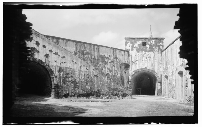
Lower court, Castillo de San Felipe del Morro, San Juan, Puerto Rico
Summary edit
| - Castillo de San Felipe del Morro, Northwest end of San Juan, San Juan, San Juan Municipio, PR
( |
||||||||||||||||||||
|---|---|---|---|---|---|---|---|---|---|---|---|---|---|---|---|---|---|---|---|---|
| Photographer |
|
|||||||||||||||||||
| Title |
- Castillo de San Felipe del Morro, Northwest end of San Juan, San Juan, San Juan Municipio, PR |
|||||||||||||||||||
| Description |
Antonelli, Juan Baustista; de Salazar, Pedro; Price, Gigi B, transmitter; Klugh, T, transmitter; Behrens, Tom, transmitter; Price, Virginia B, transmitter |
|||||||||||||||||||
| Depicted place | Puerto Rico; San Juan Municipio; San Juan | |||||||||||||||||||
| Date | 1938 | |||||||||||||||||||
| Dimensions | 4 x 5 in. | |||||||||||||||||||
| Current location |
Library of Congress Prints and Photographs Division Washington, D.C. 20540 USA http://hdl.loc.gov/loc.pnp/pp.print |
|||||||||||||||||||
| Accession number |
HABS PR,7-SAJU,6-5 |
|||||||||||||||||||
| Credit line |
|
|||||||||||||||||||
| Notes |
|
|||||||||||||||||||
| References |
|
|||||||||||||||||||
| Source | https://www.loc.gov/pictures/item/pr0076.photos.143918p | |||||||||||||||||||
| Permission (Reusing this file) |
|
|||||||||||||||||||

| Object location | | View this and other nearby images on: OpenStreetMap |
|---|
File history
Click on a date/time to view the file as it appeared at that time.
| Date/Time | Thumbnail | Dimensions | User | Comment | |
|---|---|---|---|---|---|
| current | 10:54, 1 August 2014 |  | 5,000 × 3,162 (15.08 MB) | Fæ (talk | contribs) | GWToolset: Creating mediafile for Fæ. HABS 31 July 2014 (3000:3200) |
You cannot overwrite this file.
File usage on Commons
The following 2 pages use this file:
File usage on other wikis
The following other wikis use this file:
- Usage on en.wikipedia.org