File:032606 Cocos Islands Low.PNG
032606_Cocos_Islands_Low.PNG (285 × 236 pixels, file size: 94 KB, MIME type: image/png)
File information
Structured data
Captions
Captions
Add a one-line explanation of what this file represents
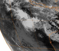
| Description032606 Cocos Islands Low.PNG | Satellite image of Tropical Low near Cocos Islands on March 26, 2006 | |||||||
| Date | ||||||||
| Source | ftp://eclipse.ncdc.noaa.gov/pub/isccp/b1/.D2790P/images/2006/085/Img-2006-03-26-15-MTS-1-IR.jpg | |||||||
| Author | Meteosat Satellite | |||||||
| Permission (Reusing this file) |
|
|||||||
File history
Click on a date/time to view the file as it appeared at that time.
| Date/Time | Thumbnail | Dimensions | User | Comment | |
|---|---|---|---|---|---|
| current | 18:40, 17 April 2008 |  | 285 × 236 (94 KB) | Hurricanehink (talk | contribs) | {{Information |Description=Satellite image of Tropical Low near Cocos Islands on March 26, 2006 |Source=ftp://eclipse.ncdc.noaa.gov/pub/isccp/b1/.D2790P/images/2006/085/Img-2006-03-26-15-MTS-1-IR.jpg |Author=Meteosat Satellite |Date=2006-03-26 |Permission |
| 18:39, 17 April 2008 |  | 335 × 288 (161 KB) | Hurricanehink (talk | contribs) | {{Information |Description=Satellite image of Tropical Low near Cocos Islands on March 26, 2006 |Source=ftp://eclipse.ncdc.noaa.gov/pub/isccp/b1/.D2790P/images/2006/085/Img-2006-03-26-15-MTS-1-IR.jpg |Author=Meteosat Satellite |Date=2006-03-26 |Permission |
You cannot overwrite this file.
File usage on Commons
There are no pages that use this file.
File usage on other wikis
The following other wikis use this file:
- Usage on pt.wikipedia.org
- Usage on zh.wikipedia.org
