File:06 Southern Leyte mudslide.jpg
Size of this preview: 750 × 600 pixels. Other resolutions: 300 × 240 pixels | 600 × 480 pixels | 960 × 768 pixels | 1,280 × 1,024 pixels | 2,560 × 2,048 pixels | 4,000 × 3,200 pixels.
Original file (4,000 × 3,200 pixels, file size: 664 KB, MIME type: image/jpeg)
Captions
Captions
Add a one-line explanation of what this file represents
Summary edit
| Description |
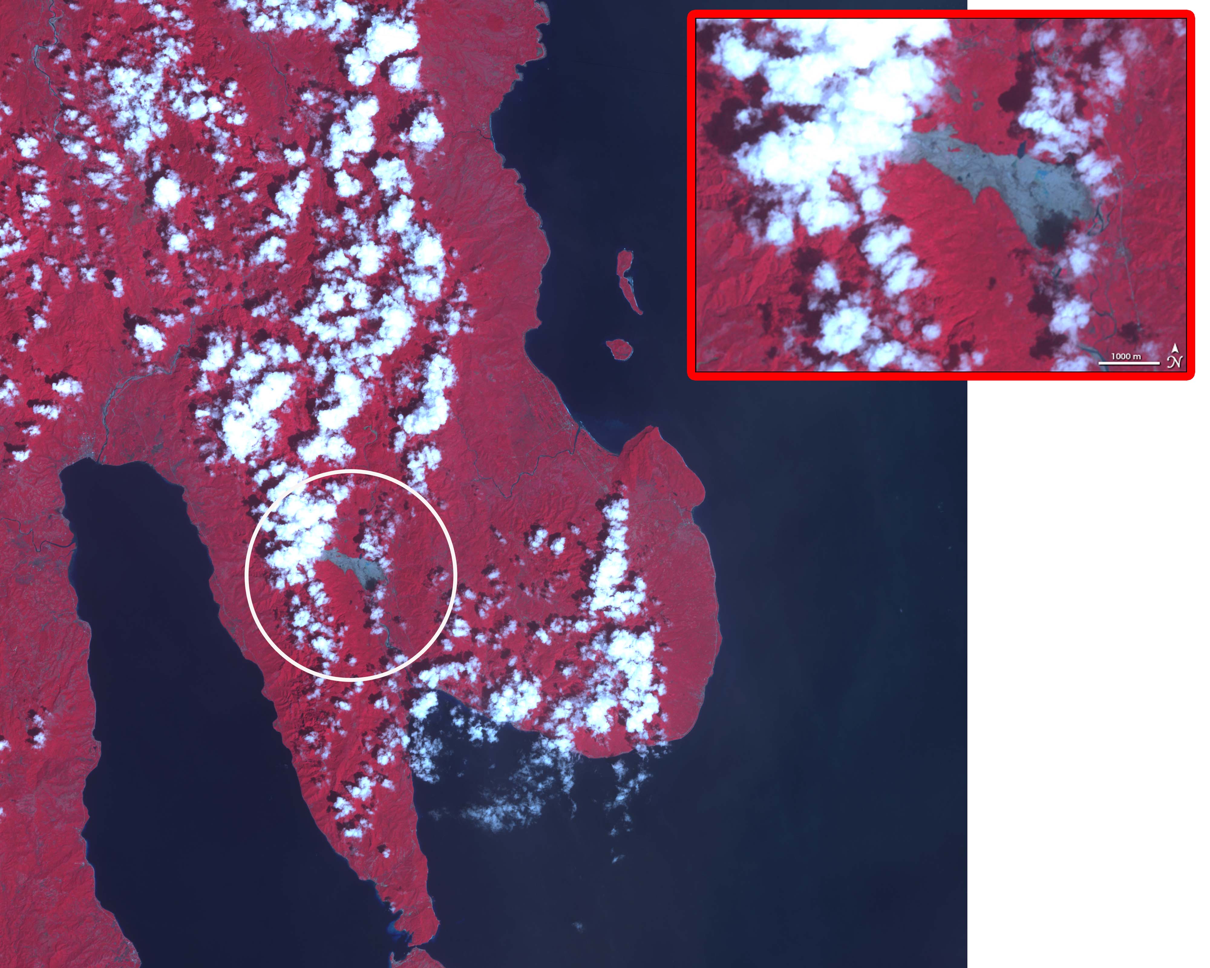
English: Original Caption: Advanced Spaceborne Thermal Emission and Reflection Radiometer (ASTER) on NASA’s Terra satellite with this view of the landslide that buried a town. Nearly 1,000 people died in the town of Guinsaugon when heavy rains triggered the landslide on February 17.
In this false-color image, the landslide is pallid gray against the vibrant red of the surrounding vegetation. Pools of pale aquamarine water on top of the mud reveal ongoing flooding. According to a Reuters news report, rescue efforts had to be suspended a few days before this image was taken because ongoing rain threatened further floods. This image also shows a dark blue lake above the landslide. This feature may have been present before the slide, or it may be a temporary lake created when the slide dammed a south-flowing waterway. |
| Date | |
| Source | http://earthobservatory.nasa.gov/NaturalHazards/view.php?id=16146 |
| Author | NASA image created by Jesse Allen, Earth Observatory, using ASTER data provided courtesy of NASA/GSFC/METI/ERSDAC/JAROS, and U.S./Japan ASTER Science Team |
Licensing edit
| This file is in the public domain in the United States because it was solely created by NASA. NASA copyright policy states that "NASA material is not protected by copyright unless noted". (See Template:PD-USGov, NASA copyright policy page or JPL Image Use Policy.) | ||
 |
Warnings:
|
File history
Click on a date/time to view the file as it appeared at that time.
| Date/Time | Thumbnail | Dimensions | User | Comment | |
|---|---|---|---|---|---|
| current | 08:54, 20 March 2013 | | 4,000 × 3,200 (664 KB) | Bonvallite (talk | contribs) | User created page with UploadWizard |
You cannot overwrite this file.
File usage on Commons
There are no pages that use this file.
File usage on other wikis
The following other wikis use this file:
- Usage on en.wikipedia.org
- Usage on fi.wikipedia.org