File:14-16-16-f-giro.jpg

Size of this preview: 800 × 532 pixels. Other resolutions: 320 × 213 pixels | 640 × 425 pixels | 1,024 × 681 pixels | 1,280 × 851 pixels | 2,560 × 1,701 pixels | 4,285 × 2,848 pixels.
Original file (4,285 × 2,848 pixels, file size: 15.25 MB, MIME type: image/jpeg)
Captions
Captions
Add a one-line explanation of what this file represents
Summary
edit| Description |
This file was uploaded with Commonist. |
||||||||||||||||||||||
| Date | |||||||||||||||||||||||
| Source | Own work | ||||||||||||||||||||||
| Author |
|
||||||||||||||||||||||

| Camera location | | View this and other nearby images on: OpenStreetMap |
|---|
|
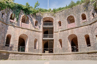
This building is inscrit au titre des monuments historiques de la France. It is indexed in the base Mérimée, a database of architectural heritage maintained by the French Ministry of Culture, under the reference PA00135351
|
Licensing
edit
This file is licensed under the Creative Commons Attribution 3.0 Unported license.
- You are free:
- to share – to copy, distribute and transmit the work
- to remix – to adapt the work
- Under the following conditions:
- attribution – You must give appropriate credit, provide a link to the license, and indicate if changes were made. You may do so in any reasonable manner, but not in any way that suggests the licensor endorses you or your use.
This image has been assessed using the Quality image guidelines and is considered a Quality image.
|
File history
Click on a date/time to view the file as it appeared at that time.
| Date/Time | Thumbnail | Dimensions | User | Comment | |
|---|---|---|---|---|---|
| current | 12:54, 6 September 2010 | | 4,285 × 2,848 (15.25 MB) | ComputerHotline (talk | contribs) |
You cannot overwrite this file.
File usage on Commons
The following 8 pages use this file:
- User:ComputerHotline/Archive 2
- User:ComputerHotline/Fort de Giromagny
- Commons:Featured picture candidates/File:14-16-16-f-giro.jpg
- Commons:Featured picture candidates/Log/September 2010
- Commons:Quality images/Subject/Places/Man made structures/Buildings, Exterior/Part 1a
- Commons:Quality images candidates/Archives September 2010
- Commons talk:Quality images/Subject/Places/Man made structures
- Category:Fort de Giromagny
File usage on other wikis
The following other wikis use this file:
- Usage on arz.wikipedia.org
- Usage on bg.wikipedia.org
- Usage on de.wikipedia.org
- Usage on en.wikipedia.org
- Usage on fr.wikipedia.org
- Usage on nl.wikipedia.org
- Usage on www.wikidata.org