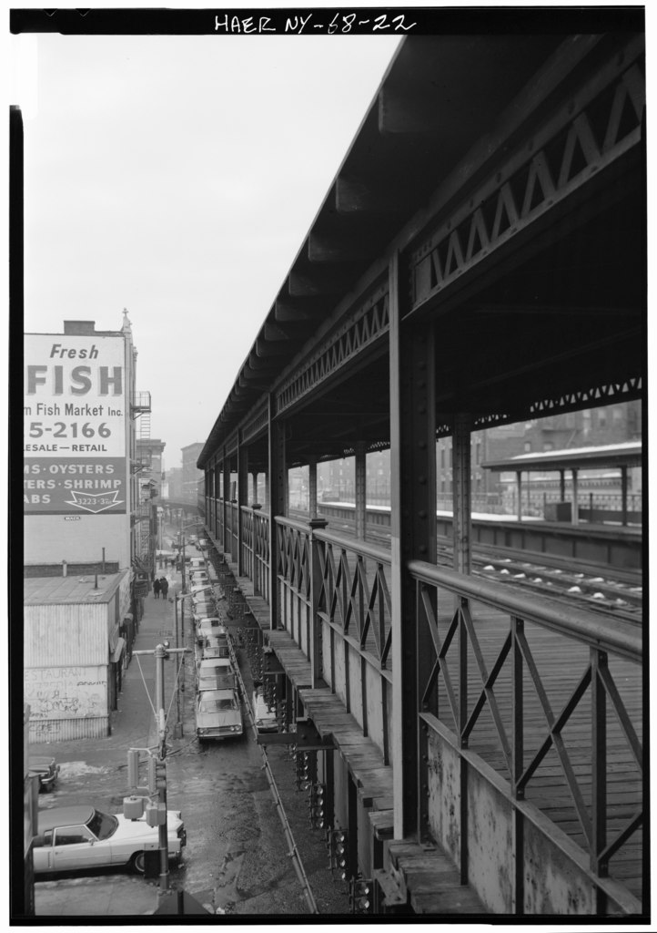
File:161ST ST. STATION, GENERAL VIEW NORTH OVER RAILING OF SOUTHBOUND PLATFORM, BETWEEN 161ST AND 162ND ST. - Interborough Rapid Transit Company, Third Avenue Elevated Line, Borough HAER NY,3-BRONX,13-22.tif

Size of this JPG preview of this TIF file: 423 × 600 pixels. Other resolutions: 169 × 240 pixels | 338 × 480 pixels | 541 × 768 pixels | 722 × 1,024 pixels | 1,444 × 2,048 pixels | 3,526 × 5,000 pixels.
Original file (3,526 × 5,000 pixels, file size: 16.82 MB, MIME type: image/tiff)
Captions
Captions
Add a one-line explanation of what this file represents
Summary edit
| 161ST ST. STATION, GENERAL VIEW NORTH OVER RAILING OF SOUTHBOUND PLATFORM, BETWEEN 161ST AND 162ND ST. - Interborough Rapid Transit Company, Third Avenue Elevated Line, Borough of the Bronx, New York, New York County, NY | ||||
|---|---|---|---|---|
| Photographer |
Boucher, Jack E. Related names:
|
|||
| Title |
161ST ST. STATION, GENERAL VIEW NORTH OVER RAILING OF SOUTHBOUND PLATFORM, BETWEEN 161ST AND 162ND ST. - Interborough Rapid Transit Company, Third Avenue Elevated Line, Borough of the Bronx, New York, New York County, NY |
|||
| Depicted place | New York; New York County; New York | |||
| Date | 1974 | |||
| Dimensions | 5 x 7 in. | |||
| Current location |
Library of Congress Prints and Photographs Division Washington, D.C. 20540 USA http://hdl.loc.gov/loc.pnp/pp.print |
|||
| Accession number |
HAER NY,3-BRONX,13-22 |
|||
| Credit line |
|
|||
| Notes |
|
|||
| Source | https://www.loc.gov/pictures/item/ny1239.photos.117677p | |||
| Permission (Reusing this file) |
|
|||

| Camera location | | View this and other nearby images on: OpenStreetMap |
|---|
File history
Click on a date/time to view the file as it appeared at that time.
| Date/Time | Thumbnail | Dimensions | User | Comment | |
|---|---|---|---|---|---|
| current | 15:22, 29 July 2014 |  | 3,526 × 5,000 (16.82 MB) | Fæ (talk | contribs) | GWToolset: Creating mediafile for Fæ. HABS 24 July 2014 (2301:2600) |
You cannot overwrite this file.
File usage on Commons
The following page uses this file: