File:1728 BostonCommon detail map byWilliamBurgis BPL.png

Size of this preview: 800 × 519 pixels. Other resolutions: 320 × 208 pixels | 640 × 415 pixels | 891 × 578 pixels.
Original file (891 × 578 pixels, file size: 1.06 MB, MIME type: image/png)
Captions
Captions
Add a one-line explanation of what this file represents
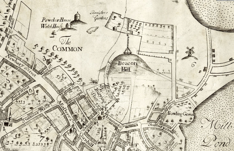
| Description | Boston Common and vicinity in 1728. Detail of map of Boston by William Burgis. Shows "Banisters gardens" |
| Date | |
| Source | Boston Public Library. http://maps.bpl.org/details_10063 |
| Author | William Burgis |
|
This work is in the public domain in its country of origin and other countries and areas where the copyright term is the author's life plus 100 years or fewer. | |
| This file has been identified as being free of known restrictions under copyright law, including all related and neighboring rights. | |
File history
Click on a date/time to view the file as it appeared at that time.
| Date/Time | Thumbnail | Dimensions | User | Comment | |
|---|---|---|---|---|---|
| current | 13:29, 15 January 2010 | | 891 × 578 (1.06 MB) | M2545 (talk | contribs) | {{Information |Description=Boston Common and vicinity in 1728. Detail of map of Boston by William Burgis. |Source=Boston Public Library. http://maps.bpl.org/details_10063 |Date=1728 |Author=William Burgis |Permission= |other_versions= }} [[Category:Boston |
You cannot overwrite this file.
File usage on Commons
There are no pages that use this file.