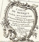
File:1771 Bonne Map of Mexico (Texas), Louisiana and Florida - Geographicus - Mexico-bonne-1771.jpg

Size of this preview: 800 × 578 pixels. Other resolutions: 320 × 231 pixels | 640 × 462 pixels | 1,024 × 740 pixels | 1,280 × 924 pixels | 2,560 × 1,849 pixels | 4,000 × 2,889 pixels.
Original file (4,000 × 2,889 pixels, file size: 3 MB, MIME type: image/jpeg)
File information
Structured data
Captions
Captions
Add a one-line explanation of what this file represents
Summary edit
| Rigobert Bonne: Carte du Mexique ou de la Nlle. Espagne Contenant aussi le Nouveau Mexique, la Californie, avec une Partie des Pays adjacents.
( |
|||||||||||||||||||||||
|---|---|---|---|---|---|---|---|---|---|---|---|---|---|---|---|---|---|---|---|---|---|---|---|
| Artist |
artist QS:P170,Q721492 |
||||||||||||||||||||||
| Title |
Carte du Mexique ou de la Nlle. Espagne Contenant aussi le Nouveau Mexique, la Californie, avec une Partie des Pays adjacents. |
||||||||||||||||||||||
| Description |
English: A beautiful example of Rigobert Bonne's 1771 map of Mexico and Florida. Covers from Baja California eastward to Florida and Carolina, extend northwards as far as the mouth of the Chesapeake Bay and southwards to Panama. Bonne, being a very cautious cartographer, abandons many of the fictious elements common to many period maps of this region, thus most unexplored areas are left blank. Being primarily a map of Mexico and the Spanish holdings in North America, this excellent map details the various Mexican states naming countless towns, villages, and haciendas. The map extends northward into the vast and largely unknown American West. Identifies numerous missionary stations along the Rio Bravo or Rivera du Nord (Rio Grande) extending well northing to New Mexico towards Santa Fe. Also names the various American Indian groups who traded with the French in Louisiana. Southern Florida is rendered as an archipelago in a primitive attempt at describing the Everglades. Drawn by R. Bonne in 1771 for issue as plate no. C 32 in Jean Lattre's 1776 issue of the Atlas Moderne . |
||||||||||||||||||||||
| Date | 1771 (dated) | ||||||||||||||||||||||
| Dimensions |
height: 12 in (30.4 cm); width: 16 in (40.6 cm) dimensions QS:P2048,12U218593 dimensions QS:P2049,16U218593 |
||||||||||||||||||||||
| Accession number |
Geographicus link: Mexico-bonne-1771 |
||||||||||||||||||||||
| Source/Photographer |
Lattre, Jean, Atlas Moderne ou Collection de Cartes sur Toutes les Parties du Globe Terrestre, c. 1775.
|
||||||||||||||||||||||
| Other versions |
|
||||||||||||||||||||||
Licensing edit
| Public domainPublic domainfalsefalse |
|
This work is in the public domain in its country of origin and other countries and areas where the copyright term is the author's life plus 100 years or fewer. | |
| This file has been identified as being free of known restrictions under copyright law, including all related and neighboring rights. | |
https://creativecommons.org/publicdomain/mark/1.0/PDMCreative Commons Public Domain Mark 1.0falsefalse
File history
Click on a date/time to view the file as it appeared at that time.
| Date/Time | Thumbnail | Dimensions | User | Comment | |
|---|---|---|---|---|---|
| current | 02:25, 23 March 2011 |  | 4,000 × 2,889 (3 MB) | BotMultichillT (talk | contribs) | {{subst:User:Multichill/Geographicus |link=http://www.geographicus.com/P/AntiqueMap/Mexico-bonne-1771 |product_name=1771 Bonne Map of Mexico (Texas), Louisiana and Florida |map_title=Carte du Mexique ou de la Nlle. Espagne Contenant aussi le Nouveau Mexiq |
You cannot overwrite this file.
File usage on Commons
The following 3 pages use this file:

