File:1771 Rizzi-Zannoni Map of Germany and Poland - Geographicus - GermanyNW-zannoni-1771.jpg
Size of this preview: 800 × 560 pixels. Other resolutions: 320 × 224 pixels | 640 × 448 pixels | 1,024 × 717 pixels | 1,280 × 896 pixels | 2,560 × 1,792 pixels | 3,500 × 2,450 pixels.
Original file (3,500 × 2,450 pixels, file size: 3.04 MB, MIME type: image/jpeg)
Captions
Captions
Add a one-line explanation of what this file represents
Summary edit
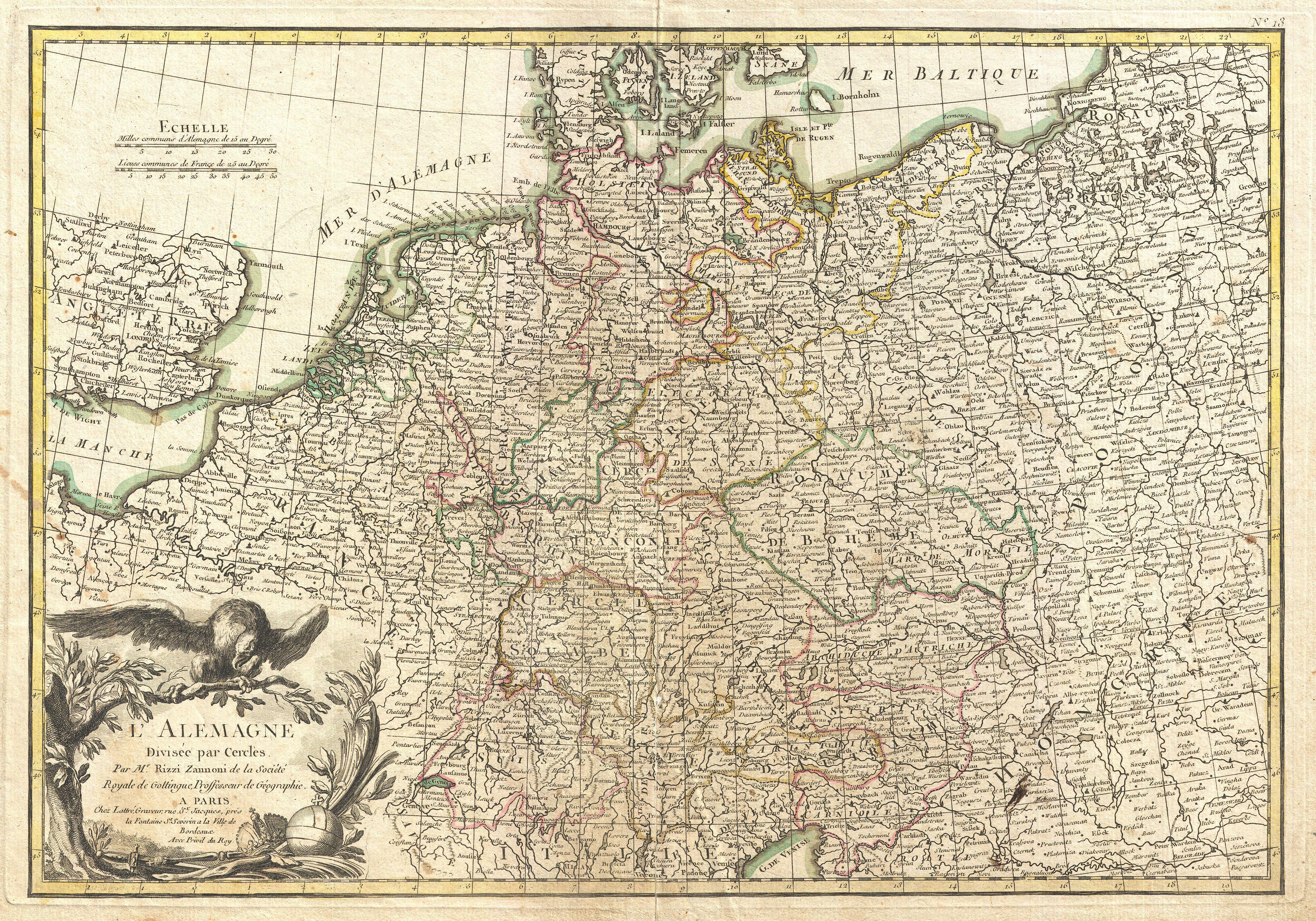
| L'Alemagne Divisee par Cercles. | ||||||
|---|---|---|---|---|---|---|
| Artist | ||||||
| Title |
L'Alemagne Divisee par Cercles. |
|||||
| Description |
English: A beautiful example of Rizzi-Zannoni's decorative map of Germany. Covers from Jutland to the Gulf of Venice and from England to Poland.. Offers excellent detail throughout showing mountains, rivers, forests, national boundaries, regional boundaries, forts, and cities. A large decorative title cartouche depicting the Eagle of Deutschland appears in the lower left quadrant. Drawn by Rizzi-Zannon in 1762 for issue as plate no. 13 in Jean Lattre's 1776 edition of the Atlas Moderne . |
|||||
| Date | 1771 (undated) | |||||
| Dimensions | height: 12.5 in (31.7 cm); width: 17.5 in (44.4 cm) | |||||
| Accession number |
Geographicus link: GermanyNW-zannoni-1771 |
|||||
| Source/Photographer |
Lattre, Jean, Atlas Moderne ou Collection de Cartes sur Toutes les Parties du Globe Terrestre, c. 1775.
|
|||||
| Permission (Reusing this file) |
|
|||||
File history
Click on a date/time to view the file as it appeared at that time.
| Date/Time | Thumbnail | Dimensions | User | Comment | |
|---|---|---|---|---|---|
| current | 17:57, 23 March 2011 | | 3,500 × 2,450 (3.04 MB) | BotMultichillT (talk | contribs) | {{subst:User:Multichill/Geographicus |link=http://www.geographicus.com/P/AntiqueMap/GermanyNW-zannoni-1771 |product_name=1771 Rizzi-Zannoni Map of Germany and Poland |map_title=L'Alemagne Divisee par Cercles. |description=A beautiful example of Rizzi-Zann |
You cannot overwrite this file.
File usage on Commons
The following page uses this file:
File usage on other wikis
The following other wikis use this file:
- Usage on fr.wikipedia.org
- Usage on id.wikipedia.org
- Usage on lt.wikibooks.org