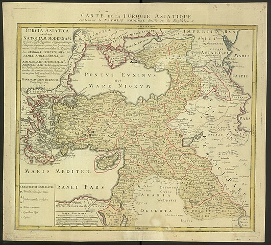
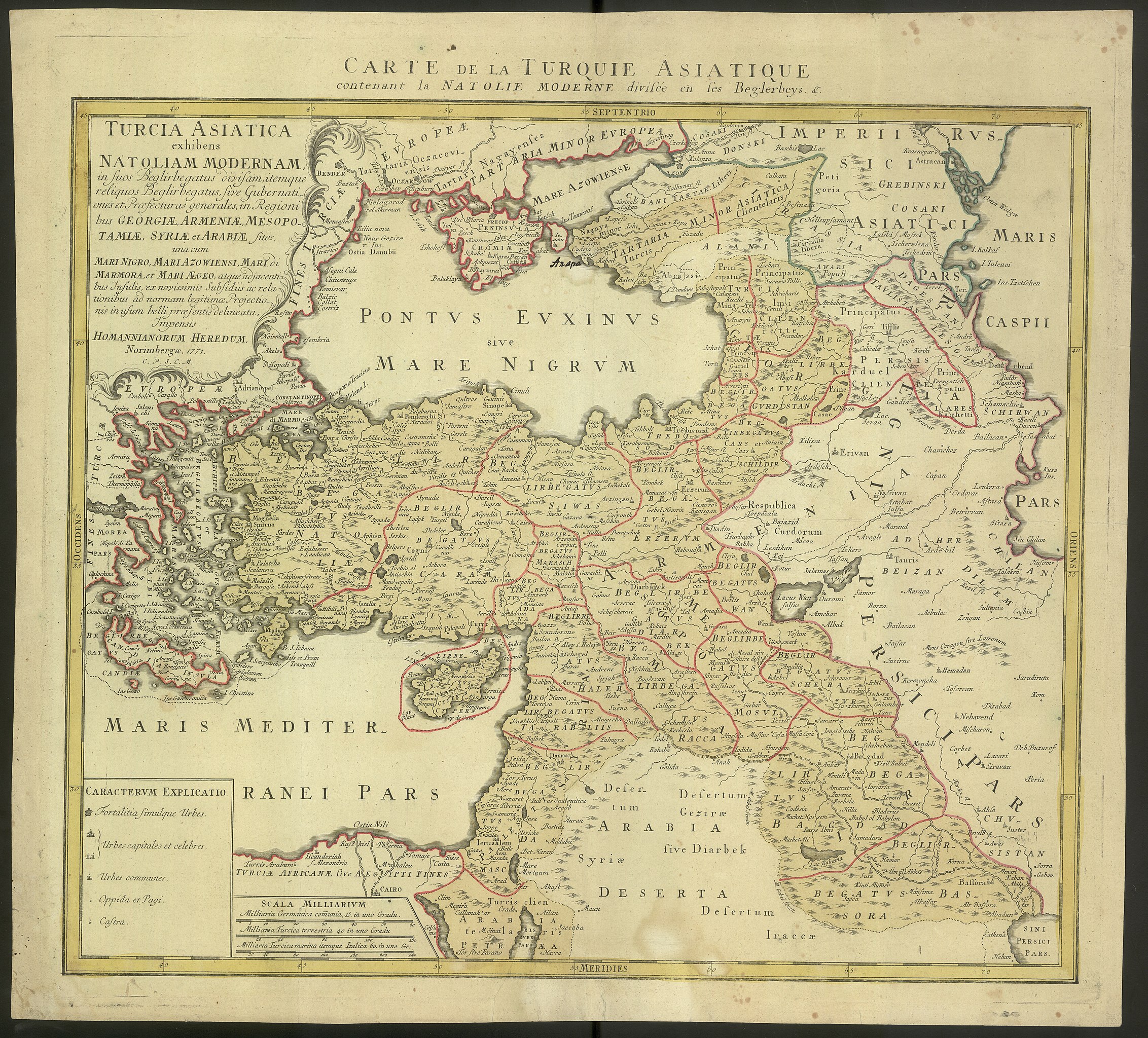
File:1771 map - Turcia Asiatica exhibens Natoliam Modernam, in suos Beglirbegatus divisam, itemque reliquos Beglirbegatus, sive Gubernationes et Praefecturas generales, in Regionibus Georgiae.jpg

Size of this preview: 663 × 600 pixels. Other resolutions: 265 × 240 pixels | 531 × 480 pixels | 849 × 768 pixels | 1,132 × 1,024 pixels | 2,264 × 2,048 pixels | 14,210 × 12,856 pixels.
Original file (14,210 × 12,856 pixels, file size: 32.52 MB, MIME type: image/jpeg)
Captions
Captions
1771 map - Turcia Asiatica exhibens Natoliam Modernam
Summary
edit
| Warning | The original file is very high-resolution. It might not load properly or could cause your browser to freeze when opened at full size. |
|---|
| Description |
English: 1771 map - Turcia Asiatica exhibens Natoliam Modernam, in suos Beglirbegatus divisam, itemque reliquos Beglirbegatus, sive Gubernationes et Praefecturas generales, in Regionibus Georgiae, Armeniae, Mespotamiae, Syriae et Arabiae sitos, una cum Mari Nigro, Mari Azowiensi, Mari di Marmora, et Mari Aegeo, atque adiacentibus Insulis. |
| Date | |
| Source | https://polona.pl/item/turcia-asiatica-exhibens-natoliam-modernam-in-suos-beglirbegatus-divisam-itemque,NzE5NDkwOTY/ |
| Author | Norimbergae: Homannianorum Heredum, 1771. |
Licensing
edit
|
This work is in the public domain in its country of origin and other countries and areas where the copyright term is the author's life plus 70 years or fewer. This work is in the public domain in the United States because it was published (or registered with the U.S. Copyright Office) before January 1, 1929. | |
| This file has been identified as being free of known restrictions under copyright law, including all related and neighboring rights. | |
File history
Click on a date/time to view the file as it appeared at that time.
| Date/Time | Thumbnail | Dimensions | User | Comment | |
|---|---|---|---|---|---|
| current | 10:35, 5 October 2019 | | 14,210 × 12,856 (32.52 MB) | Balkanique (talk | contribs) | User created page with UploadWizard |
You cannot overwrite this file.
File usage on Commons
The following page uses this file:
File usage on other wikis
The following other wikis use this file:
- Usage on fr.wikipedia.org
- Usage on zh.wikipedia.org